
Jim Martin
-
Posts
2,469 -
Joined
-
Last visited
Content Type
Profiles
Blogs
Forums
American Weather
Media Demo
Store
Gallery
Everything posted by Jim Martin
-

Short-Term Severe/Flooding Discussion
Jim Martin replied to Quincy's topic in Central/Western States
-
Short-Term Severe/Flooding Discussion
Jim Martin replied to Quincy's topic in Central/Western States
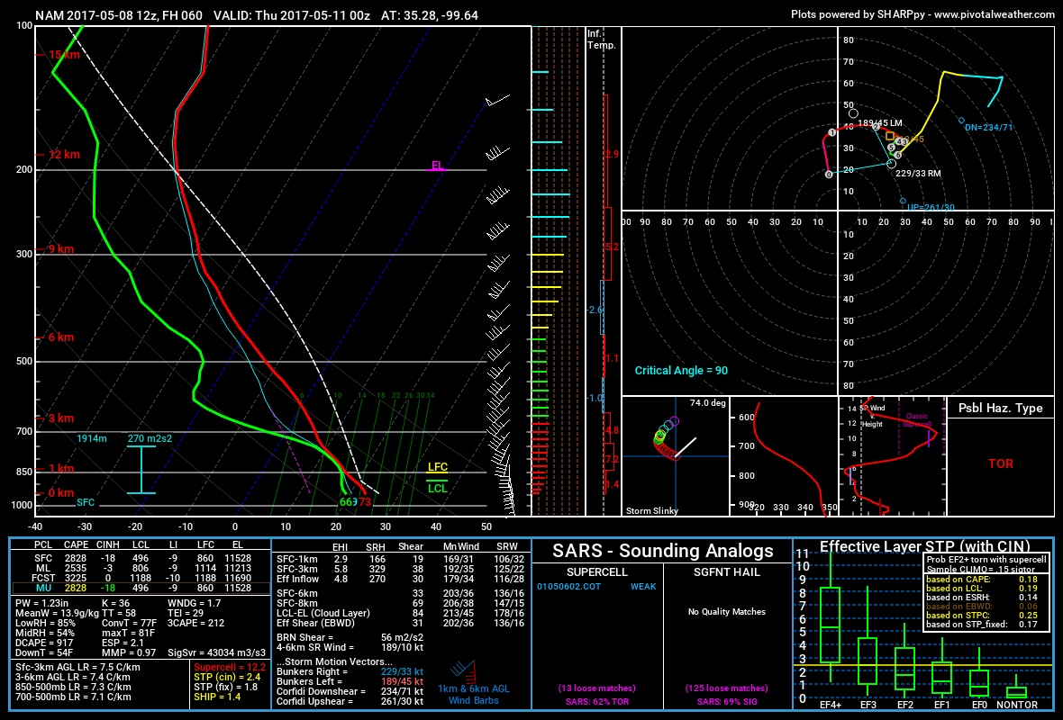
Beckham County, Oklahoma Wednesday Evening off the 12z NAM.
-
Short-Term Severe/Flooding Discussion
Jim Martin replied to Quincy's topic in Central/Western States
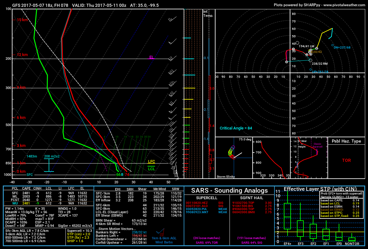
Southwest Oklahoma Wednesday Evening off this afternoon's GFS.
-
Central/Western Medium-Long Range Discussion
Jim Martin replied to andyhb's topic in Central/Western States
For Wednesday of next week.
-
Short-Term Severe/Flooding Discussion
Jim Martin replied to Quincy's topic in Central/Western States
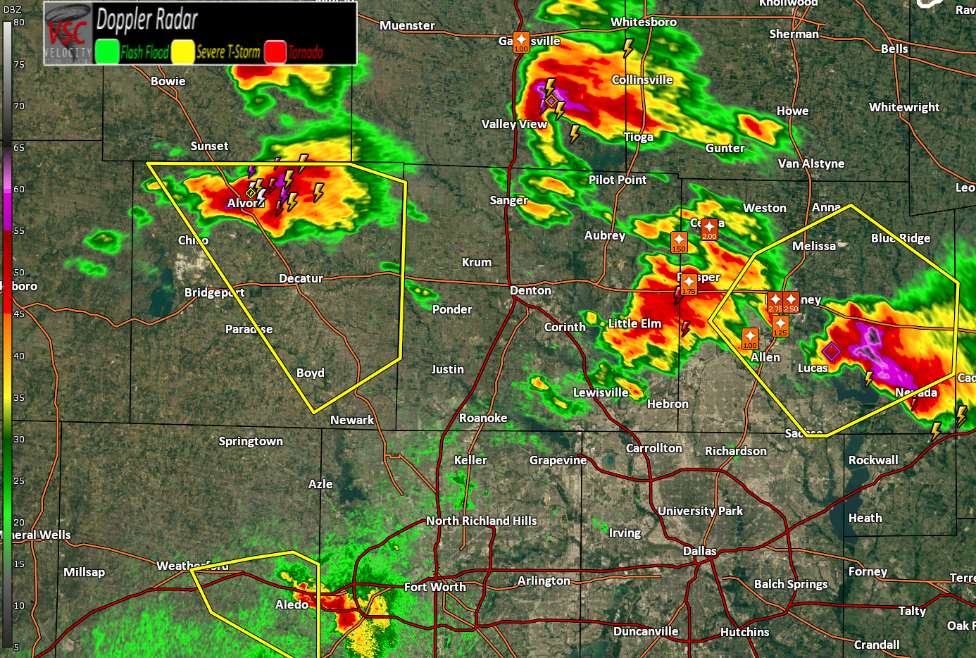
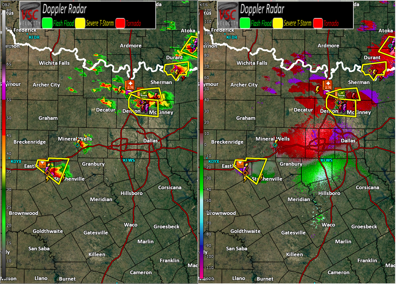
This severe storm could pay a visit to Fort Worth later this evening. The one north of Decatur, that is, moving southeast.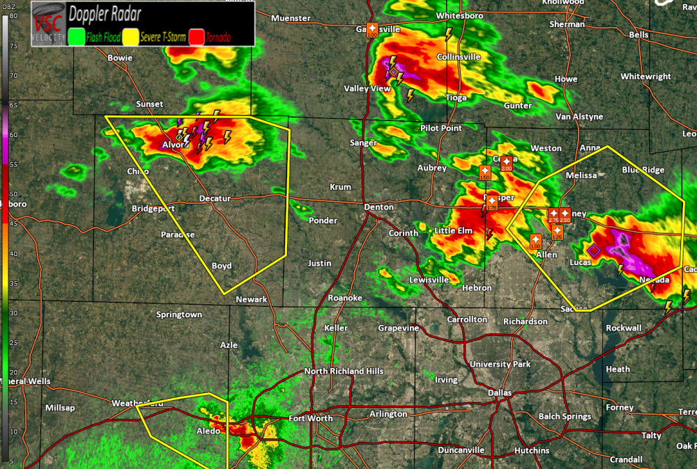
-
Short-Term Severe/Flooding Discussion
Jim Martin replied to Quincy's topic in Central/Western States
-
Short-Term Severe/Flooding Discussion
Jim Martin replied to Quincy's topic in Central/Western States
The National Weather Service in Fort Worth has issued a * Severe Thunderstorm Warning for... Collin County in north central Texas... * Until 930 PM CDT. * At 833 PM CDT, a severe thunderstorm was located over Prosper, or 9 miles north of Frisco, moving southeast at 30 mph. This storm has a history of producing large, wind driven hail. HAZARD...Two inch hail and 60 mph wind gusts. -
Short-Term Severe/Flooding Discussion
Jim Martin replied to Quincy's topic in Central/Western States
Storms still rather discrete at this hour.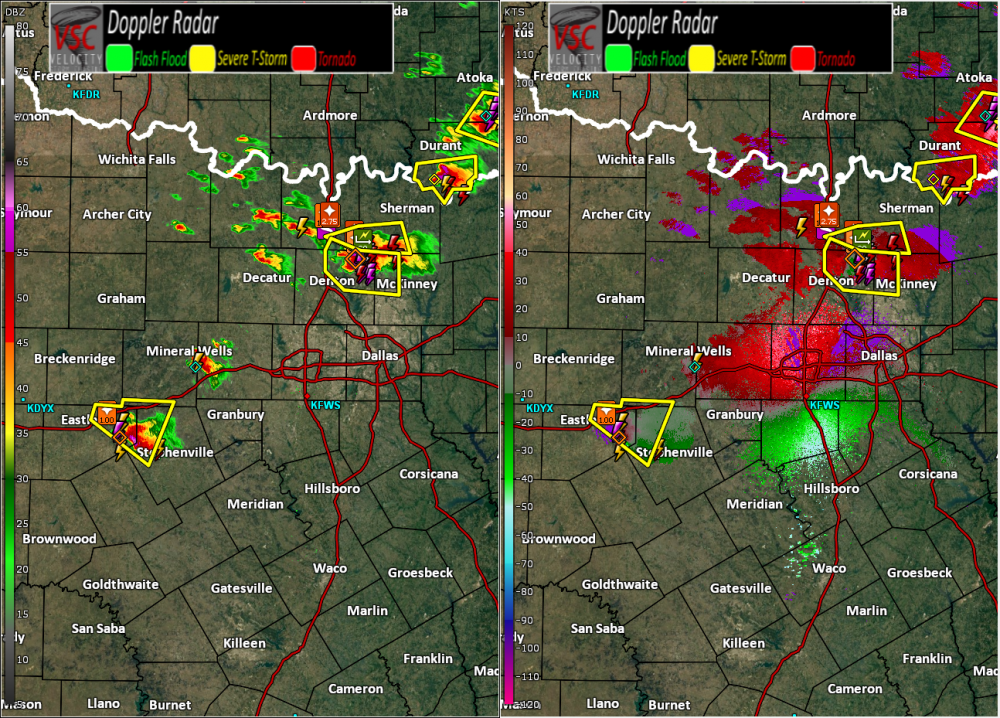
-
Short-Term Severe/Flooding Discussion
Jim Martin replied to Quincy's topic in Central/Western States
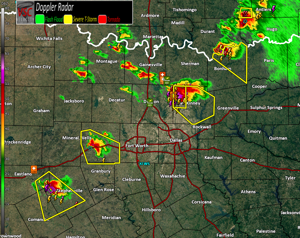
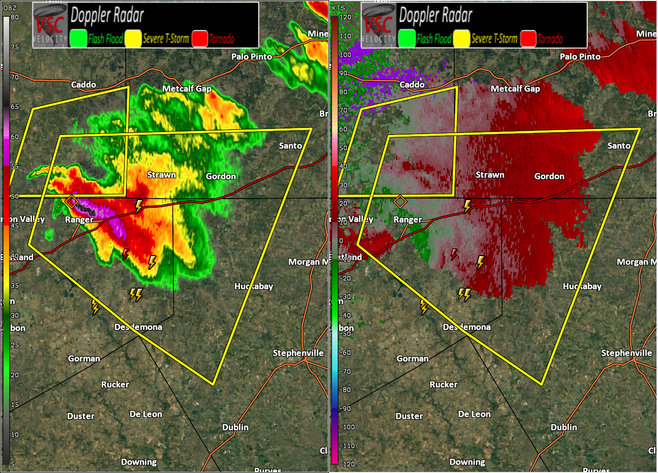
Near Ranger, Texas.
-
Short-Term Severe/Flooding Discussion
Jim Martin replied to Quincy's topic in Central/Western States
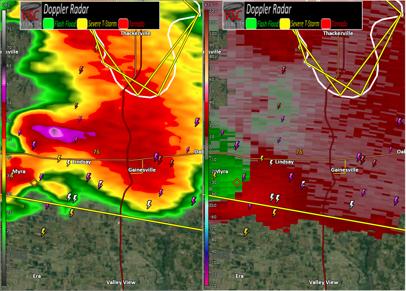
fwdchat 2017/04/21 8:22 PM iembot FWD continues Tornado Warning [tornado: OBSERVED, hail: 1.75 IN] for Cooke [TX] till 7:45 PM CDT -
Short-Term Severe/Flooding Discussion
Jim Martin replied to Quincy's topic in Central/Western States
Gainesville supercell starting to turn to the right. -
Short-Term Severe/Flooding Discussion
Jim Martin replied to Quincy's topic in Central/Western States
Tornado Warning for Gainesville, Texas proper.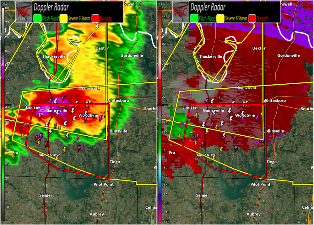
-
Short-Term Severe/Flooding Discussion
Jim Martin replied to Quincy's topic in Central/Western States
Currently just outside of Gainesville.
-
Short-Term Severe/Flooding Discussion
Jim Martin replied to Quincy's topic in Central/Western States
Rotating wall cloud reported per Spotter Network just west of Gainesville, Texas. -
Short-Term Severe/Flooding Discussion
Jim Martin replied to Quincy's topic in Central/Western States
The Atoka/Bryan County, Oklahoma supercell is headed in the general direction of Paris, Texas along the Red River here after while. -
Short-Term Severe/Flooding Discussion
Jim Martin replied to Quincy's topic in Central/Western States
Storms starting to take off along the Red River.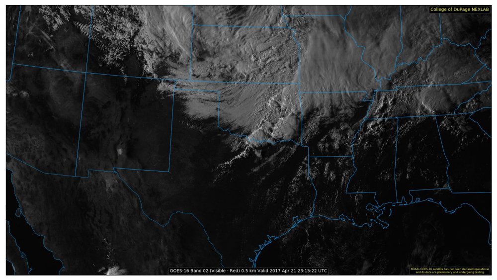
-
Short-Term Severe/Flooding Discussion
Jim Martin replied to Quincy's topic in Central/Western States
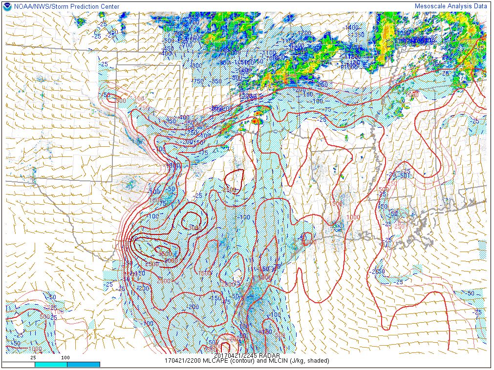
CINH is eroding fast in North Central Texas.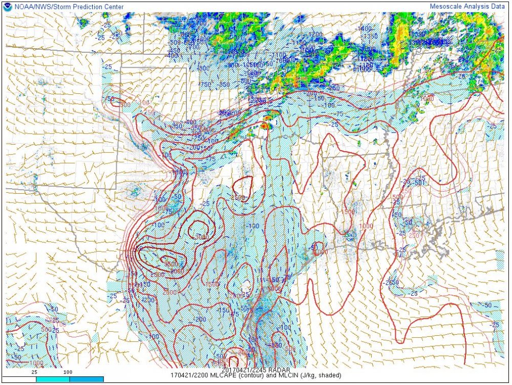
-
Short-Term Severe/Flooding Discussion
Jim Martin replied to Quincy's topic in Central/Western States
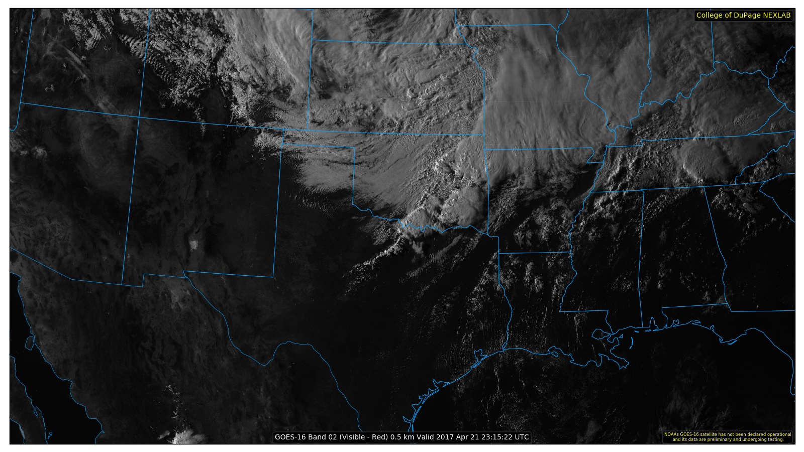
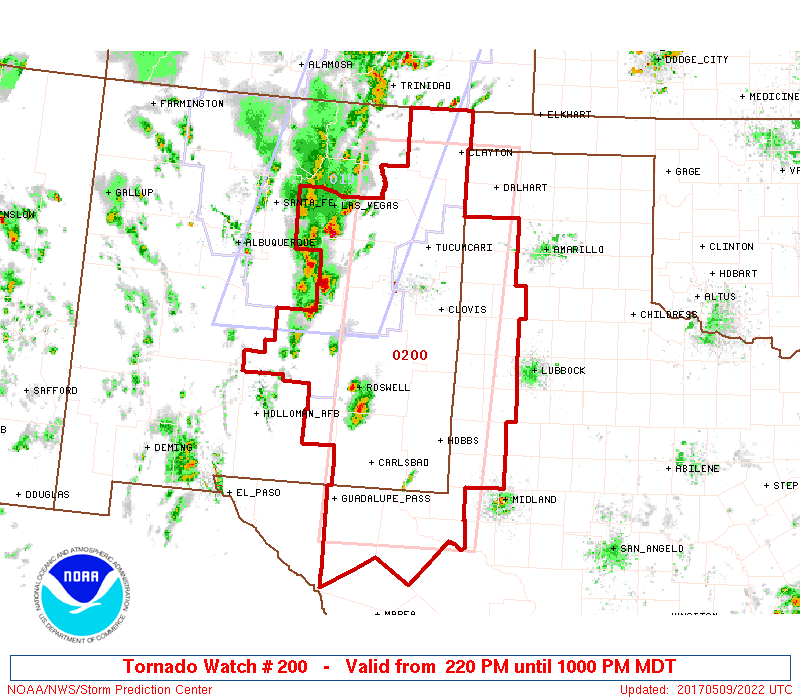
Big picture view currently of the active convective watches/warnings.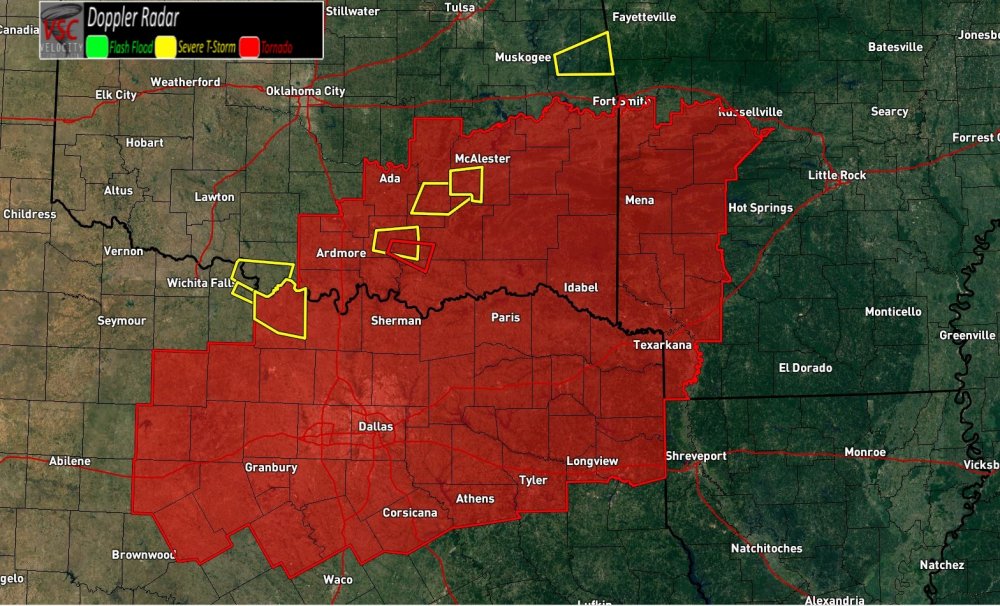
-
Short-Term Severe/Flooding Discussion
Jim Martin replied to Quincy's topic in Central/Western States
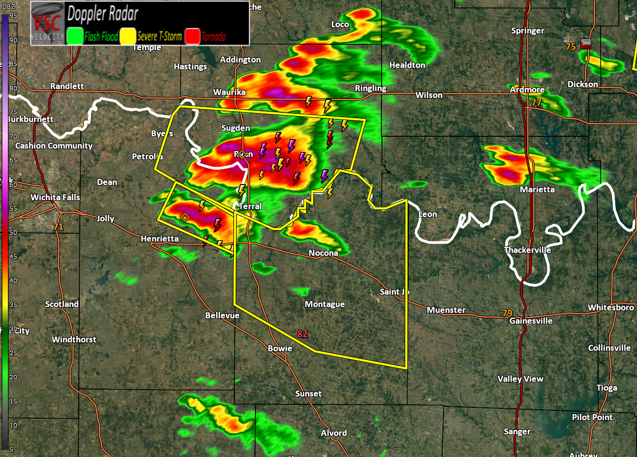
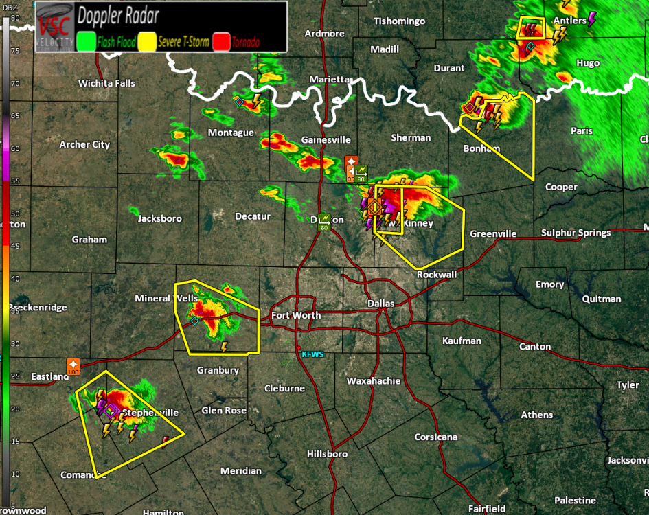
Severe storms now near Montague, Texas crossing out of Clay County TX and Jefferson County OK.
-
Short-Term Severe/Flooding Discussion
Jim Martin replied to Quincy's topic in Central/Western States
New Warning for South Jefferson County OK and NE Clay County TX.
-
Short-Term Severe/Flooding Discussion
Jim Martin replied to Quincy's topic in Central/Western States
Tornado Warning just issued.
-
Short-Term Severe/Flooding Discussion
Jim Martin replied to Quincy's topic in Central/Western States
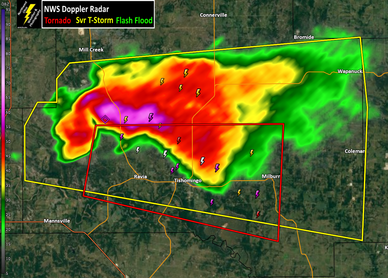
Hail core is growing too as well. Would not be shocked to hear of hail larger than golf ball size here soon. -
Short-Term Severe/Flooding Discussion
Jim Martin replied to Quincy's topic in Central/Western States
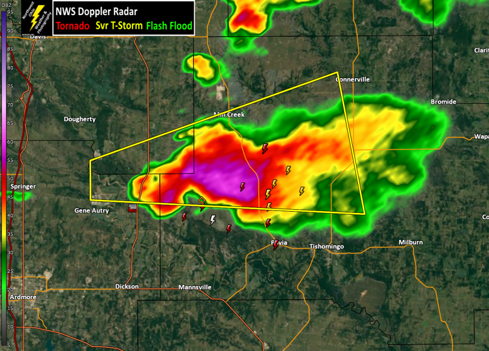
Headed in the general direction of Tishomingo... -
Short-Term Severe/Flooding Discussion
Jim Martin replied to Quincy's topic in Central/Western States
-
Short-Term Severe/Flooding Discussion
Jim Martin replied to Quincy's topic in Central/Western States
Rotating Wall Cloud per Spotter Network report near Gene Autry, Oklahoma.