
Jim Martin
-
Posts
2,469 -
Joined
-
Last visited
Content Type
Profiles
Blogs
Forums
American Weather
Media Demo
Store
Gallery
Everything posted by Jim Martin
-
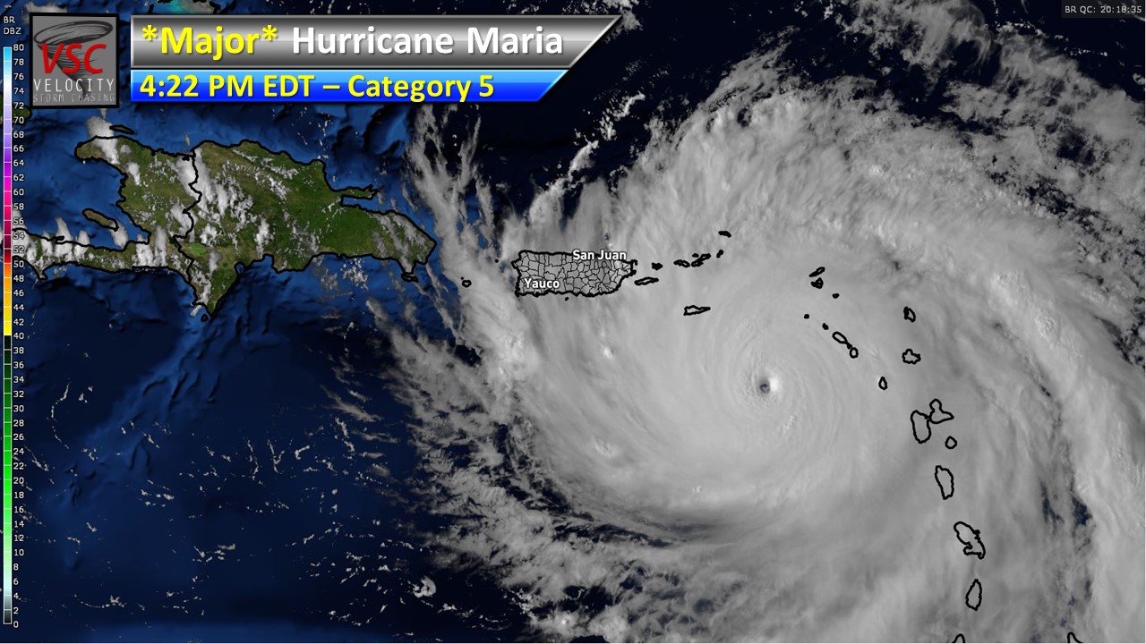
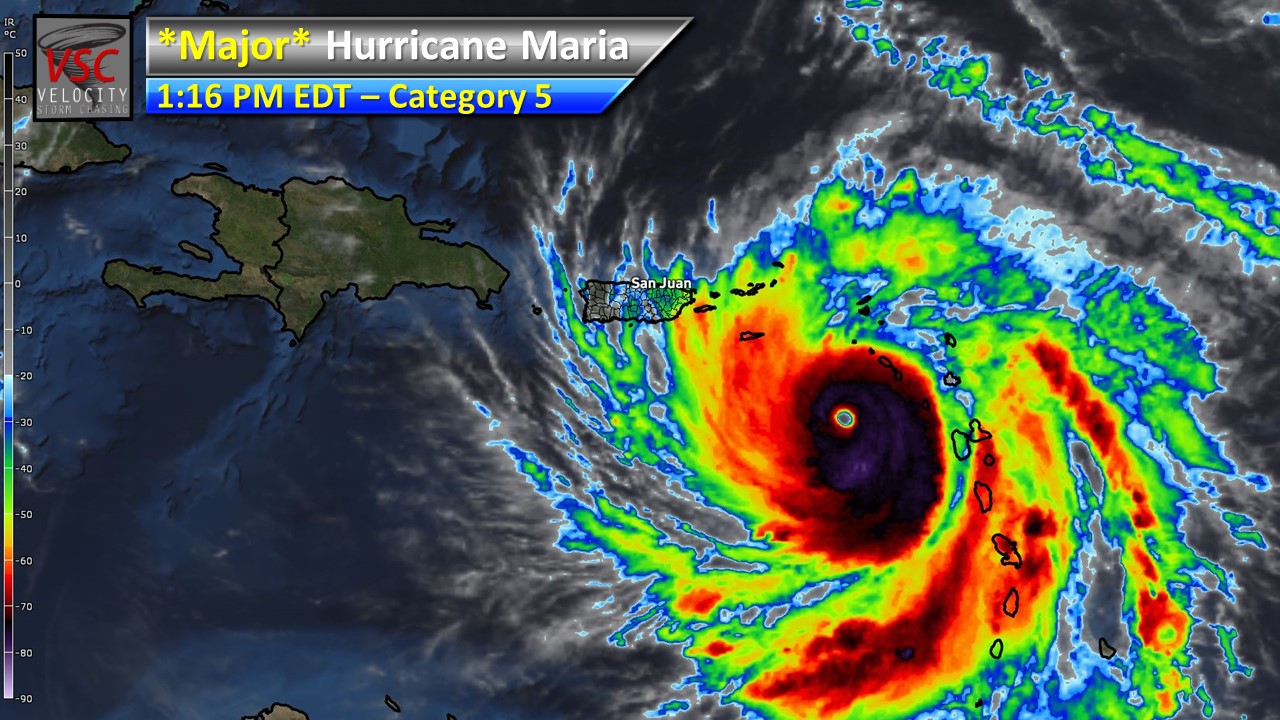
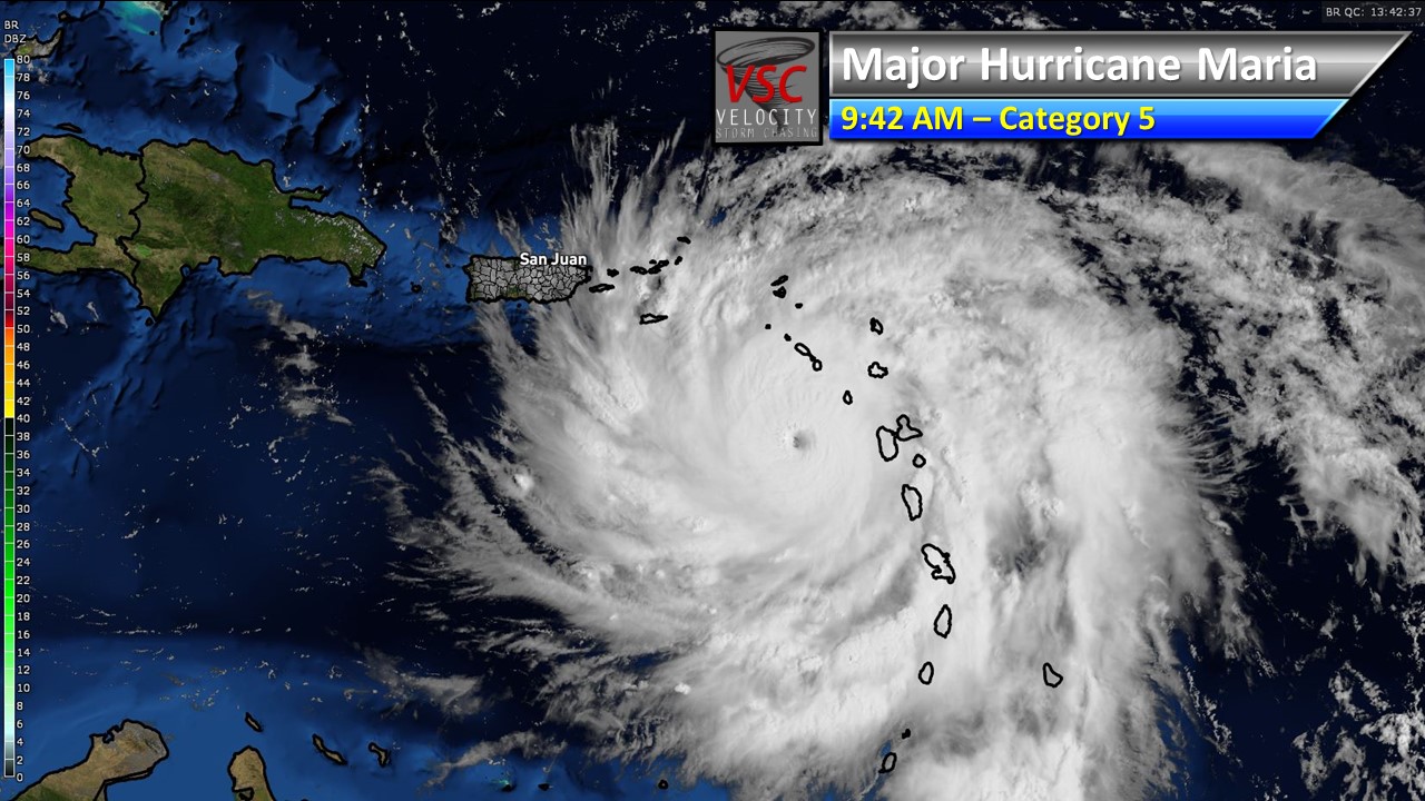
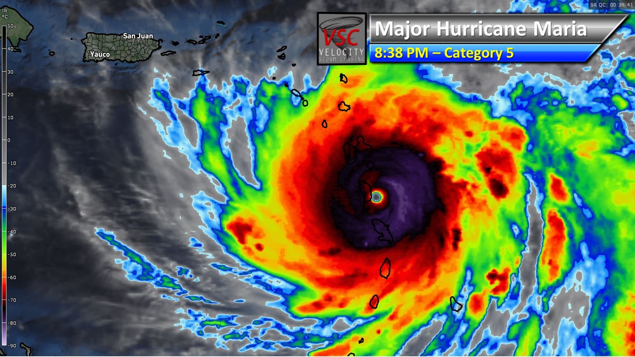
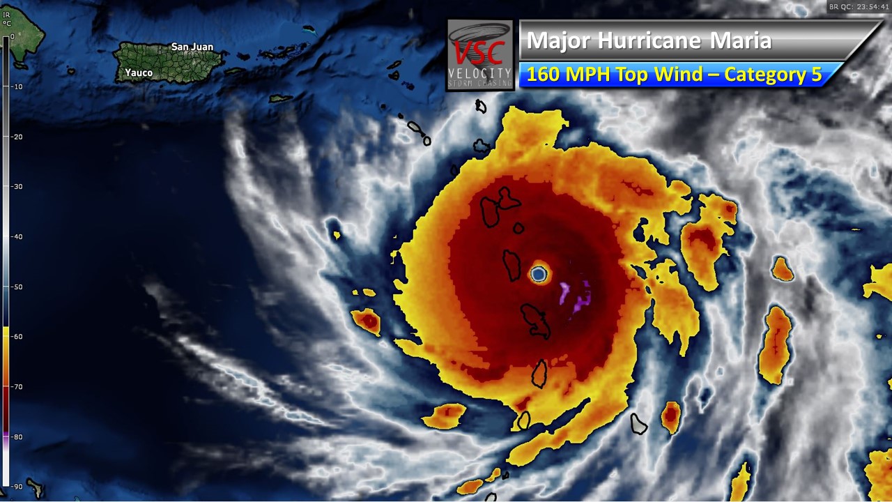
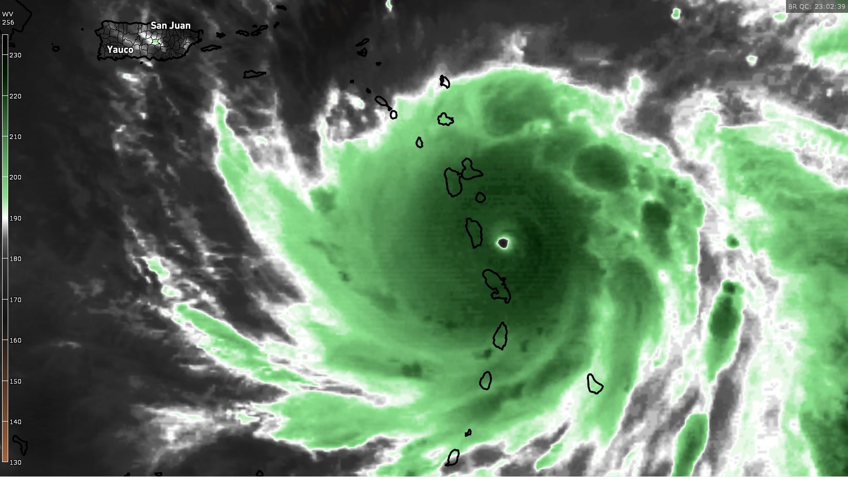
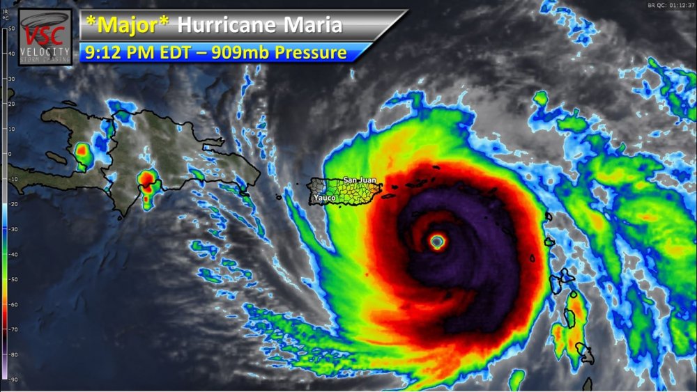
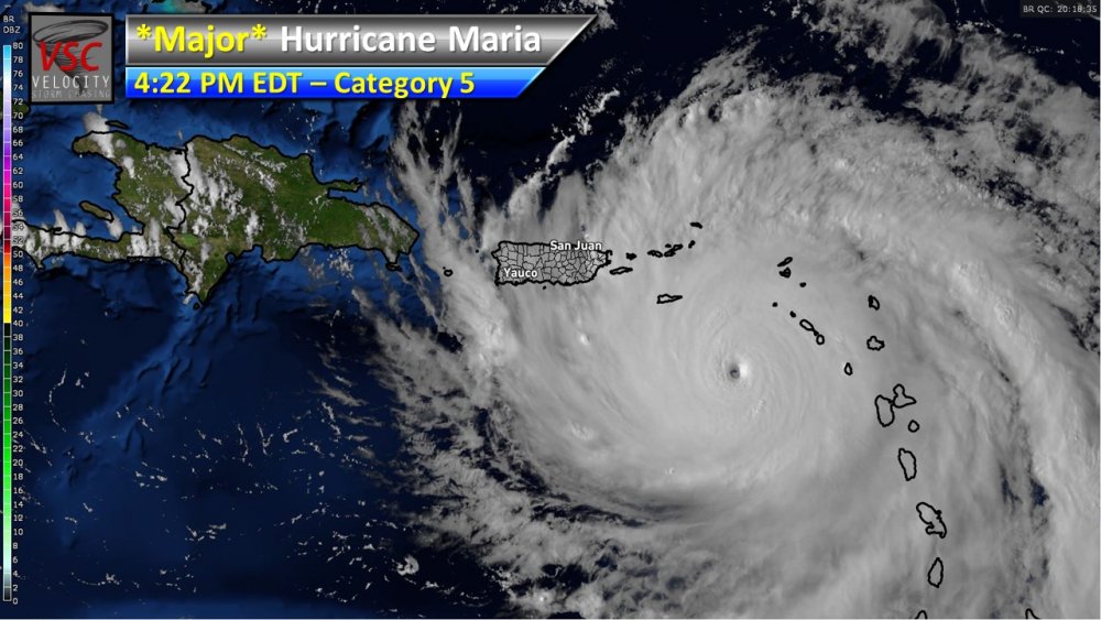
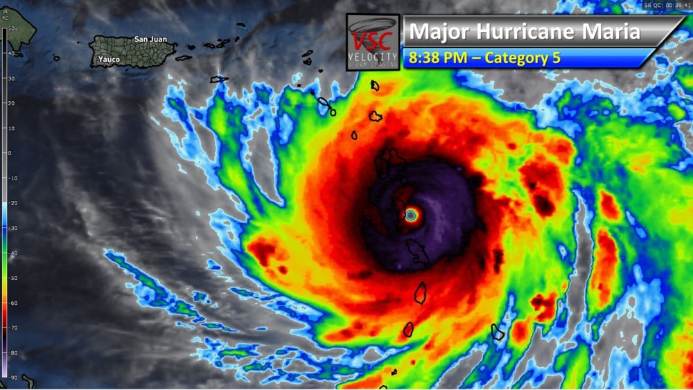
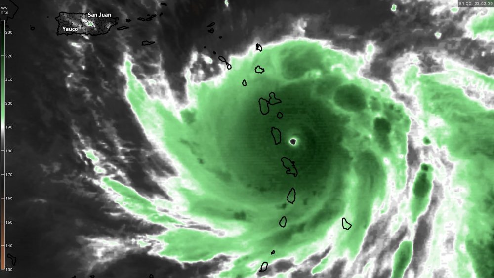
Any possibility Maria goes below 900 mb pressure in the next day or two?
-
-
-

-

Short-Term Severe/Flooding Discussion
Jim Martin replied to Quincy's topic in Central/Western States
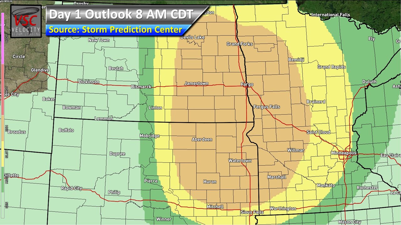
Looking like an active weather day across portions of North Dakota, South Dakota, and Minnesota.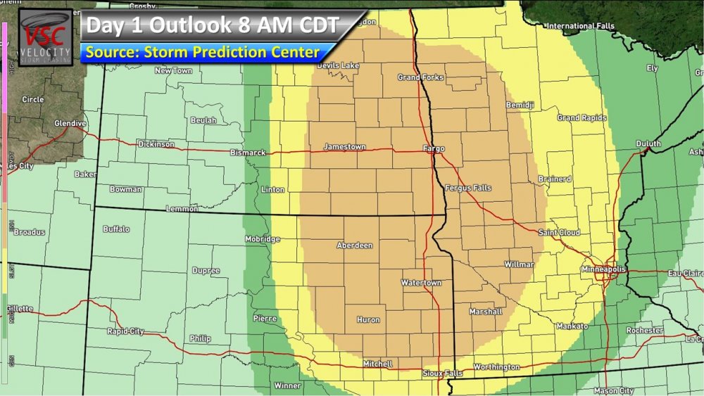
-
-

-
-
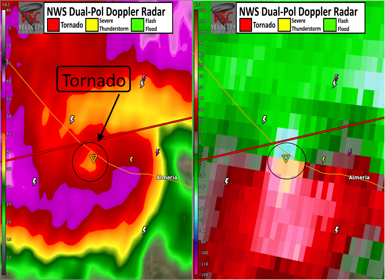
Short-Term Severe/Flooding Discussion
Jim Martin replied to Quincy's topic in Central/Western States
From earlier near Almeria, Nebraska. Tornado even showing up on the base reflectivity mode.
-
Short-Term Severe/Flooding Discussion
Jim Martin replied to Quincy's topic in Central/Western States
Enhanced risk for severe weather today across eastern Kansas and western Missouri. All severe hazards possible.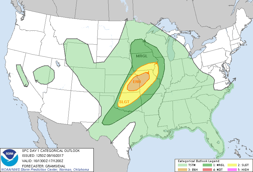
-
Short-Term Severe/Flooding Discussion
Jim Martin replied to Quincy's topic in Central/Western States
Dangerous supercell tonight near Kiowa, KS, moving SE. This supercell is warned for 4" hail & 70 MPH wind currently. Movement is southeast.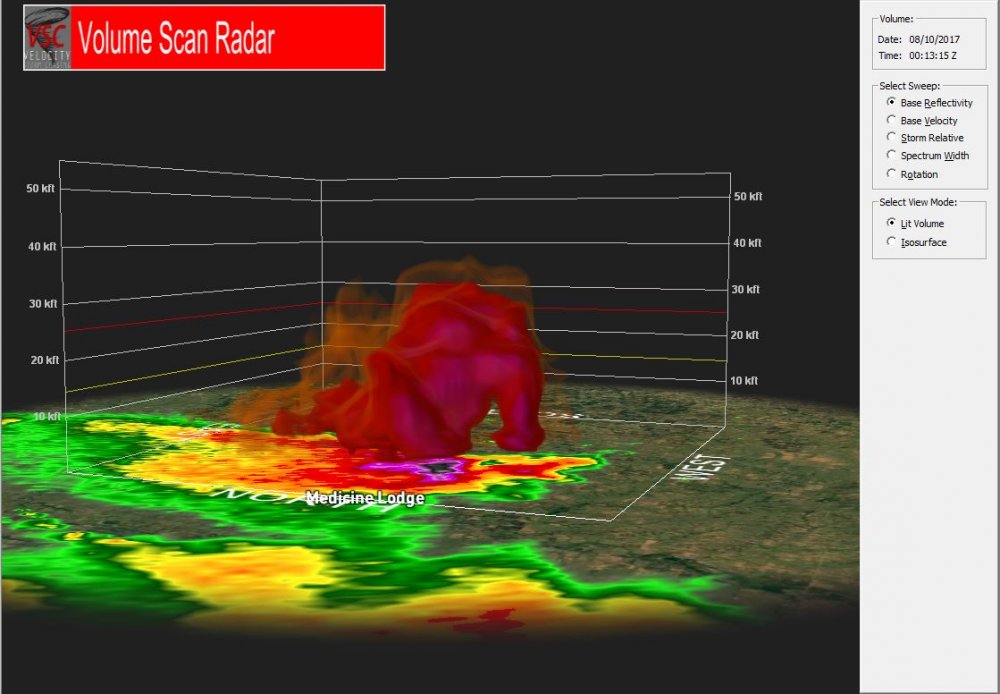
-
Short-Term Severe/Flooding Discussion
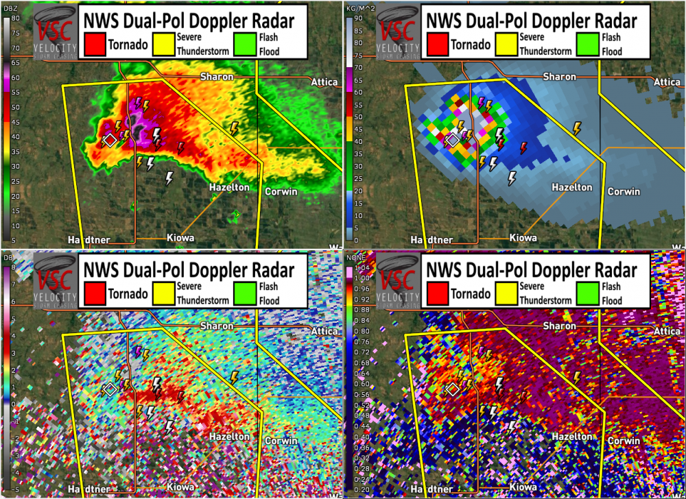
Jim Martin replied to Quincy's topic in Central/Western States
In addition, this same supercell is producing very large, damaging hail. It is confirmed by dual pol data (ZDR, CC, HCA) -
Short-Term Severe/Flooding Discussion
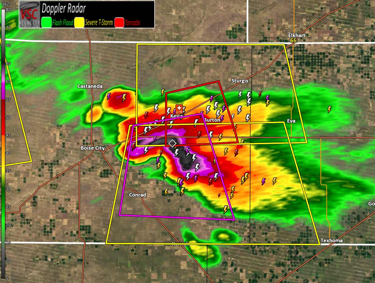
Jim Martin replied to Quincy's topic in Central/Western States
Confirmed tornado currently east of Boise City, Oklahoma. Movement is to the south.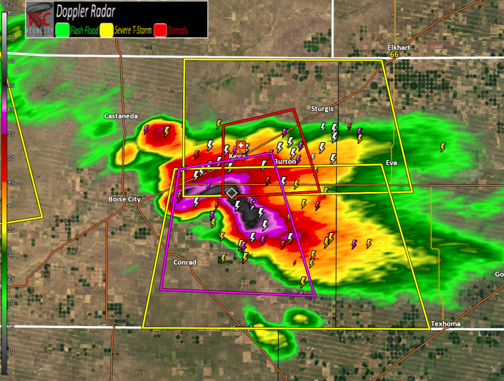
-
Short-Term Severe/Flooding Discussion
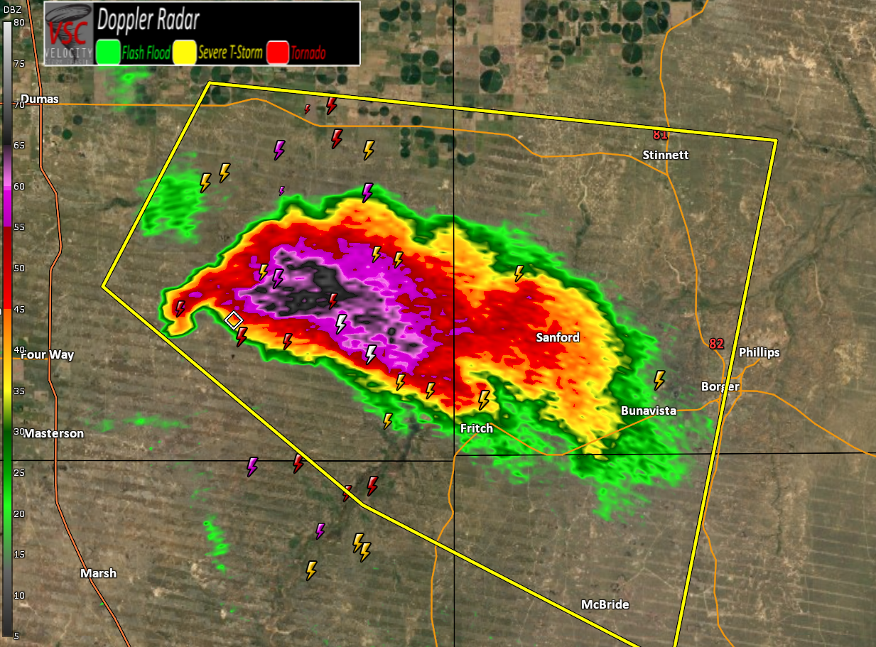
Jim Martin replied to Quincy's topic in Central/Western States
Currently near Fritch, Texas.
-
Short-Term Severe/Flooding Discussion
Jim Martin replied to Quincy's topic in Central/Western States
Tornado Warning now for this supercell.
-
Short-Term Severe/Flooding Discussion
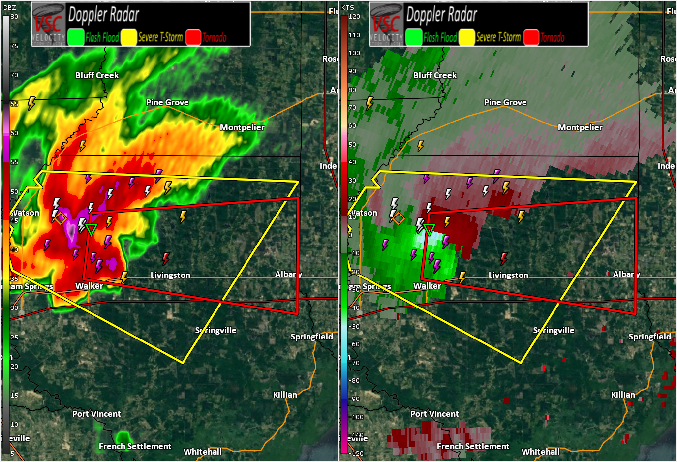
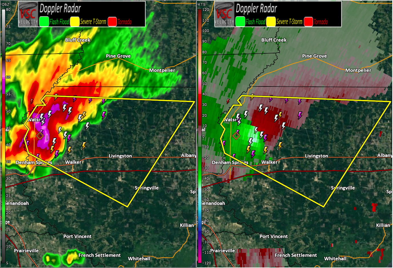
Jim Martin replied to Quincy's topic in Central/Western States
Strong rotation noted on radar west of Livingston, Louisiana currently. Large hail/damaging wind threat.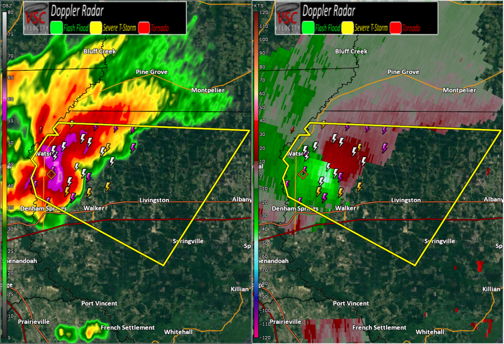
-
Central/Western Medium-Long Range Discussion
Jim Martin replied to andyhb's topic in Central/Western States
From the Storm Prediction Center... ...Day 6/Tue - Southern/Central Plains... Guidance has become more consistent in ejecting a stronger shortwave impulse across the southern Rockies and into the Plains on Tuesday. Rich boundary layer moisture will have had enough time to surge northward ahead of this feature while a lee low deepens over the northern/central Plains. Confidence in an organized severe threat developing in the vicinity of a dryline across parts of central KS into western/central OK and perhaps the eastern TX Panhandle into north TX has increased enough to introduce 15% probabilities. The severe threat may extend further north into the mid-MO Valley ahead of the eastward progressing surface cyclone, but confidence in quality moisture that far north is low at this time.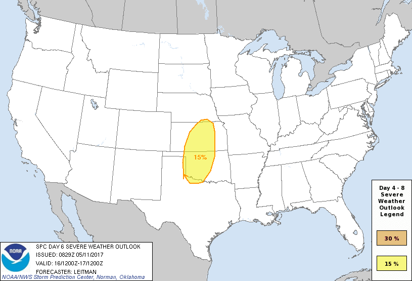
-
Short-Term Severe/Flooding Discussion
Jim Martin replied to Quincy's topic in Central/Western States
Several discrete supercells late tonight in eastern New Mexico and western Texas.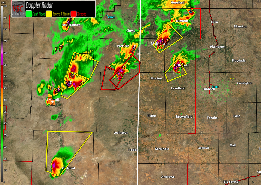
-
Short-Term Severe/Flooding Discussion
Jim Martin replied to Quincy's topic in Central/Western States
The next supercell now crossing into Texas.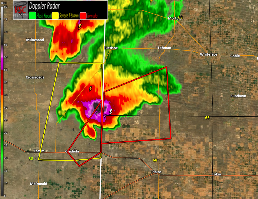
-
Short-Term Severe/Flooding Discussion
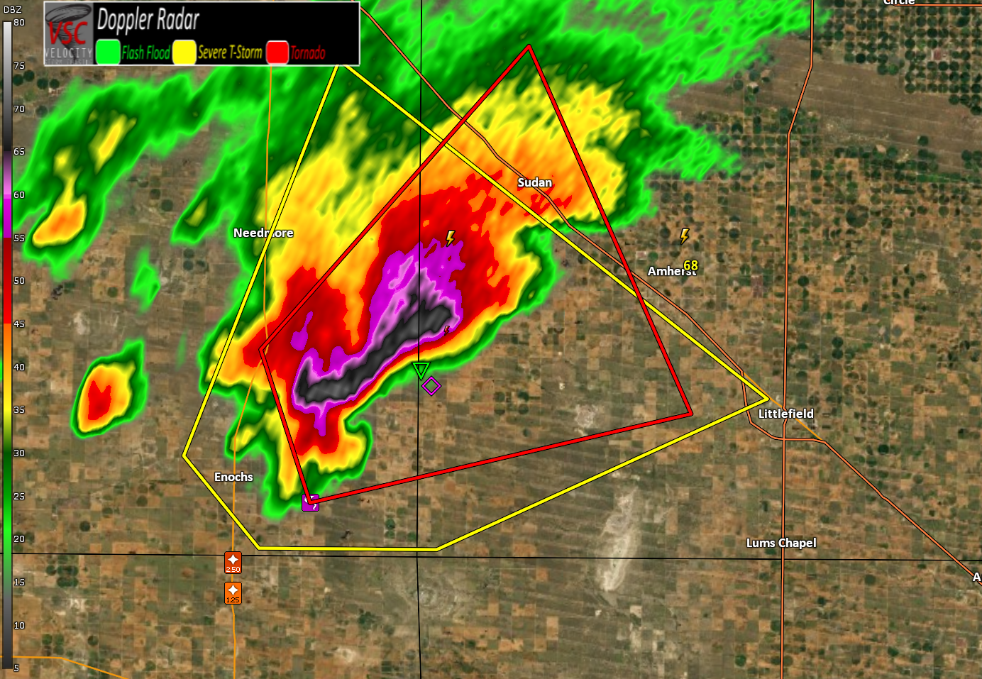
Jim Martin replied to Quincy's topic in Central/Western States
Brief tornado touchdown reported with this supercell near Enochs, Texas. Tornado Warning currently in effect.
-
Short-Term Severe/Flooding Discussion
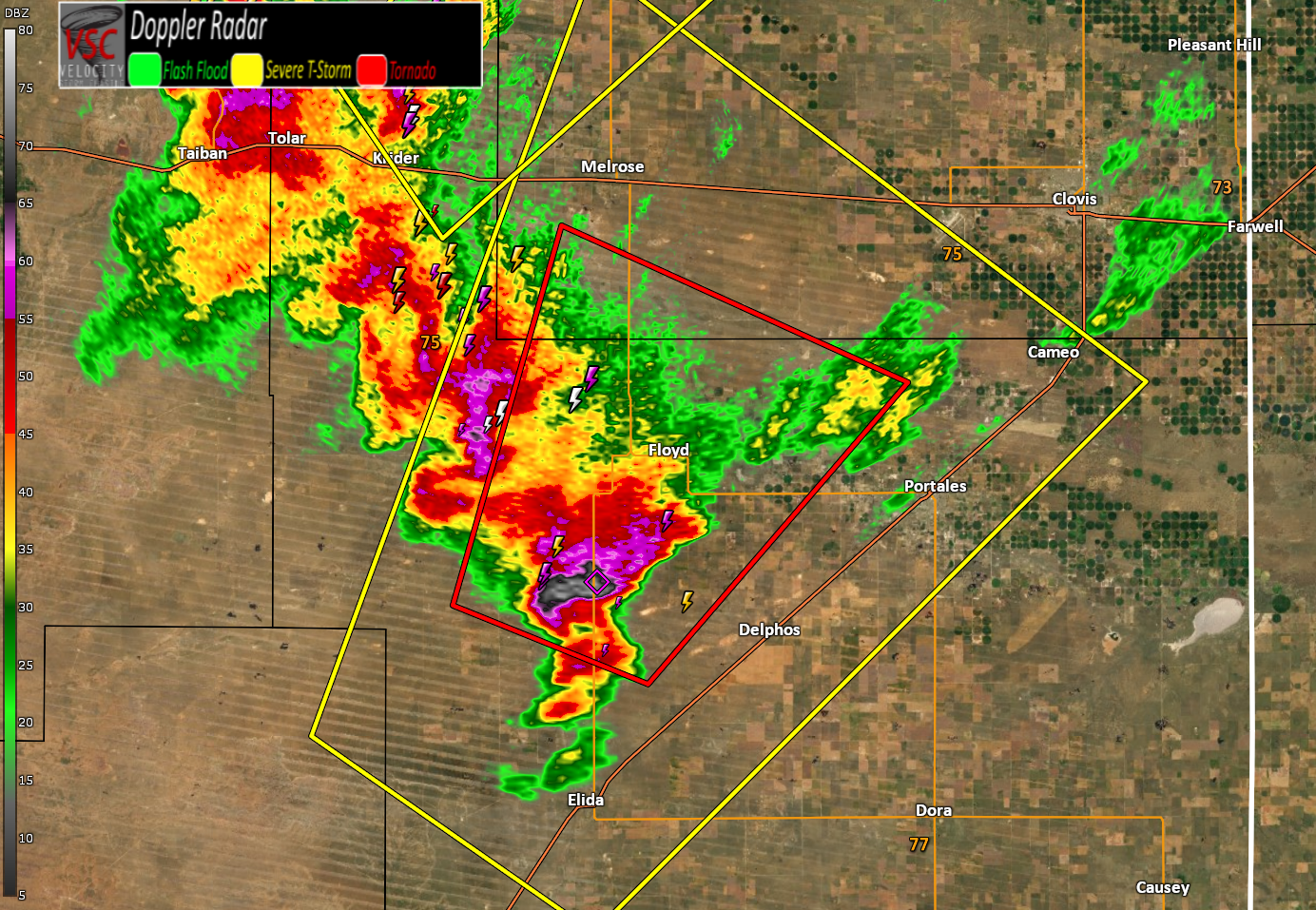
Jim Martin replied to Quincy's topic in Central/Western States
Clovis supercell is now tornado warned.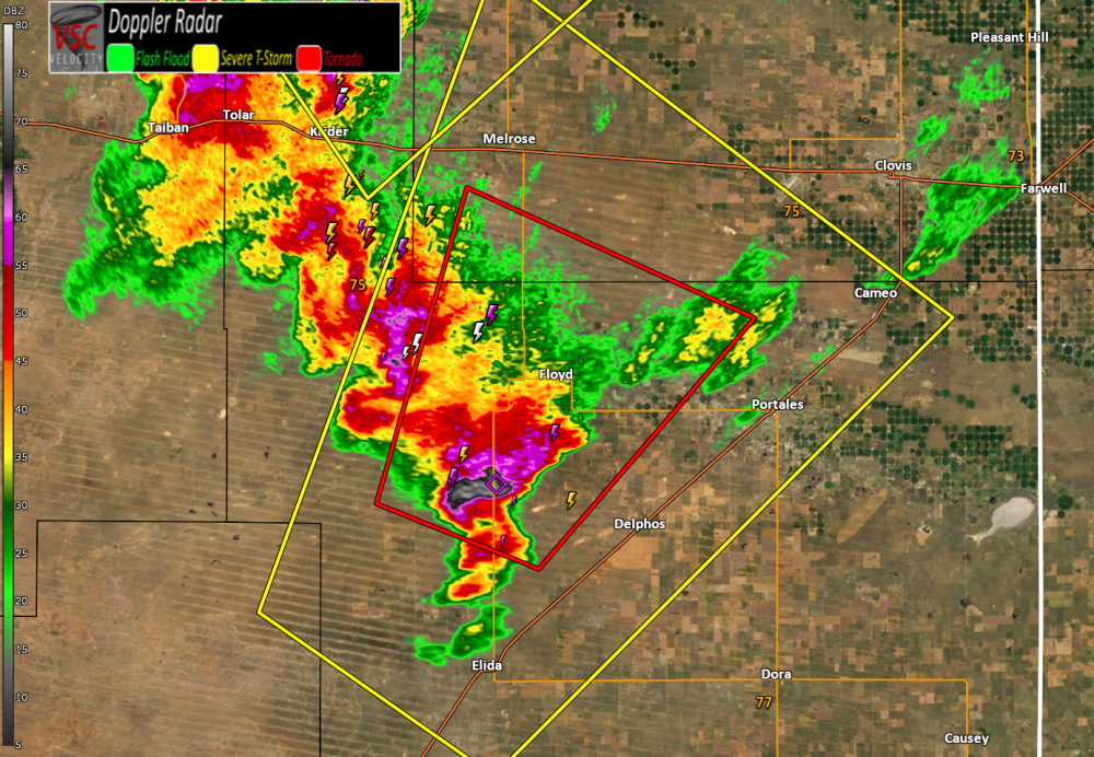
-
Short-Term Severe/Flooding Discussion
Jim Martin replied to Quincy's topic in Central/Western States
Big picture view currently of the watches/warnings in effect.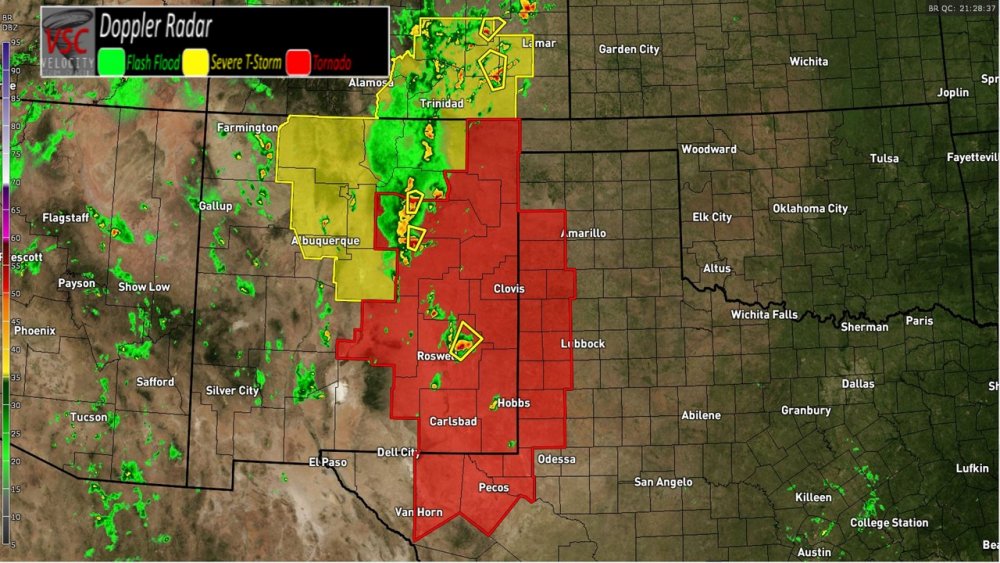
-
Short-Term Severe/Flooding Discussion
Jim Martin replied to Quincy's topic in Central/Western States
It is listed when a convective weather watch is issued by the Storm Prediction Center. -
Short-Term Severe/Flooding Discussion
Jim Martin replied to Quincy's topic in Central/Western States
Possible Tornado southeast of Las Vegas, New Mexico currently. Storm moving north.