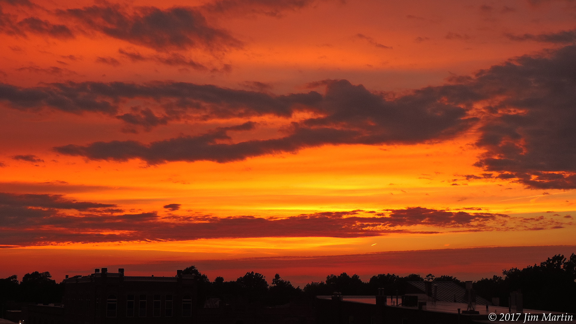

Jim Martin
-
Posts
2,469 -
Joined
-
Last visited
Content Type
Profiles
Blogs
Forums
American Weather
Media Demo
Store
Gallery
Everything posted by Jim Martin
-

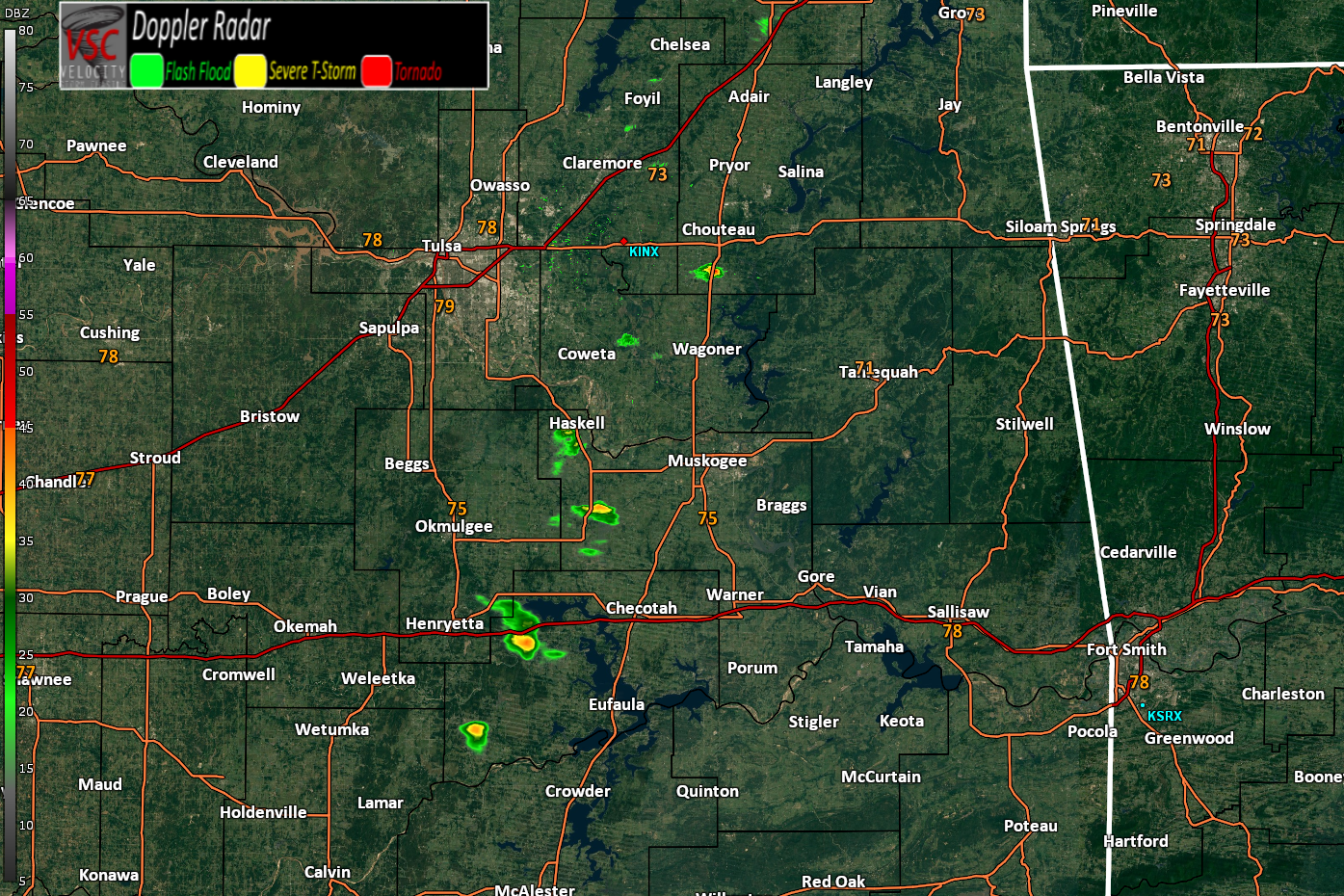
Short-Term Severe/Flooding Discussion
Jim Martin replied to Quincy's topic in Central/Western States
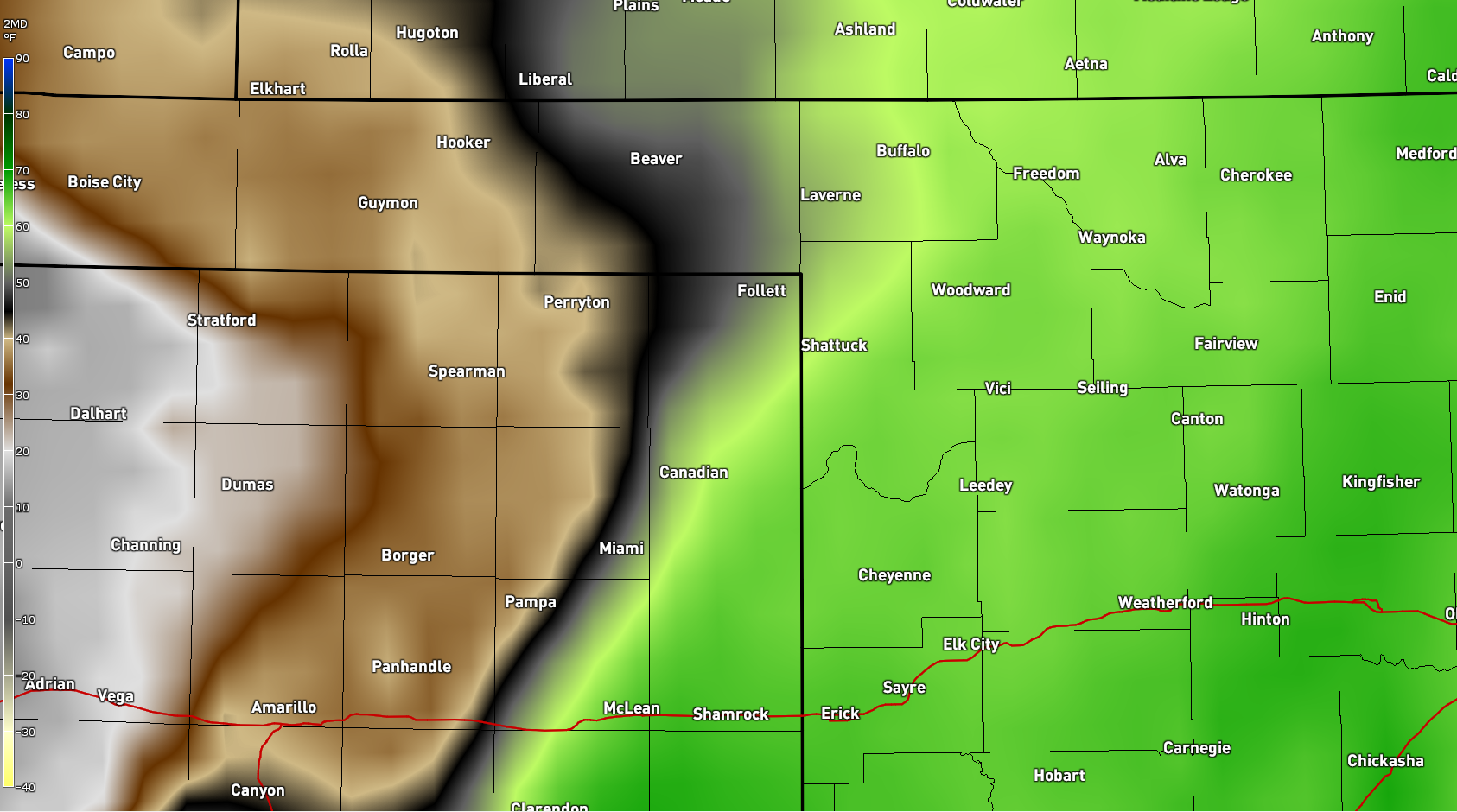
We were not that enthusiastic yesterday. Until the storm developed near Dimmitt. -
Short-Term Severe/Flooding Discussion
Jim Martin replied to Quincy's topic in Central/Western States
First few radar returns too.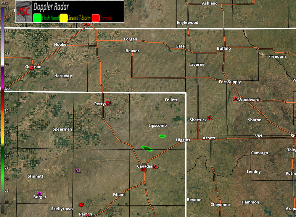
-
Short-Term Severe/Flooding Discussion
Jim Martin replied to Quincy's topic in Central/Western States
-
Short-Term Severe/Flooding Discussion
Jim Martin replied to Quincy's topic in Central/Western States
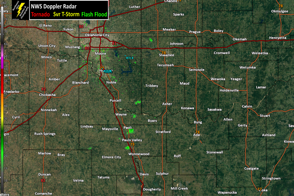
Mid 60s dewpoints already getting into the far eastern Texas Panhandle and western Oklahoma.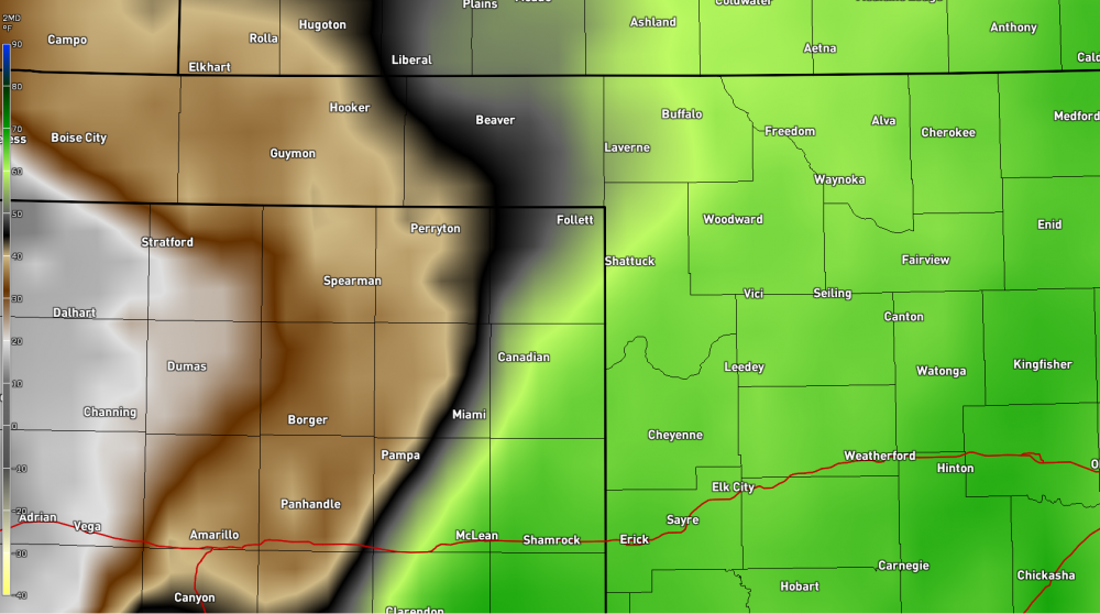
-
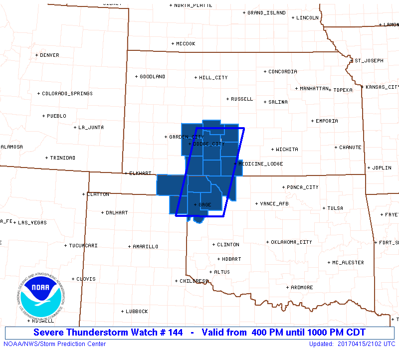
Short-Term Severe/Flooding Discussion
Jim Martin replied to Quincy's topic in Central/Western States
Severe Weather Watch to be issued. Consideration being given to it possibly being a Tornado Watch.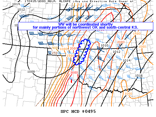
-
Short-Term Severe/Flooding Discussion
Jim Martin replied to Quincy's topic in Central/Western States
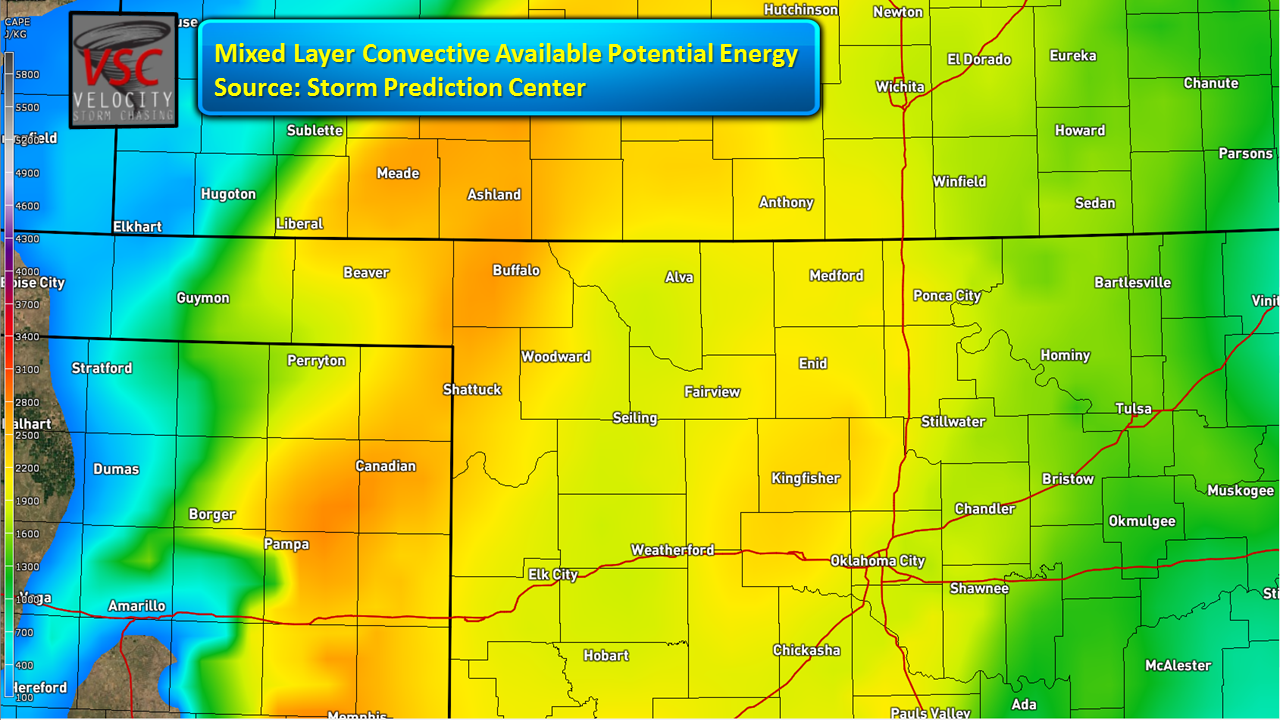
The current SPC Mesoanalysis Mixed Layer Convective Available Potential Energy.
-
Short-Term Severe/Flooding Discussion
Jim Martin replied to Quincy's topic in Central/Western States
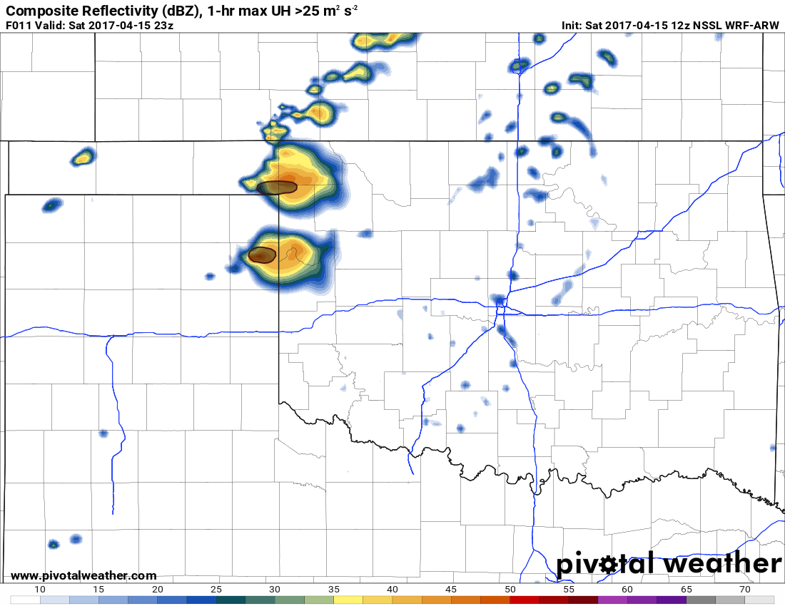
Of all the Convective Allowing Models, the 12z NSSL WRF-ARW is indicating potential for a couple of isolated supercell thunderstorms later today in the Oklahoma and Texas Panhandles, and into far Northwest Oklahoma.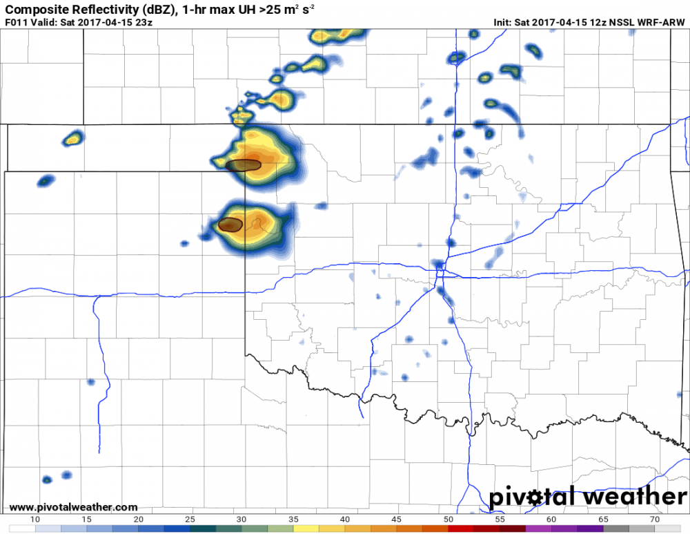
-
Short-Term Severe/Flooding Discussion
Jim Martin replied to Quincy's topic in Central/Western States
Risk of severe weather once again today.
-
Short-Term Severe/Flooding Discussion
Jim Martin replied to Quincy's topic in Central/Western States
Not exactly sure Chinook. -
Short-Term Severe/Flooding Discussion
Jim Martin replied to Quincy's topic in Central/Western States
The anvil from this evolving supercell is now into Kansas based on satellite returns. -
Short-Term Severe/Flooding Discussion
Jim Martin replied to Quincy's topic in Central/Western States
Now it has evolved to be twin supercells.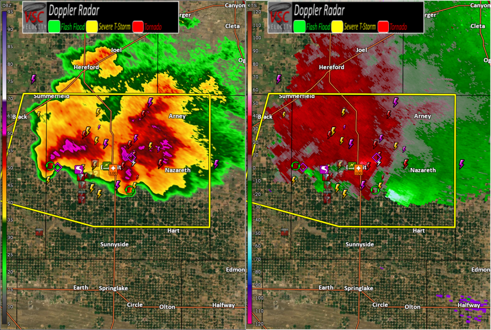
-
Short-Term Severe/Flooding Discussion
Jim Martin replied to Quincy's topic in Central/Western States
This storm has been going for at least the last two to three hours Chinook. To me, it draws comparison to Greensburg KS from May 2007 based on radar. -
Short-Term Severe/Flooding Discussion
Jim Martin replied to Quincy's topic in Central/Western States
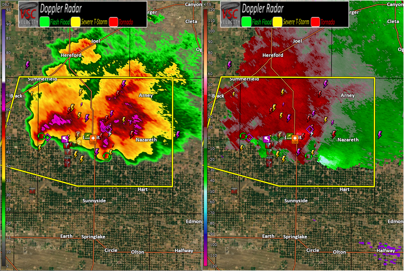
TXC069-150200- /O.CON.KLUB.TO.W.0019.000000T0000Z-170415T0200Z/ Castro TX- 850 PM CDT FRI APR 14 2017 ...A TORNADO WARNING REMAINS IN EFFECT UNTIL 900 PM CDT FOR NORTHERN CASTRO COUNTY... At 847 PM CDT, a severe thunderstorm capable of producing a tornado was located near Dimmitt, moving east at 10 mph. The greatest area of concern is about 3 miles southeast of Dimmitt. A second area of rotation was located about 12 miles west of Dimmitt. These storms continue to evolve and require constant monitoring. -
Short-Term Severe/Flooding Discussion
Jim Martin replied to Quincy's topic in Central/Western States
This storm will be studied for some time... Easily the storm of the year to this point. -
Short-Term Severe/Flooding Discussion
Jim Martin replied to Quincy's topic in Central/Western States
Currently north of Dimmitt.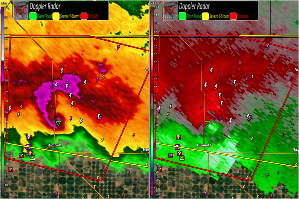
-
Short-Term Severe/Flooding Discussion
Jim Martin replied to Quincy's topic in Central/Western States
This speaks for itself.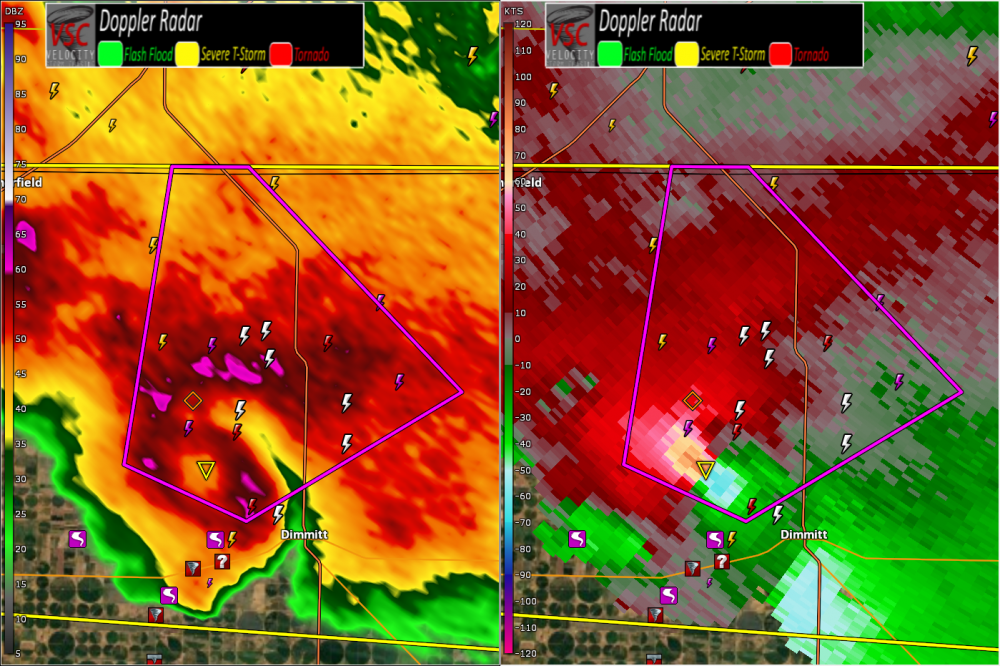
-
Short-Term Severe/Flooding Discussion
Jim Martin replied to Quincy's topic in Central/Western States
Just wow...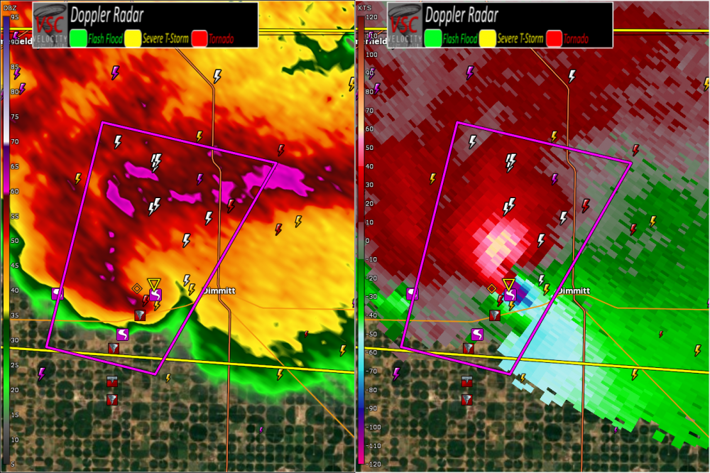
-
Short-Term Severe/Flooding Discussion
Jim Martin replied to Quincy's topic in Central/Western States
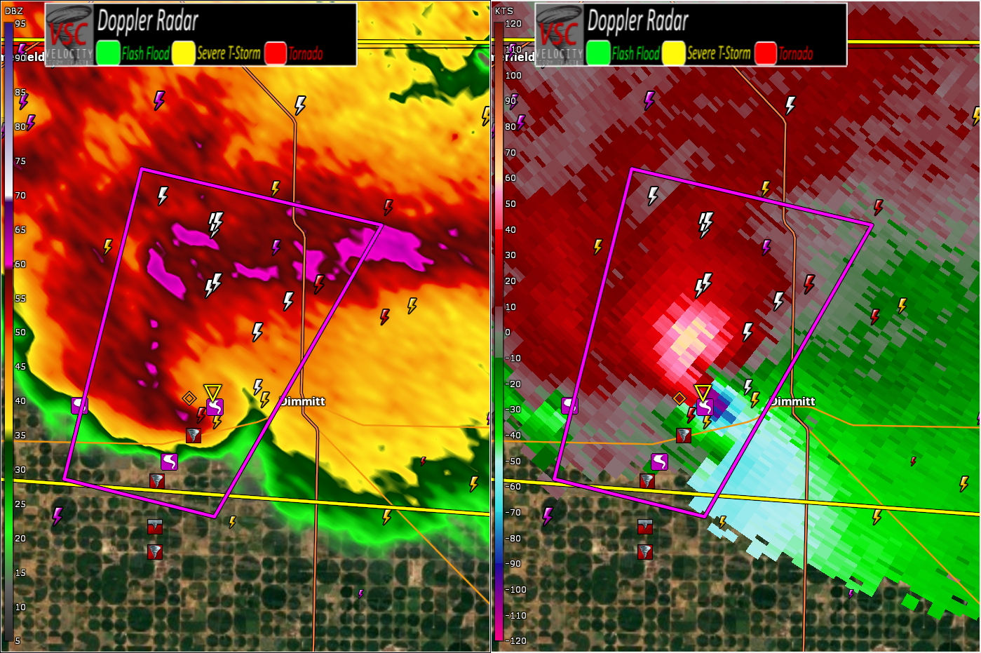
Radar view of the same tornado producing supercell thunderstorm.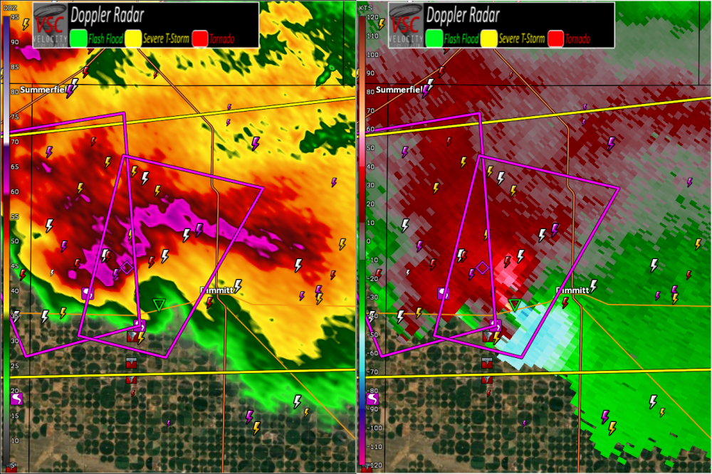
-
Short-Term Severe/Flooding Discussion
Jim Martin replied to Quincy's topic in Central/Western States
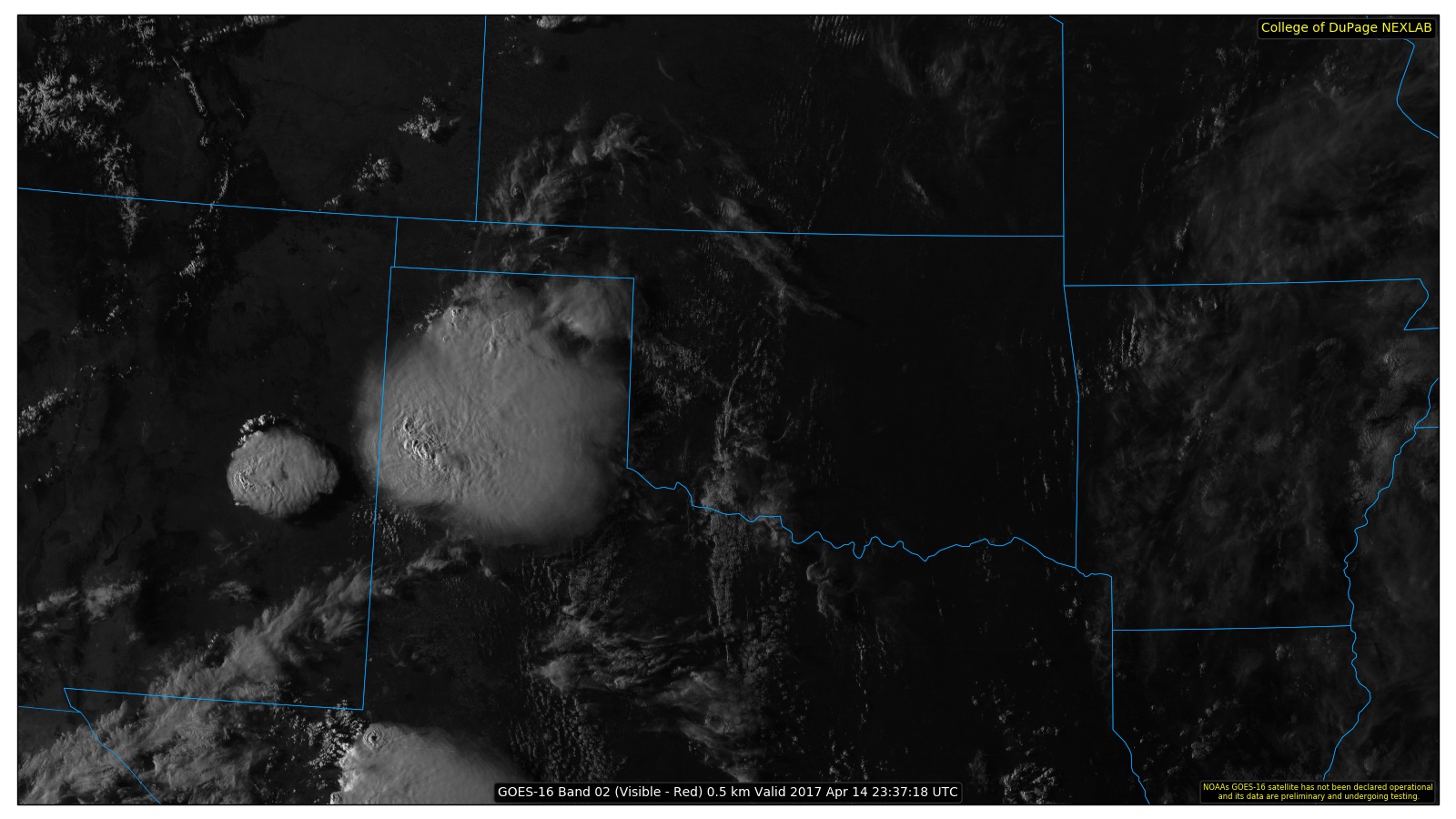
Impressive GOES-16 Satellite view of the Dimmitt, Texas tornado producing supercell thunderstorm this evening.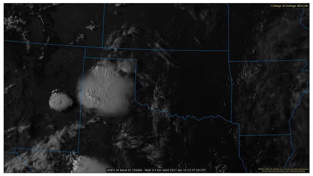
-
Short-Term Severe/Flooding Discussion
Jim Martin replied to Quincy's topic in Central/Western States
The National Weather Service in Lubbock Texas has issued a * Tornado Warning for... Northeastern Parmer County in the Panhandle of Texas... Northwestern Castro County in the Panhandle of Texas... * Until 700 PM CDT * At 628 PM CDT, a confirmed large and extremely dangerous tornado was located 8 miles southwest of Easter, or 10 miles west of Dimmitt, moving north at 10 mph. -
Short-Term Severe/Flooding Discussion
Jim Martin replied to Quincy's topic in Central/Western States
Confirmed tornado west of Dimmitt, Texas currently. Storm also warned for hail up to three inches in diameter.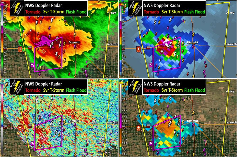
-
Short-Term Severe/Flooding Discussion
Jim Martin replied to Quincy's topic in Central/Western States
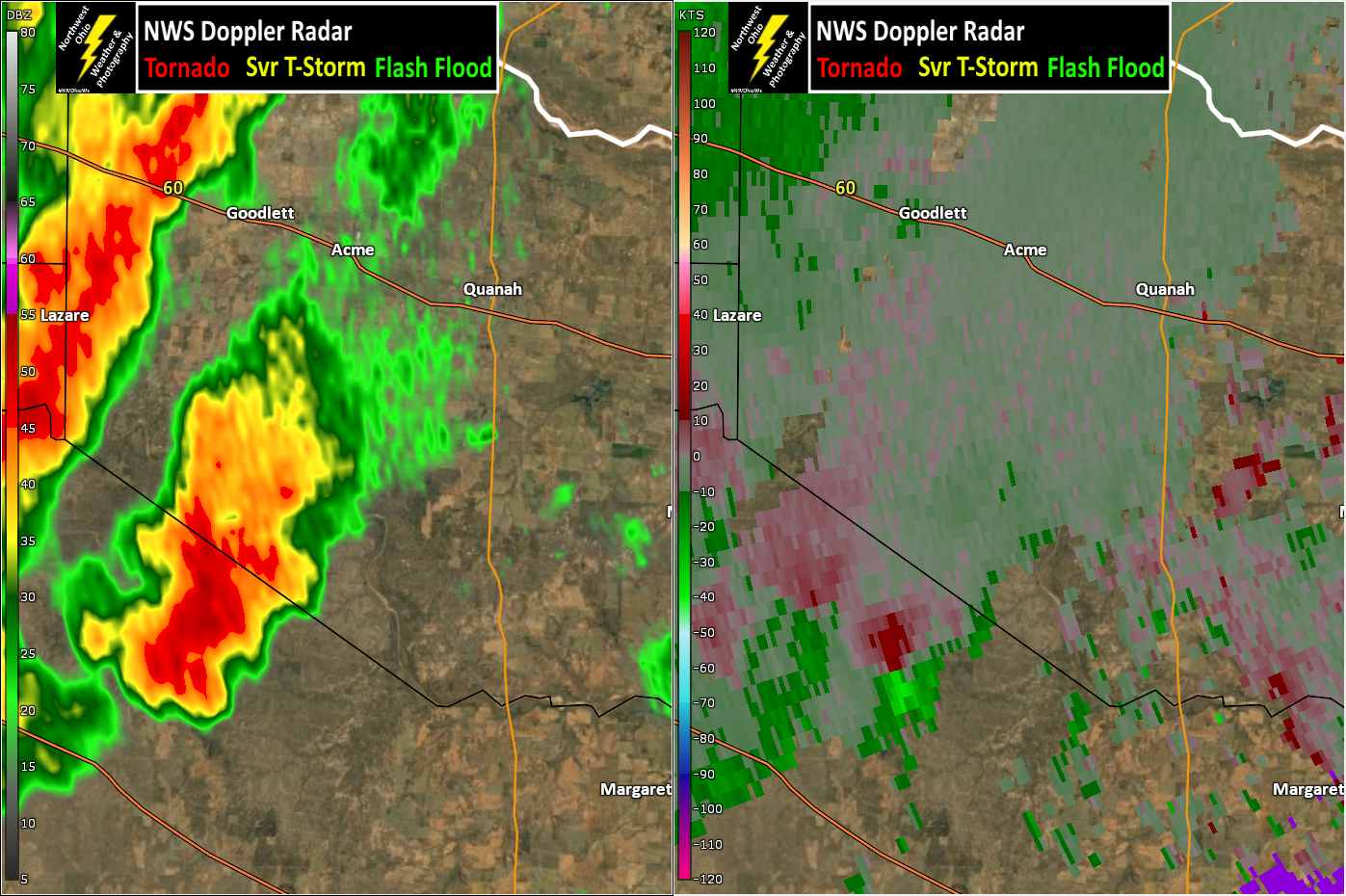
A bit of rotation with this discrete thunderstorm on the Foard/Hardeman County, Texas line this hour.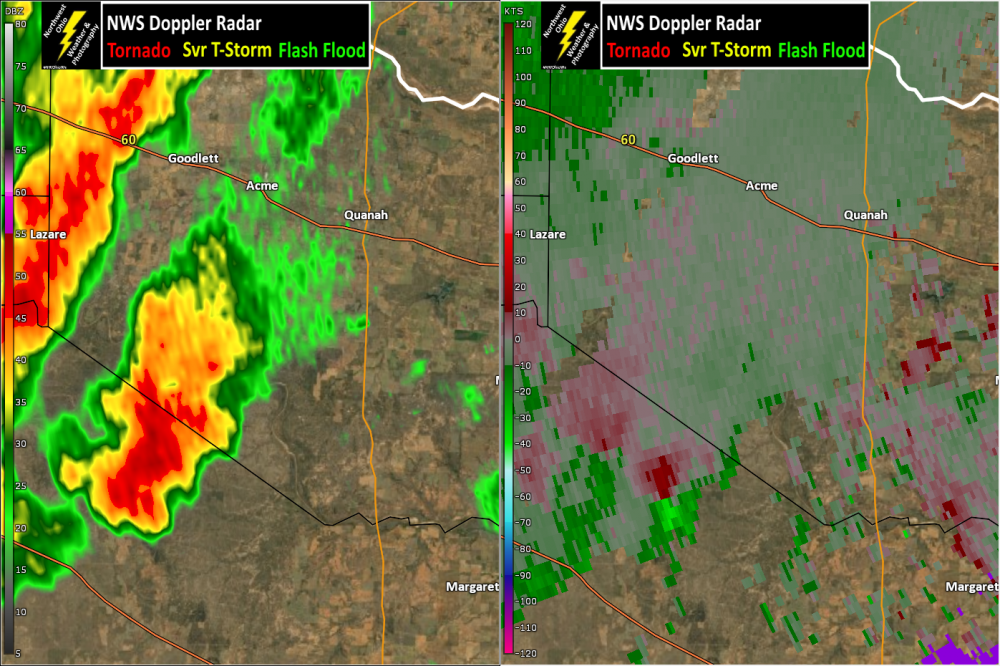
-
Short-Term Severe/Flooding Discussion
Jim Martin replied to Quincy's topic in Central/Western States
This severe thunderstorm earlier north of Oilton, Texas had quite the warning on it... TXC479-112330- /O.CON.KCRP.SV.W.0017.000000T0000Z-170411T2330Z/ Webb TX- 610 PM CDT TUE APR 11 2017 ...A SEVERE THUNDERSTORM WARNING REMAINS IN EFFECT UNTIL 630 PM CDT FOR SOUTHEASTERN WEBB COUNTY... At 610 PM CDT, a severe thunderstorm was located 11 miles northeast of Ranchitos Las Lomas, or 28 miles southwest of Freer, moving southeast at 20 mph. This is a very dangerous storm. HAZARD...Softball size hail and 60 mph wind gusts.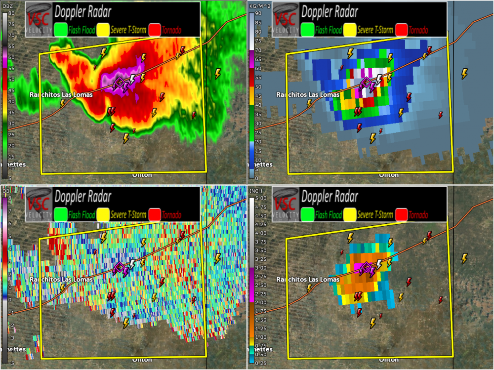
-
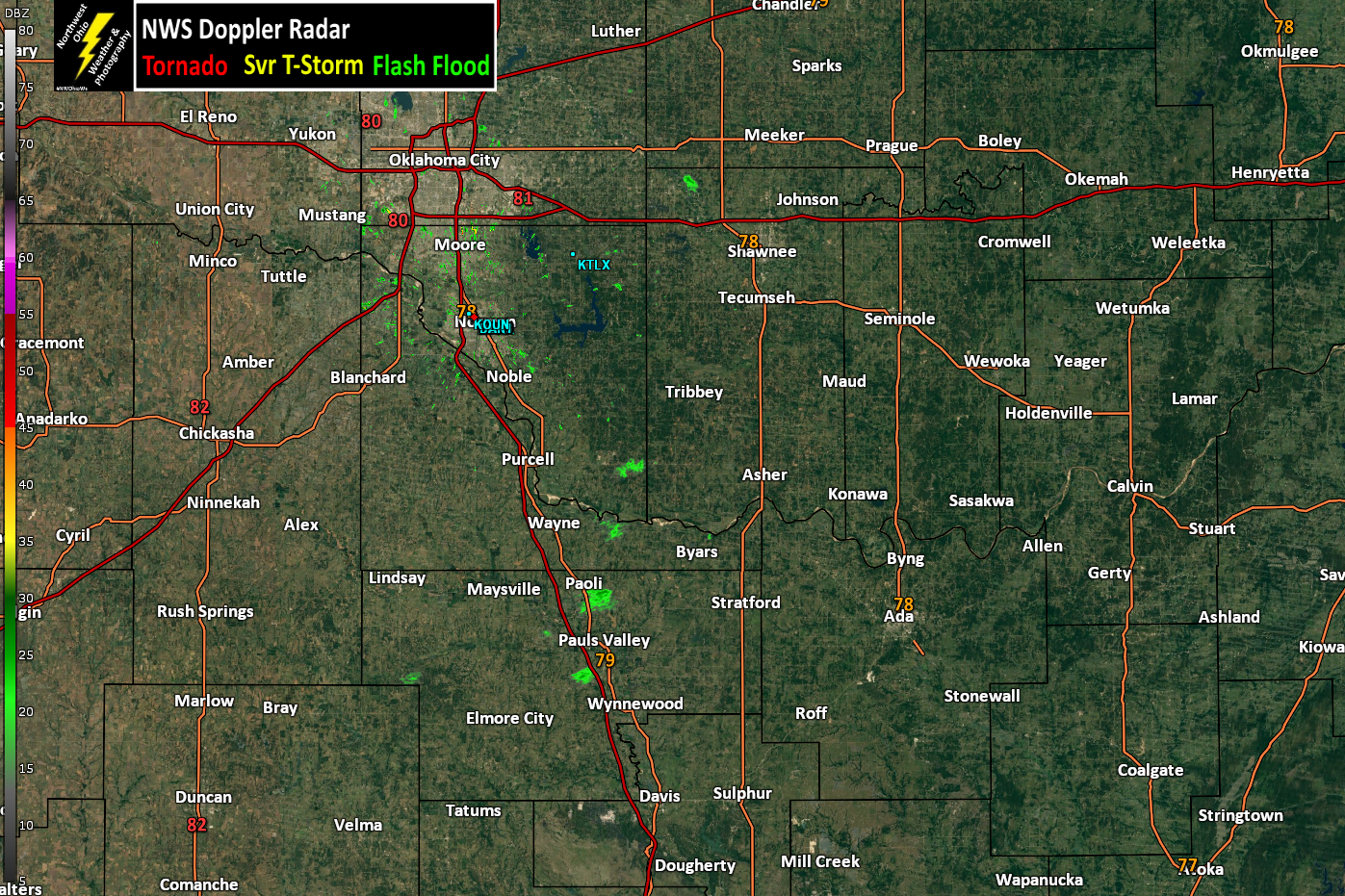
Central/Western Medium-Long Range Discussion
Jim Martin replied to andyhb's topic in Central/Western States
Cap breaking possibly?
-
Central/Western Medium-Long Range Discussion
Jim Martin replied to andyhb's topic in Central/Western States
Few cells trying to develop east of Interstate 35 this hour.