CAPE
-
Posts
36,844 -
Joined
-
Last visited
Content Type
Profiles
Blogs
Forums
American Weather
Media Demo
Store
Gallery
Everything posted by CAPE
-
It's compacting. At 6am when I checked Ridgely had 8.1"
-
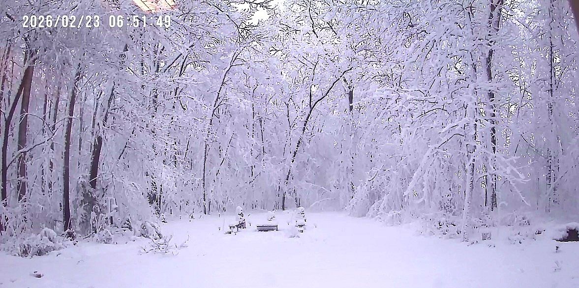
Reposting here. I put it in the other thread. Here is a shot from my security cam. Lots of sagging tree limbs and I am sure there is damage. The power was out there for 2 hours last night. Looks like Narnia lol.

-

The February 22-23 Late Season Miracle: JV Disco/Banter Thread
CAPE replied to bncho's topic in Mid Atlantic
Shot from my security cam. Haven't seen branches bent and sagging like that for a long time. Narnia look lol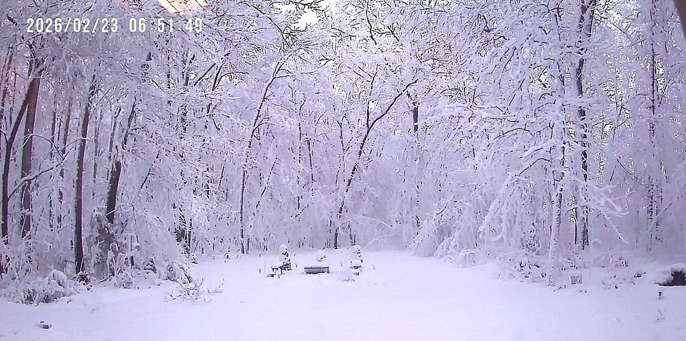
-
Looking at the local Mesonet stations, Ridgely snow depth is 8.1 and Goldsboro 9.6. My house is in between those 2. Still snowing moderately per radar.
-
eta- Goldsboro, 3 mi to my NE is reporting a depth of 6.8"
-
Ridgely Mesonet station, 3 miles to my SW, is reporting a snow depth of 5.43 inches. Reasonable to think my yard is pushing 6"
-
That's a long term deal. So are mine. We know why. But the 'losing the margins' argument doesn't apply to every discrete event. Macro vs micro.
-
The last storm we had was very cold- historically so for the period that followed. Several storms such as the beach blizzards in 2017 and 18 were cold powder. I don't disagree with the general concept, but it simply does NOT apply in all cases and you beat that dead horse constantly. We get it. I remember forecasts failing for not being cold enough as a kid up in your world back in the 80s. Always counterpoints to these arguments.
-
Yeah the yellows are filling in. I'm not there though.
-
My uncle lives there. Those bands are pivoting west, hopefully to my yard.
-
or was it dry
-
Although in recent winters its been the opposite, so I am afraid you arent going to have much agreement on this one from those in the NW burbs.
-
I made a post early this morning about the forecast for here being too bullish. I said it should be more like 8-12, but I would favor closer to 8 at this point.
-
There was a clear trend across guidance for the heavier snows to occur right along the MA coast up into eastern NJ and Long Island. Not sure about Philly, but they probably should do ok.
-
I mean yeah, my 10-16 forecast tonight and 2-4 tomorrow sure as fuck isn't going to verify. This was clearly going to be a legit COASTAL storm, favoring places east and NE. Hopium is powerful shit. Maybe someone can explain how the MA beaches get more blizzards in the last 10 years instead of complaining about generic margins, and don't tell me its all NINA climo. That's lazy.
-
What?
-
What margins are we losing when eastern areas at low elevation are getting crushed, in a marginal cold set up!. There is always nuance to this stuff. The deepening low and its location in this situation favors heavy snow in places that normally get less, while places inland at elevation are struggling to accumulate. I need more explanation about losing margins. Otherwise it sounds like whiny BS.
-
Looks like 4 inches or so on my security cam at home. Snow has been moderate here in Easton and going sideways with the wind. Probably 2-3 inches.
-
Yeah I'm here at the school now. Snowing pretty good but smallish flakes. Nice coating otg.
-
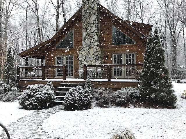
Just out cleaning off and starting the jeep. My next post will be from Easton. Hate to leave this. Last shot before I go. Some of those flakes are 2"
-
Love these massive flakes. beautiful. All the tree limbs are covered. Wish it were a couple degrees colder/not a wet ground. This would easily be 2-3 inches. As it is the first inch is otg. Glad this happened earlier than expected so I could enjoy it before hitting the road. still 32.5
-
Been continuously in these heavy bands. Right on the edge. Should see action increase further west at the low strengthens.
-
Hopefully. Ill see what's otg tomorrow around 4pm lol I have some local peeps that will periodically measure for me.
-
Heavy rates and dynamic cooling doin it temp 32.5
-
One pic before I have to go spend the rest of the storm at work lol