blizzardof96
-
Posts
1,565 -
Joined
-
Last visited
About blizzardof96

Recent Profile Visitors


-
Interesting. I think you're right. Looking at the YYZ daily data they have 13.4cm recorded on Feb 17th. Good chance that YYZ recorded more than 1.6cm past midnight.
-
Looks like ~3" here in kingston with a glaze of ice underneath. YYZ reporting a 6" storm total although I suspect many parts of the city are above that. Considerable blowing and drifting as well.
-
It was bang on this afternoon with the timing of the GTA changeover. Very helpful for these events.
-
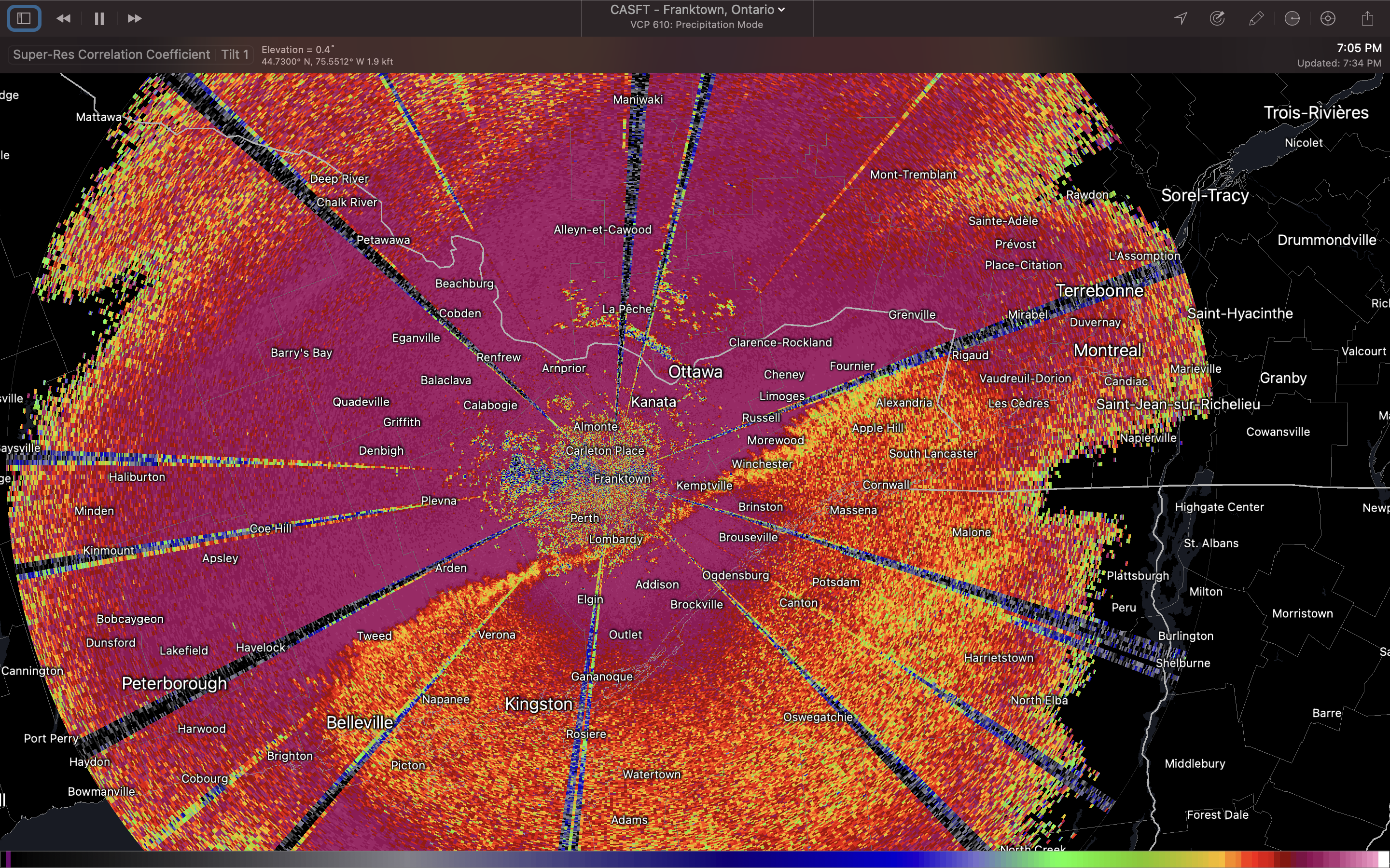
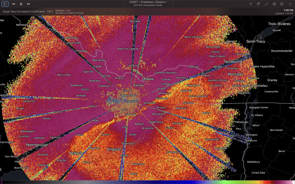
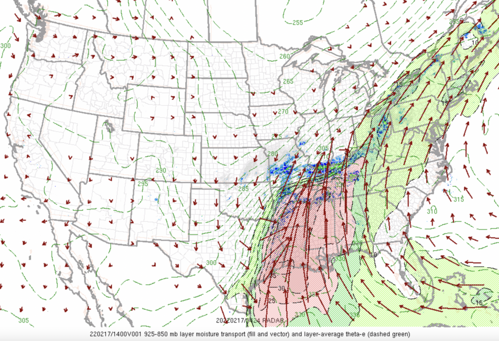
Pouring rain here in Kingston with snow being reported in Ottawa. Mixing line located from north of Belleville - Perth - Kemptville, expected to push southeast over the next few hours. Expecting a fairly decent amount of PL before changeover to snow.
-
-
Something that popped into my head that is kind of interesting. My first memory of posting on this forum was with the Feb 7/8 storm in 2013. Crazy to think that it's been over 9 since since then and that we still interact from time to time on this forum. Time flies.
-
18z 3kNAM big hit for GTA with amounts near 10". Low tracks ~990mb through Erie, PA always seem to get it done around here.
-
Agreed. I think they'll either issue WSWs or snowfall warnings for areas further east into GTA. Probably coming out this afternoon or into tonight. They are always hard to predict though, lol.
-
EC has hoisted winter storm warnings for SW ON, extending from Windsor-Sarnia-London-St Thomas
-
Fairly good model consensus on 6-10" for the GTA with 401 bullseye
-
Measured 18" at my place. Downsview recorded the same amount. Everybody in the neighbourhood agreed that was the most snow they have ever experienced by far. Never seen anything like it before in Toronto.
-
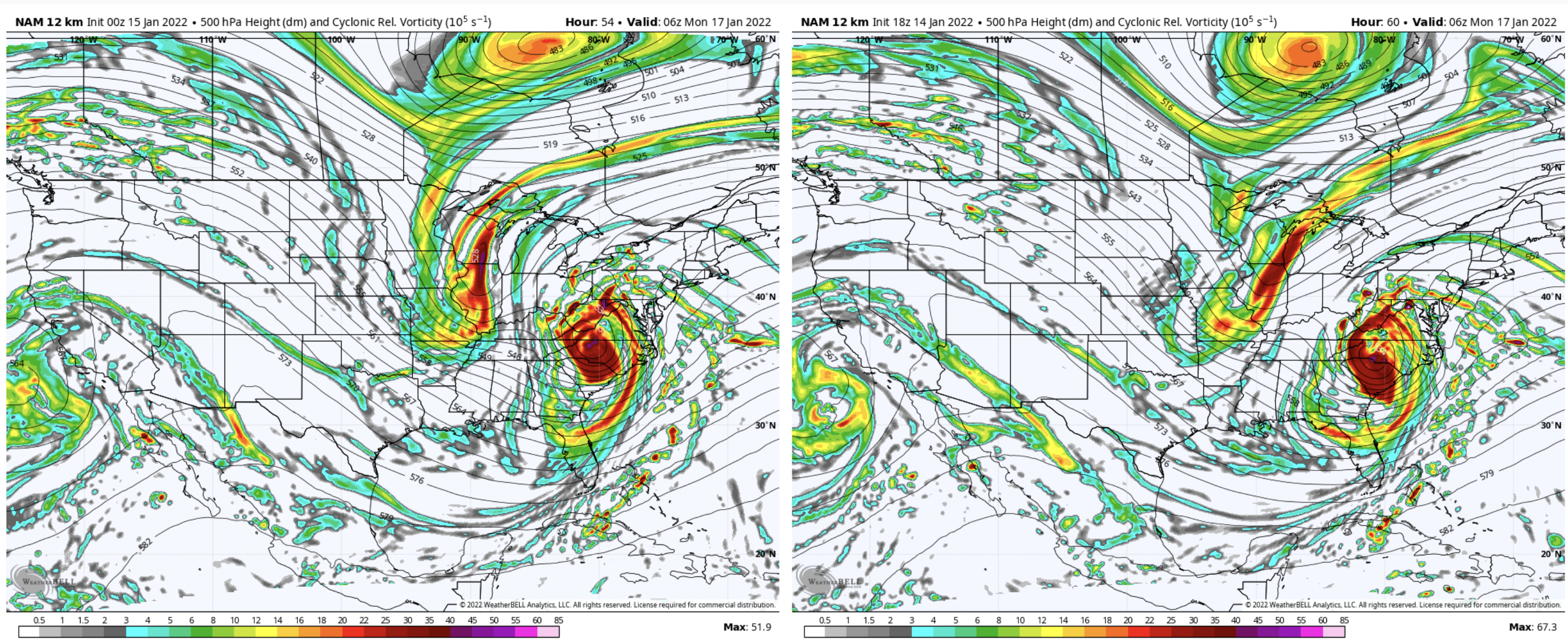
 Can see the differences in the energy over the plains. 0z NAM (left) vs 18z NAM (right).
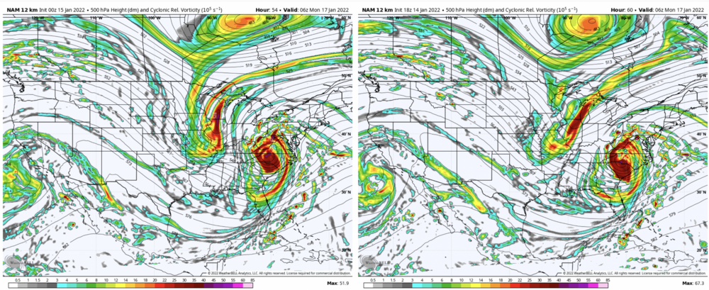
-
For Toronto, since 1855: Number of 24"+ events 0 Number of 20"+ events 4 Number of 18"+ events 7 Number of 15"+ events 21 Number of 12"+ events 46 % chance of seeing a 12"+ snowstorm in a snowfall season 28% 15"+ 13% 18"+ 4% 20"+ 2.5% 24"+ RARE
-
Tough to say at this point. Small changes in the strength/positioning of the plains vort is resulting in practical changes to the low track. This alters the position of the deformation zone. Recent runs have been trending a bit further south/stronger with the plains vort... leading to more phasing with our cutoff low. Under this scenario (eg 18z ECMWF), the heaviest snow band tracks a bit further NW through GTA etc. Another plausible scenario is something like the 18z NAM which is a bit less phased with the low track further east. Future runs (starting with 0z tonight) should help clarify things and build consensus... hopefully.
-
Fingers crossed that we get into that deformation zone in Toronto