All Activity
- Past hour
-

Central PA Winter 25/26 Discussion and Obs
pasnownut replied to MAG5035's topic in Upstate New York/Pennsylvania
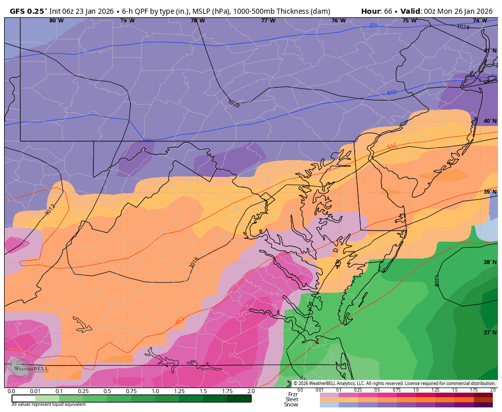
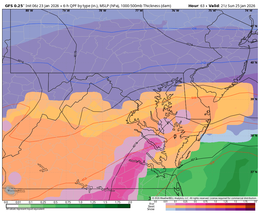
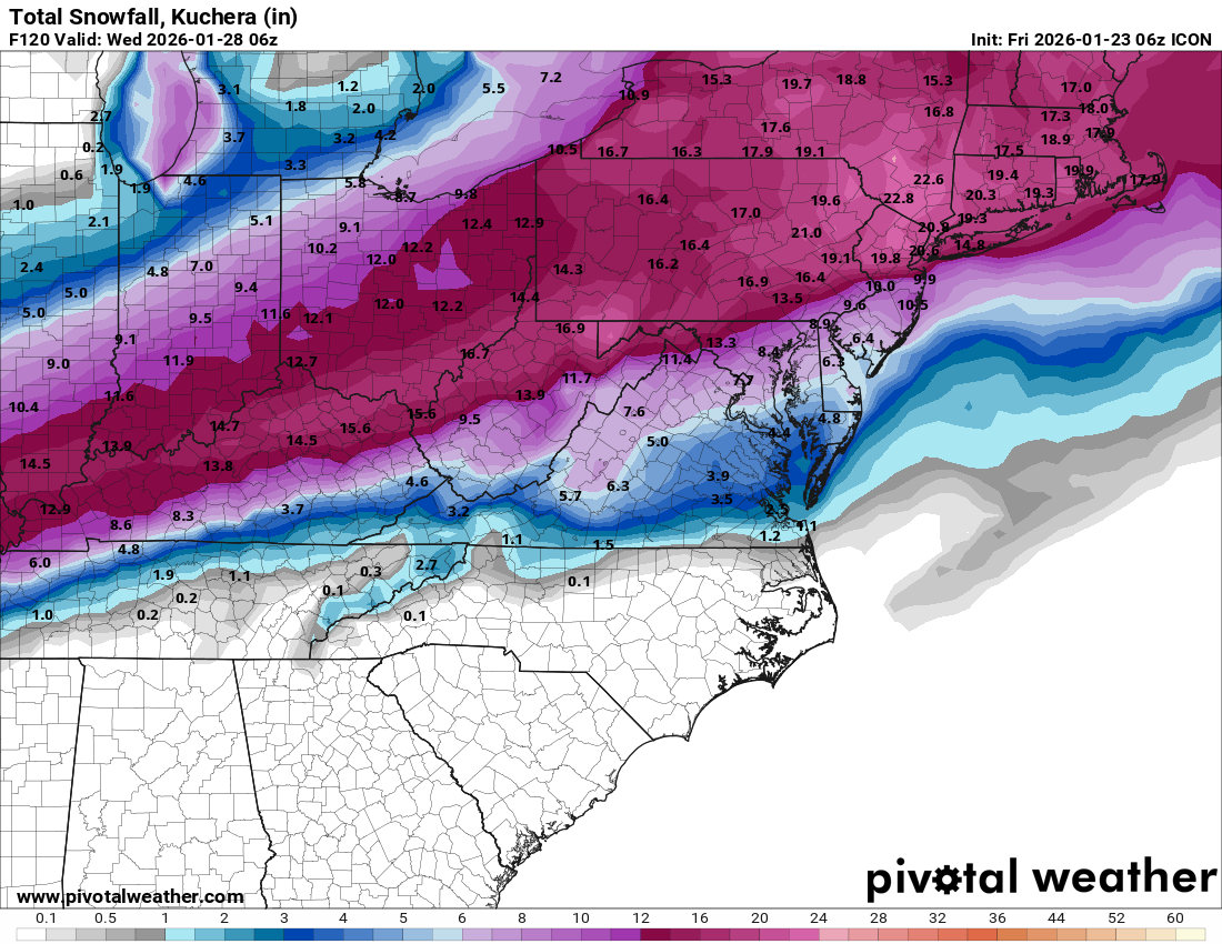
6z GFS also ticks S and has no taint except for extreme SE corner of Philly really nice to see cold holding its ground, and not getttin bullied by primary. Just a thing of beauty. -
The backside always works out when it’s that juicy.
-
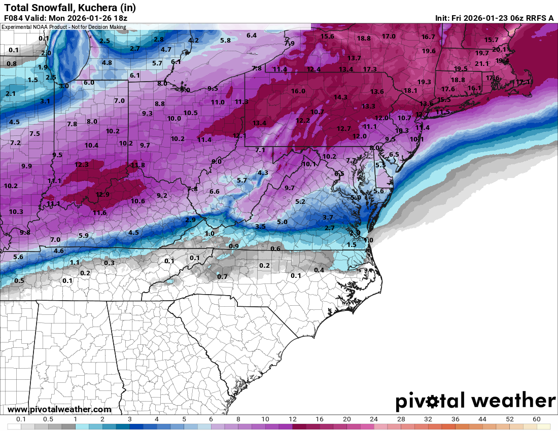
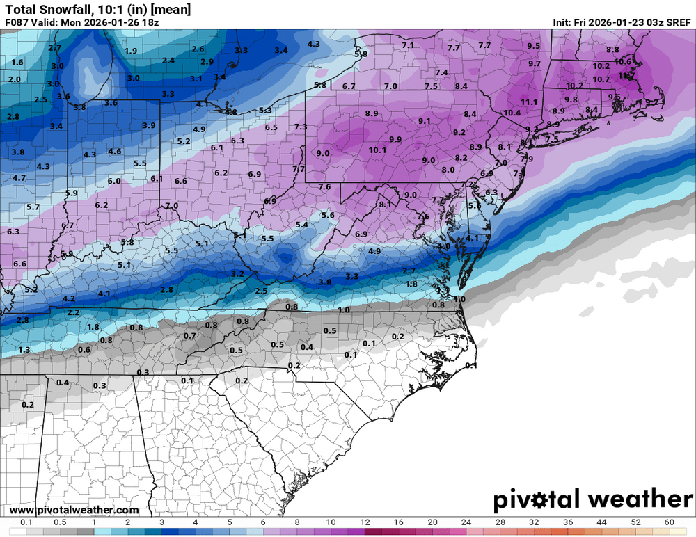
Gfs smoke show
-
WB 6Z GFS....another solid run!!!


-
Man.. I hope that backside works out. Light to moderate snow Sunday night would be pure powder.
-

Pittsburgh/Western PA WINTER ‘25/‘26
colonel717 replied to Burghblizz's topic in Upstate New York/Pennsylvania
-
-

Central PA Winter 25/26 Discussion and Obs
mahantango#1 replied to MAG5035's topic in Upstate New York/Pennsylvania
Your forecast is almost identical to mine. -
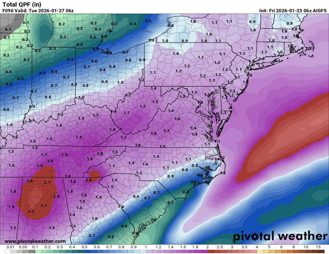
About the best run we could ask for and still more to come as we flip back
-
Smoke show up here
-
Still getting rocked at 60, freezing line around Fredericksburg
-
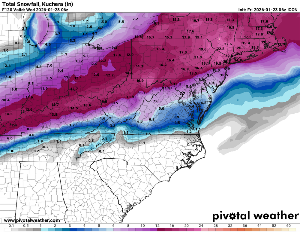
Central PA Winter 25/26 Discussion and Obs
pasnownut replied to MAG5035's topic in Upstate New York/Pennsylvania
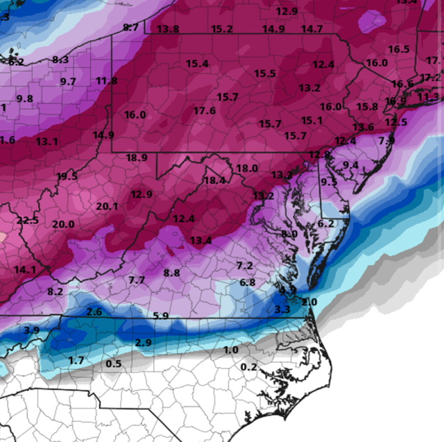
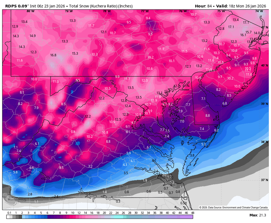
6z's starting off the day w/ good steps. Icon pops secondary quicker and bring perty blues 40-50 mile SE with it. Saves my ass from much taint. Giddy up buttercups.... Yardsticks snippet from ctp also a thing of beauty. Celebration of life service this morning Celebration of snow rest of weekend. -
7 pm

-
4 pm

-
Pittsburgh/Western PA WINTER ‘25/‘26
colonel717 replied to Burghblizz's topic in Upstate New York/Pennsylvania
-
Getting rocked at 57
-
10 am
-
7am

-
Pittsburgh/Western PA WINTER ‘25/‘26
colonel717 replied to Burghblizz's topic in Upstate New York/Pennsylvania

-
Money frames inbound at 51 and colder
-
Wow! Big improvement. Hopefully the models are picking up on the power of this cold.
-
Pittsburgh/Western PA WINTER ‘25/‘26
colonel717 replied to Burghblizz's topic in Upstate New York/Pennsylvania
-
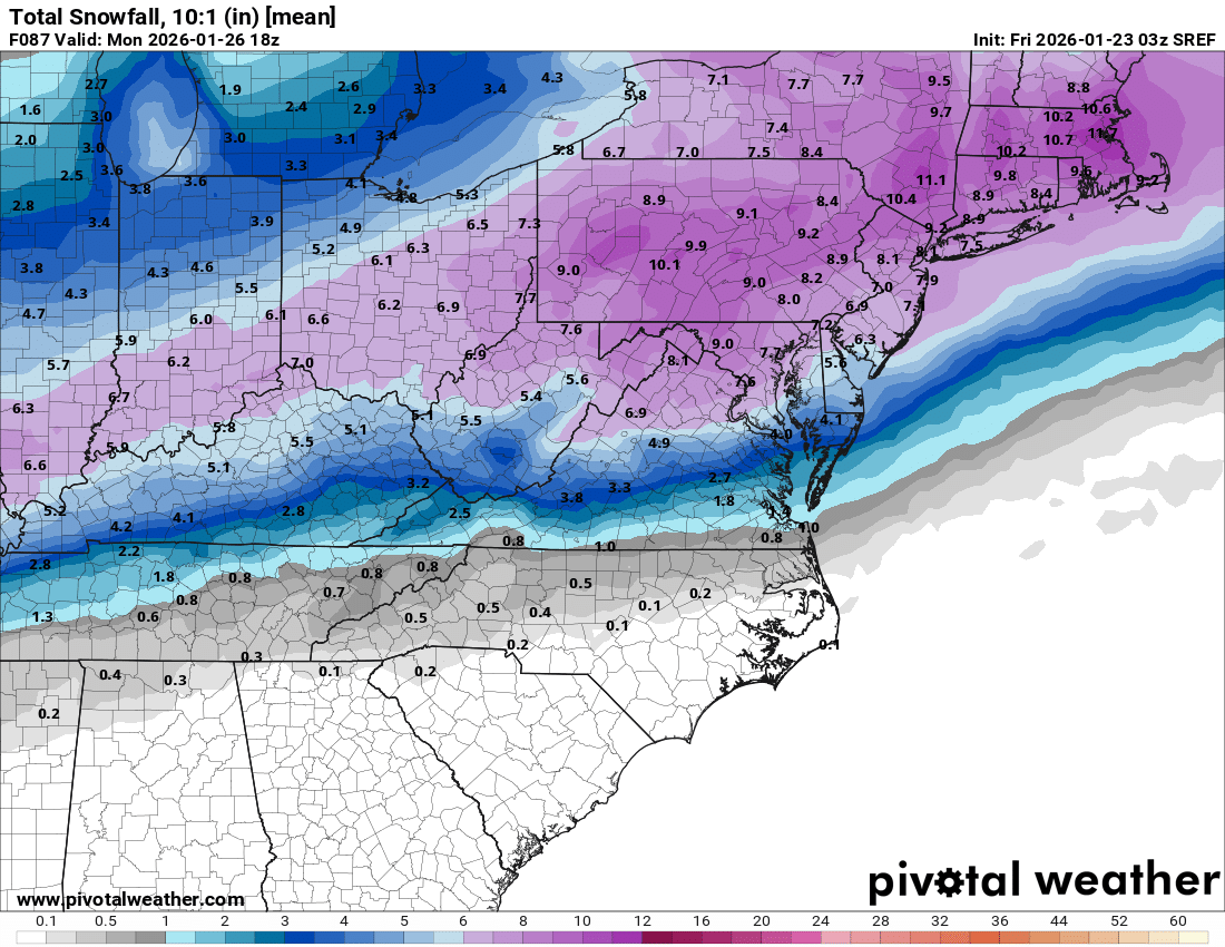
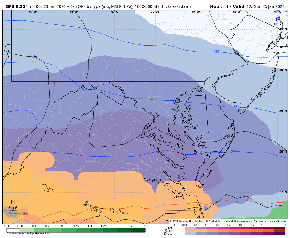
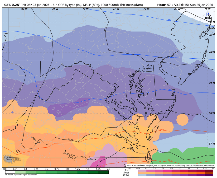
Room also in LWX's forecast for DCA: Saturday Night Snow. The snow could be heavy at times. Low around 17. Northeast wind 3 to 6 mph. Chance of precipitation is 100%. New snow accumulation of 3 to 7 inches possible. Sunday Snow, freezing rain, and sleet. The snow could be heavy at times. High near 27. Northeast wind 8 to 10 mph. Chance of precipitation is 100%. New snow and sleet accumulation of 3 to 7 inches possible. Sunday Night Snow, freezing rain, and sleet before 10pm, then snow and freezing rain between 10pm and 4am, then a chance of snow after 4am. Low around 20. Chance of precipitation is 90%. New snow and sleet accumulation of around an inch possible.
-
Snow in region at 45: looking about same as 0z
-

Central PA Winter 25/26 Discussion and Obs
Voyager replied to MAG5035's topic in Upstate New York/Pennsylvania
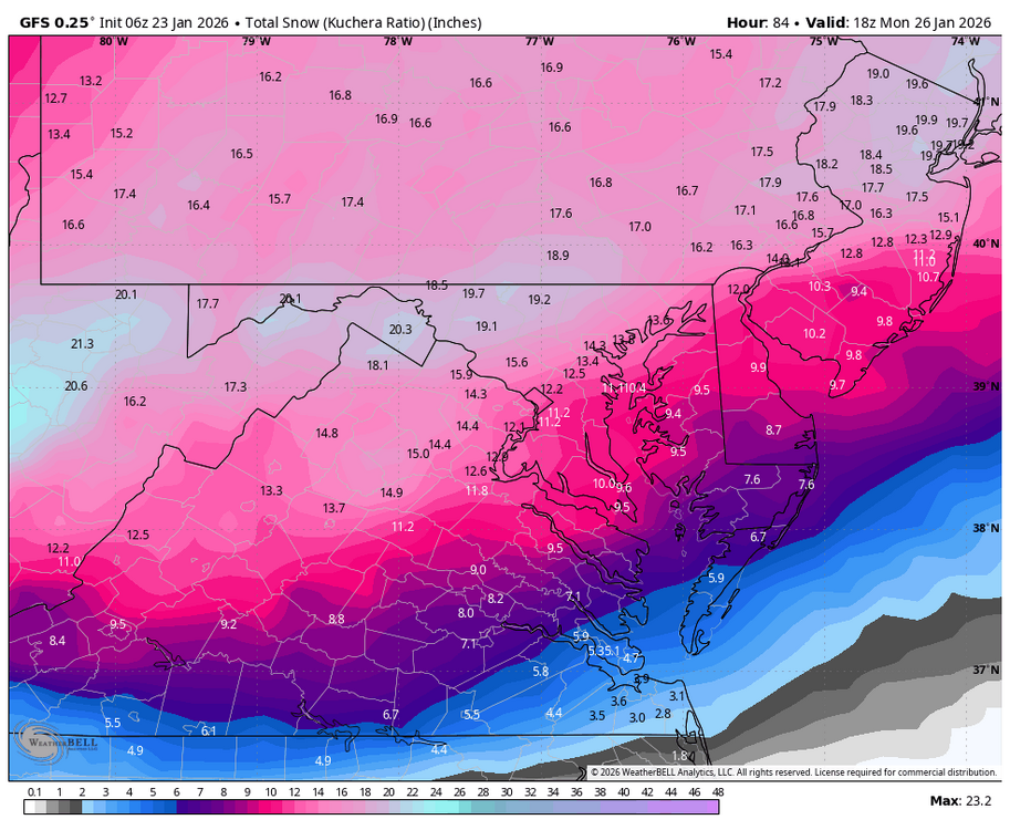
To answer my question, I just had to wait until this morning's update. Thy added in Sunday overnight accumulations, which gives me a range of 12-22 inches. Still mum on Monday's possible accumulations if it snows late into the morning. Saturday Night Snow likely after 1am. Cloudy, with a low around 8. Calm wind. Chance of precipitation is 70%. New snow accumulation of 1 to 3 inches possible. Sunday Snow. The snow could be heavy at times. High near 18. East wind 5 to 7 mph, with gusts as high as 22 mph. Chance of precipitation is 100%. New snow accumulation of 8 to 12 inches possible. Sunday Night Snow. The snow could be heavy at times. Low around 15. Chance of precipitation is 100%. New snow accumulation of 3 to 7 inches possible. Monday A chance of snow before 1pm. Mostly cloudy, with a high near 22. Chance of precipitation is 50%.