All Activity
- Past hour
-
Discrete CELLS starting to spin.
-
Hampton effect strikes again
-
Ah
-
Will
-
Who's the snowman?
-
Up to 76°. Steam bath. Looks like it’s about to go downhill.
-
curious to see what it does over the valley
-
That has to be dropping close to quarters over Windsor
-

E PA/NJ/DE Spring 2025 Obs/Discussion
Birds~69 replied to PhiEaglesfan712's topic in Philadelphia Region
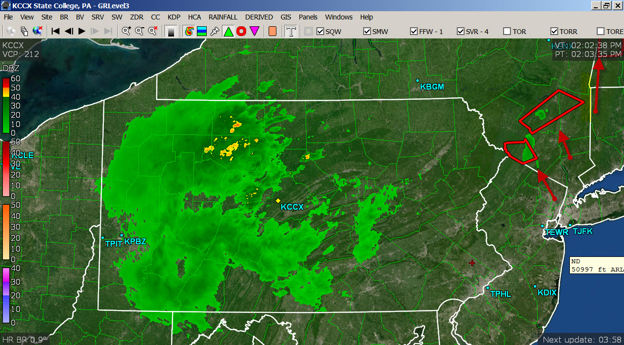
Radar has shrunk...what a mess.
-
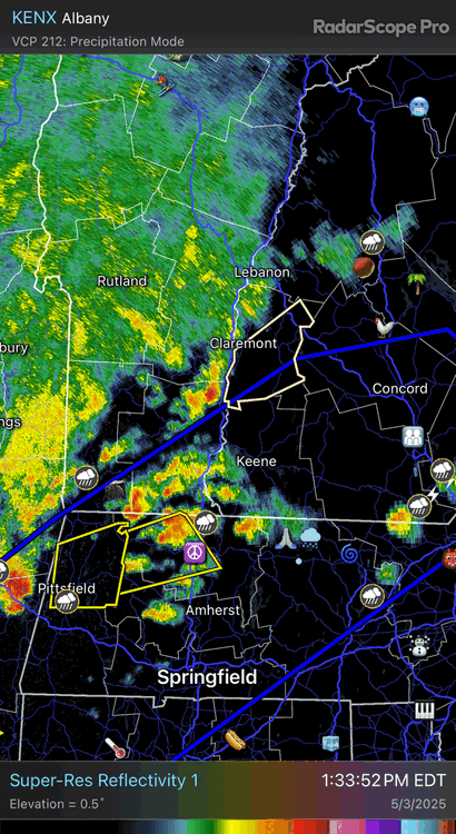
Nice hook on that cell now east of Pittsfield
-
that storm on the MA/VT line is also interesting north of colrain
-
Nah we're getting rain, the drier models have fluke written all over it. This is just winter PTSD clouding judgement.
-
I wish dews were even 4-5F higher in the Hartford-Springfield corridor. That cluster in southeast New York would be prime to take off. We are also increasing mlvl winds and ulvl divergence so that will compensate a bit.
-
PSF to near EEN to MHT or just south is where it’s at.
-
Nice to be tracking! Primetime goodies.
-

E PA/NJ/DE Spring 2025 Obs/Discussion
dseagull replied to PhiEaglesfan712's topic in Philadelphia Region
Check again. Lol -
Looks like a dry hot weekend on tap. I don't buy the euro. Alway go with the least stormy model. Congrats NY on the drought buster.
-
probably also a ton of tree buds flying around. Trees going to look like winter again when all said and done
-
One tiny cell to my NW, lots of bubblies around but CIN will probably win out here
-
Yeah, looked straight line to me.
-
that was one of the wildest live cams I've seen.. I need to get in that storm
-
I’m not sure it can stay discrete, but the non warned cell near Newburgh could get interesting if it does.
-
interesting...looks to be going in different directions too...was right to left across the camera then left to right...but could just be the storm rolling through with a Wind shift
-
Maybe some debris too?
-
holy shit debris flying by tornado or winds just that bad????