

radarman
-
Posts
14,464 -
Joined
-
Last visited
Content Type
Profiles
Blogs
Forums
American Weather
Media Demo
Store
Gallery
Everything posted by radarman
-
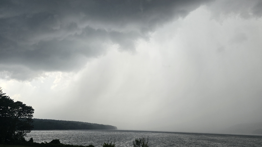
Quick hit heavy rain and a nice breeze

-
Big, big waves. Let's lock in an offshore breeze, TIA
-
That's why we complain in the valley when it's actually hot and humid
-
Glad to be escaping the heat tomorrow to head to Texas. Looking forward to the recurving whiff to kick up some surf. GTG at Weekapaug?
-
#3... Devers was traded
-
I thought pools were not in play with dews less than 70?
-
If you have access to a boat, take it up the Songo river, through the locks, across Brandy Pond, and dock in Naples for lunch.
-

July 2025 Obs/Disco ... possible historic month for heat
radarman replied to Typhoon Tip's topic in New England
Yep, crushed. Stations over 1.5" and a fair amount more to come. Very wet month here. -
July 2025 Obs/Disco ... possible historic month for heat
radarman replied to Typhoon Tip's topic in New England
A jungle a short ways to your south. -
July 2025 Obs/Disco ... possible historic month for heat
radarman replied to Typhoon Tip's topic in New England
75/72, some combination of fog/smoke and absolutely awful -
July 2025 Obs/Disco ... possible historic month for heat
radarman replied to Typhoon Tip's topic in New England
Bad air this morning. Like poison it tastes. -
July 2025 Obs/Disco ... possible historic month for heat
radarman replied to Typhoon Tip's topic in New England
Missed the strong stuff but caught 2 little pop up storms. Raining now along the boundary -
July 2025 Obs/Disco ... possible historic month for heat
radarman replied to Typhoon Tip's topic in New England
That's ok nobody cares about the handling of convection in a rapid refresh model anyway Oh wait -
July 2025 Obs/Disco ... possible historic month for heat
radarman replied to Typhoon Tip's topic in New England
Perfect. Aug 15th-Oct 1st might as well be AN. Prime beach season. Tickling 90 here and there is nbd. -
July 2025 Obs/Disco ... possible historic month for heat
radarman replied to Typhoon Tip's topic in New England
What a couple days. Longsleeves in the house this morning, low of 48. Sun and 77 today, dark blue skies, bugs on vacay. -
July 2025 Obs/Disco ... possible historic month for heat
radarman replied to Typhoon Tip's topic in New England
Just so much better today, objectively speaking -
July 2025 Obs/Disco ... possible historic month for heat
radarman replied to Typhoon Tip's topic in New England
My fam has been sitting on a small buildable lot very near the Bourne Bridge on the mainland side since the early 1950s. I'm tempted to do something with it someday just for weeks like this last one. The funny thing is all the existing houses are at ground level grandfathered in, but now the code requires stilts like 12' up. All the better for that extra bit of wind. -
July 2025 Obs/Disco ... possible historic month for heat
radarman replied to Typhoon Tip's topic in New England
Was more of a comment regarding the afternoon as a whole. And yeah the air always moves better near the ocean. Probably 9 mos a year I could hard pass on it, but we can all admit the coast is great in the summer. -
July 2025 Obs/Disco ... possible historic month for heat
radarman replied to Typhoon Tip's topic in New England
Finally an effing breeze -
July 2025 Obs/Disco ... possible historic month for heat
radarman replied to Typhoon Tip's topic in New England
I won't speak for other places but the combination of humidity and lack of air movement in these parts is the absolute worst. Buggy. Food molding. Wet. Horrendous. -
July 2025 Obs/Disco ... possible historic month for heat
radarman replied to Typhoon Tip's topic in New England
Something about that part of the valley in recent years. Not the case over here. I'm needing to do driveway repairs after multiple heavy downpours -
July 2025 Obs/Disco ... possible historic month for heat
radarman replied to Typhoon Tip's topic in New England
SVR up. Damage reported in Williamsburg -
July 2025 Obs/Disco ... possible historic month for heat
radarman replied to Typhoon Tip's topic in New England
Glad we weren't camping, yikes -
July 2025 Obs/Disco ... possible historic month for heat
radarman replied to Typhoon Tip's topic in New England
God I love this location for severe * At 547 PM EDT, a severe thunderstorm was located over Belchertown, or 8 miles southeast of Amherst But seriously though I doubt this one verifies. Classic SPS event IMO -
July 2025 Obs/Disco ... possible historic month for heat
radarman replied to Typhoon Tip's topic in New England
No peas here but quite a bit of lightning, a good amount of rain, and a nice change to the airmass. Stein, we hardly knew ye


