WxWatcher007
-
Posts
35,736 -
Joined
-
Last visited
Content Type
Profiles
Blogs
Forums
American Weather
Media Demo
Store
Gallery
Everything posted by WxWatcher007
-
We got our Arctic shot and that cold won’t be topped for a long time. Don’t really care what happens now, though hopefully NNE can keep the slopes and trails going.
-
Absolutely.
-

The event of the season - 2 days of hell!
WxWatcher007 replied to Go Kart Mozart's topic in New England
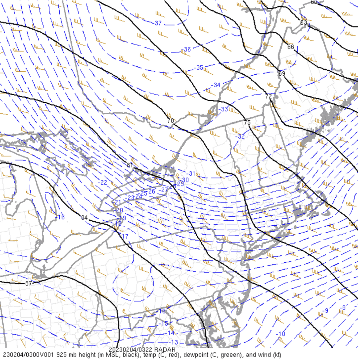
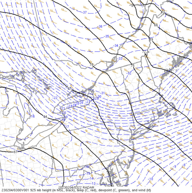
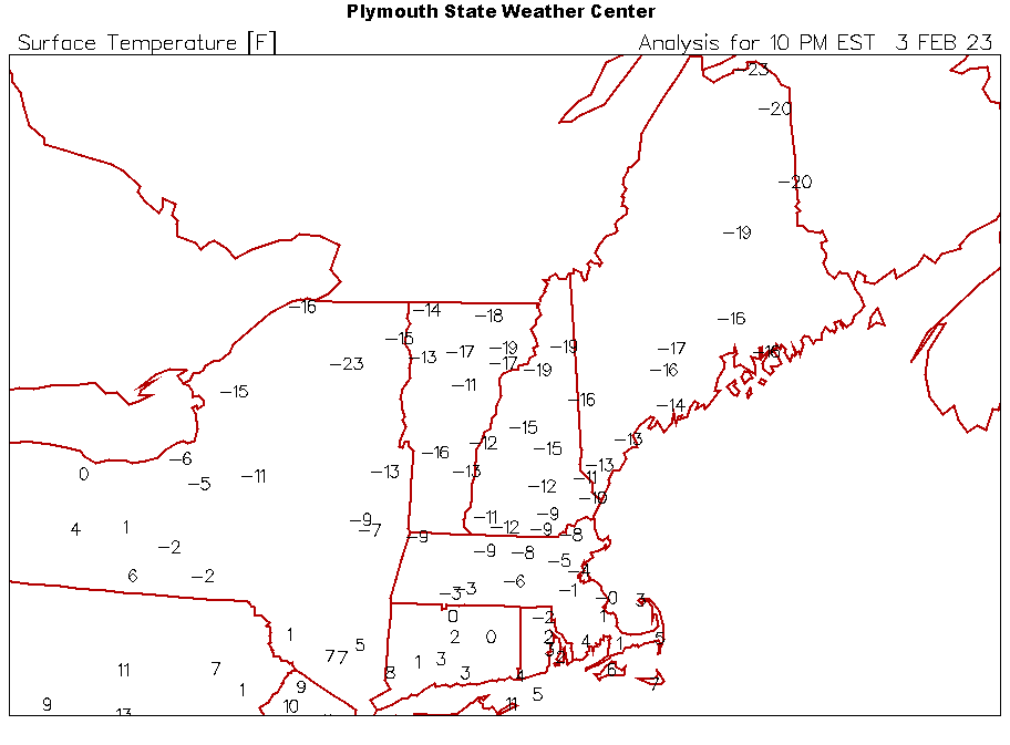
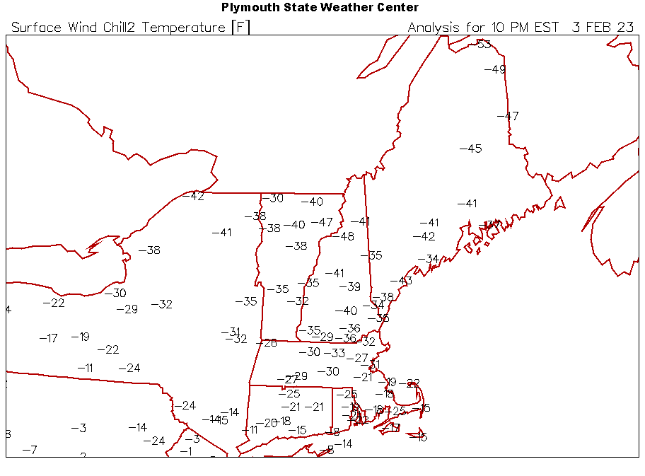
Love this. Your maps are great. -
The event of the season - 2 days of hell!
WxWatcher007 replied to Go Kart Mozart's topic in New England
-
The event of the season - 2 days of hell!
WxWatcher007 replied to Go Kart Mozart's topic in New England
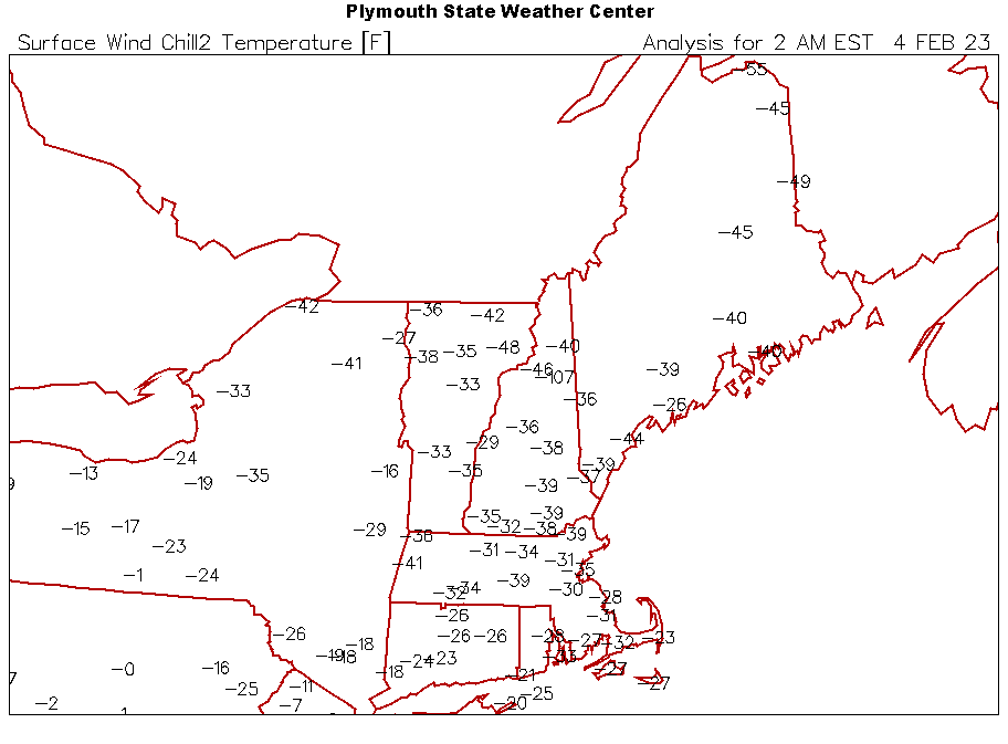
-7.6° for the low. With no snow cover, big wind, and temps below zero before midnight. Here in The Valley. Absolutely incredible. Just getting back after two hours outside. Spectacular morning. -
The event of the season - 2 days of hell!
WxWatcher007 replied to Go Kart Mozart's topic in New England
Still -6.1° at home. -
The event of the season - 2 days of hell!
WxWatcher007 replied to Go Kart Mozart's topic in New England
I’ll care about 2/11 when I see the warnings hoisted. -
The event of the season - 2 days of hell!
WxWatcher007 replied to Go Kart Mozart's topic in New England
We up. We out. We frigid. We enjoy. -
The event of the season - 2 days of hell!
WxWatcher007 replied to Go Kart Mozart's topic in New England
We rode into battle with them and they didn’t let us down. -
The event of the season - 2 days of hell!
WxWatcher007 replied to Go Kart Mozart's topic in New England
Around the house this morning in a t-shirt and flip flops. Good thing the neighbors are asleep -
The event of the season - 2 days of hell!
WxWatcher007 replied to Go Kart Mozart's topic in New England
Weird. Thanks for catching.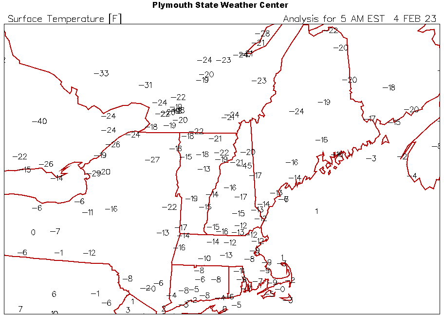

-
The event of the season - 2 days of hell!
WxWatcher007 replied to Go Kart Mozart's topic in New England
Going to be close. I think I bottomed out here at -7.6°. -
The event of the season - 2 days of hell!
WxWatcher007 replied to Go Kart Mozart's topic in New England
-2 WC -25 at GON 0 WC -17 at HVN 0 WC -21 at BDR -
The event of the season - 2 days of hell!
WxWatcher007 replied to Go Kart Mozart's topic in New England

-
The event of the season - 2 days of hell!
WxWatcher007 replied to Go Kart Mozart's topic in New England
-5.6/-21 Just about all the PWS I see in CT outside of BDR and points SW are below zero. 5 minute obs have BDR at zero. -
The event of the season - 2 days of hell!
WxWatcher007 replied to Go Kart Mozart's topic in New England
This is all just so impressive. Absolute temperatures and wind chills. -
The event of the season - 2 days of hell!
WxWatcher007 replied to Go Kart Mozart's topic in New England
Block Island -1 WC -22 -
The event of the season - 2 days of hell!
WxWatcher007 replied to Go Kart Mozart's topic in New England
-3.0/-19 at midnight here. -
The event of the season - 2 days of hell!
WxWatcher007 replied to Go Kart Mozart's topic in New England
DP has really tanked recently. Down to -18 -
The event of the season - 2 days of hell!
WxWatcher007 replied to Go Kart Mozart's topic in New England
-
The event of the season - 2 days of hell!
WxWatcher007 replied to Go Kart Mozart's topic in New England
I was in DC in 2016, but man, flush hit in all of CT with that PV lobe. -
The event of the season - 2 days of hell!
WxWatcher007 replied to Go Kart Mozart's topic in New England
Hovering at zero -16 dew point -
The event of the season - 2 days of hell!
WxWatcher007 replied to Go Kart Mozart's topic in New England
-
The event of the season - 2 days of hell!
WxWatcher007 replied to Go Kart Mozart's topic in New England
Wow -
The event of the season - 2 days of hell!
WxWatcher007 replied to Go Kart Mozart's topic in New England
0.6°/-14 Dew and temp dropped with pick up of wind.