

schoeppeya
-
Posts
579 -
Joined
-
Last visited
Content Type
Profiles
Blogs
Forums
American Weather
Media Demo
Store
Gallery
Posts posted by schoeppeya
-
-
4 minutes ago, Amped said:
GFS looks like it's over Bradenton 6z Thursday.
I don’t know how much to value it but just for trend it’s basically steady state on intensity between now and landfall
-
 2
2
-
-
34 minutes ago, weatherwiz said:
I guess now its just waiting for another ERC to get going. Something is going to have to give soon for another round of "weakening". I am curious though if this remains steady state and the eye happens to find that blob of warmer water. Some new convection developing southeast side but a tad out from the center. Def fighting that shear too on the northern side
Yeah have to think the next 10-12 hours are the best remaining window of higher water temps and lowish shear. Should be solidly over the loop current now
-
6 minutes ago, David Reimer said:
Back to a pinhole eye. Not something you typically see with consecutively after two EWRCs.
F. Eye Character: Closed
G. Eye Shape & Diameter: Circular with a diameter of 7 nautical milesDoes like maybe the beginnings of a new outer eyewall/secondary wind max as well?
-
1
-
-
6 minutes ago, MUWX said:
HMON is an absolutely terrifying run for central Florida. If this thing is still in the low 900s tomorrow afternoon, the surge forecast is likely underdone, potentially substantially so.
Looks like it might be heading for a landfall north of Tampa.
Literally rides the northern side of Tampa Bay as well
-
18z HAFS B initialized about 35 mb too high
-
3 minutes ago, lilj4425 said:
I’m sorry but I am not seeing the eye contracting currently.
Don't be sorry, I am wrong all the time!
ETA: I measured and youre right its pretty stable in size right now
-
 4
4
-
-
The eye is really contracting again... I wonder if we will see another EWRC and intensification phase while conditions are still very favorable tonight into tomorrow morning
-
 1
1
-
 2
2
-
-
Almost perfect IR presentation again. I don't think we will get there but just given the overall look I wouldn't be shocked if we make a run at yesterdays numbers.
-
1
-
-
5 minutes ago, Amped said:
There is pretty low spread in the 12z tracks so far. GFS, Ukmet, Icon , Jma and even the cmc all track over Longboat Key from what I can tell.
HAFS-B still wants to ride the north side of the bay but the hurricane models are becoming outliers on that at this point
-
Wow that IR presentation escalated quickly
-
12 minutes ago, SnowLover22 said:
With a 70knot wind…. They missed the center
I dont know if they missed it as much as the center was in between data readings because the eye is so small... waiting for that dropsonde
-
2
-
-
No signs of an ERC yet
-
1
-
 1
1
-
-
6 minutes ago, StormChazer said:
The eye has gotten unbelievably small. If this is the start of an EWRC, I just hope recon gets there first so we can give this thing the records it deserves.
They should be basically through a pass, last update on TT is from almost half an hour ago and they were just outside the CDO
-
4 minutes ago, WxWatcher007 said:
Recon is descending now. Should start getting data shortly.
Going to be a biblical run, eye still condensing and cloud tops still cooling
-
1
-
1
-
-
6 minutes ago, Nibor said:
Recon seems to have done a loop just outside of the southern eyewall.
The stuff these hurricane hunters do inside storms makes me feel like an absolute fool for any type of flight anxiety I have.
-
4
-
2
-
-
Eye really clearing on IR, pressure likely going to continue to crater.
-
1 minute ago, Windspeed said:
11°C increase from eyewall to eye with hail/grapple. Pressure falling rapidly. No sign of outer band. With such a small VDM, if Milton gets into the 920s, we're most likely going to see a Category 5 status within a few more hours. It's certainly not done bottoming out.
Considering we are on the cusp of 5 already I think that's almost a lock at this point
-
HWRF continues to show worse case scenario for TB. Actually re-deepens in a few mb before landfall.
-
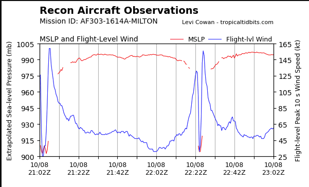
10mb drop in between passes?!
-
4 minutes ago, Floydbuster said:
I am not that impressed with Milton tonight. It doesn't seem to be exhausting outflow the way I would like to see for significant overnight intensification. The interaction with the frontal system in the eastern Gulf is also giving it a strange look on satellite. It almost looks like Milton is being undercut or squashed. Anyone else see this?

Looks like a steadily/rapidly intensifying hurricane to me.
-
13 minutes ago, xAllVolsx said:
Don’t the Dam fail after that pic was taken?
Yeah, was implying if it already looked like that before the damn failure its probably going to be completely washed out for a long ways.
-
1
-
-
1 hour ago, WxWatcher007 said:
This this is beneath where the dam just failed, they have have to rebuild a huge stretch of it
-
2 minutes ago, SchaumburgStormer said:
Recon has to be getting the shit kicked out of them on the path they are on through the N eyewall.
That first plane earlier tried and decided thanks but no thanks and went home.
-
Pretty incredible to see the similarities between this storm and Michael. The IR presentation and evolution approaching landfall is even remarkably similar
-
2
-
Major Hurricane Milton
in Tropical Headquarters
Posted
Eye coming into view on the key west radar