

bristolri_wx
-
Posts
1,691 -
Joined
-
Last visited
Content Type
Profiles
Blogs
Forums
American Weather
Media Demo
Store
Gallery
Posts posted by bristolri_wx
-
-
2 hours ago, STILL N OF PIKE said:
I wish some engineers could build like a 4000 foot high plateau over say a 50 square mile area in SNE (maybe just outside 128) so we could have a dependable winter season every year . I’ll recommend This to the state legislature . Would have sick upslope enhancement on East flow as well lol
Plans are already made, should be possible:

-
 1
1
-
 6
6
-
-
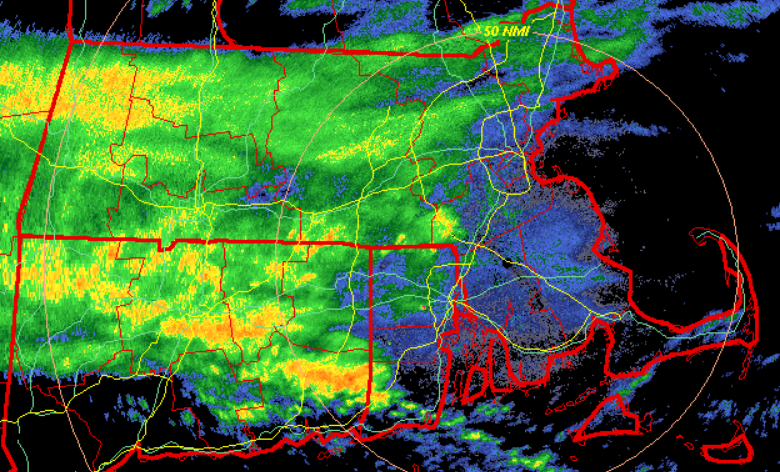
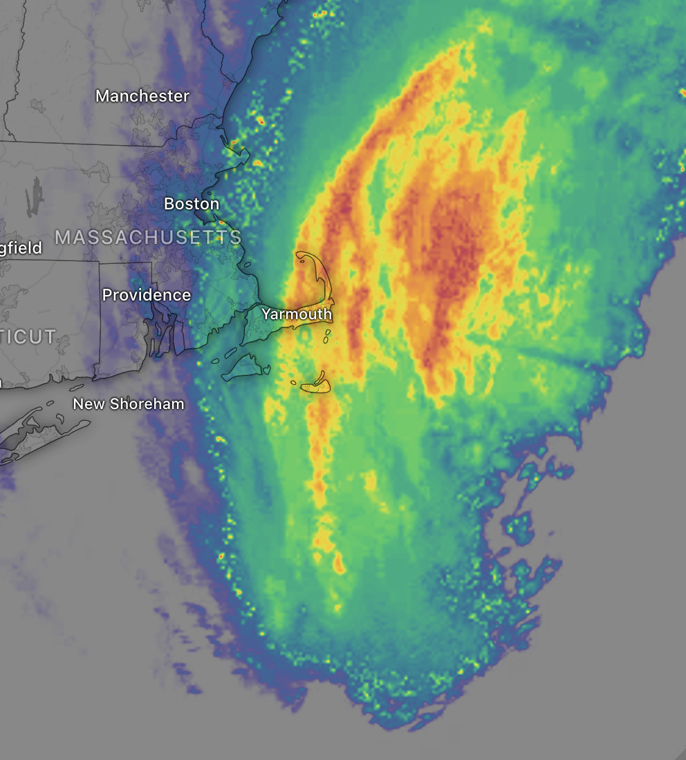
Current radar loop looks cool… rain moving in three different directions. South from NH/VT, east over MA, WNW over CT and RI.
-
 1
1
-
-
48 minutes ago, CoastalWx said:
This weather fucking blows
No one likes it, except ODB…
-
1
-
-
Who's working the Massachusetts border preventing that rain from moving north? Don't think I've ever seen it that close to following a border like that lol.
-
3
-
-
19 minutes ago, CoastalWx said:
When do the floods start?
Short term another win for the GFS. May be too dry for tomorrow though.
-
1 hour ago, Typhoon Tip said:
I have a feeling the NAM’s up to its NW bias.
Not sure how the NAM wins against the blocking building down.
True. But all the meso models are wetter than the GFS. GFS is kind of on its own at the moment, and even the 18z ensembles were wetter than the operational run.
Common sense forecast: most likely not as juicy as the NAM 3K and not as dry as the GFS. Somewhere in the middle is the answer, though my gut feeling is that the mesos are picking something up that the GFS isn't seeing... -
On 9/15/2023 at 6:38 AM, Lava Rock said:
Tapatalk under new ownership. Getting lots of emails from my other forums saying they are discontinuing tapatalk use. Will this forum abandon it?
Sent from my SM-G981U1 using Tapatalk
I was curious and did some research. Tapatalk was re-purchased by the founder. Probably good news for the app. Almost all the forums that are removing support are owned by a company called Verticalscope which apparently have bought up thousands of forum sites on the internet over the last decade. They also own the forum hosting software XenForo, and the competing app to Tapatalk, Fora. Looks more like this Verticalscope company looking for an opportunity to consolidate than issues with Tapatalk. Apparently almost the same message verbatim was posted in most forums, which made some people suspicious.
-
1
-
-
1 minute ago, dendrite said:
I never said it sucks up here. We’ll see how it’s looking in another week after some lows in the low 40s.
Kevin did, but I don't think you got my joke anyway

-
1
-
-
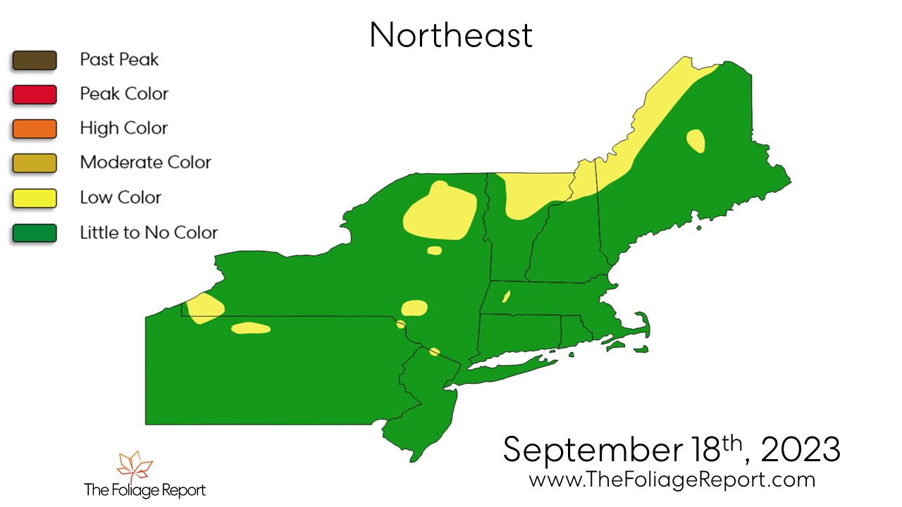
30 minutes ago, dendrite said:

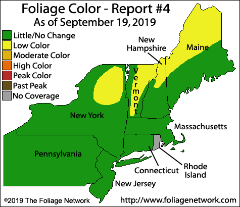
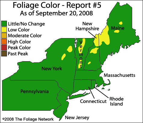
If you think it sucks up in Northern New England, how do you think I feel here in RI with GRAY foliage!
-
3
-
-
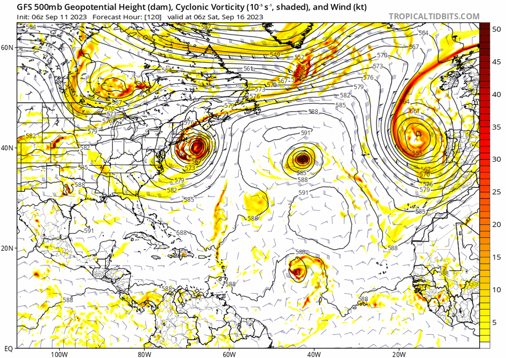
GFS and Euro continue to generate something off the Florida coast and kick it north-northeast up the coast. Supported in the ensembles as well. Doesn't look like it gets too organized yet. Something to watch since it's so close by...
-
1
-
-
7 minutes ago, Childude645 said:
does anyone have an explanation for whats keeping the rain bands from moving west?
barely raining west of barnstable...

Lots of dry air being pulled in from the NW below 5000 feet.
-
2
-
-
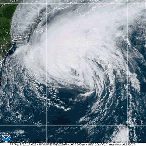
1 hour ago, WxWatcher007 said:
Final approach.
Not worth hitting the road for this one, but best of luck to all the Mainers and Nova Scotia peeps.

-
1
-
1
-
-
So much for that modeled NW hook/tug. Entirely gone from guidance… due north it is.
-
2
-
-
2 minutes ago, WhiteLawns said:
Anyone gonna talk about how the gfs saw this happening like 15 days ago?
GFS/GEFS did a good job on this one, but if it ever gets a hurricane track 15 days out it’s pure luck. However it has been in the ballpark and not waivered as much as the Euro throughout Lee’s existence. Score 1 for the Americans!!
-
In weather model news, Pivotal has the new RRFS, which is replacing the RAP and HRRR sometime in the next year or so:
https://www.pivotalweather.com/model.php?m=rrfs_a
Doesn't look like it's consistently getting data as of yet...
-
7 minutes ago, STILL N OF PIKE said:
I’m interested to see the coastal flooding for this from the surge , I think it’s a wildcard to a degree , that is where I think any damage may surprise to the upside , literally on the beach .
The circulation Is huge and If that backs in enough to get onshore winds to gale force with the giant wave action on top , that is really and has really been my area of excitement / concern / interest .
This could be a major concern in eastern facing areas, especially along the coast of Maine. Even though this will be nor'easter strength when it's decaying east of Maine Lee's remnants will probably have more ability to generate coastal flooding because of its strength and size before it begins to wind down. This is probably of more significance than wherever Lee's remnants make landfall.
-
1
-
-
1 hour ago, dendrite said:
Took me 15 minutes to figure out WTF this guy was talking about in relation to Tropical Tidbits. To think in my younger days I would watch the Long Ranger on Accuweather Pro to get his opinions, lol...
-
23 hours ago, tiger_deF said:
If we get both a Lee landfall/close brush and Nigel becomes a threat, would this be the most active tropical period for NE in recent history?
Nigel’s targeted landfall is the west coast of Scotland. Take that for what it’s worth.
-
1
-
-
13 minutes ago, 40/70 Benchmark said:
Meaningful...sure, in the sense of major nor'Easter ...said that all along. But in my world, that is "who caresville".
I agree in principal but we’ve had many strong autumn nor’easters that have caused significant amounts of winds and damage… just not hurricane level stuff.
-
“The environment ahead of Lee is expected to gradually become less
conducive for the hurricane as it moves into a region of higher
wind shear, drier air, and over progressively cooler SSTs.  These
conditions favor weakening, but since the system is so large the
weakening process should be slow.  The NHC intensity forecast is a
little lower than the previous one, in part due to the initial lower
wind speed, and remains near the HCCA and IVCN guidance.
Regardless of the details, there is high confidence that Lee will be
a large hurricane near the coast of New England Friday night and
Saturday.

It should again be noted that the 34- and 50-kt wind speed
probabilities beyond 36 hours in the text and graphical products are
likely underestimating the risk of those winds occurring.  This is
because the forecast wind field of Lee is considerably larger than
average compared to the wind field used to derive the wind speed
probability product.”
Stick a fork in it - though perhaps the Tropical Storm force winds will be farther out than we would normally expect. The fact it’s taking a while to wind down may influence that as well. Looks like the rain risk is fading away as well, 1-2” for ESNE 2-4” for Maine…
-
The narratives around here change about as quickly as the weather.
Early on people were excited about direct hits to New England with Lee being a hurricane, and possibly strong, with this unusual eastern track Lee is taking.
Some are treating this as a strong nor’easter because Lee will be acting more like that than it will be a landfalling New England hurricane. This doesn’t mean we won’t see effects and damage. But it won’t be like anything like a land falling hurricane that take the usual west of the Gulf Stream track that those storms have made. This will be a decaying storm, over cooler waters, not phasing and experiencing much extra tropical transition until it gets farther pas our area. Nor’easters have also produced damage to our area as well, without snow.
There is nothing I see in guidance from models or even the NHC that says otherwise. It’s gonna be a very crummy weekend for a large chunk of New England which falls on the westerns side of Lee.
-
2 minutes ago, WxWatcher007 said:
Right. Looking objectively at the ensemble graphics I posted, the jump west yesterday was significant. Nobody could have taken one euro op run that was an outlier and immediately jump on board.
Agree that this morphs into a compromise deal. That’s usually how these go. I’m thinking just west of Bangor when all is said and done, leaving a fairly close approach for the Cape.
Not that it matters that much for anyone who has a tree that falls on their house, but Lee might be barely tropical by the time it gets here.
Biggest risk here is tree damage from higher winds considering all the rain we have gotten before Lee arrives. Should be quite wet and breezy east of the track. I think many will be disappointed by gusts though.
-
2
-
-
30 minutes ago, ineedsnow said:
still 4 days plus days out I wouldnt say that yet
Just because something is possible doesn't mean it's going to happen. There's a very high probability that this will be a nothing-burger for most, if not all, of New England. There is a very low probability of other outcomes. The NHC forecasts have been outlining this for a while now.
-
Lee really wants to interact with that Canadian shortwave and phase with it at 500mb. If that shortwave slows down then Lee will move towards it. Right now it goes right by into SE Canada and Lee follows it N/NNE.
Not certain by any means, but the trend all day on the GFS has been slightly east each run.


Octorcher or Roctober 2023 Discussion Thread
in New England
Posted
Watching the Pats game will not add to its perfection.