hudsonvalley21
-
Posts
4,248 -
Joined
-
Last visited
Content Type
Profiles
Blogs
Forums
American Weather
Media Demo
Store
Gallery
Everything posted by hudsonvalley21
-
-
Hard to tell total accumulation here at the lower elevation of 125’. Highest acculms on cars and grassy surfaces. I’d give a rough estimate of 2.75”. Hopefully the sun will come out and dry up some of this before the freeze tonight. Temps forecasted to be in the mid teens tonight.
-
30/29 with 2.0”. Looks real nice with the snow on most surfaces. Street is down to pavement since being treated. Just had a burst of moderate snow.
-
Life at it’s best! We’ll said 31/30 with occasional light snow.
-
Thanks for the update Walt. I’m sure NWS will be hoisting up advisories in their afternoon packages today. It will be fun too see how the second event unfolds in the next couple of days. A definite taste of winter is on it’s way.
-
Fairfield County Crusher 12/11-12/12
hudsonvalley21 replied to Go Kart Mozart's topic in New England
It’s a real treat having him post in the interior thread in the NYC region section. -
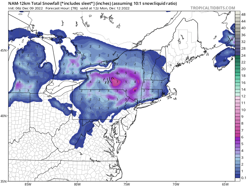
06z NAM ticked up slightly from the 00z run
-
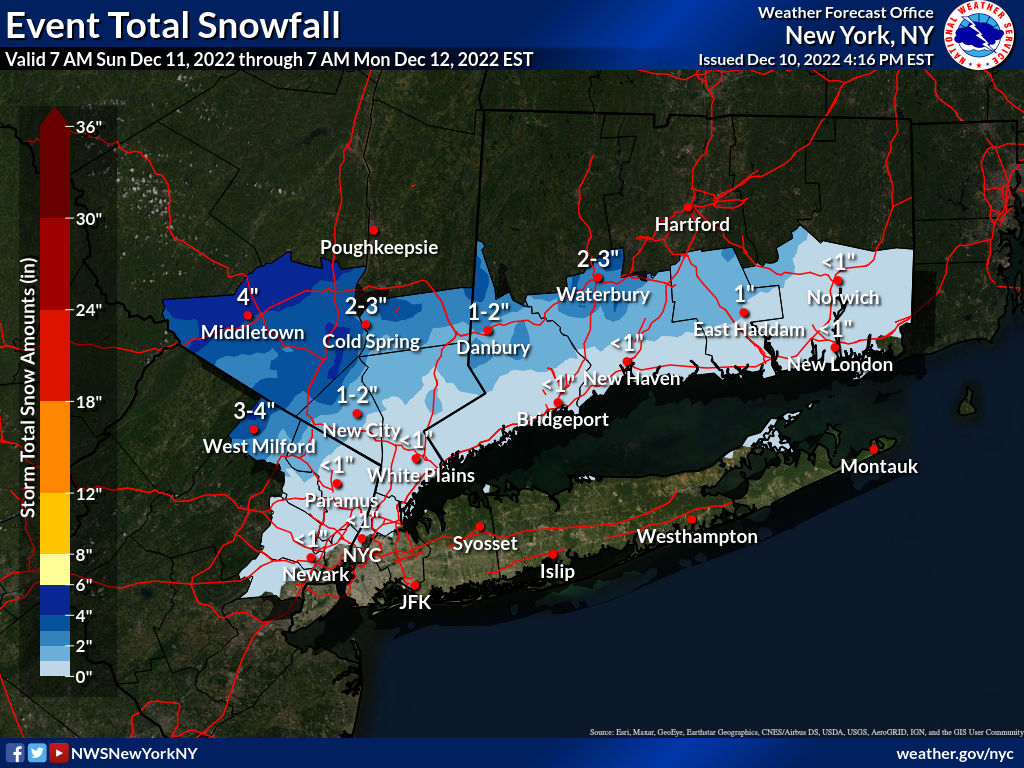
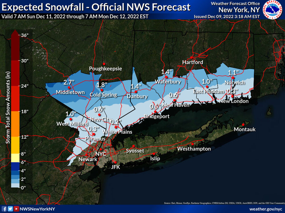
Upton’s current snow map.
-

-
-
-

-
NYC 33” EWR 38” MMU 32” ISP 33” SWF 47”
-
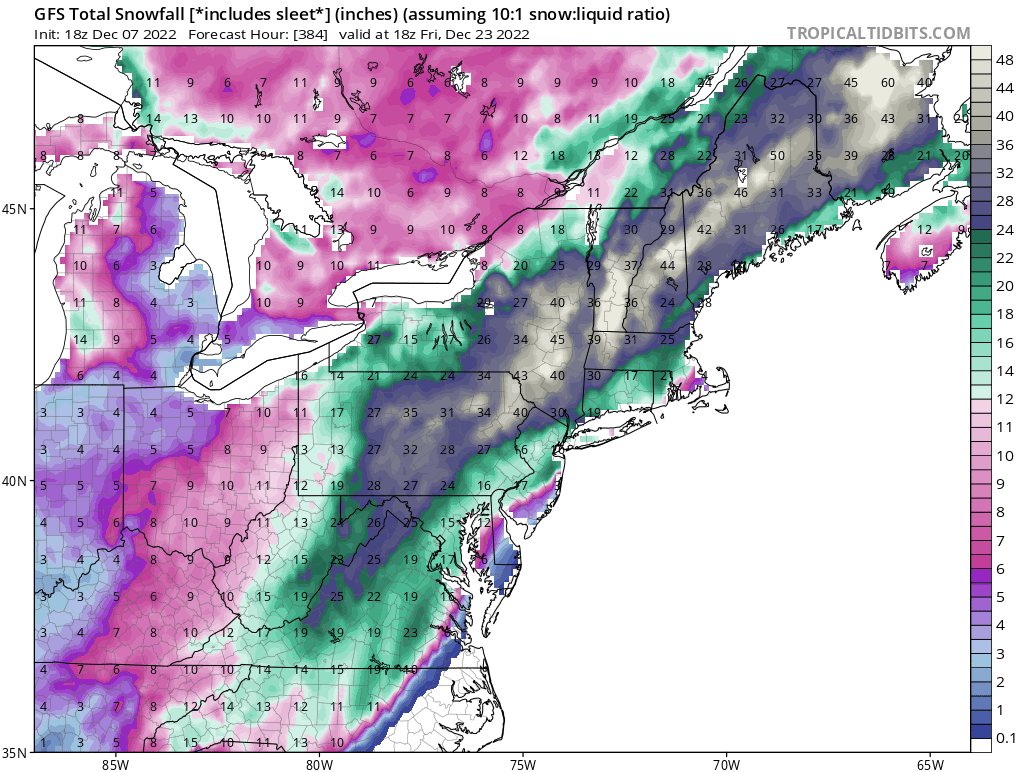
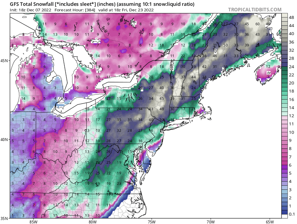
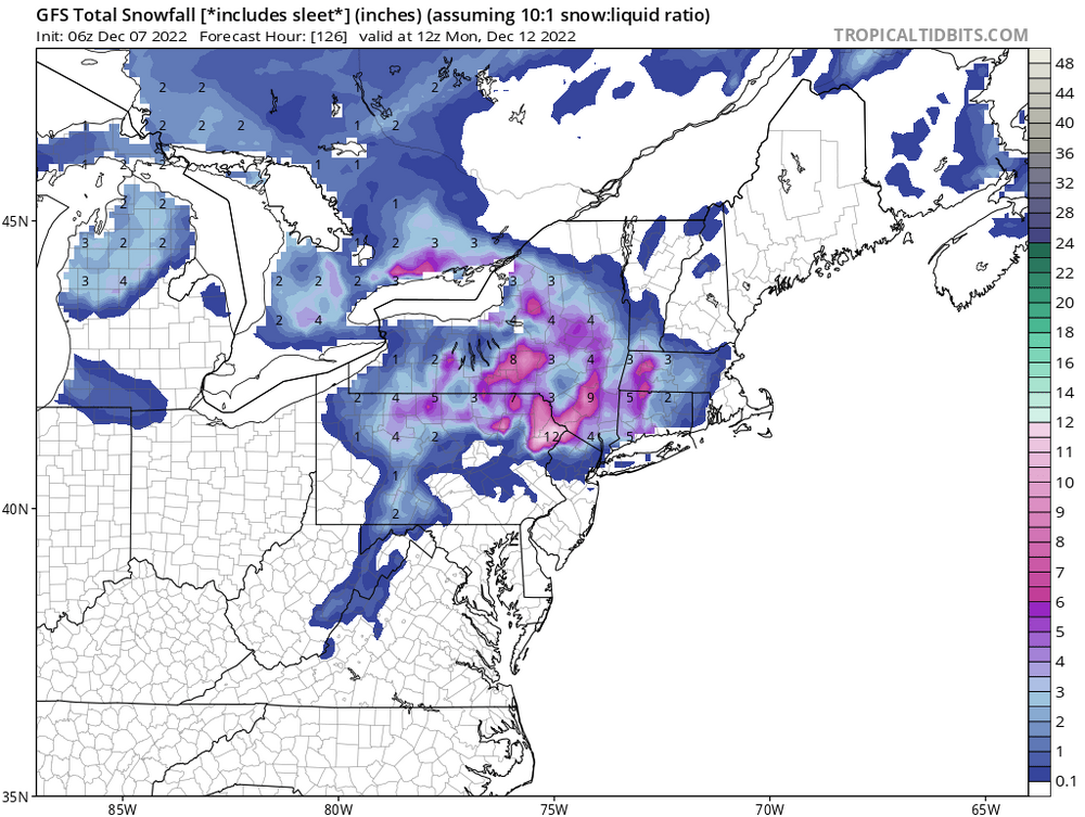
The 06z GFS run is showing a little more from the 00z run.

-
06z GFS is showing this. A tick up from the 00z run.
-
True. It is on it’s own for now.
-
Yes,a more wintery look. The 12z is running now, we’ll see if it keeps that trend.
-
You can keep the GFS I’ll take the beer

-
As long as it’s showing an event, it’s good. Where it tracks is anyones guess this far out.
-
-
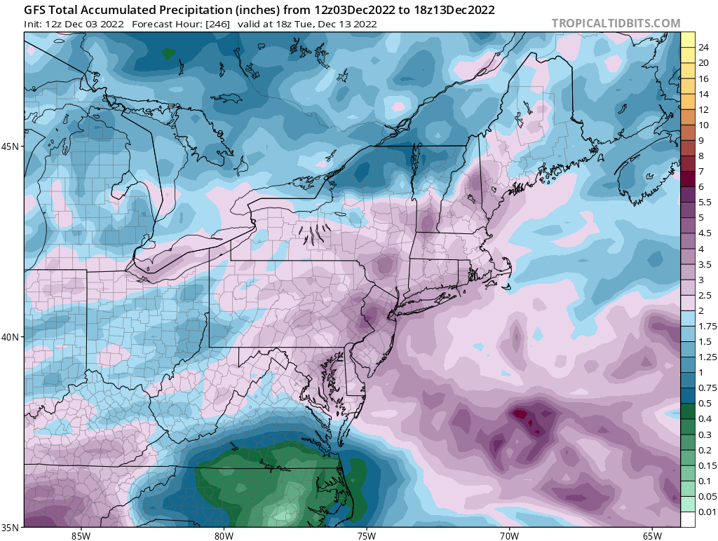
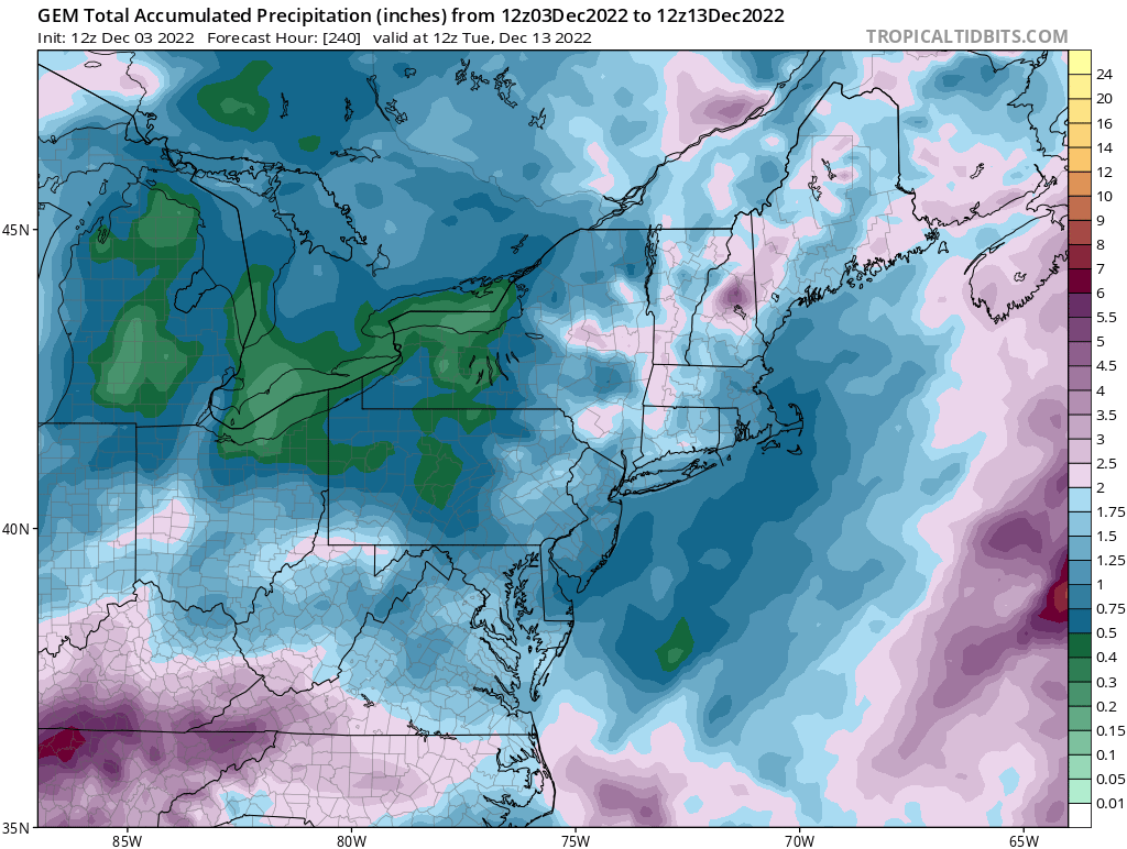
GFS & CMC QPF maps at 240 hrs. for comparison


-
Excellent post. Hopefully most will understand it and just sit back and let things unfold.
-
No flurries here this morning, cloudy and breezy. 0.38 in the bucket for yesterday.
-
As seen in today’s 12 and 18z runs of the GFS. I guess if it’s still showing an event on 12/13 let’s see how long it holds on to the idea.