hudsonvalley21
-
Posts
4,228 -
Joined
-
Last visited
Content Type
Profiles
Blogs
Forums
American Weather
Media Demo
Store
Gallery
Everything posted by hudsonvalley21
-
Just came back on.
-
Wondering if it swings up this way as it’s moving east
-
Just lost power here.
-
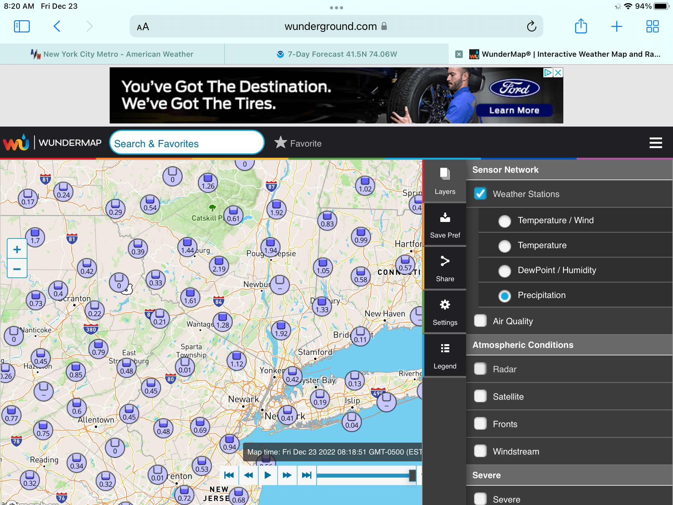
Screenshot of rain amounts in the area from weather underground

-
Wife said around 3am there was thunder and lightning I slept thru it I’m in a sheltered spot so I don’t usually get the highest winds.
-
27 mph record on the Davis.
-
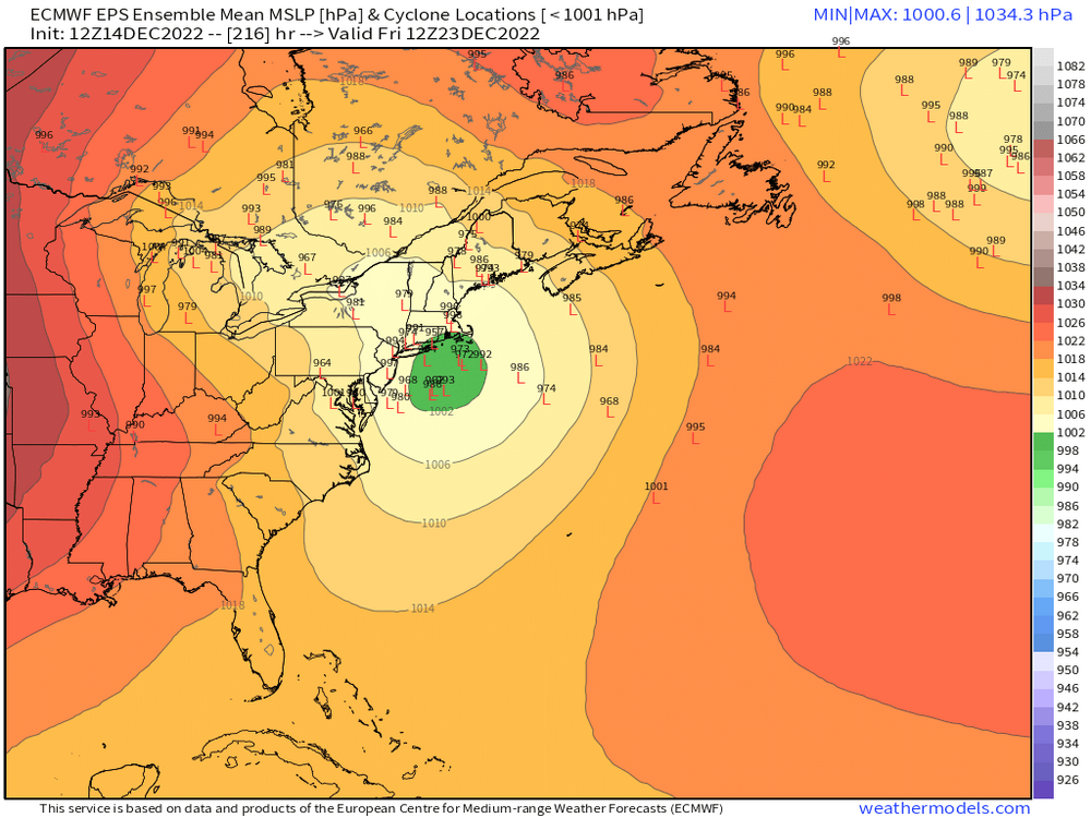
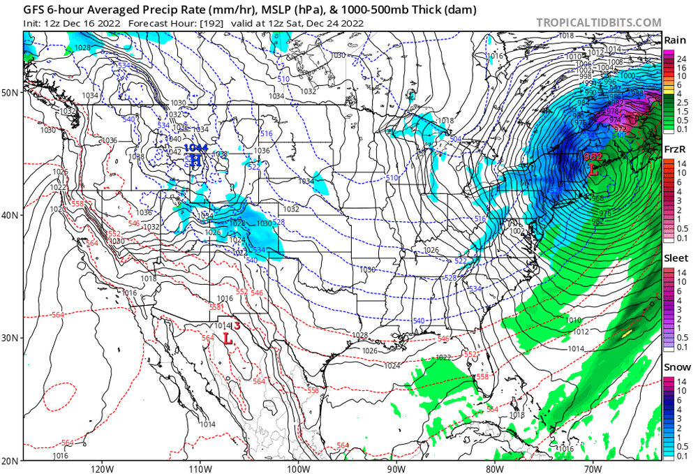
December 22nd - 23rd Cutter Discussion and Observations
hudsonvalley21 replied to NJwx85's topic in New York City Metro
Wondering how much will be frozen type. -
December 22nd - 23rd Cutter Discussion and Observations
hudsonvalley21 replied to NJwx85's topic in New York City Metro
Currently 57/52. 2.20” in the rain gauge for the event so far (1.95” since midnight). -
Currently 57/52. 2.20” in the rain gauge for the event so far (1.95” since midnight).
-
And a frozen one too
-
Yup agree, I see there’s a bunch of schools doing early dismissals tomorrow. Hopefully there’s no issues on the roads. The front will be in our area around noon when these schools are getting out.
-
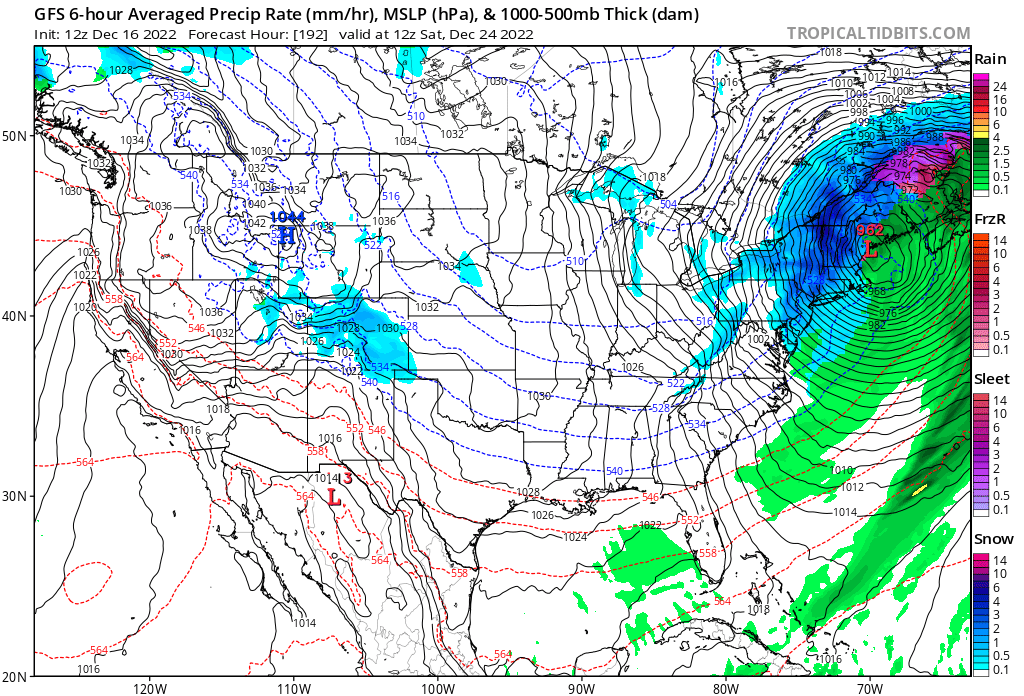
Up to 36 here. All rain for the event so far. It will be an interesting evening and FROPA event tomorrow.
-
Definitely something to monitor Friday afternoon/evening. Walt mentioned in the other thread we could get a quick 0.2-1.5” snowburst. Along with the winds and temp drop. Roads could get a little slick especially the bridges and overpasses.
-
Thanks for the heads up Walt. Friday evening could be a travel nightmare with that quick 0.2-1.5” and a flash freeze with untreated roads along with the gusty winds. Bridges and overpasses could be the real trouble spots.
-
Black ice and frozen car door locks could be a possibility.
-
How bout some flash frozen black ice.
-
Yup it’s always been a rule to close off well east of the Mississippi River.
-
Windy also
-
12/15 - 12/16 Coastal/Winter Storm & Observations
hudsonvalley21 replied to Northof78's topic in New York City Metro
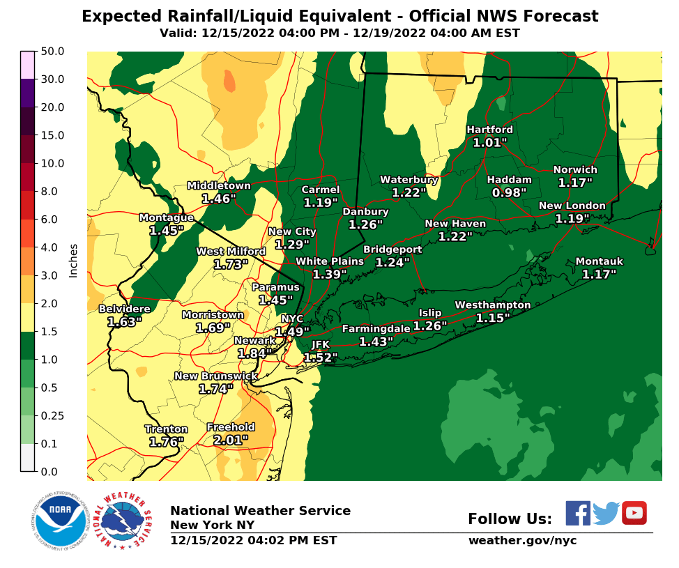
All rain and total of 0.42” in the bucket so far. Currently drizzle 37/35. -
12/15 - 12/16 Coastal/Winter Storm & Observations
hudsonvalley21 replied to Northof78's topic in New York City Metro
37/35 here in eastern Orange County 0.08” in the rain gauge. All liquid for the event so far. -
12/15 - 12/16 Coastal/Winter Storm & Observations
hudsonvalley21 replied to Northof78's topic in New York City Metro
Agree, and the QPF is about the same across the whole county.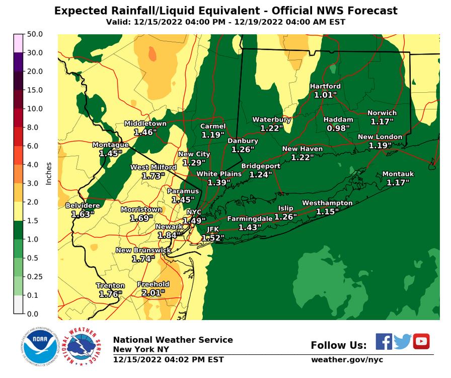
-
37 and rain currently.
-
12/15 - 12/16 Coastal/Winter Storm & Observations
hudsonvalley21 replied to Northof78's topic in New York City Metro
37 and rain here at 125’ of elevation in eastern Orange County, NY -
Now it’s just seeing run to run the 50-100 mile wobbles that will make some pull out their hair after sitting up for those 00z runs for the next week
-
Borrowed from the New England folks