DTWXRISK
-
Posts
3,412 -
Joined
-
Last visited
Content Type
Profiles
Blogs
Forums
American Weather
Media Demo
Store
Gallery
Everything posted by DTWXRISK
-
Dec 5/6th major coastal/ west Atlantic cyclogenesis ...?
DTWXRISK replied to Typhoon Tip's topic in New England
BOS 7pm SAT dec 5 was 36 dew point 32.... snow rain mix, sounding seemed accurate to me -
Dec 5/6th major coastal/ west Atlantic cyclogenesis ...?
DTWXRISK replied to Typhoon Tip's topic in New England
WHAT DID YOU END UP WITH ? nws says lewiston was all rainb -
Dec 5/6th major coastal/ west Atlantic cyclogenesis ...?
DTWXRISK replied to Typhoon Tip's topic in New England
this may be the worst most delusional comment in this entire thread -
GOOD CHANCE OF 1ST LIGHT SNOW EVENT VA / nw NC/ MD DEL MONDAY DEC 7
DTWXRISK replied to DTWXRISK's topic in Mid Atlantic
-
GOOD CHANCE OF 1ST LIGHT SNOW EVENT VA / nw NC/ MD DEL MONDAY DEC 7
DTWXRISK replied to DTWXRISK's topic in Mid Atlantic
welcome to 3 days ago -
CAPE .. the Big Alaskan Upper Trough / Low is in part associated with Mod / strong La Nina in 2nd half of the winter as La Nina weakens that feature will go bub bye ... and IF .IF... Atlantic side holds we may be in business
-
FWIW I consider March to be part of winter if you take a look at recent Trends over the past 20 or 25 years you will have noticed that the month of December has really become an extension of November for the eastern half of the CONUS. By that we mean that for the most part they have not been a lot of significant cold air outbreaks or big snow storms especially before Christmas. On the other hand over the past 20-25 years the month of March has seen very little early spring weather in the eastern half of the country. There have been quite a few number of significant snow storms ice storms and below normal temperatures
-
the DEC 14 event I have been talking about since last week and in the 3 week newsletter but I am not sure which short wave might be " the chance "/ or the s/w behind DEC 16
-
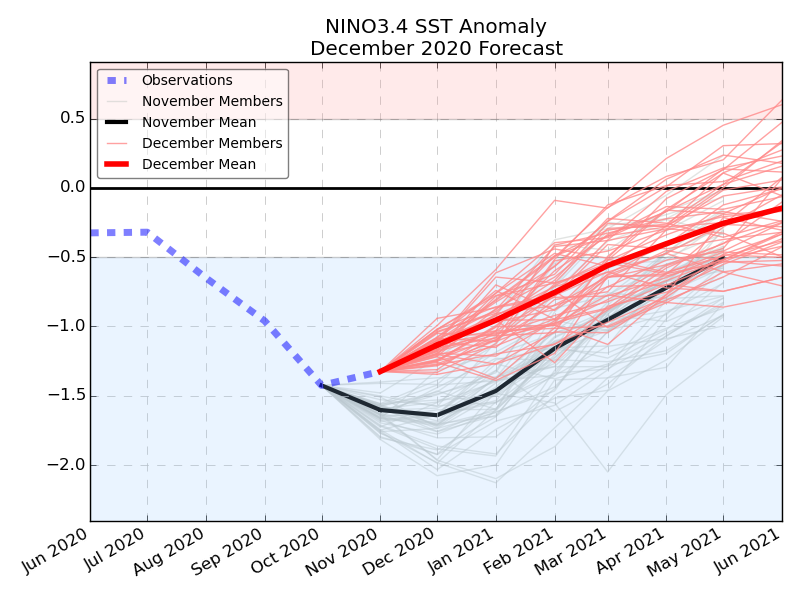
IN MAJOR DEVELOPMENT the ecmwf enso model shows DRAMATIC WEAKENING of the Moderate La Nina. It is hard to understate how BIG this is...or COULD be... a rapidly weakening La Nina... in essence a WEAK La Nina combined with SSW EVENT

-
2019 ENSO
DTWXRISK replied to AfewUniversesBelowNormal's topic in Weather Forecasting and Discussion
wow talk about a TOTAL mis read.... Good luck with that this issue is will the moderate DEC La Nina have the same impact in JAN FEB MAR as it under goes RAPID weakening? clearly the answer is no -
IN MAJOR DEVELOPMENT the ecmwf enso model shwos DRAMATIC WEAKENING of the Moderate La Nina. It is hard to understate how BIG this is...or COULD be... a rapidly weakening La Nina... in essence a WEAK La nina combined with SSW EVENT t
-
GOOD CHANCE OF 1ST LIGHT SNOW EVENT VA / nw NC/ MD DEL MONDAY DEC 7
DTWXRISK replied to DTWXRISK's topic in Mid Atlantic
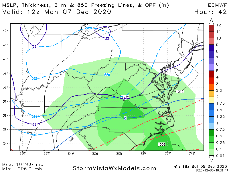
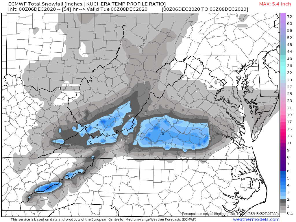
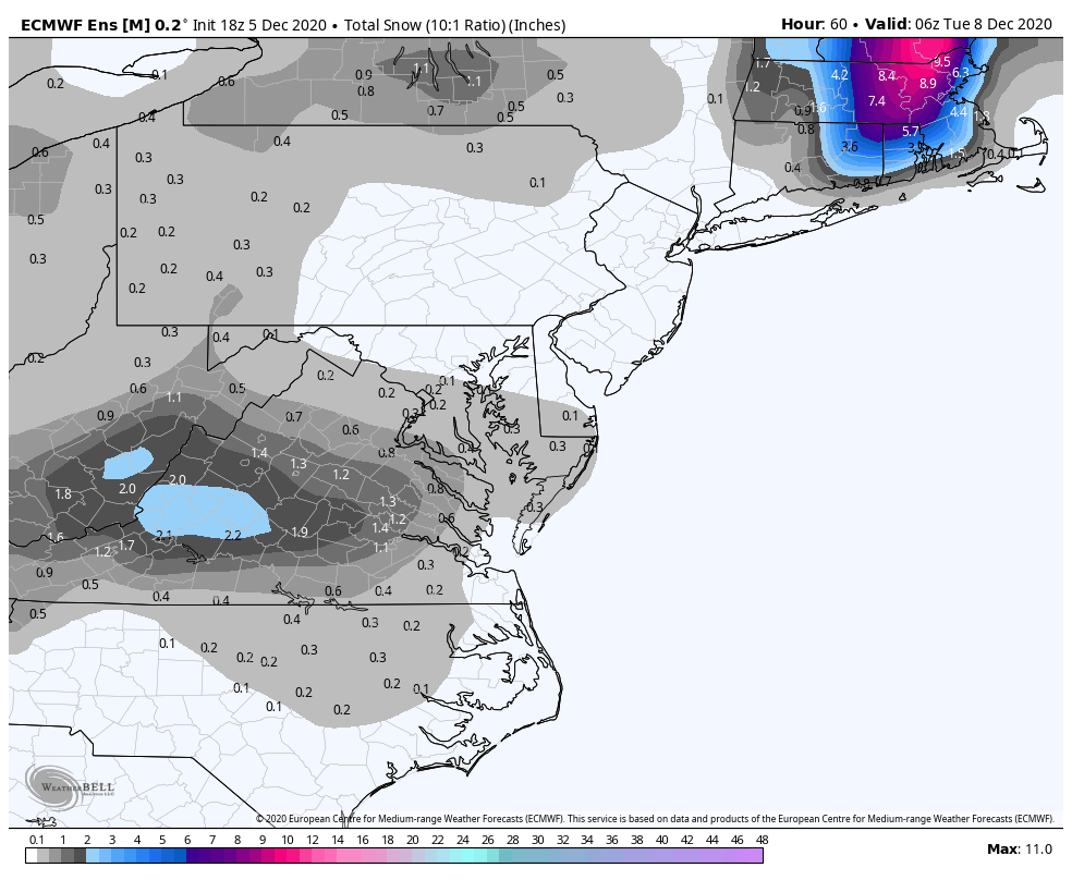
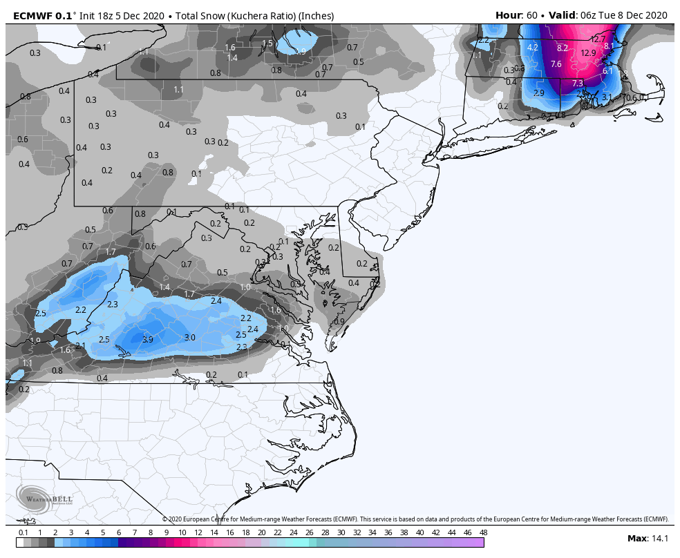
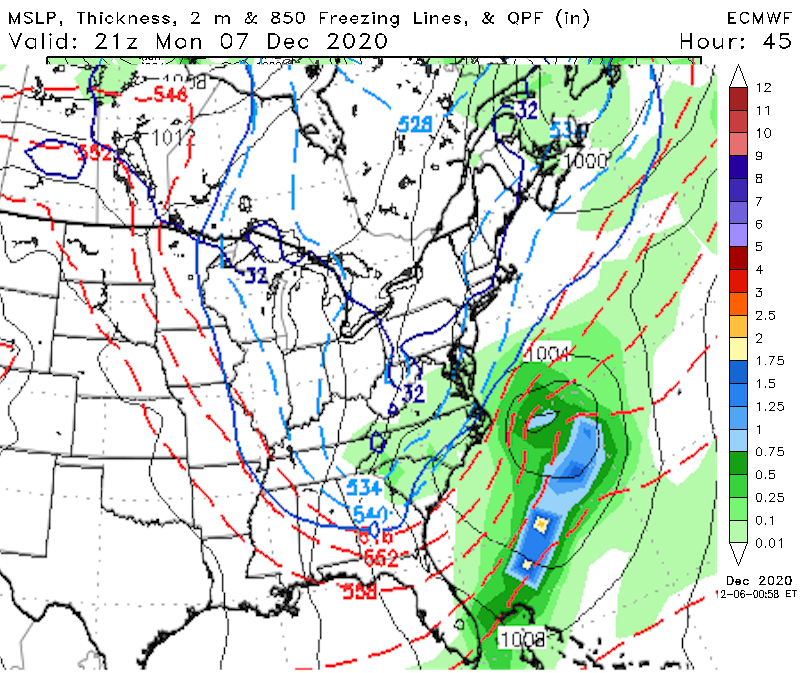
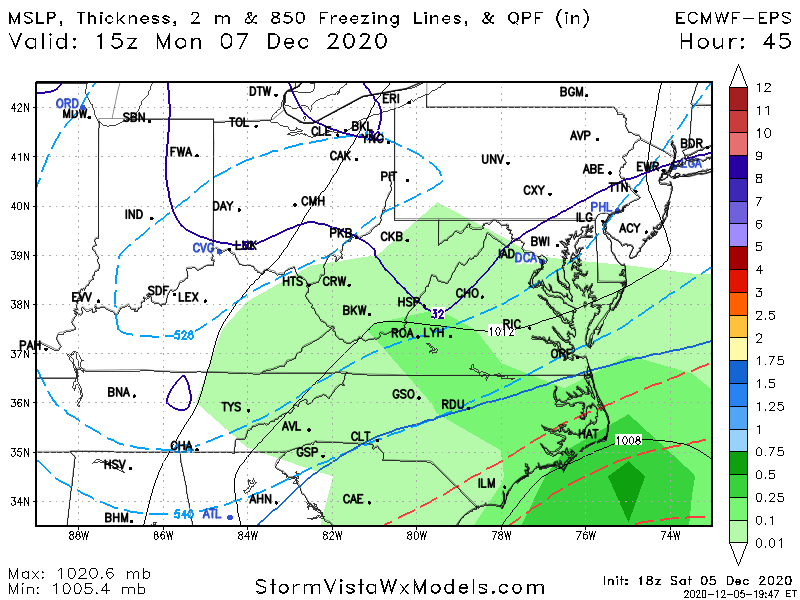
Looks like the euro from 3 days ago -
GOOD CHANCE OF 1ST LIGHT SNOW EVENT VA / nw NC/ MD DEL MONDAY DEC 7
DTWXRISK replied to DTWXRISK's topic in Mid Atlantic
THAT WILL DO IT
-
-
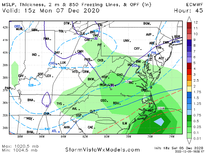
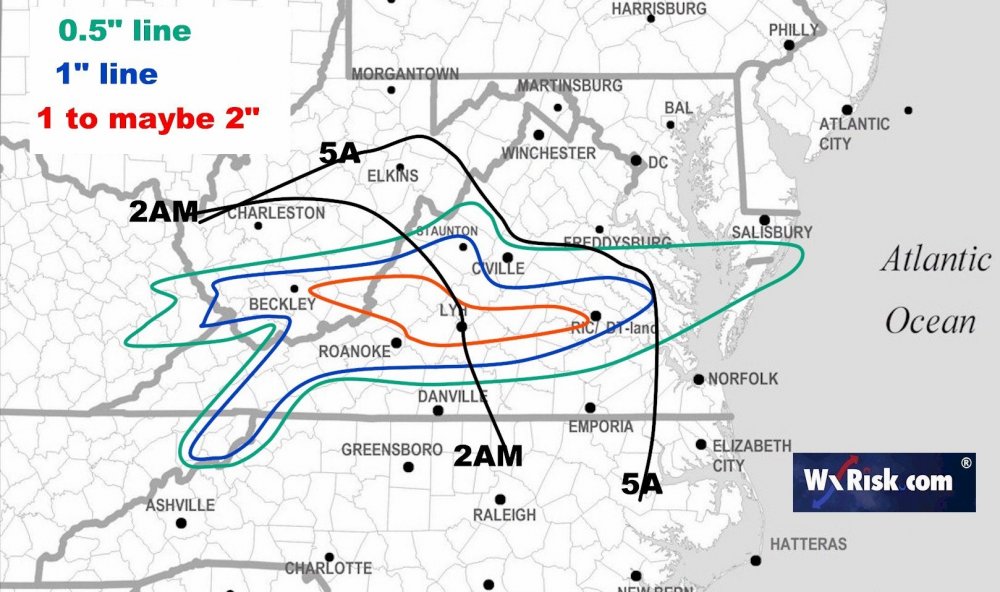
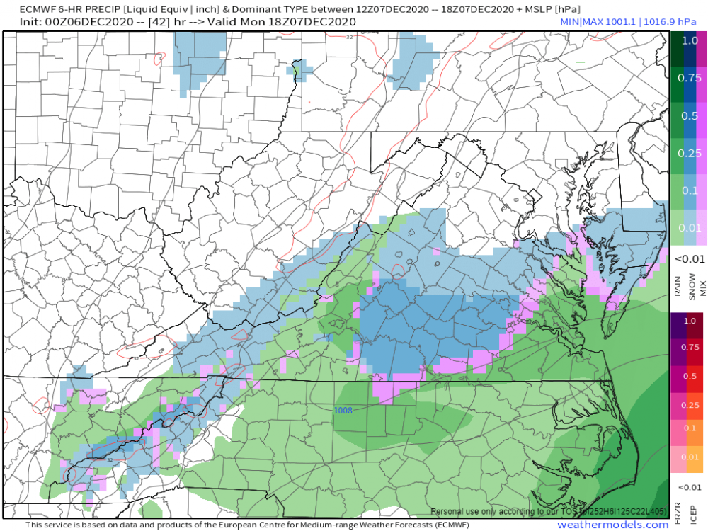
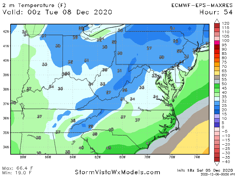
all runs are colder for ric LYH central VA especially Dew points after 11am
-

-
GOOD CHANCE OF 1ST LIGHT SNOW EVENT VA / nw NC/ MD DEL MONDAY DEC 7
DTWXRISK replied to DTWXRISK's topic in Mid Atlantic
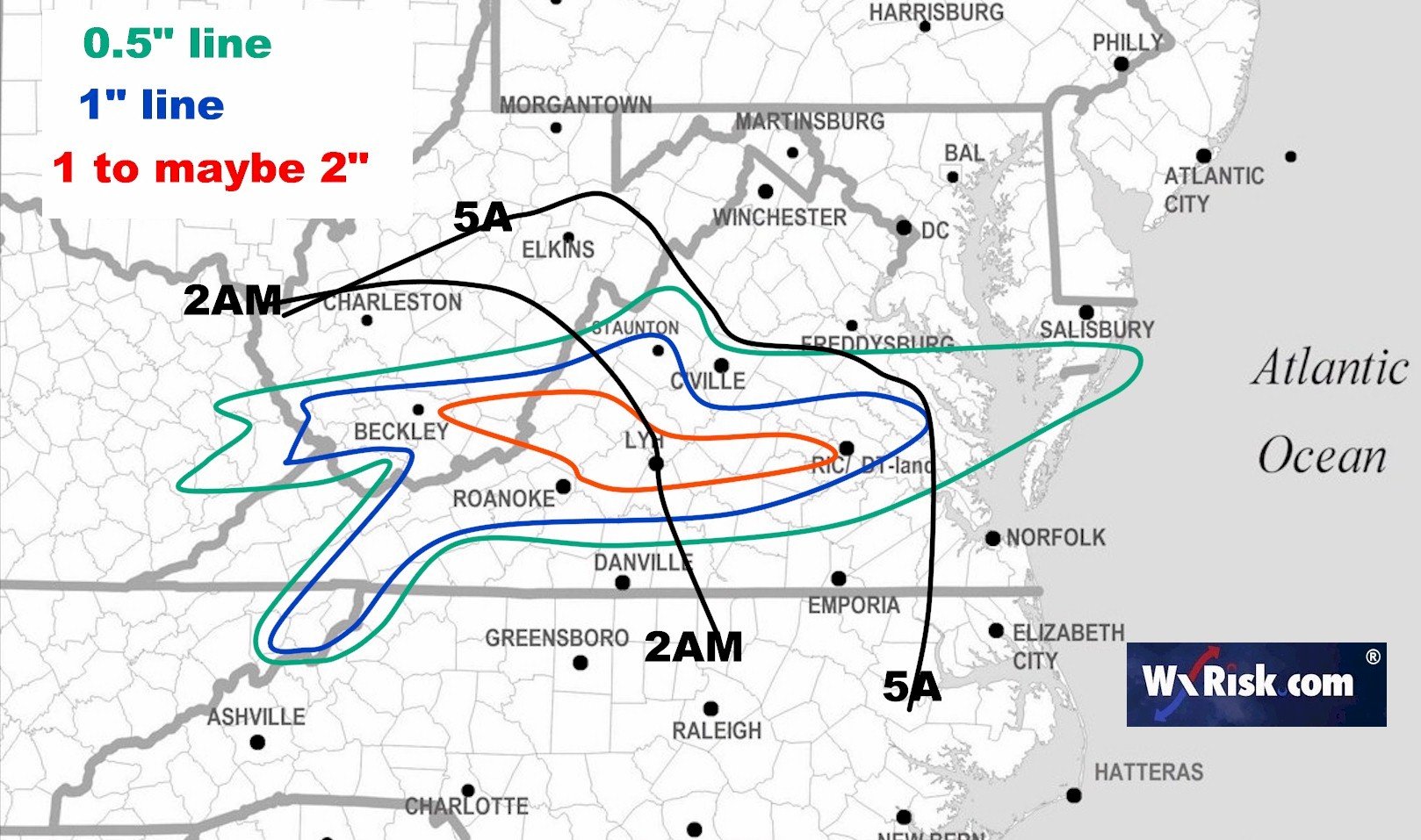
this will GOOD for ME Business wise... a Lot of FRI forecast and saturday TV / NWS Really down played this -
GOOD CHANCE OF 1ST LIGHT SNOW EVENT VA / nw NC/ MD DEL MONDAY DEC 7
DTWXRISK replied to DTWXRISK's topic in Mid Atlantic


-
GOOD CHANCE OF 1ST LIGHT SNOW EVENT VA / nw NC/ MD DEL MONDAY DEC 7
DTWXRISK replied to DTWXRISK's topic in Mid Atlantic
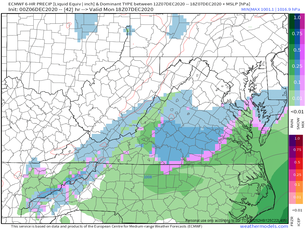
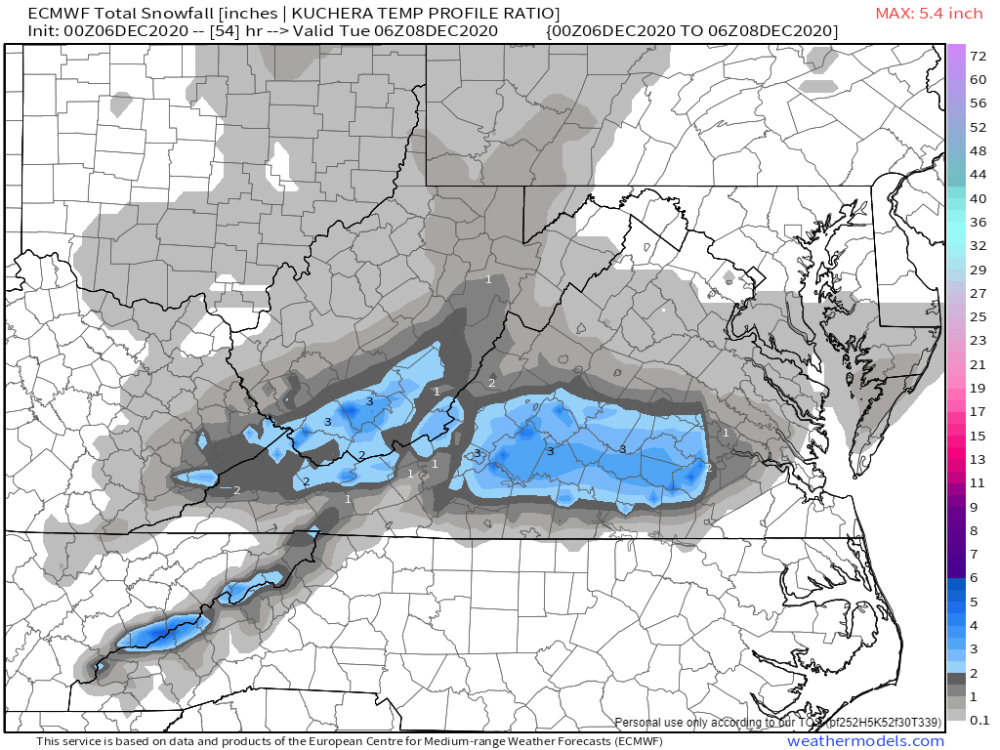
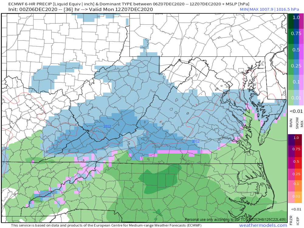
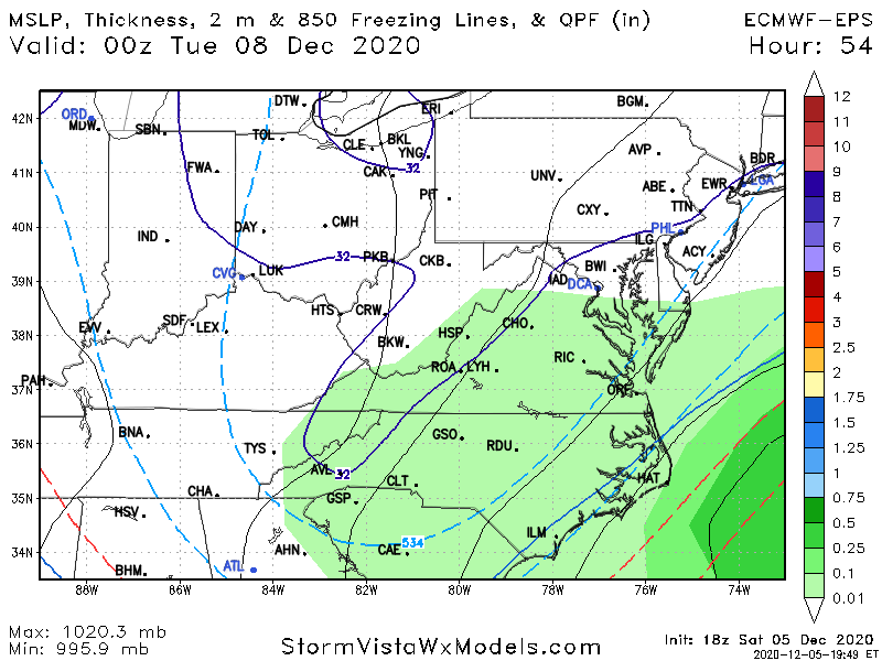
0z euro is ****ing juicy for all of VA except for SE va north edge of snow line get to DC for 6 hrs I-666 is 'IN" the snow such as it is 7A TO 7P
-
GOOD CHANCE OF 1ST LIGHT SNOW EVENT VA / nw NC/ MD DEL MONDAY DEC 7
DTWXRISK replied to DTWXRISK's topic in Mid Atlantic
NEW ENGLAND se canada moving away -
GOOD CHANCE OF 1ST LIGHT SNOW EVENT VA / nw NC/ MD DEL MONDAY DEC 7
DTWXRISK replied to DTWXRISK's topic in Mid Atlantic
well I will try and be more "focused" in my comments central VA vs DC north VA BAL fair enough ? -
GOOD CHANCE OF 1ST LIGHT SNOW EVENT VA / nw NC/ MD DEL MONDAY DEC 7
DTWXRISK replied to DTWXRISK's topic in Mid Atlantic
LOL suddenly GFS gets a clue and look like RGEM EURO 36 + hours ago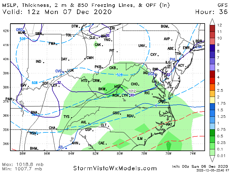
-
GOOD CHANCE OF 1ST LIGHT SNOW EVENT VA / nw NC/ MD DEL MONDAY DEC 7
DTWXRISK replied to DTWXRISK's topic in Mid Atlantic
this may be a shock to you but Mid Atlantic also includes va- 346 replies
-
- 11
-

-

-
GOOD CHANCE OF 1ST LIGHT SNOW EVENT VA / nw NC/ MD DEL MONDAY DEC 7
DTWXRISK replied to DTWXRISK's topic in Mid Atlantic
18Z ECMWF AND 18Z are bth colder and have the snow in central VA lasting until 7pm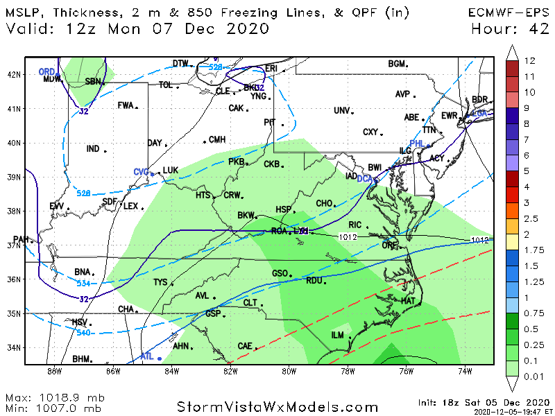

-
GOOD CHANCE OF 1ST LIGHT SNOW EVENT VA / nw NC/ MD DEL MONDAY DEC 7
DTWXRISK replied to DTWXRISK's topic in Mid Atlantic
18Z ECMWF 18Z eps BARKING