DTWXRISK
-
Posts
3,412 -
Joined
-
Last visited
Content Type
Profiles
Blogs
Forums
American Weather
Media Demo
Store
Gallery
Everything posted by DTWXRISK
-
The video from 2011 ---watch it 2x and note all the predictions that joe blowhole BUSTardi got wrong. https://youtu.be/3mzUjn2Z-2E
-
The other day in another thread in the New England subforum Kevin of tolland suggested I was a drunk because I was posting something he didn't like
Now JI is back to doing what he was doing before. He took a tweet I made and lied about it. Specifically lied about my forecast for Leesburg.
He didn't even give a reason he just ridicule the post (LOL) by that mine analysis of the 12z euro dec 11 run was inept and that I was incompetent.
The issue isn't that he disagrees with me. It's the ridicule and distain from a person who is clearly mentally unstable yet allowed to dominate the boards and especially the Mid-Atlantic region for no particular reason.
In my return here I was sgoing out of my way to be positive after 4 years. Instead I continue to see that these two assholes continue to run rampant and treat other meteorologists -- or is it just me ? in a particularly bad manner. And for whatever reason it seems to be okay here an American weather forums.
-
.
-
LET ME GO UPDATE ( CRASH facebook)
-
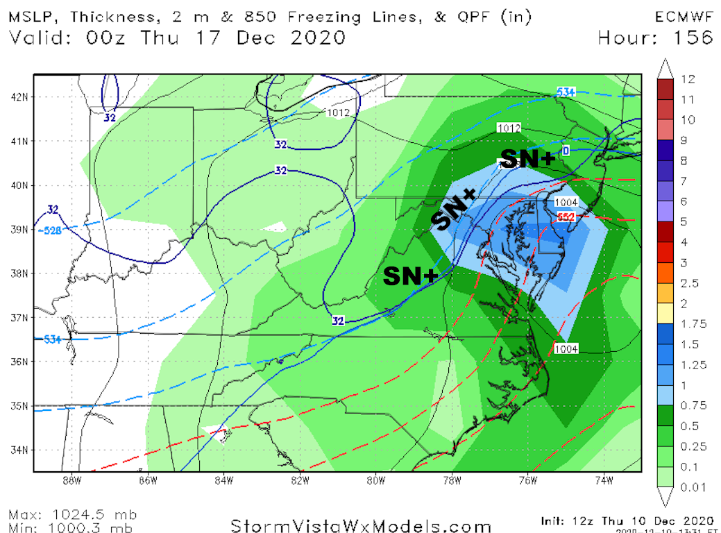
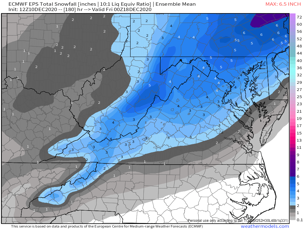
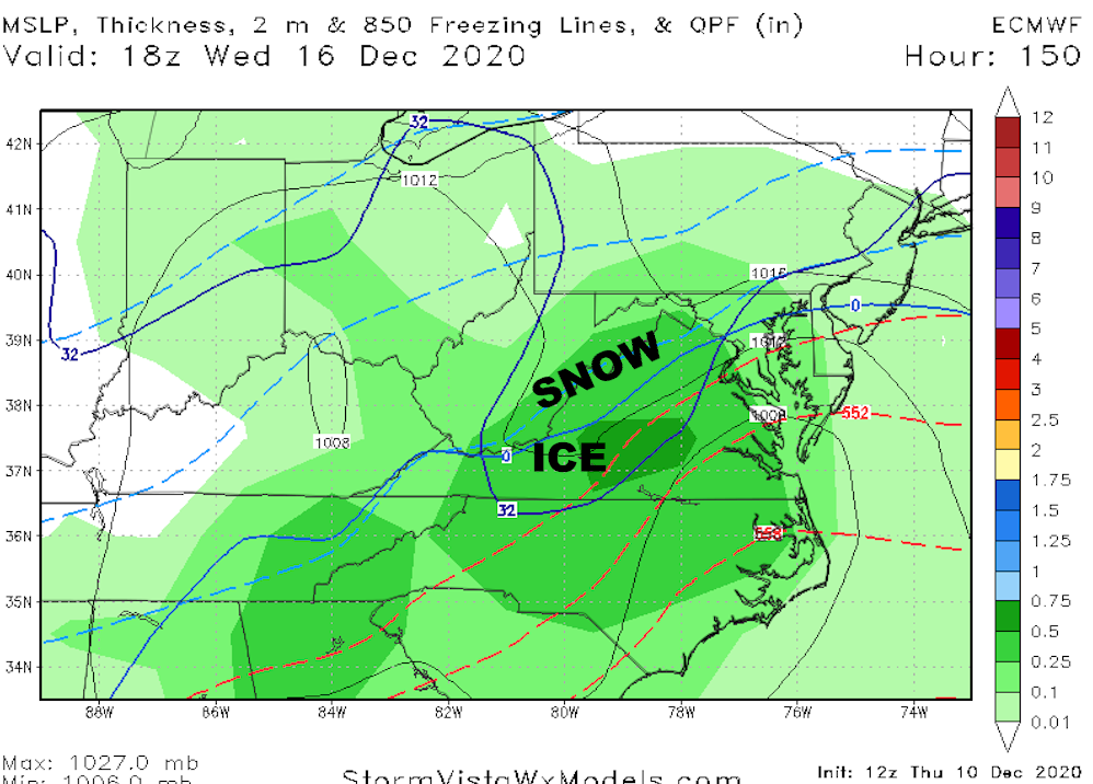
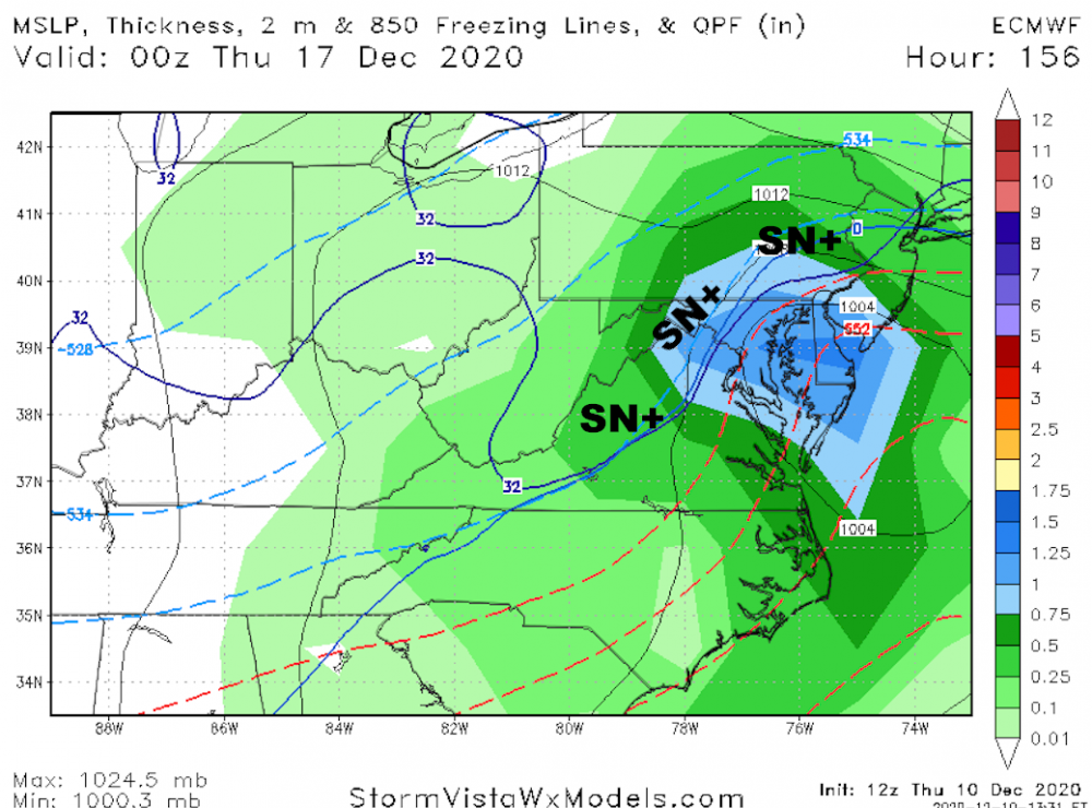
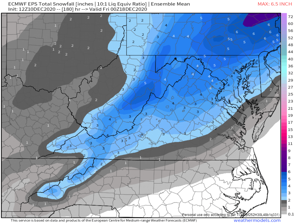
DCA NORTH VA BAL SNOW DROUGHT
-
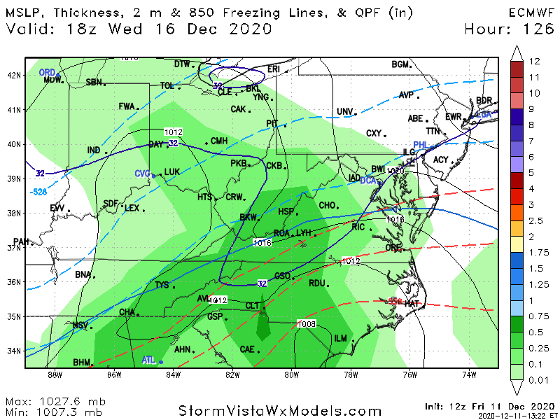
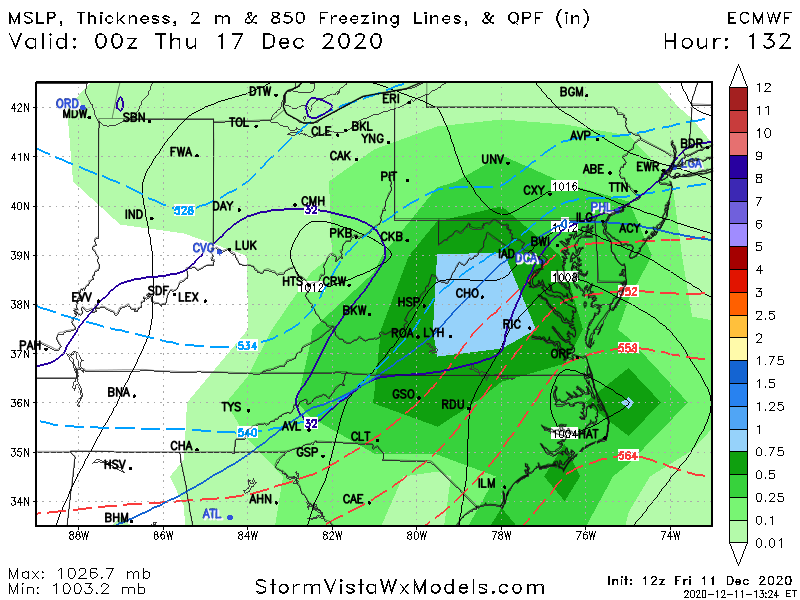
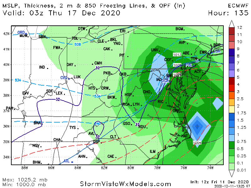
dec16
-
.
-
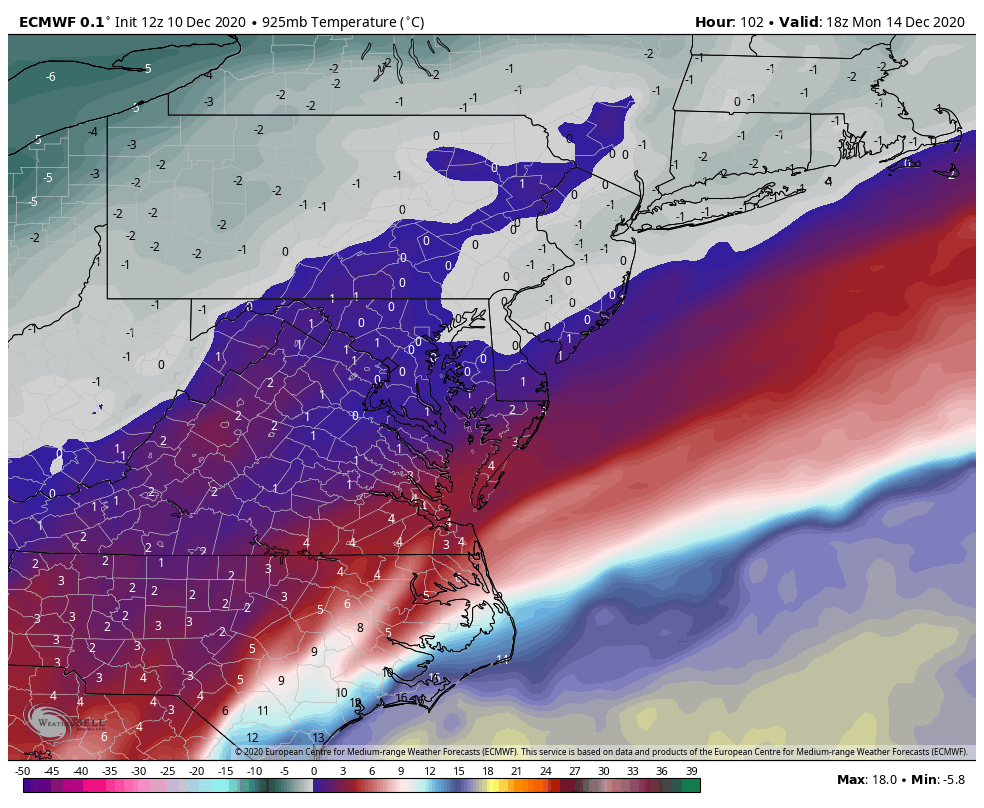
Cause gfs is dry. Icon is 32-34 yes at 90 hrs ...18z MON .. BUT dude when the event begin at 12z Monday DCA is 38 CHO is 40 Winchester is 35f A lot of rain until 18z ....
-
WARM SNOW??? what the hell is that? is it like LIBERAL Bustardi???
-
Icon is warm snow at 40-45 degrees? Good luck with that
-
P13ftw 12 of 24 hit DCA BAL nw third of VA central MD with ACCUMULATING snow
-
its the GFS that model simply does not see stj ast 72 84 hrs ... never has been never will be see the DEC 7 event here in central VA... GFS has NOTHING every run for 6 days until 42 hrs before the event
-
the monday event is a cold rain
-
Lol so much for the meterogically impossible to get cutters during a strong AO NAO block no that not what it means what it means is that a) even if the model shows an inland track with - AO/ - NAO you should NOT accept that solution as valid b) and it means after 15 years you have learned not a damn thing
-
counting on the ICON for snowstorm is a LOSE situation
-
no one with a brain should ever look at the EPS or GEFS control runs the only met I know that does that is a ****ing idiot Henry M
-
in a Miller B? dude come on stop
-
well i edited it a while ago but maybe you are right
-
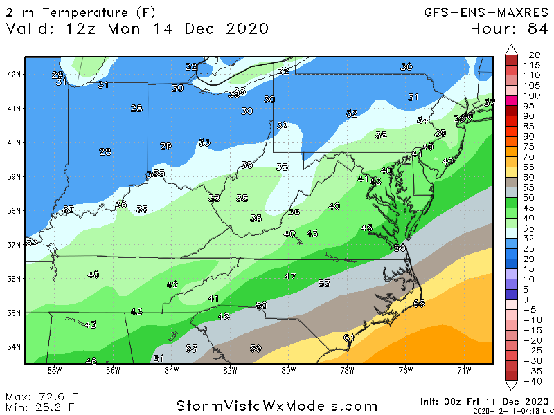
snowchaser In my earlier reply I got the 2 event dates DEC 14 confused you may be confused by what I ma saying here My comments about rain in VA in western VA are for the dec 14 event ONLY if you saw MY recent previous post I am BULLISH have been for more than 36 hrs about all of western VA for WED DEC16 SURFACE TEMPS WED DEC 14 AM 925MB temps well above zero..... if YOU think you are going to get snow in westrn VA with temps 39-43 degrees and 925 mb temps above 0z ... that not gonna happen

-
I DONT KNOW IF OTHERS POSTED THESE OR NOT screaming ice storm VA Piedmont to snow... BIG hit for sw va All of the Shend valley central / western MD
-
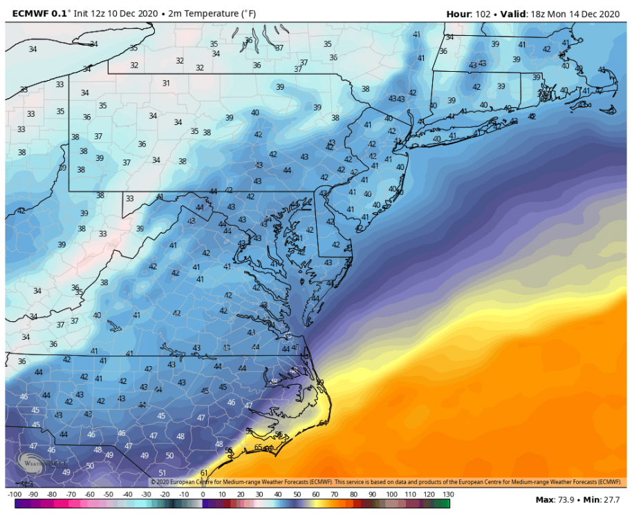
dec 14 look at the data
-
dec 14
-
yes ... CANT wait to move there in March
-
its the 18z GFS dont care... WHY? LOOK at the 18z GEFS ... the differences between the OP GFS and the 18z GEFS are significant which tells me that the op GFS is still not getting it
-
again very much like 12z euro//eps again east coast storms EURO leading with consistency