DTWXRISK
-
Posts
3,412 -
Joined
-
Last visited
Content Type
Profiles
Blogs
Forums
American Weather
Media Demo
Store
Gallery
Everything posted by DTWXRISK
-
The video from 2011 ---watch it 2x and note all the predictions that joe blowhole BUSTardi got wrong. https://youtu.be/3mzUjn2Z-2E
-
The other day in another thread in the New England subforum Kevin of tolland suggested I was a drunk because I was posting something he didn't like
Now JI is back to doing what he was doing before. He took a tweet I made and lied about it. Specifically lied about my forecast for Leesburg.
He didn't even give a reason he just ridicule the post (LOL) by that mine analysis of the 12z euro dec 11 run was inept and that I was incompetent.
The issue isn't that he disagrees with me. It's the ridicule and distain from a person who is clearly mentally unstable yet allowed to dominate the boards and especially the Mid-Atlantic region for no particular reason.
In my return here I was sgoing out of my way to be positive after 4 years. Instead I continue to see that these two assholes continue to run rampant and treat other meteorologists -- or is it just me ? in a particularly bad manner. And for whatever reason it seems to be okay here an American weather forums.
-
December 2020 General Discussions & Observations Thread
DTWXRISK replied to bluewave's topic in New York City Metro
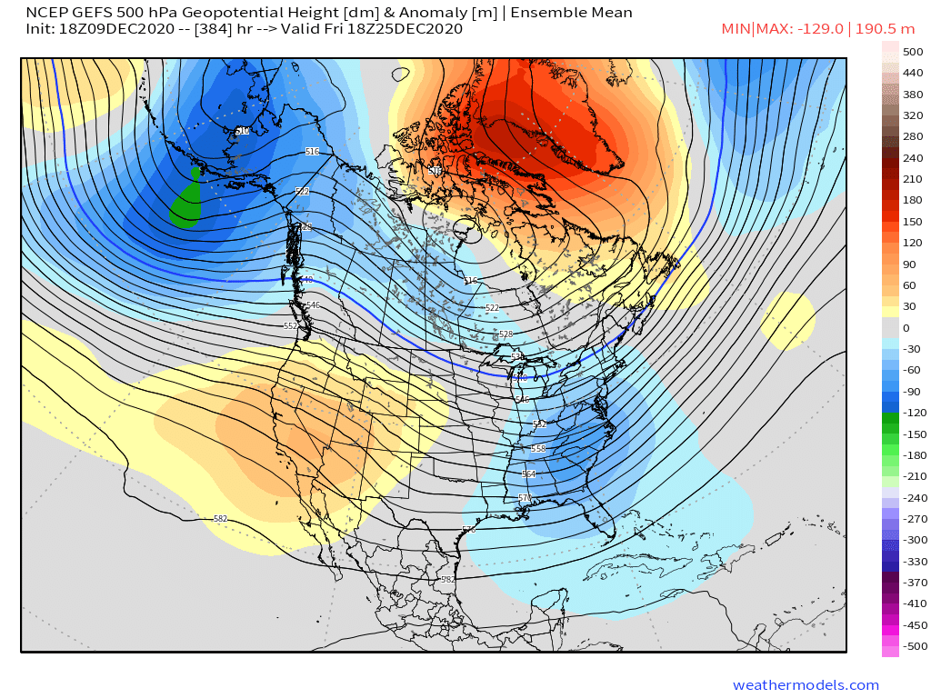
wooof monster -NAO if its correct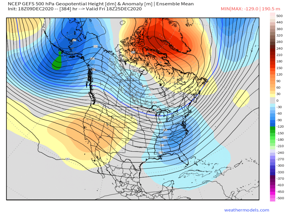
-
December 2020 General Discussions & Observations Thread
DTWXRISK replied to bluewave's topic in New York City Metro
MILLER B EVENT SEEMS LIKELY DEC 16 -
December 2020 General Discussions & Observations Thread
DTWXRISK replied to bluewave's topic in New York City Metro
it certainly is a a full split -
miller b event seems likely DEC 16 for northern Mid Atlantic and New England
-
2019 ENSO
DTWXRISK replied to AfewUniversesBelowNormal's topic in Weather Forecasting and Discussion
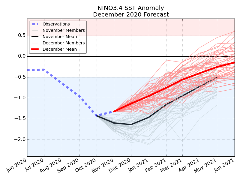
wow talk about a TOTAL mis read.... Good luck with that this issue is will the moderate DEC La Nina have the same impact in JAN FEB MAR as it under goes RAPID weakening? clearly the answer is no -
IN MAJOR DEVELOPMENT the ecmwf enso model shwos DRAMATIC WEAKENING of the Moderate La Nina. It is hard to understate how BIG this is...or COULD be... a rapidly weakening La Nina... in essence a WEAK La nina combined with SSW EVENT t
-
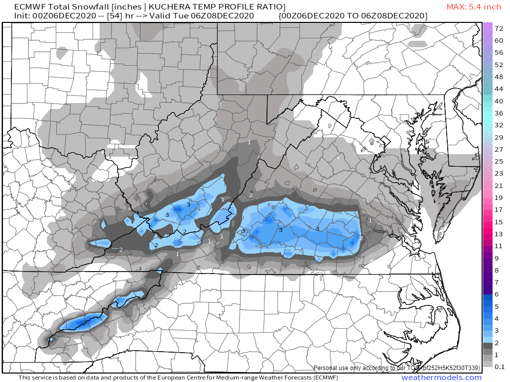
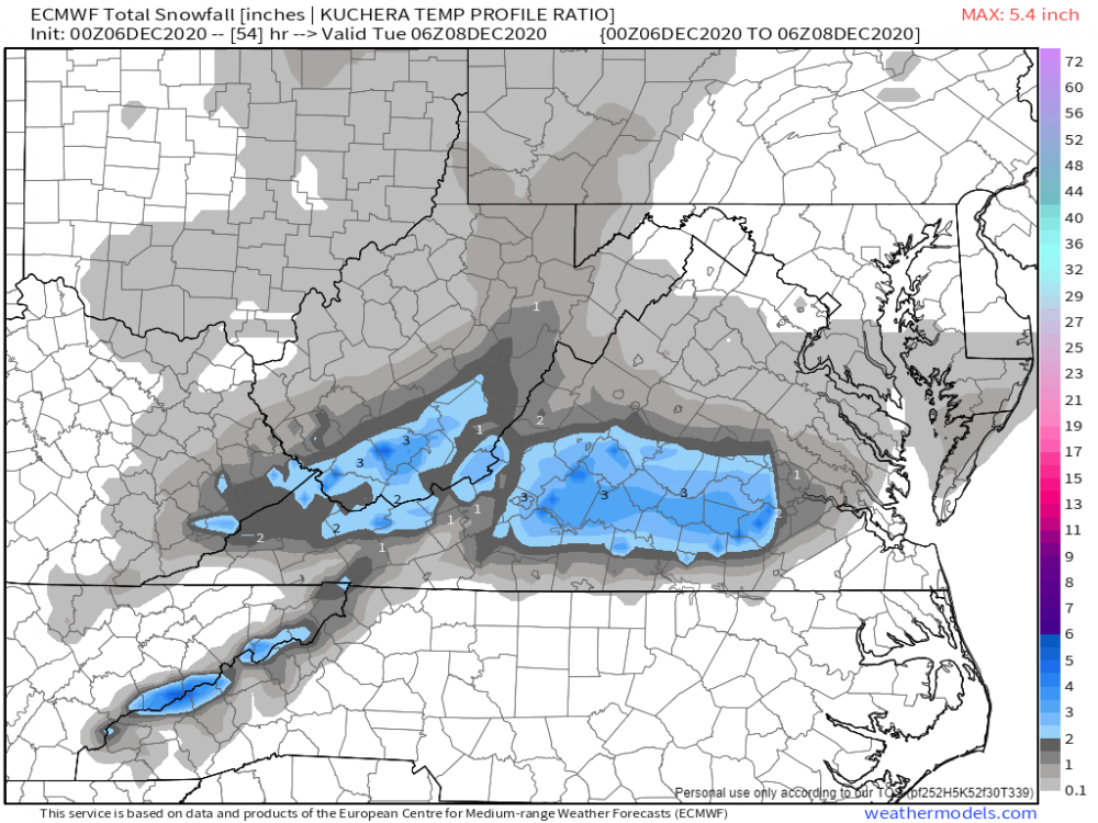
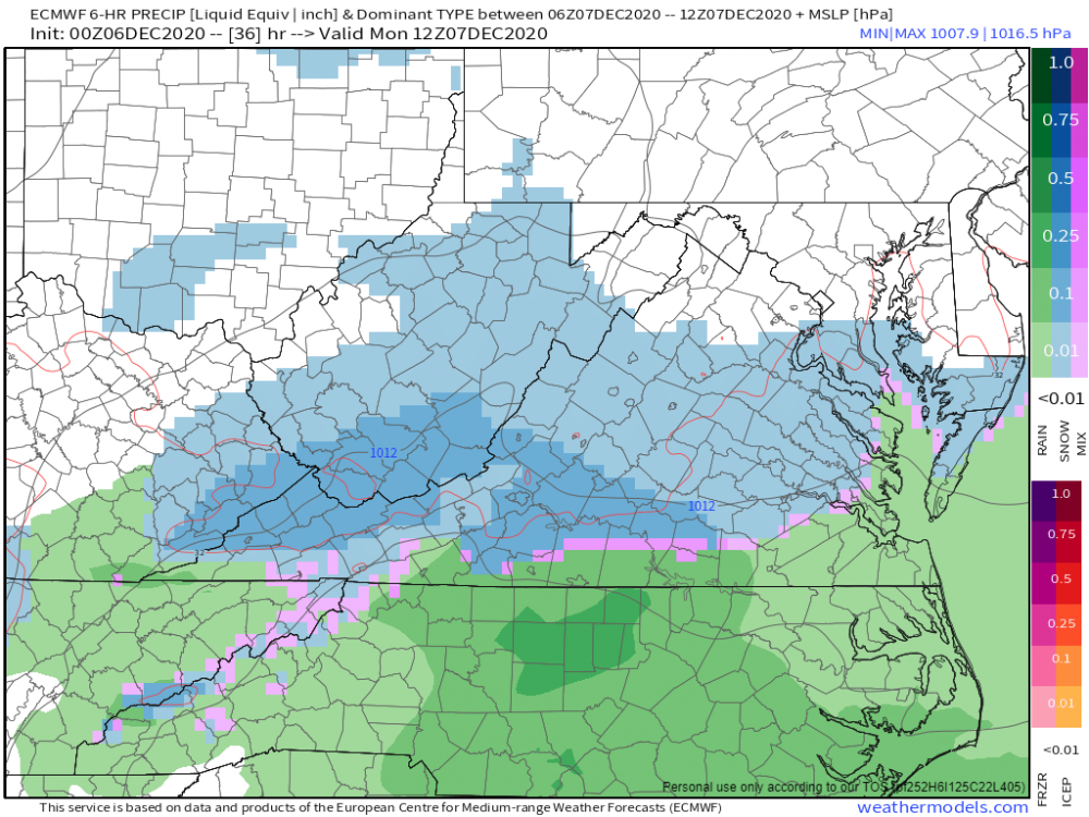
all runs are colder for ric LYH central VA especially Dew points after 11am
-
-
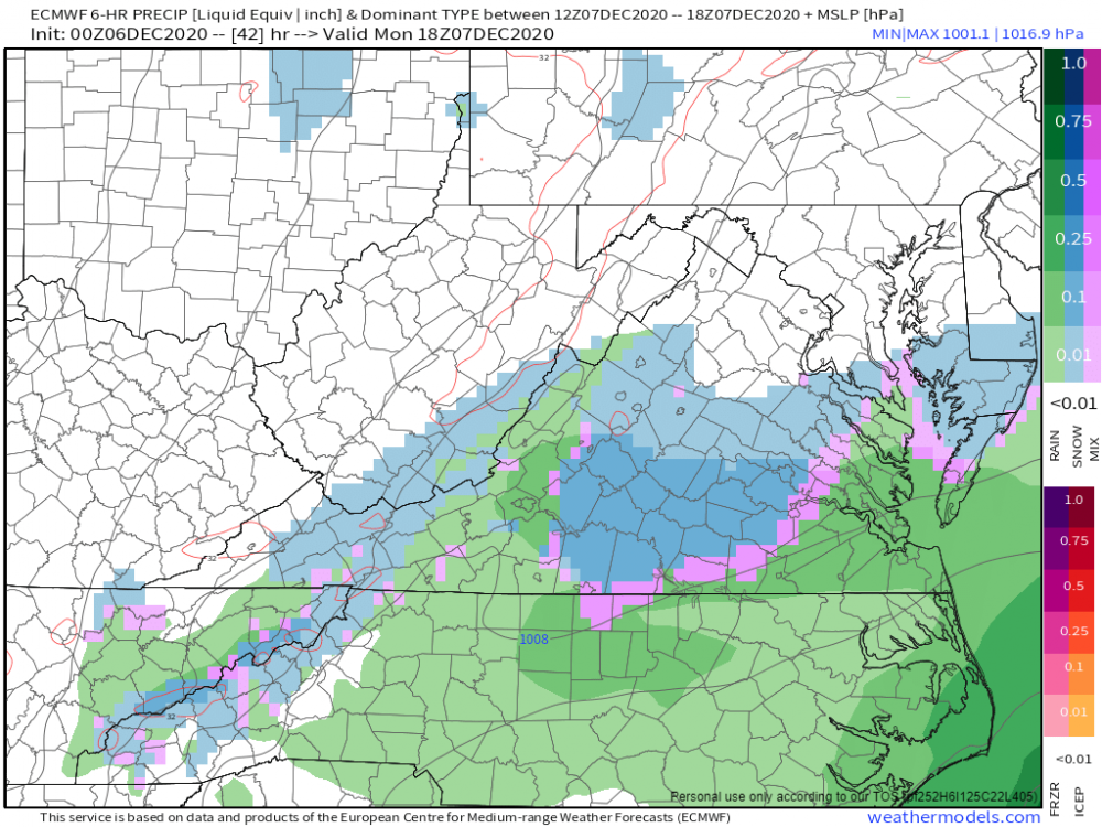
JUST IN CASE YOU DID NOT NOTICE... since the time I left ... Oct /Nov 2016 we have NOT have BIG widespread northeast US snowstorms--- ya know like RDU/ GSO to BOS snowstorm big KU event we have been close a few times DEC 8-10 2017 Jan 3-5 2018 March 6-8 2018 DEC 12-13 2019

-
December 2020 General Discussions & Observations Thread
DTWXRISK replied to bluewave's topic in New York City Metro
simon lee ...good met -
December 2020 General Discussions & Observations Thread
DTWXRISK replied to bluewave's topic in New York City Metro
-
OUTSTANDING POST ANALYSIS.... WOW I like the north pacific Riidge +QBO map sicne 1990 a LOT
-
I haven't been through the entire thread in this group or in the general forums but I am increasingly bothered by the amount of groupthink regarding the winter. it seems the data is overwhelming that the La Nina whether it's moderate or strong … only reaches that intensity for short interval of time - DEC - and that the La Nina is going to significantly weaken in the second half of the winter. Again I do not know if others have mentioned this but seems to me that this is being overlooked buy a lot of folks and I think this is a huge mistake The second issue has to do with the amount of incredibly warm water that is piled up in the Eastern Pacific along the immediate west coast of Canada and the Gulf of Alaska. I have looked on the SST maps on weatherbell and weathermodels sites along with other sources and so far I have yet to see a La Nina with that much warm water piled up with that sort of intensity along the west coast of North America. Maybe somebody else has found something that matches it but so far I haven't seen anything. So I am concerned that these the two things are being overlooked by a lot of people.
-
YOU do realize that the idea that the La Nina is going to stay Moderate to strong all winter long is total crap right ? that None of the enso data / models supports that idea ?
-
ah
-
There are several powerful short waves in the the southern jet stream. The 0z Saturday European takes the shortwave at 120 hours over Texas and Oklahoma and develops into a major snowstorm for NC VA MD DEL and slides the Low off the coast clipping Cape Cod . The 0z GFS sees that shortwave over Texas and Oklahoma at 120 hours BUT it crushes into a weak flat system in the Gulf at 144 the surface Low does not develop into anything significant. Instead the 0z GFS has a moderate amount of snow and ice from Tennessee Valley and portions of NC VA followed by a weak LOW that slides off the coast. Instead the GFS focuses on an next shortwave coming out of the SW states and develops that one is the major East Coast snowstorm at 234 hours I have no idea which solution is correct but I will say that given the fact that we are dealing with a strong enhance STJ and the fact that the GFS loves to crush the short waves in the southern jet stream during Arctic outbreaks that the GFS solution for January 15-16 - ( the weak wave of Low pressure) is probably bogus and the European solution is more likely to be correct And there may be a second a significant system after January 20
-
no hype with snowmagedon?
-
UM no...
-
ANOTHER JB BUST