Sydney Claridge
-
Posts
539 -
Joined
-
Last visited
Content Type
Profiles
Blogs
Forums
American Weather
Media Demo
Store
Gallery
Everything posted by Sydney Claridge
-
 Spring 2020 was interesting, with a particularly intense period in April, but tornadic activity dropped off pretty quickly after that, with a quiet autumn to boot. I'm going to assume that 2021 could be an intense season, with a La Niña currently in place. I know that a transitioning La Niña favors an uptick in tornadic activity in the Southern Plains (Texas-Oklahoma), but that Dixie Alley and the Ohio Valley often see increased activity in cases of a resurgent La Niña (see "US regional tornado outbreaks and their links to spring ENSO phases and North Atlantic SST variability" by Lee et al.). Forecast precipitation anomalies seem to show increased precipitation in the Ohio Valley in particular. I'm going to place my bets on an active 2021 season for Dixie Alley and the Ohio Valley.
 -
There’s quite the temperature divide across the Houston metro this morning, with 50s in the far west suburbs (Katy), with 40s not too much further west, but generally upper 60s over the rest of the metro. Definitely cannot rule out severe storms in the Houston area until the front passes through (which it should do in the next few hours as the storm system moves NE). The storm coming ashore at Surfside Beach looks slightly isolated and now has a severe thunderstorm warning with “tornado possible” wording indicated.
-
We actually had some favorable values (EHI, SigTor, VTP) earlier that showed up on the SPC Mesoanalysis between DFW and the Red River. Some of those values were pretty high (there were VTPs exceeding 9, for instance) before the storms came through, so I’m not surprised at all that there were a few tornado-warned storms.
-
No wonder why COVID has preyed on this country so much. None of our politicians seem to have the chutzpah to rein in the junk food industry, and the false narrative of "personal choice" (look up "food deserts") continues to be an issue. As much as I hate to say it, our country was primed for a pandemic that would come in, spread, and take advantage of the large number of people who are overweight or obese. Our healthcare system was apparently designed to deal with acute illnesses, and fails miserably at the treatment and prevention of certain chronic illnesses ("pre-existing conditions") that can contribute to severe cases of COVID. Preventing things like this in the future might require a full-on "War on Obesity," and politicians (and others) will have to make many hard decisions (and challenge the powerful junk-food lobby) should they follow this path.
-
2020 Mid-Atlantic Severe Weather - General Thread
Sydney Claridge replied to Kmlwx's topic in Mid Atlantic
NBC4 Washington on-air met thinks a tornado warning may be coming in for DC soon, hook over NW DC. I did notice an outflow boundary on radar earlier west of Arlington/south of McLean along I-66, however. -
General severe weather discussion
Sydney Claridge replied to Quincy's topic in Central/Western States
I've noticed that SPC has included hatching on 15% wind risks, starting earlier this year, when there is potential for a major damaging wind event but there is a degree of uncertainty as to whether said threat will actually materialize (such as capping, etc.). -
General severe weather discussion
Sydney Claridge replied to Quincy's topic in Central/Western States
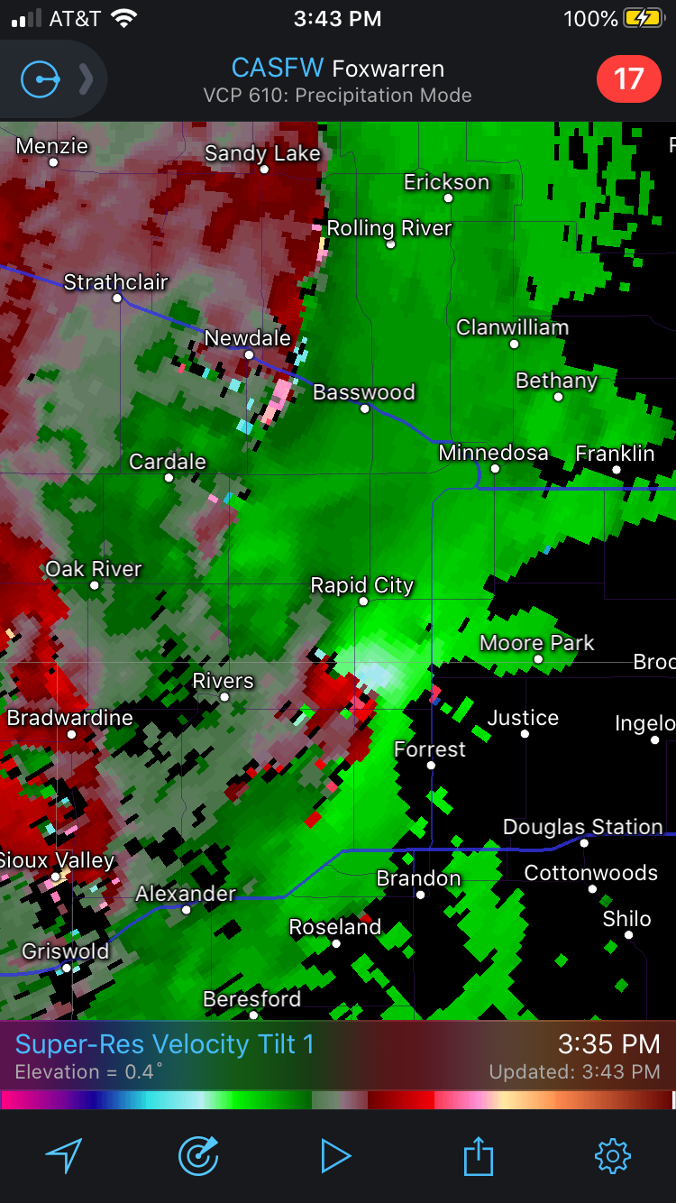
We have a tornado watch in North Dakota for today. Meanwhile, across the Canadian border in Manitoba it looks like there is a storm with significant rotation: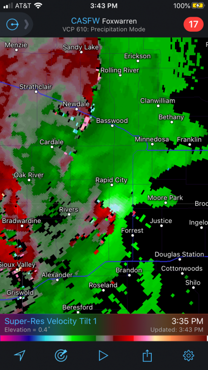
-
General severe weather discussion
Sydney Claridge replied to Quincy's topic in Central/Western States
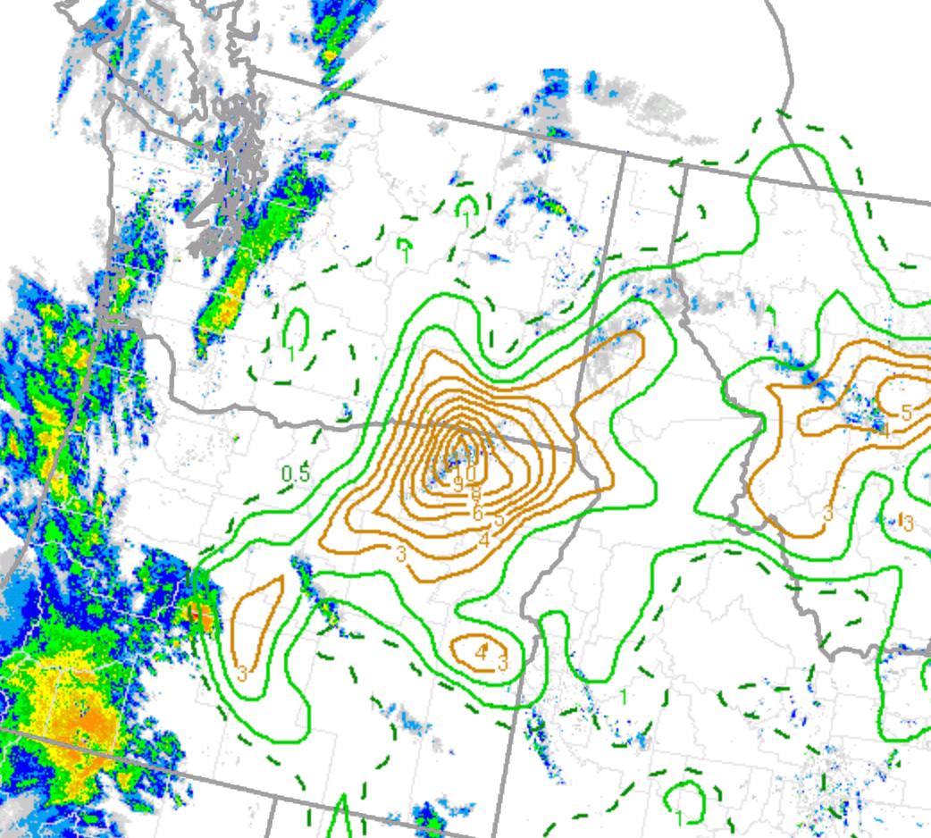
0-3km EHI is as high as 10 along the OR/WA border. I have never seen values that high in the Pacific Northwest before, but keep in mind that LCL heights are very high. Storm south of (and moving towards) Bend, OR has lower LCL heights.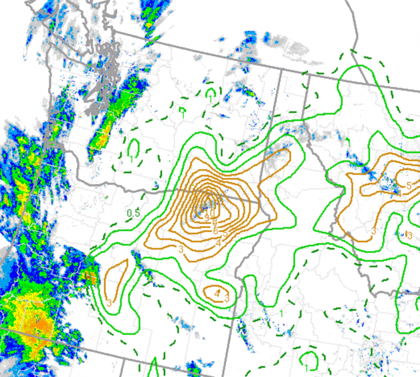
-
Central/Western Medium-Long Range Discussion
Sydney Claridge replied to andyhb's topic in Central/Western States
This pattern would have been good for winter in the Northeast, too bad it came too late. At the same time however, western ridging in the winter would have meant reduced mountain snowpacks and worse drought. A return of the Pacific "blob" would be good for big-time Northeastern snowstorms but very bad for western water supplies, especially outside of the coastal Pacific Northwest where the warmer water can serve to increase the amount of moisture available to a storm system. Eastern troughing and western ridging has killed severe weather seasons in many recent years. If I recall correctly, 2013 had somewhat of a late start to the Plains severe weather season, but once it got going in May, we had some very powerful tornadoes in Oklahoma, including the most recent EF5 on record (Moore, OK), not to mention the El Reno tornado (that would also have been an EF5 if it had it hit structures). There have been strong and violent tornadoes in Dixie Alley so far, and a persistence of the eastern troughing pattern would lead me to believe that areas on the southern and eastern flanks of the trough, namely Dixie and the Carolinas, would remain prone to potential tornado events through May, especially with warmer-than-average Gulf of Mexico water temperatures. Perhaps with some northward shifts into the Ohio Valley and southern Great Lakes region as warmer air gains a foothold in that region. The Plains might very well be stuck with northwest flow in this pattern. Provided sufficient moisture, severe thunderstorms (and possible derechos) on the rim of the building western heat are a possibility, particularly if this western ridging/eastern troughing pattern continues into summer. I would also watch to see if the High Plains EML gets advected further east into any regions favorable for severe weather that are on the southern and eastern rim of the troughing. Western ridging that affects the Rocky Mountains and High Plains could be favorable for making a stronger EML, but this might also kill severe weather events as well, if the cap is too strong. -
Central/Western Medium-Long Range Discussion
Sydney Claridge replied to andyhb's topic in Central/Western States
I guess there could be some northwest flow events in the Southern Plains even if we wind up with that pattern, provided there is enough moisture available to fuel severe thunderstorms. There was northwest flow severe earlier this month in the Midwest and Great Lakes states, even though northwest flow is not normally favorable for severe thunderstorms there until the summer. Northwest flow is not the most ideal for tornado activity, but it might at least be something. You would think that with cooler-than-normal water temperatures off the U.S. and Mexican Pacific coasts and warmer-than-normal temperatures in the Gulf of Mexico that we would be more prone to western troughing and eastern ridging. -
Central/Western Medium-Long Range Discussion
Sydney Claridge replied to andyhb's topic in Central/Western States
Would definitely be interesting to see the severe storm potential start to move further north. So far, the Gulf Coast states look to remain prone to severe thunderstorms and tornadoes for the next couple of weeks. Given what happened in Mississippi on Easter (and with said areas still recovering), it would be nice to get the severe storm potential away from that area. But they have another significant risk for tornadoes tomorrow (also including Louisiana once again, so still relevant to this subforum), and the 22nd and 23rd are also looking like potential severe weather days in that same area once again. With all that warm water in the Gulf, it would not surprise me that whenever the severe storm potential marches north, that things could get intense with plentiful low-level moisture. As for the traditional Tornado Alley, this is a Dixie Alley pattern, but parts of Texas may get in on the action (I don't want to necessarily rule out the I-35 corridor or the Southern Plains of TX/OK completely, especially if the storm systems come in northwest of where they are modeled, but everything looks like it will be east of there). I'm just a little surprised that it has remained quite cold in the Midwest and Great Lakes regions, but they will probably get their turn for severe storms once this warm, humid air can move further north than Dixie. -
Central/Western Medium-Long Range Discussion
Sydney Claridge replied to andyhb's topic in Central/Western States
With the COVID-19 pandemic and all, getting a major tornado outbreak (or just one major tornado striking a populated area) would be horrific, especially once you consider the need for hospital beds for both the injured and COVID-19 patients. It would be much more manageable if the tornadoes stuck to rural areas, but that is never a guarantee; just look at what happened back in 2011. Something like the 2011 Joplin tornado (which destroyed a hospital), if it occurred today, would be a lot worse given the current pandemic. A quiet pattern is a much needed reprieve right now, and hopefully we don't have to worry too much about severe thunderstorms and tornadoes until COVID-19 quiets down somewhat. But you never know, especially considering that we are now in the most active time of year for severe thunderstorms and tornadoes (April/May/June). -
Turns out today will be defined by a southward-surging cold front and then chilly temperatures. Temperatures around Oklahoma City and north-northwestwards are below freezing this morning (and there is even some elevated instability above that cold layer too). Except for southern Texas, forget any potential for severe, aside from perhaps elevated hail producers in some areas of central Texas. Later on, there may possibly be some cells initiating near the Serranias del Burro of northern Mexico and then moving into southern Texas. Should be a quick chilly spell this weekend before warm and humid air begins to surge northwards on Sunday and (especially) Monday. Enjoy it if you like cold weather as this could easily be the last time we see temperatures like these until next fall.
-
I am starting to wonder about this rainy pattern currently present across the north-central Texas region. With all this moisture in place, and with the region being within an active pattern for precipitation, sooner or later I would not be surprised to see a major severe weather event unfold (I'm not saying that will happen, though). At the moment cool temperatures are dominant, but next week looks as if conditions could get quite warm and humid, possibly setting the stage for severe weather. Additionally, late this week, SPC discussion suggests the possibility of some severe weather in TX on Friday (4/3). Longer-range models (GFS and Euro) suggest that there could be a storm system early next week, with possibly another system around the middle of next week. While less pertinent to this region, the early-week system may also get pretty strong as it moves up towards the Great Lakes at mid-week (if GFS/Euro are correct, especially GFS, and that might mean severe storms in the IA/IL region that was largely spared from having a tornado outbreak last week).
-
Laredo got well into the triple-digits today for their high temperature today (3/26). And I believe my location (Fort Worth, TX) got to 90 yesterday, although temperatures were cooler today. What is interesting is that I am seeing what could be convection trying to go up over north-central Texas, both on satellite imagery and outside my window. I know there is a cool down coming, but it seems that summer wants to try and appear early. If heat like this tries to show up again in April (we will likely see this again by the end of May), I am wondering about the effects on the severe storm season; for Texas that would probably mean more capping and a stronger EML, but elsewhere (further north and further east) that might mean more severe storms. For instance, I know the EML is modeled to move north-east over Missouri and Illinois for their severe storm event on Saturday.
-
I believe the lapse rates were pretty high with this severe weather event. That could have compensated for the lower temperatures and dewpoints somewhat. This also seems to be the first really bad tornado this year. It’s only been a few months since we had a tornado go through north Dallas on October 20th, so it has not been too long since we last had a tornado go through a densely populated urban area. Unfortunately this time around people lost their lives (unlike in Dallas, despite that being one of the costliest US tornadoes monetarily, and that tornado was probably weaker than what moved through Nashville), and the late-night timing could not be worse.
-
If we are going to see above-normal temperatures and precipitation at the beginning of March, perhaps the severe storm season could start to ramp up. GFS and Euro are both depicting a storm system for the Southern Plains for early next week (around March 2nd), with what seems to be sufficient moisture return across Texas into southern Oklahoma. We are still a ways out, so any model data should be taken with a grain of salt, but the modeled pattern caught my eye (with multiple low-pressure systems moving out of the Rockies on the GFS, and a big storm on the Euro). I'm a little concerned about the late-week storm (that should impact the Great Lakes with snow) scouring the Gulf of Mexico of moisture, though water temperatures are above average across much of the GoM.
-
Need to watch that storm NW of San Antonio for hail potential. It’s just behind the front so I would expect it to stay elevated (and SPC agrees), though the surface warm sector is fairly close.
-
Storm initiation looks to have started just east of Wichita Falls. Looks to be on the front itself.
-
Had a dusting of snow up near Texas Motor Speedway earlier today.
-
GFS seems quite the outlier right now, depicting a major snowstorm over the north Texas area (especially just west of DFW) on Wednesday. Most other models (NAM, Euro, etc.) are further north.
-
Maybe an early start to the spring severe season is in order? Not going to comment on summer at this time. GFS gives some threat across the SPC-delineated regions for Friday and Saturday though the Euro runs look more amped (bringing a fairly-humid warm sector as far north as the Ohio Valley next weekend); if those Euro runs verify then a stronger storm system would track from central Texas to the Midwest-Great Lakes region. EDIT: The only cold I see for DFW is way out in GFS fantasy land. I guess we know how that tends to go.
-
I'll guess 1250 total tornadoes, first high risk April 1st.
-
I know we are only in a marginal risk zone, but the storm parameters over the DFW area look somewhat interesting right now. Temperatures in the lower 70s (in places) with upper 60s dew points, in conjunction with some high helicity values (ESRH in the 300-500+ m2/s2 range), could produce some potentially severe storms if we can get storm initiation, though veer-back-veer seems to be an issue based on the change in wind directions between the 700mb and 500mb levels (based on the available SPC mesoanalysis data at the time of this post).
-
The GFS-based models (GFS and GFS-FV3) are placing the warm front with the Saturday system just south of DFW on the 0z runs. Those models do seem to have moved the front's location slightly further north with each of the last few runs. The 0z runs puts DFW in the upper-50s for dewpoints with mid-to-upper 60s dewpoints just to the south and SE. It will be interesting to see how far north the warm front can come, as well as what the NAM has to say about it as it comes into range.