Sydney Claridge
-
Posts
537 -
Joined
-
Last visited
1 Follower

About Sydney Claridge

Recent Profile Visitors


-

Texas 2026 Discussion/Observations
Sydney Claridge replied to Stx_Thunder's topic in Central/Western States
We've had several cloud-to-ground lightning strikes well ahead of the storm in Fort Worth (and across the northern Metroplex). Two potentially-tornadic supercells are moving towards the Metroplex, although the southwestern storm with its unimpeded inflow is the stronger of the two. -
Fox 6 Milwaukee is taking shelter per livestream.
-
The eyewall should start hitting land within the next two hours or so. This is one dangerous storm. I wonder how good typhoon preparedness is in the Northern Mariana Islands, especially when it comes to a direct hit?
-
Sinlaku's eyewall looks like it's coming right at Saipan and Tinian. I'm not sure if Extreme Wind Warnings can be issued for the Northern Mariana Islands (I know they can, and have, been issued for Guam), but the situation appears as if it would warrant an EWW once the eyewall gets closer.
-
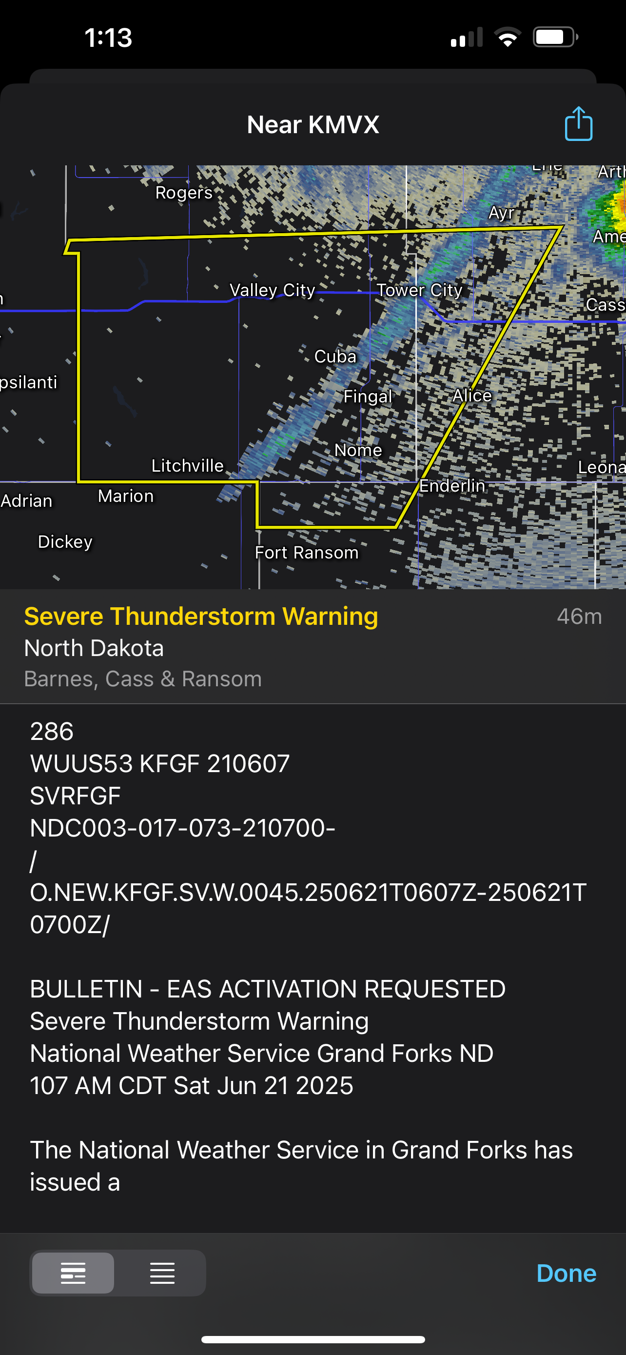
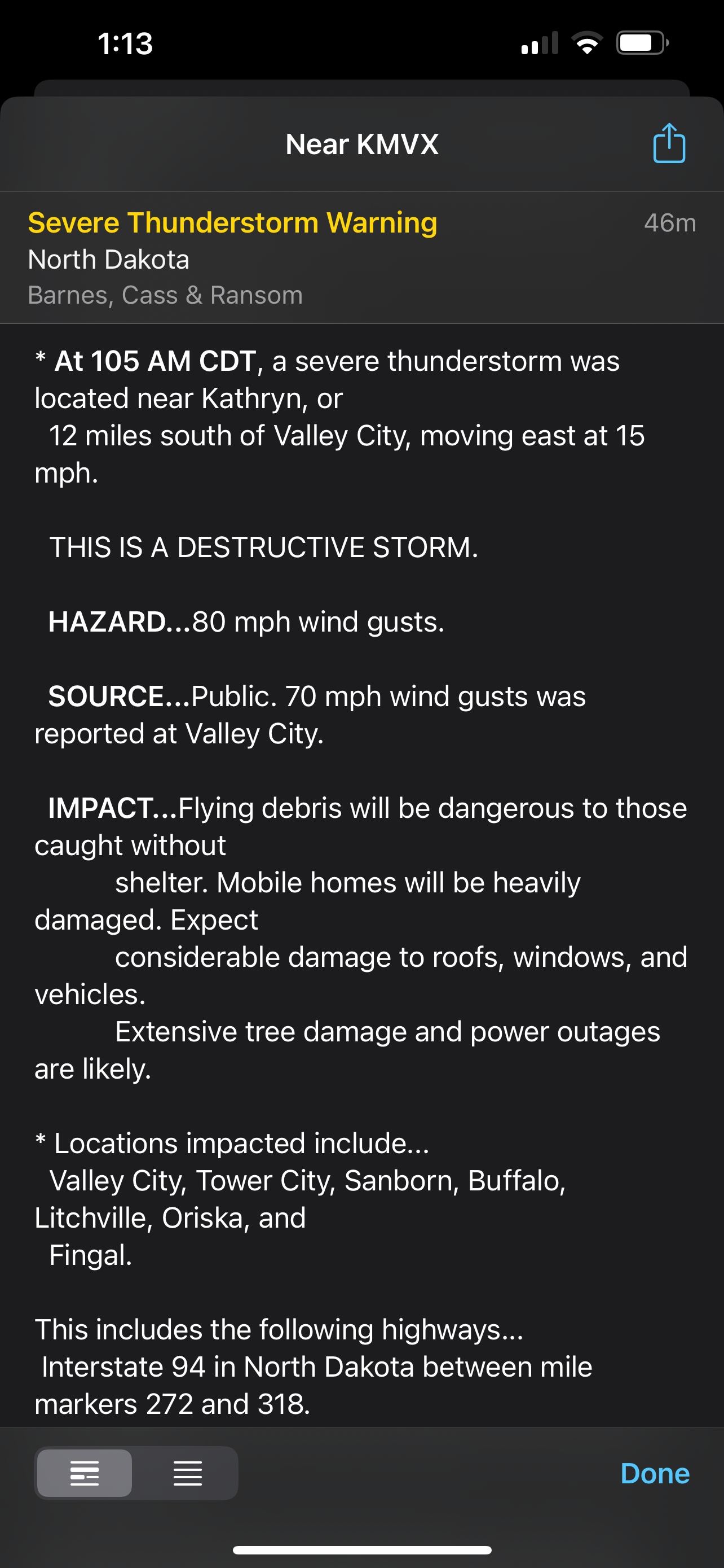
Those storm cells near the Quad Cities should be watched very closely. There seems to be some issues with other nearby cells interfering, but the cells over McCausland and Colona might be starting to get that “look.” The tornado-warned storm moving towards Toronto, IA also bears watching; it’s about to merge with the line behind it.
-
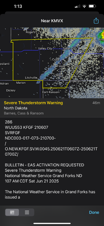
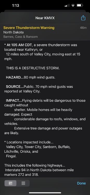
Even this gust front got a severe thunderstorm warning with a “destructive” tag. It’s incredible how much wind energy there is.
-
Rotation seems to be tightening near/over Kimball, MN.
-
4/2-4/3 Potential Major Severe WX Outbreak
Sydney Claridge replied to Geoboy645's topic in Lakes/Ohio Valley
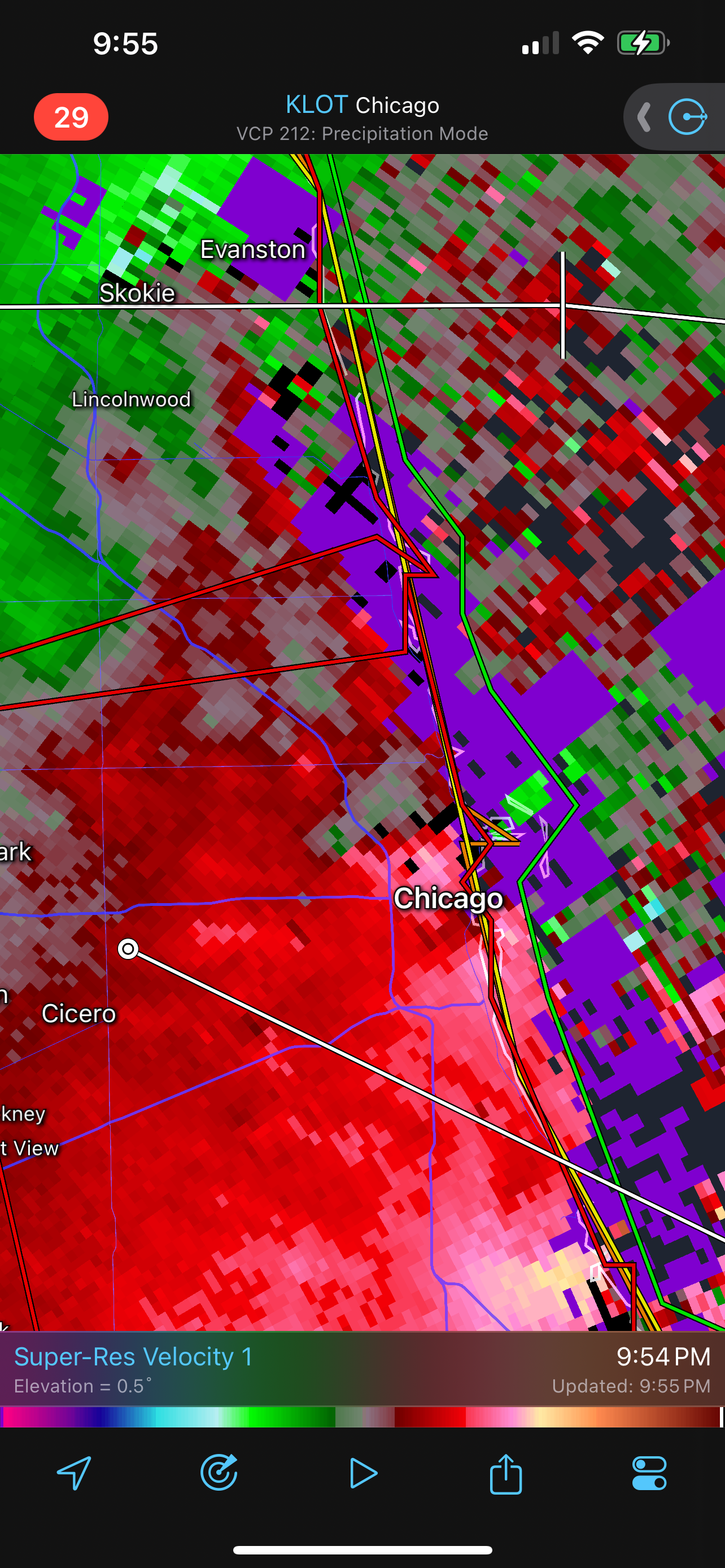
Tornado crossing I-55 in Cape Girardeau, MO with power flashes, per KFVS livestream. -
4/2-4/3 Potential Major Severe WX Outbreak
Sydney Claridge replied to Geoboy645's topic in Lakes/Ohio Valley
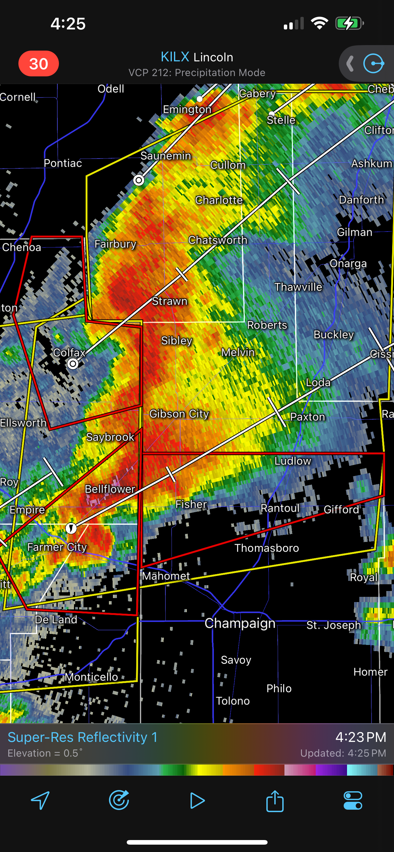
The county to the north probably needs a tornado warning on it. The rotation looks to be passing more towards Paxton, IL and north of Rantoul (the county line there is the boundary between the NWS offices in ILX and LOT). -
4/2-4/3 Potential Major Severe WX Outbreak
Sydney Claridge replied to Geoboy645's topic in Lakes/Ohio Valley
This storm east of Farmer City, IL moving towards Rantoul looks a little concerning, especially if the rotation tries to tighten up any more.
-
March 14-15 Severe Weather Outbreak
Sydney Claridge replied to MazooWeather's topic in Lakes/Ohio Valley
I'm getting very concerned about this tornadic storm as it moves closer into the STL metro. A PDS warning was definitely warranted for it. -
March 14-15 Severe Weather Outbreak
Sydney Claridge replied to MazooWeather's topic in Lakes/Ohio Valley
I feel like there are questions on moisture return at the moment as to why SPC didn’t go PDS. -
Texas 2024 Discussion/Observations
Sydney Claridge replied to Stx_Thunder's topic in Central/Western States
70/40 tornado probabilities too. The watch does cover a large area (DFW all the way up to the OK/KS border), though. -
Texas 2024 Discussion/Observations
Sydney Claridge replied to Stx_Thunder's topic in Central/Western States
I'm definitely keeping an eye on that area of showers currently over the DFW area (and more generally along and west of the I-35 corridor in north Texas), to see if any supercells try to go up within the next few hours. -
2024 Short/Medium Range Severe Weather Discussion
Sydney Claridge replied to Chicago Storm's topic in Lakes/Ohio Valley