.png.2082198afdafcedf9ad03f1d6dfb7336.png)
HIPPYVALLEY
-
Posts
32,714 -
Joined
-
Last visited
Content Type
Profiles
Blogs
Forums
American Weather
Media Demo
Store
Gallery
Everything posted by HIPPYVALLEY
-
Get some rope to set up lanes for chicken freestyle races later.
-
The “messenger shuffle” isn’t that common in these set ups but yeah I know what you mean.
-
Torrential rain in the past 30 minutes. 1.5”
-
Any wind?
-
In Greenfield forecast temps failed by 10+ degrees and wind by a huge margin. Even the rain was a good .5" less than forecast. Pedestrian on all fronts, happens sometimes.
-
I'm not sure we have even gusted above 5 mph here.
-
Just shocking. Pedestrian rain in the valley, has not warmed above 38F and I'm assuming no wind gusts to speak of here.
-
Yeah pretty nasty day but at least we are missing the heavy rain in the valley.
-
Still 37F here with light to occasionally moderate rain. 0.3" so far.
-
Yeah, nobody in NNE is getting wiped out wrt snowpack. The ski areas will have their work cut out for them with grooming and rebuilding but it won’t be a full on Grinch. as usual, winds will disappoint outside of inland coastal and elevation. I’m anticipating highest gusts around 25-30 mph in the valley.
-
Unless it’s a thunderstorm, the valley is generally where wind goes to die.
-
.thumb.png.4150b06c63a21f61052e47a612bf1818.png)
December 2024 - Best look to an early December pattern in many a year!
HIPPYVALLEY replied to FXWX's topic in New England
I have a prescription for those but I’ve been procrastinating getting them because I think I’m younger than I am. -
December 2024 - Best look to an early December pattern in many a year!
HIPPYVALLEY replied to FXWX's topic in New England
Grinch coming early this year and then Christmas week, starts the lean towards a decent early to mid-winter period. -
December 2024 - Best look to an early December pattern in many a year!
HIPPYVALLEY replied to FXWX's topic in New England
I dunno', pattern looks to turn neutral to favorable during Christmas week for Southern New England. That would be nice. -
December 2024 - Best look to an early December pattern in many a year!
HIPPYVALLEY replied to FXWX's topic in New England
May not work for us this week but you’ll come to learn that Brattleboro to Greenfield corridor knows how to cold air damn with the best of them. Many a year while the Grinch storms devastate most areas we stay at a pack preserving, 34° rain through much of the event. I mean, when there is actually pack to preserve. -
December 2024 - Best look to an early December pattern in many a year!
HIPPYVALLEY replied to FXWX's topic in New England
A little over an inch in Greenfield. The now rare snow on snow event. Lol -
December 2024 - Best look to an early December pattern in many a year!
HIPPYVALLEY replied to FXWX's topic in New England
GFS gives your area the qpf jack this week. Congrats! -
December 2024 - Best look to an early December pattern in many a year!
HIPPYVALLEY replied to FXWX's topic in New England
I mean it sucks but I think we are all becoming comfortably numb with regards to these annual December disaster cutters. -
December 2024 - Best look to an early December pattern in many a year!
HIPPYVALLEY replied to FXWX's topic in New England
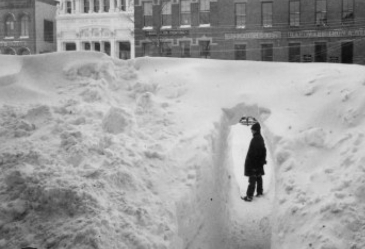
The valley got crushed in 1888. Below is a picture from Northampton.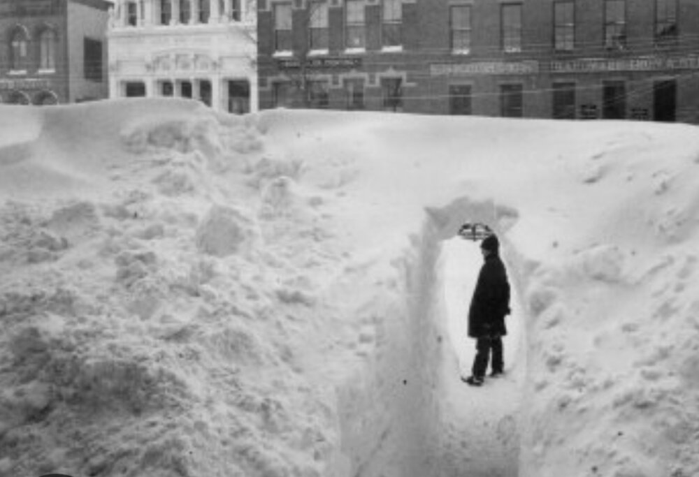
-

-
Measured and cleared twice, a bit over 5” but settled to about 4.5” now. Still light snow falling here 32°.
-
I have no idea what the totals are in the hills but closing on 5" at my location says this was more of a lat / long event than an elevation event. Up and in benefited from the low and mid-level cold from not being scoured out. One of the better early season events in recent memory for Franklin Co.
-
I was a bit skeptical and conservative but even at my modest elevation, it's a legit early December "snow storm". Certainly a school delay tomorrow if not full cancel.
-
4.5" at 1:15am Greenfield MA.
-
Franklin Co has been getting it pretty good. 4.25" with moderate snow. 31/30.