HIPPYVALLEY
-
Posts
32,949 -
Joined
-
Last visited
Content Type
Profiles
Blogs
Forums
American Weather
Media Demo
Store
Gallery
Everything posted by HIPPYVALLEY
-

1/21-1/22 Winter Storm OBS Thread
HIPPYVALLEY replied to metalicwx367's topic in Southeastern States
My brother took this photo this morning in Hilton Head. That is a lot of sleet!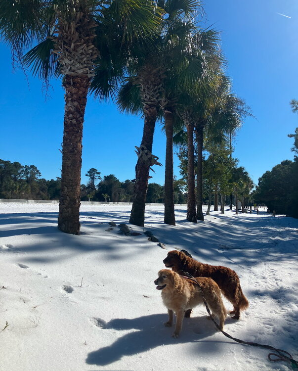
-
they hit those temperatures with record snow on the ground! Just incredible.
-
It’s just depressing to have warm and wet in the winter.
-
Cold and dry. Despite the heating bills, I like winter to feel like winter thanks.
-
The friends and relatives I have in the deep south have said it’s incredible that there has been snow on the ground all day and now a night in the 20s.
-
1/21-1/22 Winter Storm OBS Thread
HIPPYVALLEY replied to metalicwx367's topic in Southeastern States
My brother said over an inch of sleet in Hilton Head. -
Interesting cold air distribution when you and I are at the same temperature for a low in January.
-
Before we left for school, I let the boy pour a cup of water on the hood of the car to watch it slow motion freeze.
-
-12° Fake cold?
-
1/21-1/22 Winter Storm OBS Thread
HIPPYVALLEY replied to metalicwx367's topic in Southeastern States
Amazing.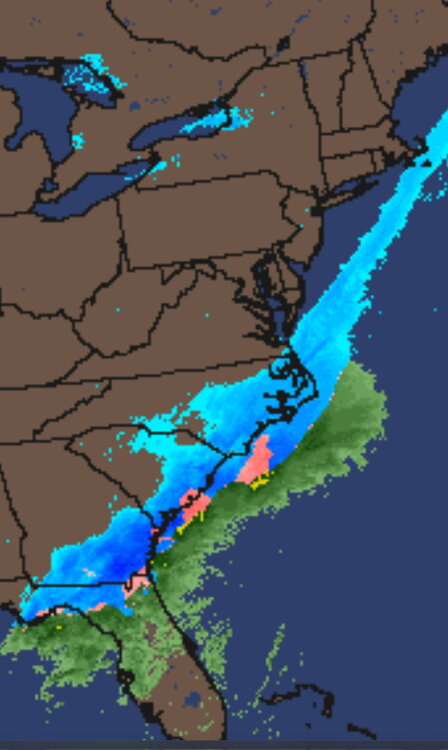
-
1/21-1/22 Winter Storm OBS Thread
HIPPYVALLEY replied to metalicwx367's topic in Southeastern States
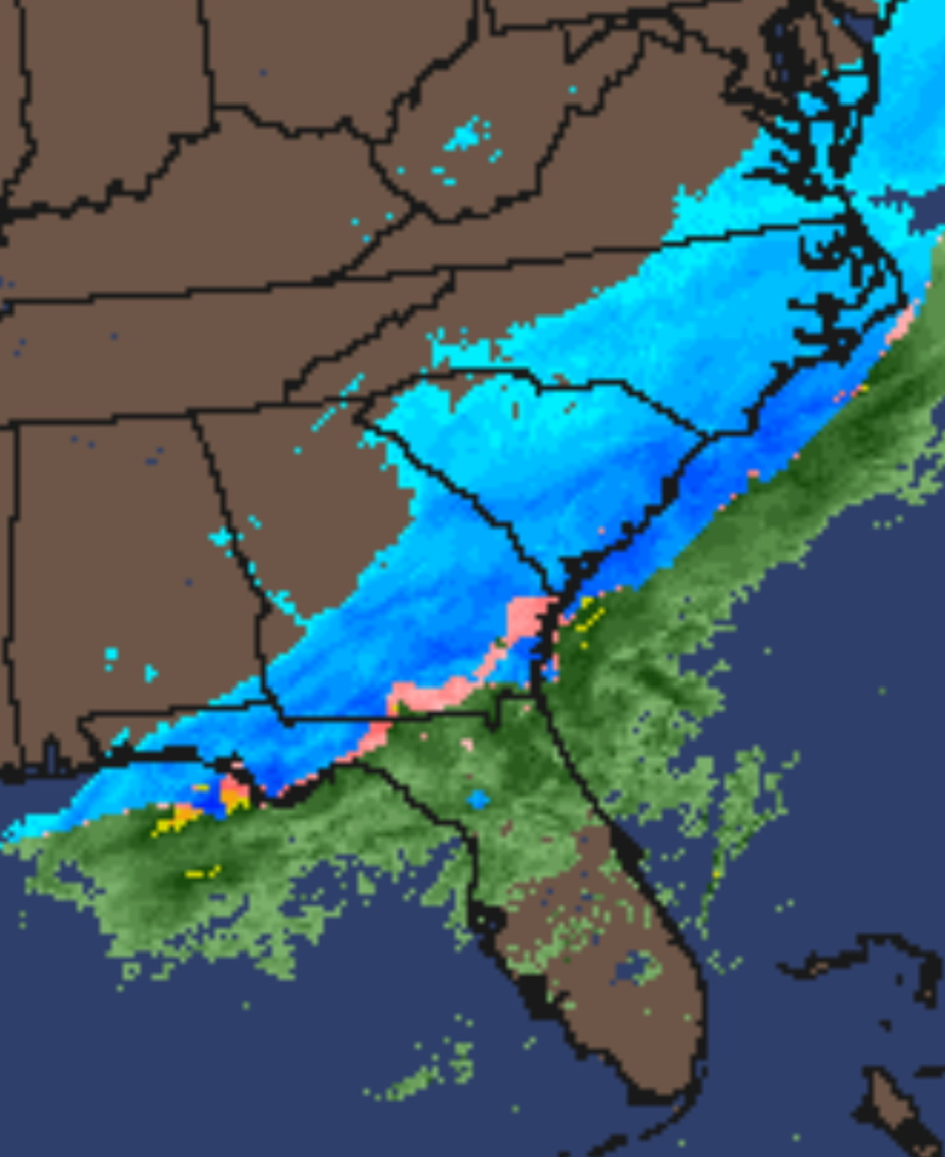
That Savannah to Hilton head area looks like it is getting smoked. i’m hoping my brother sends me pics from Hilton Head in the morning. When he went to bed at 10am, there was a coating, but it was a mix of rain, snow and sleet. -
My low this morning was -7° i’m kind of hoping for double digits below zero if we fully clear Sky and decouple.
-
Close to a foot in the northern sections of New Orleans. The pictures and videos from the south are insane.
-
I’m now down to -6/-8. Hoping we decouple and drop a few more degrees. I told my son we could do the boiling pot of water in the air tomorrow morning if it’s below -8°.
-
I mean, looking at the long range ensembles, New England does look primed for mostly below normal, bounce to slightly above normal, back to below normal temperatures.. Perhaps an average temperature winter, which we have grown unaccustomed to. Just need to get some more volatility in the flow to take advantage of the cold air.
-
Wow

-
-2°/-6°. Partly cloudy.
-
I was just thinking, in a lot of places down south, that’s not all melting tomorrow. Then those same areas with snow on the ground drop into the 20s tomorrow night. I wonder how long it takes for the novelty to wear off? That’s some weather phenomena that many long term residents down there have not dealt with.
-
Crushed! Major once in a lifetime weather event for those folks and pretty exciting for us weenies watching. The pictures of inches of snow right to the beaches is so cool.
-
My brother said snow has begun in Hilton Head. i’ll ask him to send me some pictures.
-
Jay Peak at 200” season to date, Wildcat at 42”! Absolute porkage east of the Presedentials. Hopefully turn that around, thank God for snow making.
-
I think it’s amazing. I wish they were more pictures and reports coming in.
-
You think maybe we get some red flag warnings in February?
-
It must be absolute paralysis down there.
-
Currently -6°.