

HIPPYVALLEY
-
Posts
32,949 -
Joined
-
Last visited
Content Type
Profiles
Blogs
Forums
American Weather
Media Demo
Store
Gallery
Everything posted by HIPPYVALLEY
-
 That forecast was overdone and destined to fail. I’m not sure what they were seeing to go with those totals on their maps?
 -
I think there are some 8 inch totals in the high elevations west of me. Scooter called that earlier today with a signal for good fronto indicated for the Berkshires.
-
Anyway, fun couple of hours and glad to have snow on the ground again!
-
Yeah, that’s what I experienced here the past hour or so. It’s one of the reasons I like SWFE here over coastal storms. At my mere few hundred feet of elevation. The winds aloft in coastal storms leave me often swimming in a sea of shattered dendrites, while somebody 5 miles west of me 500’ higher doubles my snow totals due to better snow growth.
-
Wow, this is winding down fast in the western zones. Looks like I’ll end around 4.5”. It won’t beat the December storm here but still a nice treat in a stingy winter. It’s going to feel very wintry this week! I was lucky to get into that good banding earlier tonight, otherwise probably would’ve ended with 2 or 3 inches.
-
A little bit over 4” but it’s basically just flurries right now.
-
It’s very banded, comes in waves.
-
How is snow growth there? Baking powder here right now.
-
Hi Bob! Missed you.
-
Winds must be cranking aloft because +SN here now but it’s baking powder. The dendrites must be getting shattered 1000’ above my noggin.
-
Reader seems to have filled a bit down into New Jersey. we should have a few hours of decent snow.
-
Had about 20 minutes of Arctic fog snow here but about to get back into the goods per radar.
-
Wow, that must be very heavy snow.
-
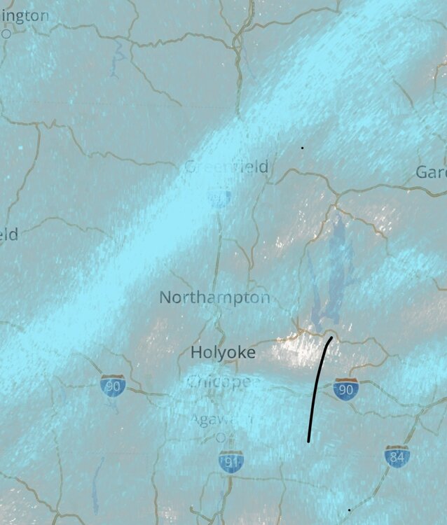
It’s a narrow band that stretches for me to you. I’m not sure I’ve ever seen an orientation like that which was so narrow. What causes that from a meteorological perspective?
-
It’s an oddly really narrow band. Kind of unusual.
-
Jeezuz, already 2”.
-
Greenfield is right in this narrow band that’s running Southwest and Northeast. getting crushed now. +SN 29F
-
Yeah, SN/SN+ now with close to an inch on the picnic table.
-
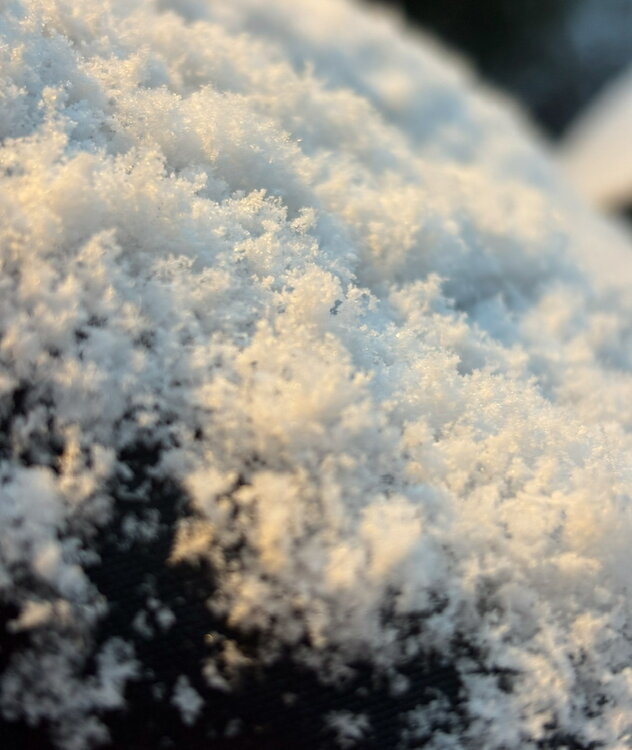
It may not last but beautiful snow growth right now, dendrites just stacking. Not used to seeing that in the valley.
-
It’s here, moderate snow, and wind picking up.
-
Snow rates getting close to moderate here now. We have some decent bands moving up towards us!
-
It’s been about 20 minutes of steady snow now. Heavy coating. Good snow growth, hope that lasts. 31.5° -SN
-
Yeah, I don’t really like seeing that “broken slate gray” look but it’s early still. Couple of flakes spitting here in Greenfield.
-
Ineedsleep will provide the screenshots every 5 minutes.


