HIPPYVALLEY
-
Posts
32,949 -
Joined
-
Last visited
Content Type
Profiles
Blogs
Forums
American Weather
Media Demo
Store
Gallery
Everything posted by HIPPYVALLEY
-
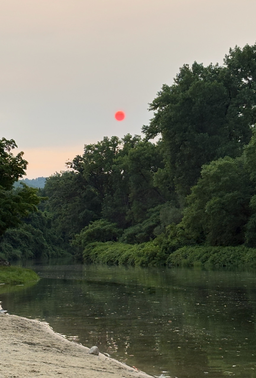
 This isn’t the smoke I prefer to bathe myself in.
 -
The sun is now completely obscured in the valley. I can taste the smoke in the air and the motion detector nightlight outside the brewery flicked on because it’s so dark right now. Killing a heat wave with smoke was not on my bingo card.
-
Greenfield actually got about .10” between the morning shower and the heavier afternoon shower. Very fortunate, good for the gardens and trees.
-
I believe that years ago, I read that a Carrington event would lead to the death of over half the populations of major cities within 6 weeks.
-
You have a better chance for a major ice storm than a major hurricane in SNE.
-
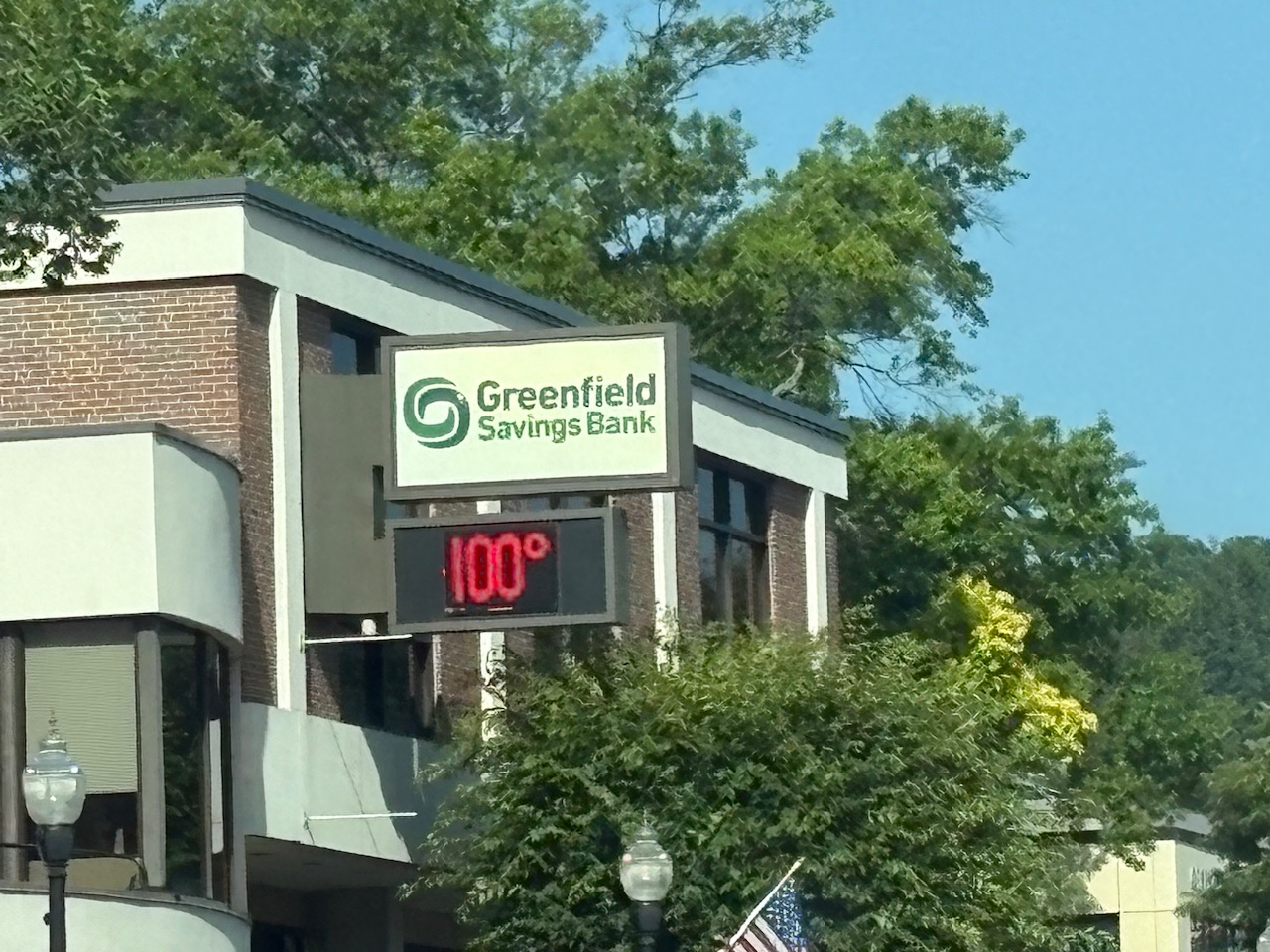
What a top 10 summer day today was!
-
It will be a classic “strong Nino” winter though.
-
Got back from Falmouth last night and I mowed well into the evening. Thinking I may not have to again for a few weeks.
-
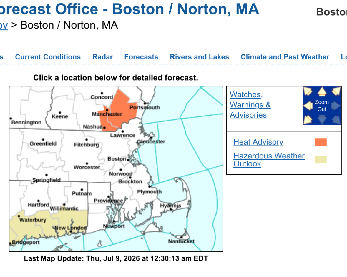
I’m not sure I’ve ever seen a heat advisory this small and specific.

-
Greenfield had under .50" yesterday so not awesome but at least it was something for the fruit trees. We dry moving forward. Good for mosquito control I suppose.
-
Looks warm and boring for the foreseeable future.
-
I like the deck chair that slides back and forth like something out of Poltergeist.
-
Hoisting the Sultan Signal: Heavy Rain Event July 5-7
HIPPYVALLEY replied to WxWatcher007's topic in New England
Falmouth is officially over 5 inches. -
There’s a new climate site for some of the pseudo-scientists on here to disagree with. “Built by former members of the team behind the National Oceanic and Atmospheric Administration's popular Climate.gov website, Climate.us will keep climate information accurate, accessible, scientifically rigorous, and useful for the people who rely on it, including educators, students, journalists, scientists, community leaders, local and state decision-makers, and members of the public.“ https://www.climate.us
-
Hoisting the Sultan Signal: Heavy Rain Event July 5-7
HIPPYVALLEY replied to WxWatcher007's topic in New England
What a dumping in Falmouth! No rain gauge but the tumbler I left out has about 4” of water in it. Lots of flooded roads. -
Hoisting the Sultan Signal: Heavy Rain Event July 5-7
HIPPYVALLEY replied to WxWatcher007's topic in New England
Franklin Co needs rain. -
Well, Greenfield could get shut out entirely, so that’s definitely gonna do nothing for the drought.
-
Last night, the wealthy folks with houses on New Silver Beach had themselves a fire a fireworks competition. The lingering smoke inversion must’ve lasted 30 minutes. I was telling my wife, between the three families setting them off, they must’ve spent a combine $20,000 on fireworks.
-
Steady light to moderate rain in Falmouth the past half hour. Can definitely use it down here.
-
Can always adjust up if necessary!
-
Yes, just got down to new Silver Beach (North Falmouth)about an hour ago. It’s 82° in the yard at their house! Natural air conditioning of the West wind coming across Buzzards Bay. At 4 PM there was zero traffic coming over the Bourne Bridge! I’ve never seen it that light!
-
West wind is great news for those of us who will be on the other side of Buzzards Bay.
-
Sitting outdoors I hope.
-
Cookin’