HIPPYVALLEY
-
Posts
32,949 -
Joined
-
Last visited
Content Type
Profiles
Blogs
Forums
American Weather
Media Demo
Store
Gallery
Everything posted by HIPPYVALLEY
-
Misquamicut.
-
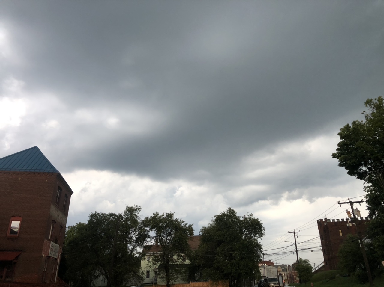
Driving the boy to camp we saw a lot of damage on the north east side of Greenfield. Big branches and big trees down.
-
I would be happy if it wasn’t a direct hit here again.
-
1.2” here.
-
West of the Rivet is generally best for severe in SNE. Can’t wait to see the local damage reports in the morning.
-
Counting Crows show?
-
-
Best severe I’ve seen in years. As you know I’m a little gun shy because I’ve had a few bad incidents but it’s still thrilling when you’re in it and somewhat safe.
-
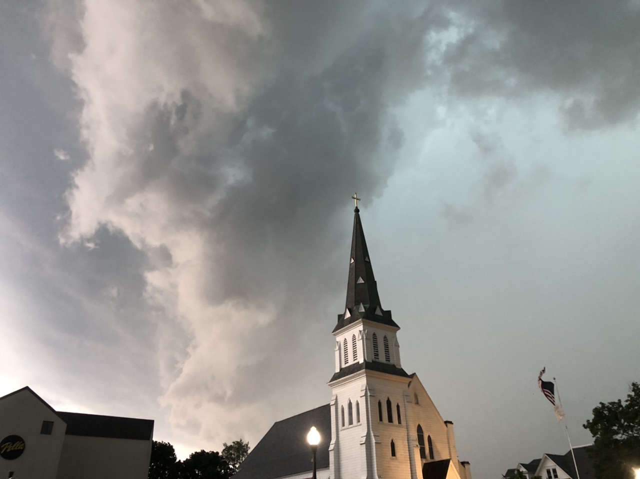
I took this about three minutes before I snapped that church photo I posted earlier.

-
I thought the best goods were going to be north but then that line coming out of the Berkshires exploded.
-
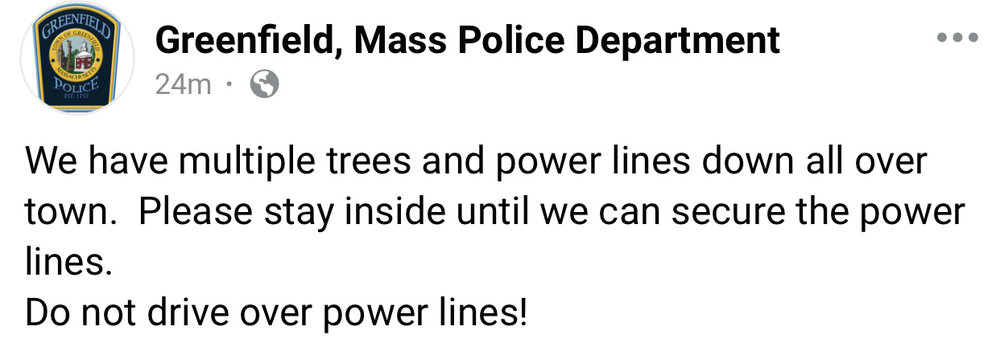
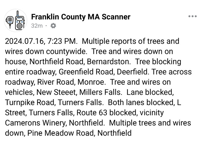
Live scanner reporting trees down everywhere. On my way home earlier, there was a branch down less than 20 feet from the tree fall that almost killed me a few years back. That spot has bad juju.
-
-
It was sacary getting caught out in it driving but that was awesome!

-
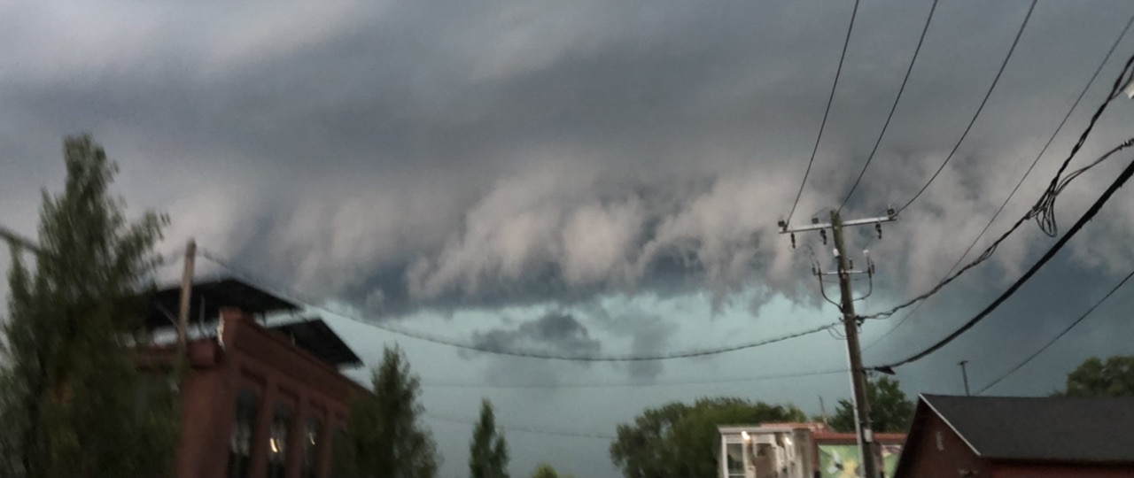
Insanity! Lots of cloud to ground branches down everywhere. I had to pull into a parking lot on the way home to let the bulk of it pass.
-
I think the one that just hit was the appetizer, Dinner should be served shortly.
-

-
Torrential rain though.
-
That little Cell that is almost right on top of Greenfield looked potent but it’s kind of meh so far.
-
It’s probably going to get broken up a bit in the big hills west of here so I’m not expecting severe in Greenfield.
-
92° in downtown Northampton right now.
-
Because Vermont could sure use more damaging weather.
-
It's weird because we usually have plenty of deer flies but I've hardly seen any this year and almost no mosquitos in Greenfield but friends say tons of them down towards Northhampton and Easthampton.
-
5 minute shower here, I always love it when you can see sun and blue sky but it’s raining.
-
Sun finally came out here. 89/73 How much does the lack of rain in certain areas affect localized dewpoints? When a humid air mass blankets the area will places that have seen rain in the past few days end up with higher DP’s or is it negligible and mostly based on the air mass in place?
-
Wow! Hotter tomorrow?