michaelmantis
-
Posts
283 -
Joined
-
Last visited
Content Type
Profiles
Blogs
Forums
American Weather
Media Demo
Store
Gallery
Everything posted by michaelmantis
-
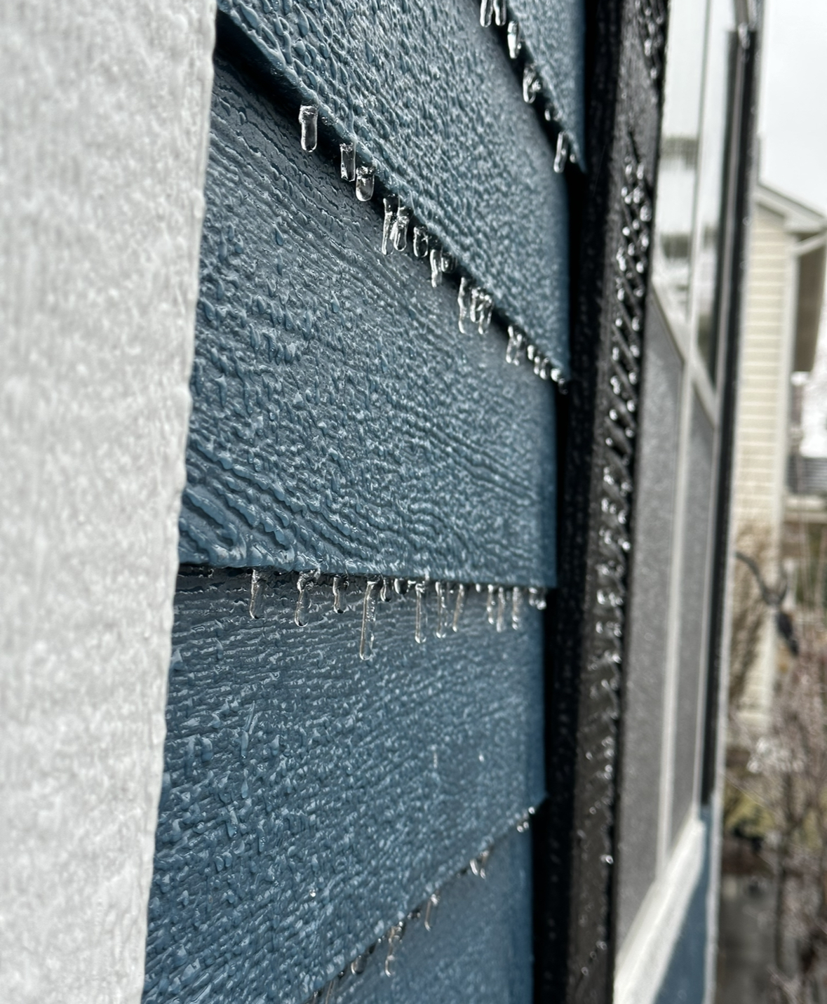
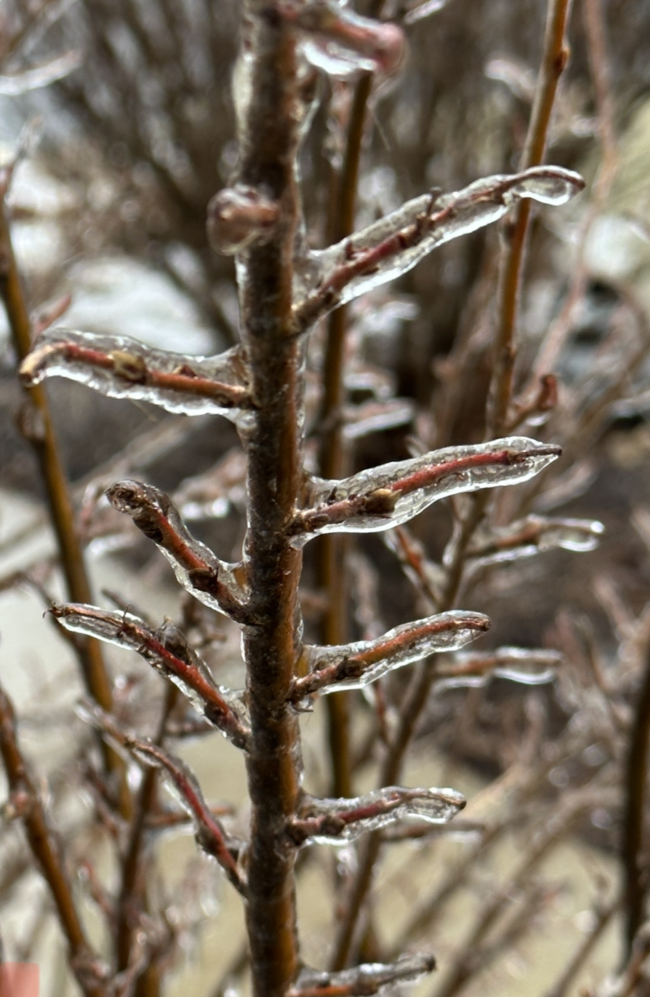
I have a Birch tree covered with ice that if we get a few gusts or sustained winds I'm afraid it may fall. Leaning a good deal. About to head out and the roads themselves look ok. River of water through the backyard from the run off.
-
31.6 for me for last 3 hours. Rain coming down pretty nicely now.
-
The temp where I'm at in N IL is overing between 31/32. It's rain now, icing up on some areas. One of those situations where a degree down would make a huge (bad) difference. We look to be at the low for the day (31/32) and fingers crossed it doesn't drop a degree or two. It would get bad very fast. Edited 2:55 - Power flickering; I can count on two hands the times in 15 years I've lost power here.
-

-
Seems like more rain now but definitely a good deal of ice.

-
Just was out for a quick drive and roads are fine but grass and trees have a coating of ice that quickly started within the last hour. Temp 31 degrees (dropped a few the last hour).
-
Normally I'm all for the thread-the-needle being on the edge of precip, but I'm not liking being uncomfortably close to all the ice that is being predicted. Ricky made me feel better a few days ago with the oversampling of snow/cold in N IL but this is just a little too close.
-
Anticipating a nice cold rain, but what's the source of that purple blob in far NE IL?
-
Thoughts on that band over the river making it our way?
-
Roads are a sloppy mess and looks like a thump of snow is crossing the Mississippi River that should be in the Chicago area in a few hours. Throw a few inches of quick snow on top of this and freezing temps and it's not going to be fun. But then again it will be all melted this weekend anyway! Bring on summer!
-
Heavy pingers and sounds like someone throwing sand at the window. I'm 5ish miles from the snow line. My bet is there's a good hour or two of SN+ at the end of this right during the afternoon rush! ;-)
-
Huge cotton balls fell for around 30 minutes and now just a nice decent snowfall but smaller flakes. I'm right on the edge of the WSW that was just issued and this one is looking like a 4 incher for me. Someone may get lucky if a band sets up over an area and I'm sure there will be a few circles of 8ish somewhere that gets lucky.
-
You never hear about I-90 being the focus area of a storm it seems like. Always I-80/88 ;-) Very much liking my spot 5 miles south of I-90. I posted a few weeks back, all I want is some good sledding snow.
-
-
Thanks for the summary. I was wondering where all the model reviews I've come to love to read were at with this system. Still liking my spot in the first two tiers of counties in N IL. I just have to chuckle that there was over a week pregame to the Christmas non-event with hundreds of posts and now just two pages of posts thus far on this event that looks to hit in 48 hours. Everyone jaded/burned waiting for summer? ;-) @A-L-E-Ktossing up the Wammy gives me hope this may be a real one for our area.
-
Pre-Christmas (Dec 21-23rd) Winter Storm Part 2
michaelmantis replied to Chicago Storm's topic in Lakes/Ohio Valley
Now that is a nice temp drop from 30 degrees at 10 am to 5 degrees now (my backyard).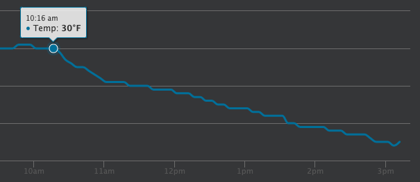
-
Pre-Christmas (Dec 21-23rd) Winter Storm Part 2
michaelmantis replied to Chicago Storm's topic in Lakes/Ohio Valley
Can someone share the background again on why the NWS reduced the types of Winter "advisories" a few years back? (Getting rid of Winter Weather Advisories, etc). I'm out in an area along what is really the end of a populated area in N IL and we have an inch at most on the ground right now. However, drive 3 miles west of me to the open fields and it is not a place anyone should be driving or out right now. Forget about the "hype of a big storm" and "how could most of the models been so off" but really isn't the issue that the NWS doesn't have a way to effectively communicate the hazards of a winter storm? I get you don't want 100 types of advisories, but a clearly worded "we are only getting 2 inches of snow but driving will be impossible in some areas" type message would be better than a "Winter Storm Warning" where someone not as crazy as all of us (who have followed this thing for a week and every model run) looks outside and thinks "this isn't a storm" and puts themself at risk? -
Pre-Christmas (Dec 21-23rd) Winter Storm Part 2
michaelmantis replied to Chicago Storm's topic in Lakes/Ohio Valley
Transition from Pixie Dust to some mood flakes in Elgin IL. Just looked at the temp drop between where I'm at and about 50 miles west, no surprise some wind is coming our way... -
Pre-Christmas (Dec 21-23rd) Winter Storm Part 2
michaelmantis replied to Chicago Storm's topic in Lakes/Ohio Valley
I get the bad timing and why they NWS office hit the warnings a bit earlier than I think anyone here expected, just wonder what this map would look like, same storm, January 12th or something. If the winds do materialize, even where I'm at (2-4 forecasted) Thursday night will be no time to be on the road. -
Pre-Christmas (Dec 21-23rd) Winter Storm
michaelmantis replied to Chicago Storm's topic in Lakes/Ohio Valley
I really do like the NWS "Probabilistic Forecast" charts they started publishing which show a "Low", "Expected", and "High" range and are updated every few hours with new model runs. The options seem to set expectations well based on an over/under performance of model data at any snapshot in time. Based on the maps at 9 AM on 12/20, my area can be expected to get 3 inches (low), 6 (expected), or 10 (high). The LOT forecast discussion (which I wish more of the TV mets would refer to!) basically says something I posted last night that it doesn't matter if it is 3 inches or 10 inches, 50 MPH winds are going to cause huge issues. https://www.weather.gov/lot/winter -
Pre-Christmas (Dec 21-23rd) Winter Storm
michaelmantis replied to Chicago Storm's topic in Lakes/Ohio Valley
So for my family who is in total panic about Christmas travel being a nightmare, (and looking to me as the family weather nerd) how much does this mean impact wise in N IL? -
Pre-Christmas (Dec 21-23rd) Winter Storm
michaelmantis replied to Chicago Storm's topic in Lakes/Ohio Valley
Without the wind potential my assumption is the NWS offices would hit this less hard and would have waited. The whole general thought (my words not Issi's) that "3 inches ve 9 inches doesn't matter with 55 mile per hour winds" really seems why they are sending the messages they are. So now my expectations should be anywhere from 2-12 inches of snow with wind for 36 hours?!?! ;-) -
I'm usually here for the Midwest winter storms, but heading down to Miami Thursday so funny that I'm tracking a tropical storm that actually will impact me! Just saw that Trop Storm warnings up for Miami, that eastward movement had me worried a few days ago. I'll be down there from Thursday through Sunday and wondering if this thing is going to slow down more. Was hoping for somewhat of a nice day on Saturday.
-
Damn, there are times these AFD's are just awesome. I share them with friends/family and they just don't get them. This one was almost as good as Ricky's.
-
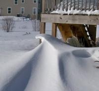
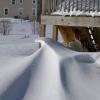
I just want a few inches to go sledding this weekend. A campout with my daughter with half melted piles of snow that have turned to ice doesn't sound like much fun.