michaelmantis
-
Posts
283 -
Joined
-
Last visited
About michaelmantis

Recent Profile Visitors


-
-
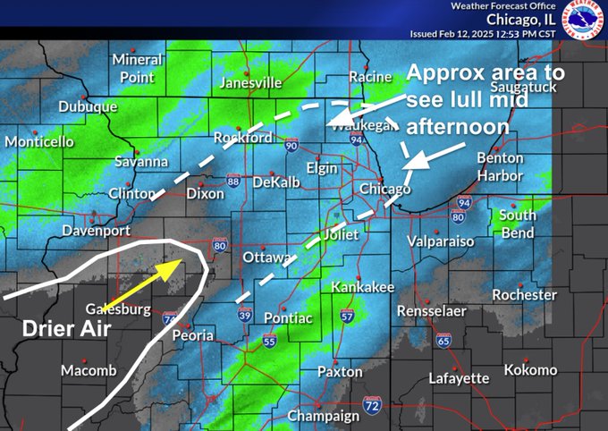
That line of storms in Northern Kane/Dekalb counties just tossed a few minutes of pea-sized hail near me. Wicked sound all around the house.
-
Feb 22nd/23rd "There's no way..." Storm Thread
michaelmantis replied to Maestrobjwa's topic in Mid Atlantic
What’s the start time for all of the heavy stuff? This more an evening/overnight thing? -
Feb 22nd/23rd "There's no way..." Storm Thread
michaelmantis replied to Maestrobjwa's topic in Mid Atlantic
Pulled the trigger and moved my flight to Chicago to 11 am Sunday from 8 pm. Looks like temps through early afternoon in the DC area look to be above freezing. Us Chicagoians saw all the hell you guys went through a few weeks ago and even we though “damn that’s crazy” :-) -
Feb 22nd/23rd "There's no way..." Storm Thread
michaelmantis replied to Maestrobjwa's topic in Mid Atlantic
Ha. Been the last few years (was beautiful). Just a quick weekend conference, DC in February was not my first choice! Whats the timing of this looking? May split the difference and try for an earlier morning flight. -
Feb 22nd/23rd "There's no way..." Storm Thread
michaelmantis replied to Maestrobjwa's topic in Mid Atlantic
Long time poster in the Ohio Valley / Midwest forum. Heading to DC this weekend for a conference with a flight scheduled back to Chicago for 3 PM on Sunday. Thoughts if I should move it earlier or try to get out late Saturday? Really seems like this is going to be a biggie for the DC area or nothing (crazy 48 hours out, it's like my Chicago storms when the Lake plays a factor!) -
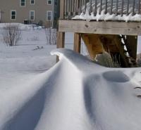
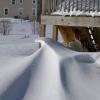
Even after the all evening rain, still looks to be 3-4 inches of snow all around on in my neck of the woods that is quickly becoming a glacier. Now just need a few inches to give it a nice look again. Sick looking out the window and the nice winter scene with what remains from a-hole people walking their dog shitting and peeing without cleaning it up.
-
I'm all good with a refresher snow once a week of 2-3 inches for the remainder of the winter. Pixie dust got a bit stronger in the last 15 minutes. Widespread 1-3 in N IL will hide some of the dirty snow and leaves.
-
Nov 28-30th Post Turkey Day Winter Storm
michaelmantis replied to Chicago Storm's topic in Lakes/Ohio Valley
I was just checking that out and the last few radar frames look decent. That could be the 1-2 inch topper to a great day. -
Nov 28-30th Post Turkey Day Winter Storm
michaelmantis replied to Chicago Storm's topic in Lakes/Ohio Valley
Looks to be a little hole of no precip a bit SW of Aurora (around 3 PMish) heading my way so I'm going to clean the driveway. Hope that fills in a bit. Few more inches would make this a great storm. -
Nov 28-30th Post Turkey Day Winter Storm
michaelmantis replied to Chicago Storm's topic in Lakes/Ohio Valley
We are just started and this surpasses anything I remember last Christmas. Another 1.5 inches (up to around 3ish depending on where I measure) for a total of 3.5ish. And this thing still has 6+ hours to it at least in N IL. -
Nov 28-30th Post Turkey Day Winter Storm
michaelmantis replied to Chicago Storm's topic in Lakes/Ohio Valley
2 inches on the ground as of 10 AM. Flake quality in last hour improved a ton. No huge flakes yet, but this new stuff is stacking nicely. -
Nov 28-30th Post Turkey Day Winter Storm
michaelmantis replied to Chicago Storm's topic in Lakes/Ohio Valley
For the first storm of the season, coming out of a bad 2024-2025, all the signs seem to be good for IA, S WI, and N IL. -
Nov 28-30th Post Turkey Day Winter Storm
michaelmantis replied to Chicago Storm's topic in Lakes/Ohio Valley
After last winters lack of snow in my part of Chicago (Far NW burbs), I'm not getting hopes up. Our last seasons best shot of snow went from 6-8 inches to a dusting within 9-12 hours between "jackpot model run" and "reality". Are patterns really changing that much or do we just have more "data points" (that don't need to be real data points they could be model hallucinations or just model gunk) that it *seems* like things are changing? -
And the towel is thrown in for most of NE IL. Amazed as the number of schools that canceled today. I'll believe the weekend storm when I see flakes. Was hoping to have a good week or two of storms and missed these threads!