David-LI
-
Posts
1,439 -
Joined
-
Last visited
Content Type
Profiles
Blogs
Forums
American Weather
Media Demo
Store
Gallery
Everything posted by David-LI
-

December 2020 General Discussions & Observations Thread
David-LI replied to bluewave's topic in New York City Metro
And gives us a shot at snow on Christmas day. -
December 2020 General Discussions & Observations Thread
David-LI replied to bluewave's topic in New York City Metro
Still far out, but both GFS and CMC very cold with a chance of snow around Xmas -
December 16-17, 2020 Storm Observations and Nowcast
David-LI replied to wdrag's topic in New York City Metro
Heavy snow and windy in north Nassau county. Really surprised with this backend snow.- 1,011 replies
-
- 1
-

-
- heavy snow
- sleet
- (and 4 more)
-
December 16-17, 2020 Storm Observations and Nowcast
David-LI replied to wdrag's topic in New York City Metro
Light snow started in North Nassau County -
December 16-17, 2020 Storm Observations and Nowcast
David-LI replied to wdrag's topic in New York City Metro
Anyone in CNJ confirm precipitation as shown in doppler radar? -
Sharing with you my favorite free Doppler radar for the area https://www.nbcnewyork.com/weather/
-
Really rooting for philly. They haven’t had decent snow in years
-
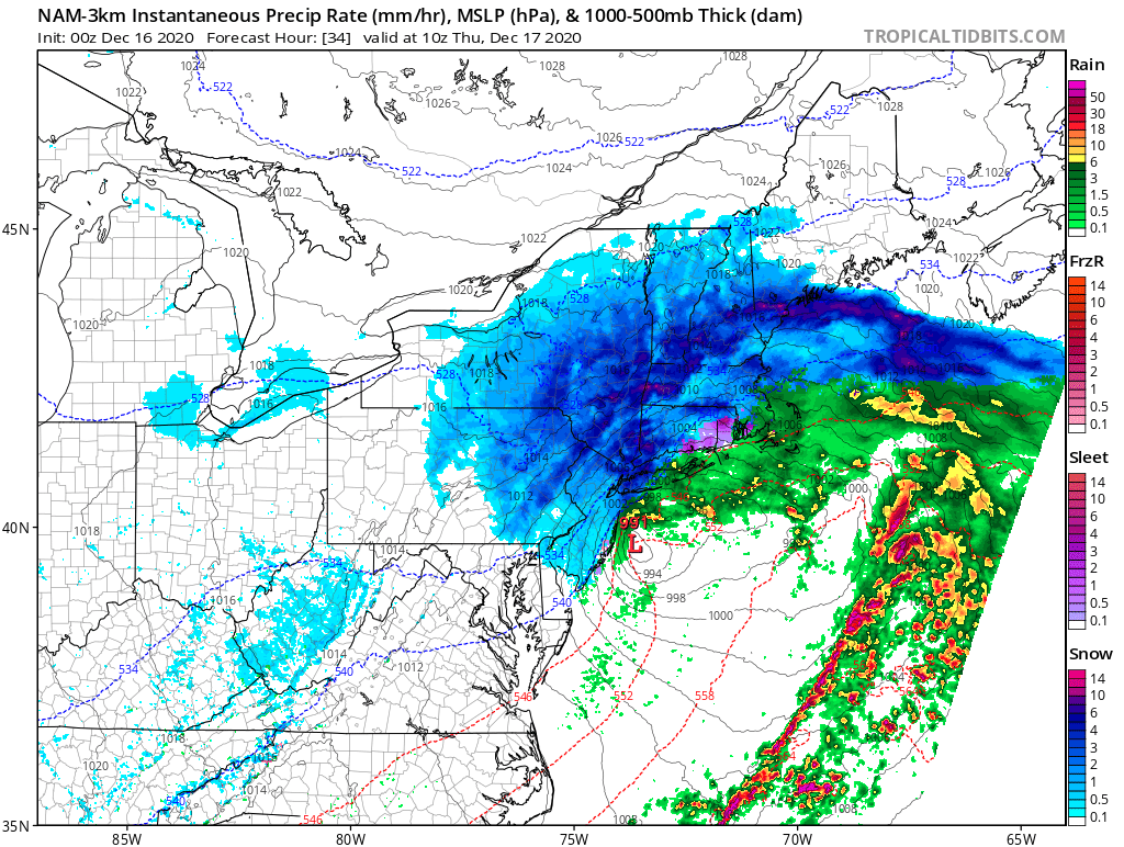
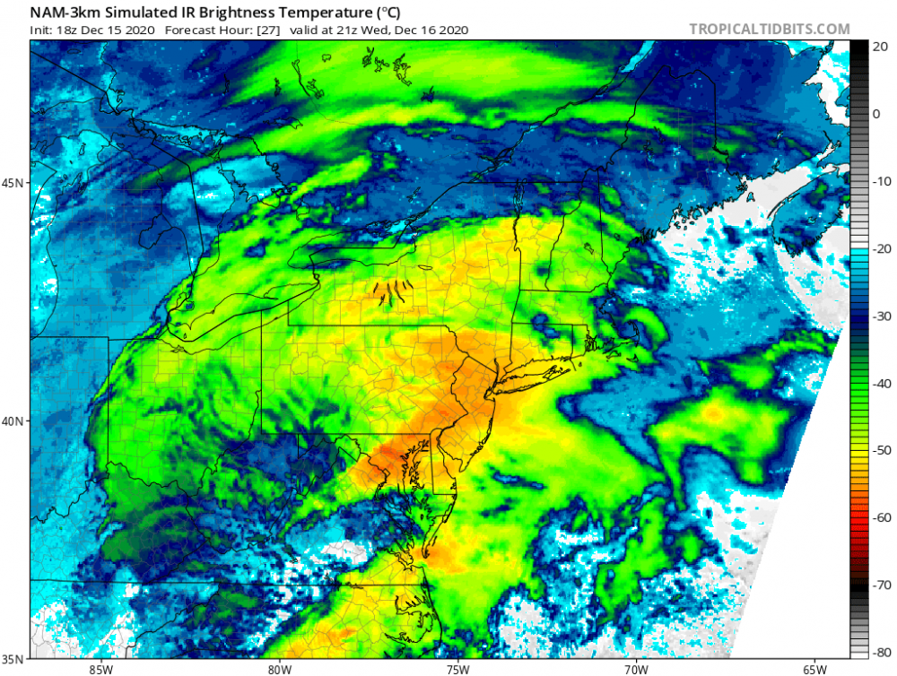
Nice banding on the 3k NAM as the storm pulls away

-
Alright now they're naming models after infectious diseases.
- 3,762 replies
-
- 1
-

-
- heavy snow
- heavy rain
- (and 3 more)
-
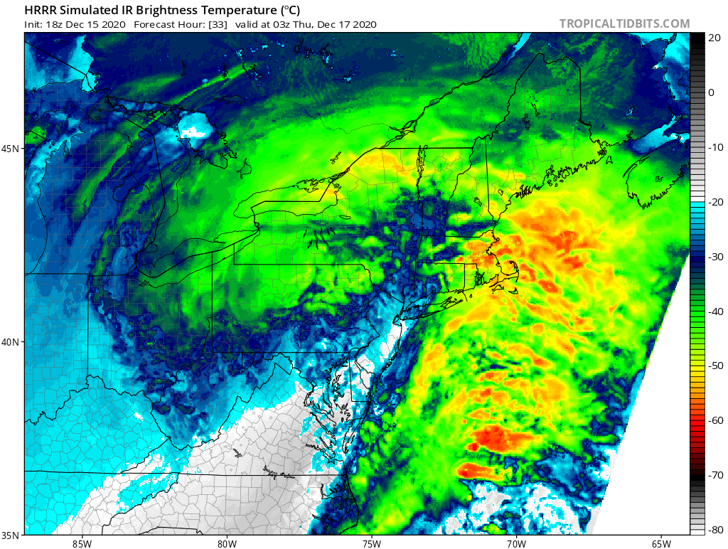
3k NAM simulated Infrared. Could this be right and we see precipitation by 4 pm tomorrow? Take it with a grain of salt
-
Like the low going sub 990?
-
Yes and then moves offshore right after, changing back to snow as it pulls away.
-
According to 18z NAM city should be seeing its first flakes at 6 pm tomorrow. Gonna be nice to watch the snow fall and accumulate with all the holiday decorations around.
-
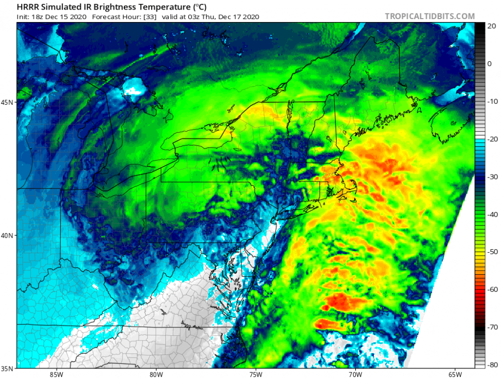
Really hoping the HRRR is out of its ideal range but it has us dry slotting and showing us the finger rather early
- 3,762 replies
-
- 3
-
-

-
- heavy snow
- heavy rain
- (and 3 more)
-
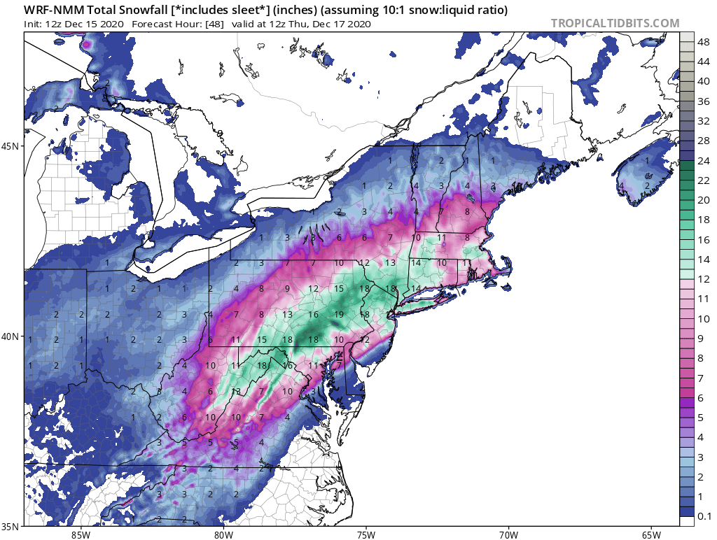
As someone mentioned, the 12z NMM is a cold and snowy run. Don't ask me if that model is reliable or not, maybe someone else can answer that. Here are the totals, for whatever is worth...

- 3,762 replies
-
- 2
-
-
- heavy snow
- heavy rain
- (and 3 more)
-
Isn't a "banana high" as depicted on the euro a textbook signal for a strong nor'easter? What's missing?
-
Definitely
-
Let the war between euro and NAM commence. Who will win in the end? We shall see. But my bet is on the NAM, unfortunately
- 3,762 replies
-
- 2
-
-

-
- heavy snow
- heavy rain
- (and 3 more)
-
That dry slot is literally giving us the finger
-
If the media hype was enough that I can get a day off from work , stay home enjoying a hot chocolate and building a snowman with the kids, then I’ll take my 2-4 inches if it comes to that.
- 3,762 replies
-
- 1
-

-
- heavy snow
- heavy rain
- (and 3 more)
-
I guess you never lived in the Bronx or Queens....
- 3,762 replies
-
- 2
-
-
-
- heavy snow
- heavy rain
- (and 3 more)
-
18z euro clown map anyone?