David-LI
-
Posts
1,439 -
Joined
-
Last visited
Content Type
Profiles
Blogs
Forums
American Weather
Media Demo
Store
Gallery
Everything posted by David-LI
-
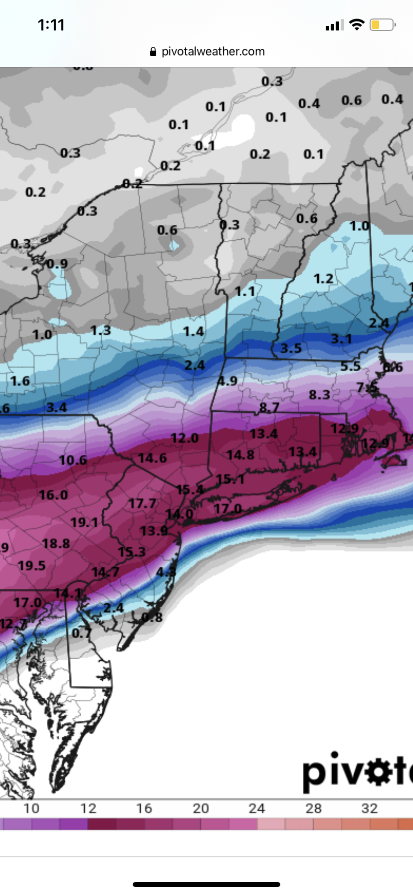
 Because it doesn't have a foot in your backyard throw the run out?
- 3,762 replies
-
- 3
-

-
- heavy snow
- heavy rain
- (and 3 more)
-
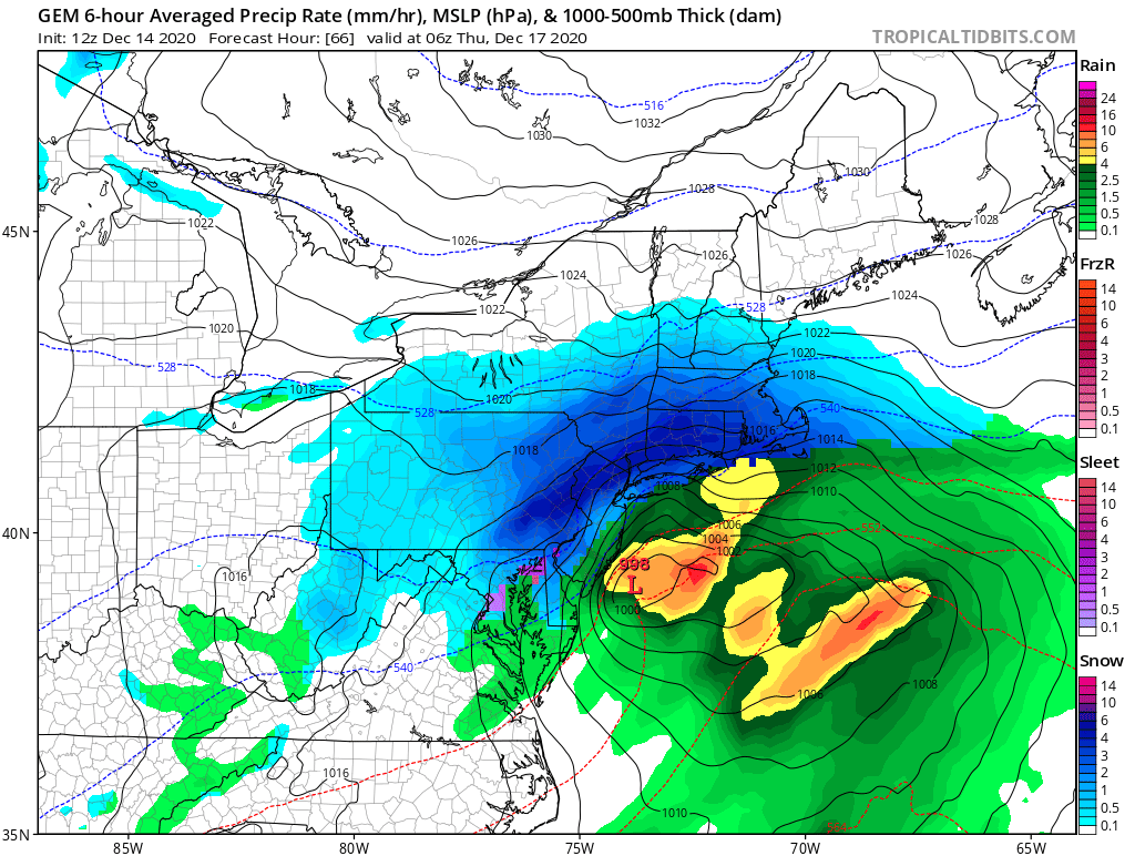
No mixing issues on the NAM unless you're in SNJ
-
Does anyone have the euro run but in 3 hour intervals instead of 6? Or even one hour intervals, not sure that product exists.
-
Low stalls east of ACY for about 6 hours as it weakens and moves away. Should be a great run for most on this sub
- 3,762 replies
-
- 2
-
-
- heavy snow
- heavy rain
- (and 3 more)
-
How’s the GEFS looking ?
-
Really? I don’t see winds meeting blizzard criteria.
-
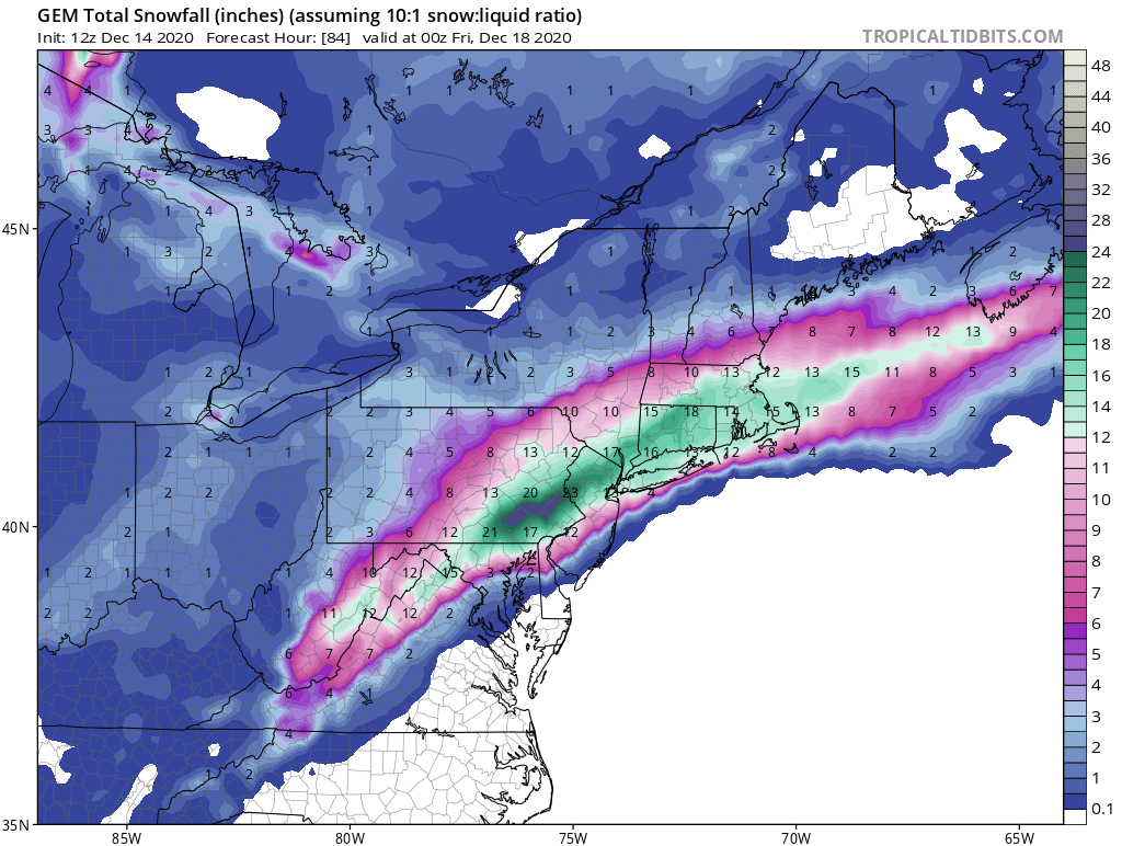
Last time this sub got a foot of snow? I don’t even remember
-
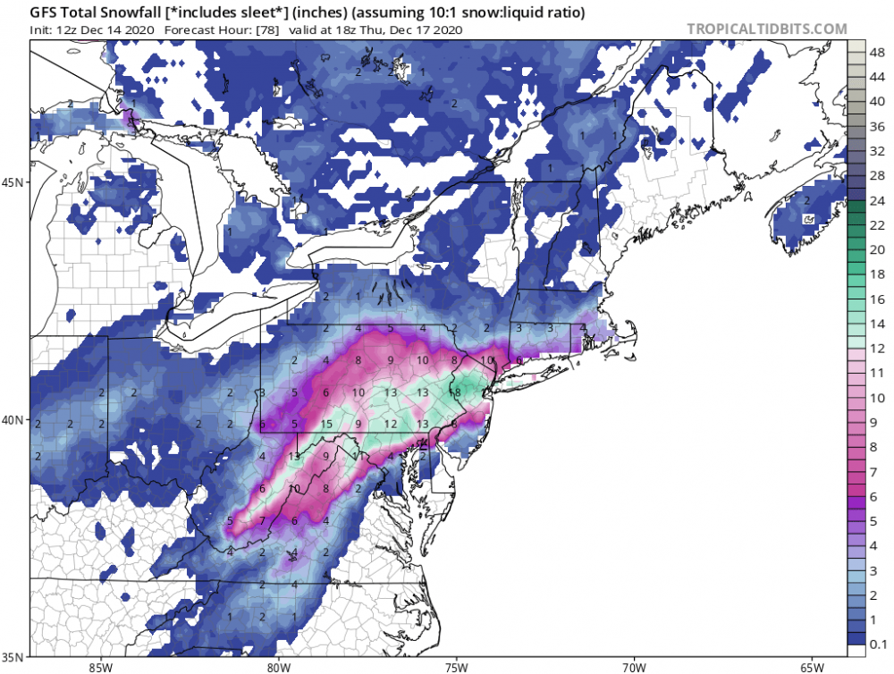
Anyone got a decent clown map for the GFS? Tidbits seems to be bugged.
-
Rain is always a concern if you live on the coast. GFS had no mixing issues though, plenty cold.
-
OK can a met explain to me why this low won’t blow up off ACY like any good nor’easter low and we get plenty of cold air in??
-
So it will come down to nowcasting an air mass then
-
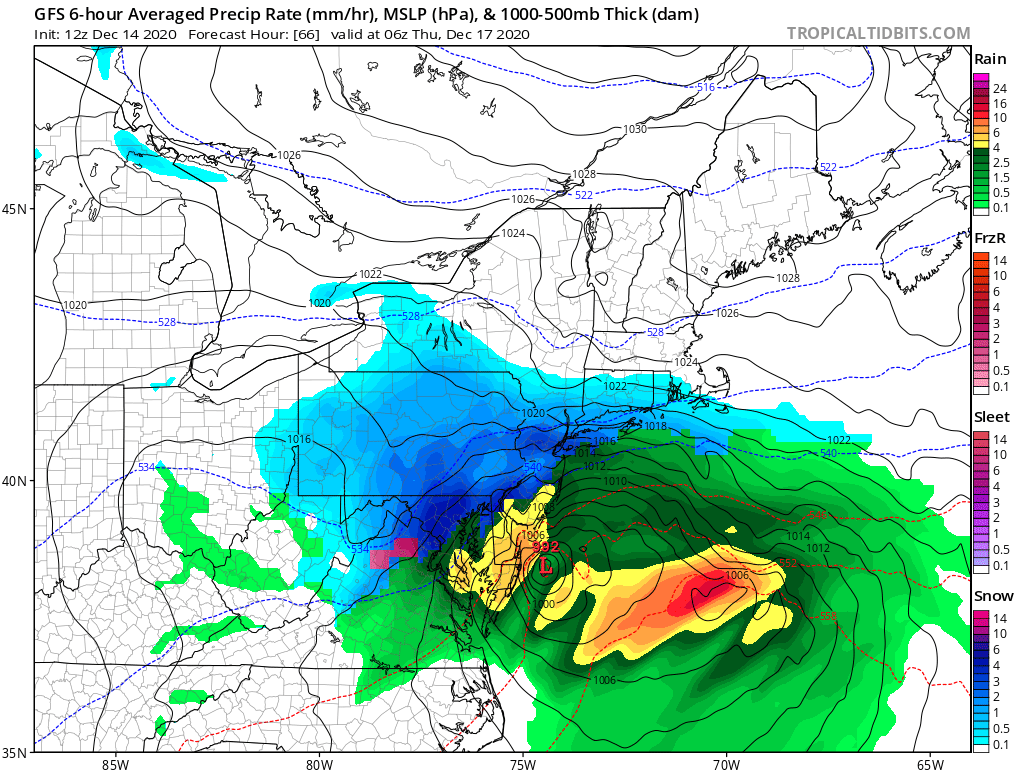
GFS being GFS
-
No way you have it that far
-
Low is almost in Mexico
-
NAM IS DIGGING! LETS GO!
-
I remember only about 48 hours from the “storm of the century” the euro had close to 30 inches IMBY, I got around 6 inches
-
Really? We never getting NAMed again?? That sucks
- 3,762 replies
-
- 2
-
-
- heavy snow
- heavy rain
- (and 3 more)