David-LI
-
Posts
1,439 -
Joined
-
Last visited
Content Type
Profiles
Blogs
Forums
American Weather
Media Demo
Store
Gallery
Everything posted by David-LI
-
 What does this mean? They’re upgrading it?
 -
I wish we could all agree that “it’s the NAM at long distance” is no longer a valid argument. It has been reliable long range before during storms.
-
nothing is impossible but very low chances
-
If we get enough snow looks like temperatures will remain cold enough for a white Xmas
-
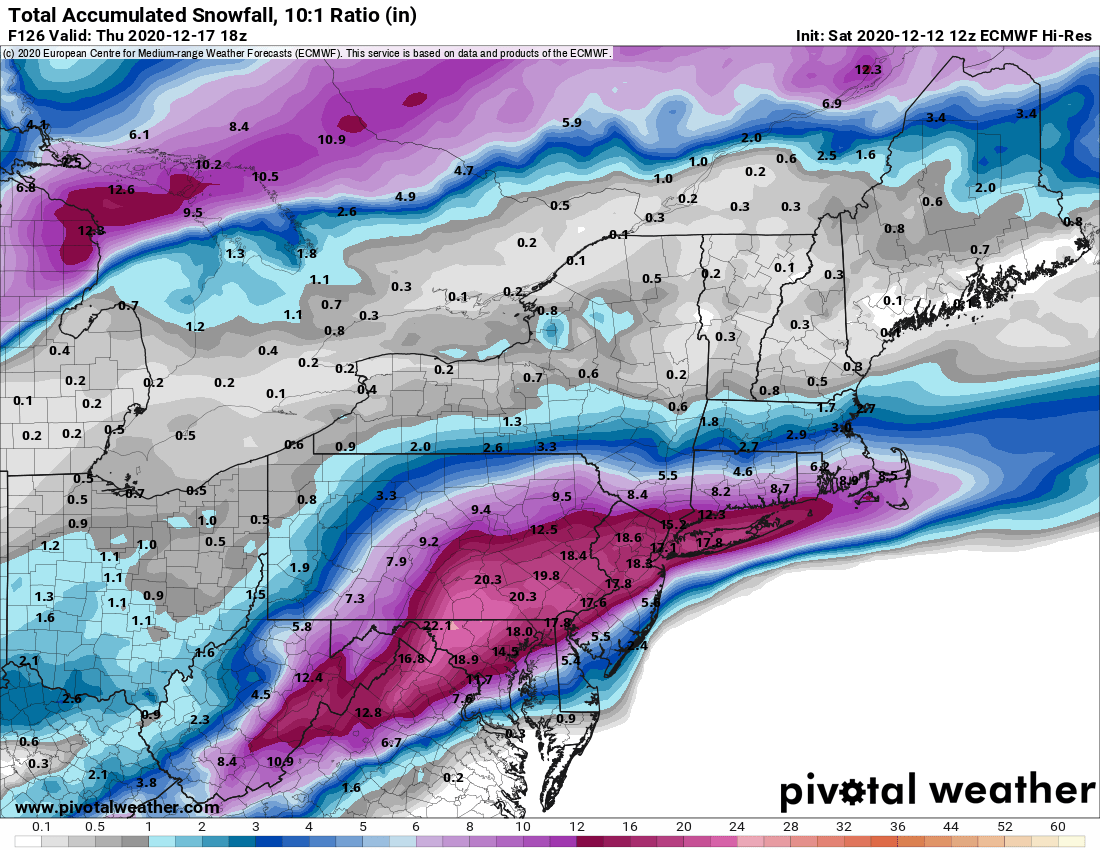
About a foot in the city Thursday morning for most in this sub on the euro, still a few hours to go
-
roll the drums, euro is running
-
What's this possible storm analog?
-
What storm setup in the past looks like this upcoming one?
-
Well deserved day off
-
Any word on 06z euro?
-
In the end I was hoping that secondary low would strengthen and hang on much longer. What happened there?
-
Welcome to the forums
-
euro looks good so far
-
There's always plenty of forecasting from mets, specially in the days closer to an event.
-
listen sir, you're respected in here but your rain forecast won't bring our hopes down. this is 2020, let us dream
-
You're right. Considering it's been a shitty year I'll hang on to hope for anything decent even if it's far out.
-
I know it's very early to even discuss a storm in my opinion, and we have people in the storm thread already asking for snow totals, but that euro run would probably be a lot of sleet for our area
-
December 2020 General Discussions & Observations Thread
David-LI replied to bluewave's topic in New York City Metro
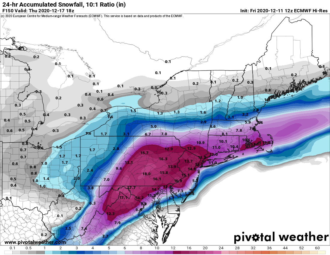
Nothing on the euro for the 17th -
December 2020 General Discussions & Observations Thread
David-LI replied to bluewave's topic in New York City Metro
Is this the best free live doppler radar in the area? I don't know, but every winter I post it here because it's really nice. Storm Tracker 4 -
December 2020 General Discussions & Observations Thread
David-LI replied to bluewave's topic in New York City Metro
I know so far things have been boring, but do we really need to be posting GFS maps 240 hours out? -
December 2020 General Discussions & Observations Thread
David-LI replied to bluewave's topic in New York City Metro
If it’s worth anything, 18z NAM is way different than 18z gfs at hr 80 for weekend storm. -
December 2020 General Discussions & Observations Thread
David-LI replied to bluewave's topic in New York City Metro
Are models showing a PV drop next week over the US? At least that's what it looks like on the canadian