

Typhoon Tip
-
Posts
42,028 -
Joined
-
Last visited
Content Type
Profiles
Blogs
Forums
American Weather
Media Demo
Store
Gallery
Posts posted by Typhoon Tip
-
-
I feel like the circulation that opened up and smeared into the gradient was probably on the verge of acquiring …E side llv jet with 65 DPs and a warm metallic feel to the air mass … this was an aborted attempt.
-
I doubt the Euro cluster works out
") ... Or, okay - it could if there are changes in the structure of the westerlies between the eastern Pacific and Ontario.
... Or, okay - it could if there are changes in the structure of the westerlies between the eastern Pacific and Ontario.
As is ... I don't believe we are drilling a -1.5 sigma 500 mb closed vortex SW from a starting position over Montreal and ending up over WV ...taking 5 days to do it.
-
I'd say by cursory evaluation the GEPs are spectacular, the GEFs are cautionary but not too bad. The EPS cancels plans
-
1 hour ago, CoastalWx said:
EPS has danger. So does GEFs.
We can always hope for the GGEM
-
Seems like some of the atmospheric pieces to the El Nino puzzle are falling into place before the ocean beneath.
STJ S of HA ... Nice b-leaf structure fanning over Texas originating from that feature as it runs up over old Mexico
-
 4
4
-
-
This is my highest DP of the season at 62 ... despite the quality of the weather, this is actually a seasonal step. heh
-
2
-
-
19 minutes ago, STILL N OF PIKE said:
Technically they love to call the games the night before , so what maybe “flooded” (some puddles of standing water) at 10pm Saturday...would be damp by 2pm Sunday
My generation ... ( as an approximation ) may be the last one that walked to school in 9" of snow and quarter mile visibility, or met up in a field for football with pouring rain on purpose...
I guess anything that is "organized" has to be overly monitored because the people the organization is providing are now useless human pustule litigates, lookin' to cash in. That's cynical humor ... But, Americana has at this point become a definitive generational cancel happy culture, so much so that we even "Cancel Culture" .. but that's something else.
It really does transcend the trope where the elder says, "...Why back when we were young..." it really is that way now, where that old guy is right. When events, schools ... et al get canceled before the snow or rain is falling, and then half the time ... we're looking out the window at a setting in which neither has occurred ... that gets a little resentful.
-
1
-
 1
1
-
-
15 minutes ago, STILL N OF PIKE said:
Gonna be pissed if Boston sports cancels my softball double header in Cambridge Sunday afternoon for wet field
They would do that? heh...candy asses ...
It's gonna be like 77 F with that kind of soothing amount of DP ( non-oppressive) lingering, and nice warm sun. Wet fields? wow ...unless you meant 'flooded field'
-
1
-
-
42 minutes ago, metagraphica said:
61 and steady rain now. Nice to get the pollen knocked down today. Wash the truck and car tomorrow.
I almost pulled the trigger when fillin' the tank last night, and use the station's free albeit grungy slime detergent they never rotate ... but then hoped in the moment that I'll just drive down the highway at 70 mph in a moderate rain and that'll clean the vehicle just fine.
-
2
-
 2
2
-
-
I’m not fully convinced… I see the euro as unchanged in the last 7 to 10 years and the other models just getting better.
Also been watching the Euro this spring and it has been decent. If it doesn’t do well in this particular event, I don’t think people are paying attention to when it is doing well. -
Not sure why others are a fighting the westward trend/versions?
is there something particularly at stake in having it rain or something?
I mean ... it rains the most of what rains ... at night. So who the f cares. You can't run humanity on a planet that doesn't rain, so consider yourselves lucky that by 10 am on Sunday it's already 70 with d-slope light tepid breezes under periwinkle blue skies ... with at that time, life nourishing water put back in the bank.
I don't get it... Is it maybe because people are seeking some sort of dystopian jerk off over a drought? You're not getting that anyway
-
1
-
-
8 minutes ago, powderfreak said:
Yeah agreed. Usually that stripe means a narrower area of heavy rain training totals, amid a more general widespread rain. I like your layout... say a narrow stripe of 2-3", among a more widespread 0.75-1.25" or something.
Either way, should be a nice widespread drink.
god I f'n hopes so...
I mean it won't stop the stein nimrodery but it's like a fetish to try - lol
-
1
-
-
13 minutes ago, powderfreak said:
Toss in the Hirpes too as a big shift westward.
Weird all the mesos like 3km NAM, HRRR, HRDPS, etc are so big way west. Must have identical algorithms or something.

The finer meshed model types have averaged on the western side of the envelope from what I've been seeing.
This also has some convective aspects to it - just scoping the region LI's they are down to -1..-2 range, so a lot of that probably is also "convective smear" - what's likely to really happen is a generalize .75" along a conduit that's ...say 30 to 40 mile's wide/core of a PWAT plume lifting up EC from subtropics NE of Florida, but within that axis ...a couple of training orange lightning producers with short duration rain rates stripe a 2.25. I don't see this event as being >3.0" over that large of an area though
-
2
-
-
12 hours ago, raindancewx said:
I don't think anyone is actually dumb enough to forecast seasonally just based on ENSO.
I have a seven factor method for seasonal stuff nationally. Then once the general idea is determined, I try to narrow it on the monthly patterns. But that's much harder.
The atmospheric river thing in La Nina is not really new though either. The Great Flood of 1862 in the West was not an El Nino as an example. These are not new patterns.
https://en.wikipedia.org/wiki/Great_Flood_of_1862
Any of this sound familiar?
The Great Flood of 1862 was the largest flood in the recorded history of California, Oregon, and Nevada, inundating the western United States and portions of British Columbia and Mexico. It was preceded by weeks of continuous rains and snows that began in Oregon in November 1861 and continued into January 1862. This was followed by a record amount of rain from January 9–12, and contributed to a flood that extended from the Columbia River southward in western Oregon, and through California to San Diego, and extended as far inland as Idaho in the Washington Territory, Nevada and Utah in the Utah Territory, and Arizona in the western New Mexico Territory. The event dumped an equivalent of 10 feet (3.0 m) of water in California, in the form of rain and snow, over a period of 43 days.[3][4] Immense snowfalls in the mountains of far western North America caused more flooding in Idaho, Arizona, New Mexico, as well as in Baja California and Sonora, Mexico the following spring and summer, as the snow melted.
...The weather pattern that caused this flood was not from an El Niño-type event, and from the existing Army and private weather records, it has been determined that the polar jet stream was to the north, as the Pacific Northwest experienced a mild rainy pattern for the first half of December 1861. In 2012, hydrologists and meteorologists concluded that the precipitation was likely caused by a series of atmospheric rivers that hit the Western United States along the entire West Coast, from Oregon to Southern California.[6]
An atmospheric river is a wind-borne, deep layer of water vapor with origins in the tropics, extending from the surface to high altitudes, often above 10,000 feet, and concentrated into a relatively narrow band, typically about 400 to 600 kilometres (250 to 370 mi) wide, usually running ahead of a frontal boundary, or merging into it.[7][8] With the right dynamics in place to provide lift, an atmospheric river can produce astonishing amounts of precipitation, especially if it stalls over an area for any length of time.
...The floods followed a 20-year-long drought.[9] During November, prior to the flooding, Oregon had steady but heavier-than-normal rainfall, with heavier snow in the mountains.[10]: 76–83 Researchers believe the jet stream had slipped south, accompanied by freezing conditions reported at Oregon stations by December 25. Heavy rainfall began falling in California as the longwave trough moved south over the state, remaining there until the end of January 1862, causing precipitation to fall everywhere in the state for nearly 40 days. Eventually, the trough moved even further south, causing snow to fall in the Central Valley and surrounding mountain ranges (15 feet of snow in the Sierra Nevada).[11][12]
I'm not sure of everyone's particular contribution in this social media, but for me this speculation was/is not a matter of "...forecast seasonally just based on ENSO"
-altho, there are many seasonal outlooks where the methodology conveyed does not signal the author did rely much upon anything else ... That's not uncommon either.
It's a matter of sciencing (asking the question) over the amounts of weighted contribution.
And also, agreed - there are no 1::1 correlations in atmospheric mode to mode relationships, nor in the events that take place over time during dominate modes of either that affect a region. Obviously river phenomenon can happen in La Nina. But when the entire manifold of different climate pathways, in general, in which ENSO is correlated begin demonstrating increased frequency of occurrences in which the correlations are less represented, that is a suggestion that the system is changing - that's just analytic/academic. That's what is paramount ( at least ) in my recent contribution to this thread.
-
1
-
-
This has been a remarkable spring for diurnal deltas ... I've clocked two that were more than 40 degrees, and several in the mid 30s. Today will also be impressive, with at least as much spread as the latter.
30 was the low ...but numerous home sites within a couple clicks of my location ranged down from that to 26. SO, figure if we get 68 out of today, that's fair enough across the Nashoba Valley for yet a 3rd d(t) spanning 40 degrees.
Three times amid so many 30+ is a kind of under-the-radar phenomenon in itself.
-
11 minutes ago, dendrite said:
Pretty cold airmass for the 2nd half of May.
Sometimesquite frequently to the extend of almost normal since about 8 years ago we can goa week inJanuary higher than this.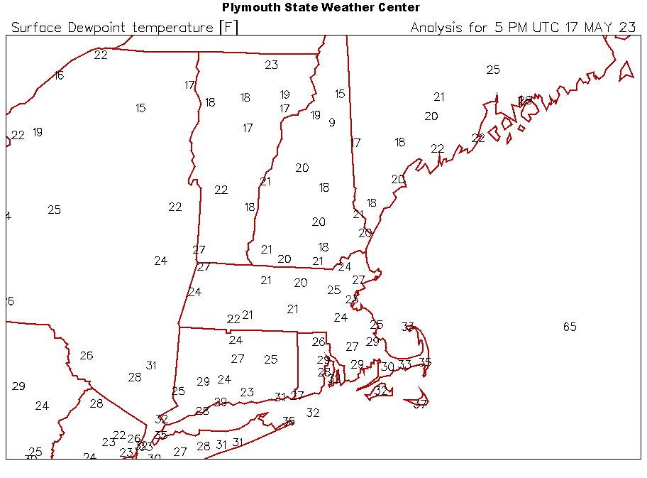
-
We're going to have to monitor the D6-10 range for a potential Sonoran/SW heat release
-
1
-
-
What a spectacular day on Sunday though
-
1
-
-
25 minutes ago, bluewave said:
ENSO has been competing with marine heatwaves in other regions. So the combination of multiple forcing areas yields new patterns. This is especially true with the El Niños due to the record WPAC warm pool imparting more of a MJO 4-6 La Niña influence. Just look at all the incorrect El Niño seasonal forecasts since 12-13. Several La Ninas over this period have featured Nino-like precipitation totals in California in years like 16-17 and 22-23. So we need to take a more comprehensive approach to seasonal forecasting. Pre-2010 analogs haven’t been working out in this newer climate era.
Bingo.
Also, Ray mentions this point and it is a good one. People likely already know ... but the NP-Lakes-NE mid latitude continent is hugely subjected to the peregrinations of the polar ward index/idiosyncrasies, which are at best ...vaguely correlated ( certainly not directly and if at all, lots of temporal lag) to ENSOs. The circuitry is perhaps through the QBO ... which almost immediately argues temporal lags ... what a rabbit hole.
CPC seasonal long lead outlooks issued Aug - Oct began mentioning this facet above, about the shaky reliance with the ENSO in these boreal latitudes described above... directly citing AO(NAO) some years ago - not sure if they still have that disclaimer recently, but it's always applicable.
It's like ENSO really seems to on shaky ground in general as the primary background assumption. So the 'more comprehensive' aspect you mentioned... yar, that's agreed -
-
1
-
-
Frankly, it would be nice to grab an inch and half of rain -
I'm not feeling particularly jaded for nice weather with a 62 to 82 temperature spectrum having been hammered by solar irradiance above climo for 10 days like this... We've been treated kindly since the April misery week and let's get real.
'Sides, every 1.5" we get ..... fails - anyway - to shut the collective pie-hole of that clear "OCD", pointless annoyance, but there's always hope
-
1
-
-
49 minutes ago, CoastalWx said:
Euro steins eastern areas Saturday.
Not shocking, no -
yeah...that idea of that morass being over sold and probably destined to just being an ordinary frontal passage, .. perhaps enhanced some, is sort of been written on the wall.
... that southern stream response is questionable as it lifts astride the EC and meshes in ( previous runs) with the frontal complex sweeping through. For one, the models tend to over amp cumulus clouds at that range, so... we watch for some normalization of that weird bullet s/w it swings down late in the week as being too strong. The other aspect, the timing of the southern system is thus questionable, as well.. seldom well managed in mid range as a general rule, but if that s/w mutes some as it rounds the bend, than capturing and all that jazz doesn't have the same melody.
-
2 hours ago, 40/70 Benchmark said:
You know, I am honestly toying with the notion of using that relative ONI that Larry referenced last week....essentially ONI -.4....ie 1.5 ONI will equate to a 1.1 adjusted ONI and hence that level of forcing on the atmosphere. On the flip end of the spectrum...this past season illustrated how utterly useless the ONI can be with respect to diagnosing winter, as the RONI had to have been much lower than 1.0.
To me, it is a better pathway using the relative approach. Not to bloviate my own horn, but I've been trying to explain that for a number of years - as ( at minimum ) a partial explanation in why some of these ENSO impact climates, over the past 20 years, have been increasingly less well correlated.
Question to answer which might help:
- when the total ENSO state is deduced, is that compared to history, or is it compared to the surrounding ambient planetary state at the time of the computations?
If it is the latter, than the "relativity" is already baked in. If it is former, 'comparing history,' then lets ask the following question: Does the +1.5 anomaly mean the same thing if the whole planetary system around it is also +1.5?
Mmm if that doesn't shutter the assumption at least a little ...folks need to consider a new hobby. Even if the ENSO is on a 'sliding scale' - it still needs to be studied as to whether it's forcing is the same.
Also, a separate gripe: part of the problem I have with these charts and graphs that are abundant on the free web ... is that they appear to refer to every metric in context that deviates from a given norm as though it is a statistical anomaly. But in reality, what is conveyed really just refers to a departure from the norm in question. A real statistical anomaly is based upon the standard deviation derivative. And that matters for this question above... because it logically leads to an important methodology issue which whether folks want to admit this or not ... climate change is changing the "standard model" for heat source vs sink ... and that's like taking Ferrari engine out and replacing it with a F150. They both run, but they rev and power distribution at different frequencies.
-
2
-
1
-
-
3 hours ago, powderfreak said:
Ahh, I’ll have to check the BTV obs.
You’re right! Flags had gone NW about 30 minutes prior. Rain band was about 90 minutes behind the wind switch.
Yeah that fractal pattern is similar to being under water and looking up - if there were a film making the boundary non-transparent it would be the same pattern. Only movements aren’t as easily seen in the sky because of scaling.
-
2
-
-
24 minutes ago, powderfreak said:
Interesting sky this afternoon ahead of the FROPA.

That kind of sky is usually after frontal passage - just sayn'
-
1
-
1
-


May obs/discussion thread - Welcome to Severe Season!!
in New England
Posted
Might have to watch for one of these over M Day weekend down there.