-
Posts
3,397 -
Joined
-
Last visited
Content Type
Profiles
Blogs
Forums
American Weather
Media Demo
Store
Gallery
Everything posted by Kevin Reilly
-
Jan Medium/Long Range Disco: Winter is coming
Kevin Reilly replied to stormtracker's topic in Mid Atlantic
That's what we call a southern slider exiting stage left. No Geese! -

Jan Medium/Long Range Disco: Winter is coming
Kevin Reilly replied to stormtracker's topic in Mid Atlantic
Looking to next Sunday we have some NFL action possibly in the snow: 1. Dallas at Washington 2. Eagles at New York May get to see a snow game? -

Jan Medium/Long Range Disco: Winter is coming
Kevin Reilly replied to stormtracker's topic in Mid Atlantic
0z This Guy will be back!!! I am telling you they know. They just gave some fodder to the GEFS for more confluence just waiting for the other flocks to leave up north. -

Jan Medium/Long Range Disco: Winter is coming
Kevin Reilly replied to stormtracker's topic in Mid Atlantic
I think that is more hours of snow than we had all of last year! Victory! They Know! -

Jan Medium/Long Range Disco: Winter is coming
Kevin Reilly replied to stormtracker's topic in Mid Atlantic
That actually happens often! -

Jan Medium/Long Range Disco: Winter is coming
Kevin Reilly replied to stormtracker's topic in Mid Atlantic
too much flow off the Atlantic there is your warm tongue of air mucking up everything happens most times now. We need a NE or NNE wind vector to hold off the Atlantic think we are still sitting 50+ ACY south. -

Jan Medium/Long Range Disco: Winter is coming
Kevin Reilly replied to stormtracker's topic in Mid Atlantic
You forgot one a warm tongue of air off the Atlantic switching things over to sleet and freezing drizzle. -

Jan Medium/Long Range Disco: Winter is coming
Kevin Reilly replied to stormtracker's topic in Mid Atlantic
-

Jan Medium/Long Range Disco: Winter is coming
Kevin Reilly replied to stormtracker's topic in Mid Atlantic
important take away is cold high up north 1035mb. -

Jan Medium/Long Range Disco: Winter is coming
Kevin Reilly replied to stormtracker's topic in Mid Atlantic
Definitely back to old times! Next will be monitoring the rain snow line also back to old times. Love it! -

Jan Medium/Long Range Disco: Winter is coming
Kevin Reilly replied to stormtracker's topic in Mid Atlantic
So far so good! Reminds me of old times when things get better as we get closer; time will tell on this thought though. -

Jan Medium/Long Range Disco: Winter is coming
Kevin Reilly replied to stormtracker's topic in Mid Atlantic
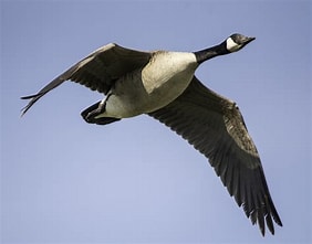
Actually, the Geese know! Had at least 6 more flocks heading south here in extreme southeastern PA they are on your way enjoy! -

Jan Medium/Long Range Disco: Winter is coming
Kevin Reilly replied to stormtracker's topic in Mid Atlantic
Let's just go triple phase east of Hatteras please! -

E PA/NJ/DE Winter 2023-2024 OBS/Discussion
Kevin Reilly replied to The Iceman's topic in Philadelphia Region
Yea huge improvements on the 18z GFS see if it holds going 0z and forward. Also has a monster storm on January 10th. I would say we have two threats one on the 7th and the 10th. The one on the 10th looks like the NAO is going from negative to positive both of these have my attention!! Let's watch!! The Geese know!! (I think that's going to be my snow call phrase, "The Geese know!!" -

E PA/NJ/DE Winter 2023-2024 OBS/Discussion
Kevin Reilly replied to The Iceman's topic in Philadelphia Region
Ralph it is a wakeup call to Winter!!! It's coming!!! Get Ready!! Also, I saw my 7th flock of geese today flying due south! They know!!! Now with my rant earlier about warm ocean temperatures I suppose it is one of the necessary ingredients for our 20" snowstorms. I have a gut feeling we see one of these Biggies that gives us 20" just a gut even if it is only one of them. -

E PA/NJ/DE Winter 2023-2024 OBS/Discussion
Kevin Reilly replied to The Iceman's topic in Philadelphia Region
Let's see what we can do but at day 700 with less than 1" of snowfall we are getting there. I cannot ignore the cyclic nature of this though. It most likely will change and around here and it often changes abruptly when most have given up (this guy). I do think interesting times are ahead! -

E PA/NJ/DE Winter 2023-2024 OBS/Discussion
Kevin Reilly replied to The Iceman's topic in Philadelphia Region
How is Baltimore and DC doing anyone have their days? -

E PA/NJ/DE Winter 2023-2024 OBS/Discussion
Kevin Reilly replied to The Iceman's topic in Philadelphia Region
Well, I feel sometimes my opinions are being ignored, but this is our new normal with the Warm Pacific Ocean, Gulf of Mexico, Atlantic Ocean, and Great Lakes and many other warm bodies of water are in complete control of our weather patterns. We can hope for a window of 2-4 weeks in February when the bodies of water hopefully cool down. We are also heading for Lake Effect snow season in February and March too. Things without doubt have certainly changed since the 70's, 80's, 90's, and past 23 years. Our snowstorm chances are like trying to track a hurricane strike in the summer along the East Coast. How about that 60-foot rouge wave out in California? I have not read up on that closely. What caused that? Waves out there on average 20-40 feet pretty cool but no doubt simply tied to the raging Pacific Ocean. Let's hope for snow! Back to my remembering the Blizzard of 1983. I am currently walking down my street in Northeast Philadelphia just surpassed 16" still coming down 2" an hour now we have graupel and lightning cool!! -

E PA/NJ/DE Winter 2023-2024 OBS/Discussion
Kevin Reilly replied to The Iceman's topic in Philadelphia Region
I am done with that read I have gone through 2009-2010, 1996, The Ice Storm Jan. 1994, currently reading February 11th, 1983, fun storm. -

Jan Medium/Long Range Disco: Winter is coming
Kevin Reilly replied to stormtracker's topic in Mid Atlantic
Time to work on it though alas it is only December 30th for this January 7th window at this lead. -

Jan Medium/Long Range Disco: Winter is coming
Kevin Reilly replied to stormtracker's topic in Mid Atlantic
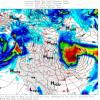
Thats a Chaotic look there: Lots of split flows pretty good split there in the Gulf of Mexico along southern branch and another out west near Los Angles heading all the way NNW to Alaska and another flow branches out into southern Arizona down to Mexico City. Now east of Edmonton and Calgary there is a pretty pronounced flow SSE from Northern and Central Canada pushing SSE down in the Mid-West and moving SSE into the Eastern United states this did not happen almost at all last year as I remember. So, maybe just maybe we are about to make the turn the cold air up north is well... relatively cold though and most likely will modify quite a bit. At least it is a bit more interesting to look at. Pennsylvania Water Vapor Satellite Weather Map | AccuWeather -

Jan Medium/Long Range Disco: Winter is coming
Kevin Reilly replied to stormtracker's topic in Mid Atlantic
Lake Tahoe -

Jan Medium/Long Range Disco: Winter is coming
Kevin Reilly replied to stormtracker's topic in Mid Atlantic
Ditto that up here in Southeastern PA I saw about 5 flocks of geese heading SSE the other day before the heavy rain set in. I always calculated and observed this, and it snowed like 2 to 3 weeks later after I saw the flocks, just something to keep an eye on. Mother Nature always knows first! -

Jan Medium/Long Range Disco: Winter is coming
Kevin Reilly replied to stormtracker's topic in Mid Atlantic
Where is the cold high up north this would most likely be a cold air would it not? -

Jan Medium/Long Range Disco: Winter is coming
Kevin Reilly replied to stormtracker's topic in Mid Atlantic
Might want to take a look at 2009-2010 too to see exactly what was going on in that winter since it is an outlier over the past 20 years at this point. I mean 2009-2010 things were set up perfectly and held off an on for 3 months.


