-
Posts
2,154 -
Joined
-
Last visited
Content Type
Profiles
Blogs
Forums
American Weather
Media Demo
Store
Gallery
Posts posted by Kevin Reilly
-
-
47 minutes ago, North Balti Zen said:
I don’t have the patience to go find them, but I could collect some posts from the really good posters on here that have said , since Jan 1, to
“watch the period starting on the tenth”
”by the 15th we should be seeing blues on runs”
”the period around the 20th is ripe”
”window should be wide open by the 24th-26th”
and now Ralph’s above. and that’s setting aside the posts from mid-December that the period from Christmas to New Years and just after New Years were ripe.
larger observation is we’ve been kicking this can down the road for about a month now - the can being “ something , anything to track”. When I’ve seen this before in the previous 11 winters I’ve been here, it is, generally, not ideal.
this road ends with the people in the maryland highlands trying to convince anyone below 1000 feet in elevation that snow on March 25th is good while they get five inches and everyone else gets puddles...
hope one of these goalpost moving periods gets closer in time, but for 30 days now the goalposts keep moving.
also, side note, props to the GFS for generally refusing to show blue over us in the long range, as that has been accurate as hell...
Also to piggy back the Pacific has now ruined our winters now for the past few years with overwhelming our entire North American Continent with relative warmth no matter the state of El Niño or La Niña states. Could it be our warming Earth? Could it be dumping worldwide warmth into our oceans which is changing the overall climate system? It takes longer to warm the oceans and cool them down hence winters in some areas are shorter and shorter windows to produce what we want snow! I have honestly not seen too many times where you have a -epo, -ao, -Nao and can’t find cold air?? Temperature wise we are above normal for January again. Just frustrating to see nothing even in a suppose good look that the Pacific overwhelms anyway. Now that I said all of this it will snow lol?
-
1 hour ago, StormchaserChuck! said:
I think it's amazing that it's mid-January and we have a -NAO and it's raining, and it's not even close. 50*. +PNA isn't getting far south anymore lol
Well we are basically tracking blocking with zero cold air makes you wonder what’s going on? Guess the cold air is on the other side of the poles.
-
-
-
3 minutes ago, Ji said:
we lost the GFSs but gained the Canadien big time lol
It’s very heavy obvious the models are having a very difficult time tracking the short waves and timing coming off of two separate streams and strengthening blocking with arctic air possibly waiting in the wings.
-
10 minutes ago, psuhoffman said:
@WxUSAF if you look the h5 going back 72 hours and through the next 160 hours the flow is perfect with vort and vort tracking just under us. But nothing is amplifying at the surface. I’m starting to think part of the problem (other then just fast flow and crowded field) is the lack of healthy baroclinicity. There just isn’t much of a thermal gradient to fuel a surface system to amplify. The airmass is all blah everywhere. Do you think that’s part of the problem?
I agree with what you are saying! Temps day and night are remarkably stable not much of a variation. We do need a better baroclinic zone and temperature gradient to develop those all important coastal fronts that east coast storms love to feed off of the gradient and whatever warmer ocean temps may be near by but we also need the cold not this modified suedo that we currently have.
-
Hmm how about help from a southeast ridge to bump the storm up the coast? The southeast ridge isn’t just going to disappear from flexing its muscles. Thoughts?
-
-
43 minutes ago, CAPE said:
My post wasn't directed specifically at you. The point was we don't need a true arctic airmass in place(for the lowlands) leading up to an event in order to get a snowstorm. Moderate cold will work when the atmospheric setup is very favorable.
Totally agree!!
-
5 minutes ago, CAPE said:
Yeah, it tends to be colder further north. Maybe go back and read the context of the original posts.
Oh I’m missing something else we were in the best spot geographically in relation to the blocking that was in place too. Just so you know I’m only about 10 miles north of the Mason Dixon Line so not too far north.
-
10 minutes ago, Interstate said:
From what I remember the Dec 09 storm was pretty darn cold... I believe it was in the low 20s... and I think the second blizzard was decently cold as well.
Yes I remember both well set ups were somewhat similar. The temps here in SE pa were mainly in the lower to mid 20s which gave us great snow ratios which really helped us get to our totals. The February 2010 storm same but that storm had winds 35-45 over our area to boot too.
-
8 minutes ago, WinterWxLuvr said:
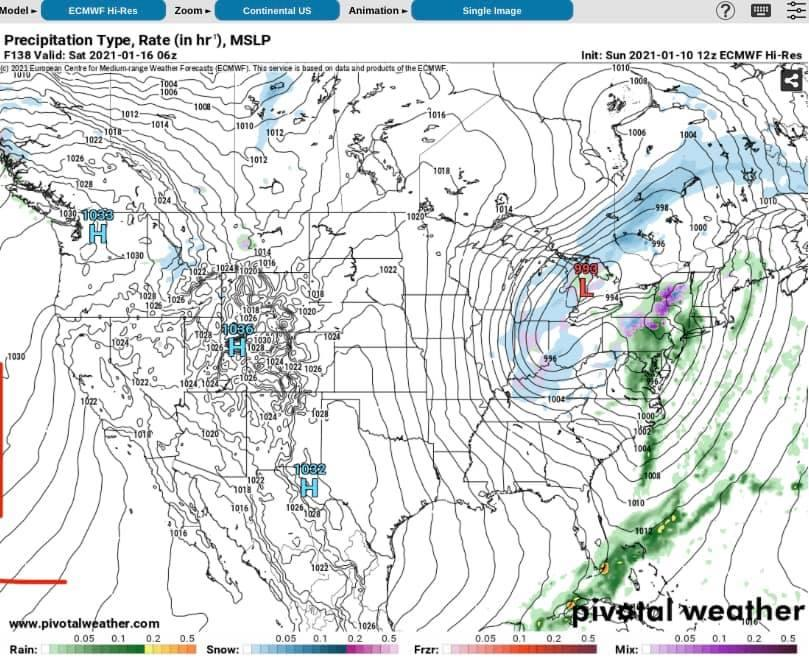
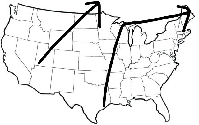
You forgot to draw in a big blue H off the coast of the Southeastern United States. Time and time again the warmth is gathering in Texas off to the east and southeast deflecting the storms to follow a developed baroclinic zone west of the southeast ridge.
-
-
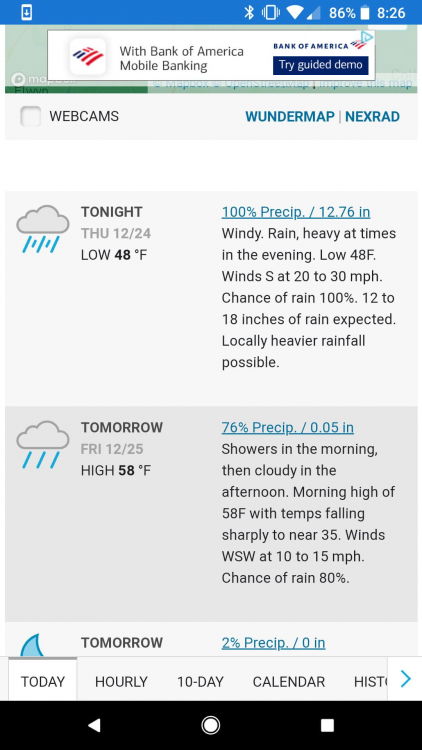
Only could muster a car topper white Christmas Yay!!! 26 here in Media
-
6 minutes ago, bigtenfan said:
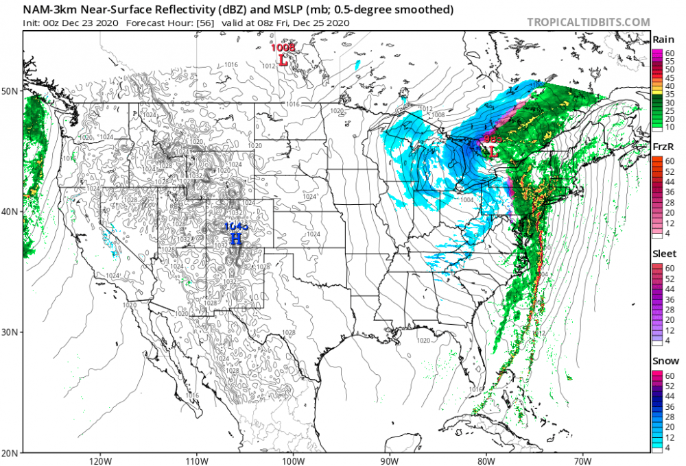
When is the last time it was several degrees warmer in Phila than Boca Raton FL on Christmas morning?
Long time!!! Just shows you how negatively tilted that storm got oh what blocking can do!!
-
Media light rain winds 30-65 mph power outages in the area 1.96” so far 64
-
Moderate to heavy rain in Media winds have like vanished weird.
-
SE pa winds past 60 lots of power flashes here in Media Delaware County 13 miles SW of PHL
-
1 hour ago, penndotguy said:
60f dead calm cloudy, we only had on and off showers.
Winds here in Media clicking 50-60 at least power flashes
-
-
-
7 hours ago, RedSky said:
Possibly the strongest for the time of year on record
Think we need this record breaking event outta here before we can see our next snow threat. While the ducks (teleconectors) look just about right I’m not seeing the sustained cold for us to score at this time crazily still looks too progressive.
-
 1
1
-
-
-
15 minutes ago, Weather Will said:
There is a warm layer coming in off the Atlantic down your way in DC Baltimore area that warm air layer gets scoured away but barely up here in southern pa by PHL due to the storm hitting the breaks and moving off the coast east bound.
-
 1
1
-









Feb Long Range Discussion (Day 3 and beyond) - MERGED
in Mid Atlantic
Posted
It's just not that the oceans are warming over time. The largest body of water on Earth is the Pacific Ocean and its warmth is overwhelming the North American climate system. While you have blocking like a -EPO, -AO, -NAO you would think it would be very cold and forcing cold out of Canada, but reality is that we instead get the relative warmth off the Pacific Ocean not allowing the normal cooling effects from land and radiational cooling. Like you said though Arctic ice melt is also probably at play as well and that is melting because the lower latitudes are on fire along with the oceans too.