

GaWx
-
Posts
17,854 -
Joined
Content Type
Profiles
Blogs
Forums
American Weather
Media Demo
Store
Gallery
Everything posted by GaWx
-
I agree with your general ideas. Per ERSST, Oct was +1.66 and Nov is likely going to be in the general vicinity of +2.0. So, for OND to come in +2.0+, Dec would probably need to come in near +2.35, likely a tough task. The better chance may be with NDJ (I’m guessing you agree) with its first month near +2.0. For that, Dec could come in, say, ~+2.1 and Jan, say, ~+1.9 or, say, Dec ~+2.2 and Jan ~+1.8 and a +2.0 ONI is reached either way.
-
As expected, today’s weekly OISST based NOAA update (for last calendar week) for Nino 3.4 came in at +2.1, an increase from the prior week’s +1.9. Also, for the first time since way back in early Feb, the weekly Nino 3.4 anomaly came in warmer than that for Nino 1+2, which remained at +2.0. Today’s weekly NOAA update: Nino 1+2: +2.0 (steady) Nino 3: +2.3 (up from +2.1) Nino 3.4: +2.1 (up from +1.9) Nino 4: +1.5 (steady) https://www.cpc.ncep.noaa.gov/data/indices/wksst9120.for
-
No worries, Mitch. If you decide to delete your two recent posts, I’ll also delete my replies to clear the thread.
-
I know. I already posted the 11/26 update here as it updates by late afternoon (before night). So, the next update (11/27) will be by late afternoon today:
-
The OHC is still being adjusted upward for the same timeframe and is now showing a new high on this graph for this event of ~+1.40 with further ongoing sharp rises being suggested. Keeping in mind reporting lag as this particular graph is updated only through ~10 days ago (midmonth instead of late month), Nov has a good shot to exceed June as the warmest month of this Nino so far in the monthly table. This is for 5N to 5S down to 300m and uses a 1991-2020 base:
-
The 11/1-18 Euro Weeklies runs were making me think a weaker than normal Dec SPV model bias quite possibly was in play due to major can kicking. The date of the SPV going below climo slipped from ~12/1 to 12/25 and thus it stayed a month+ out/like a mirage. However, the last 8 runs have come all the way back along with extending into early Jan with the last 5 runs being very impressive with today’s having the most major SSW members (30%). Thus, I no longer think a model bias is in play. Furthermore, there’s modest support on the extended GEFS. And don’t forget that the CFS fwiw is supporting a weak SPV this winter. So, I now fully expect a weak SPV will at least dominate Dec (with or without a major SSW) and may very well go into Jan. Now if we actually get a major SSW late in Dec, it could rebound within a few weeks as they sometimes do.
-
It looks great once again on the EPS for those who want a weak SPV. Similar to yesterday, the EPS mean goes weaker than climo 12/3 and is well below climo 12/7-end of run (1/10). Not that it is necessary, but this run implies the highest % of members yet with a major SSW (between 12/24 and ~1/11), 30%, which beats the 25% on yesterday’s run. The climo % chance of a major SSW by Jan 11th is only ~20-25%. More specifically, this run has 12% of its members with quite a potent major SSW (dip to <-10), which is tied with the 11/25 run for the highest of any run yet!
-
It looks like the most recent OHC was readjusted up to ~+1.35, which is about as warm as at any point on this graph and this appears to suggest more warming ahead. On average, Nov is the warmest OHC month though Dec was 0.45-0.50 warmer than Nov in both 1986 and 1991:
-
It still looks great through early Jan with the EPS mean having the SPV become weaker than the climo avg starting Dec 2nd and it being well below climo Dec 5th through Jan 9th. Keep in mind that ~a week ago, the EPS mean wasn’t going below climo til Dec 25th! This run has a whopping 25% of its members with a major SSW between mid Dec and early Jan, which is the highest of any run yet and is well above the climo chance for that period:
-
WCS PDO resumes large daily rises with latest -0.72 vs -0.86 prior day vs ~-1.28 7 days ago (Edit for 11/25 WCS: PDO -0.77, Nino 3.4 +1.10)
-
CFS prog vs Normal 10 mb N Pole temp: (C)/anomaly Dec -58 vs -70/ +12 Jan -51 vs -60/+9 Feb -49 vs -55/+6 So, latest CFS has DJF N Pole 10 mb temp anomaly at +9 C implying a weak SPV for the winter.
-
Per the following 0Z 11/24 GEFS 10 mb map for 12/19, it implies a significantly weaker SPV vs what was implied on the 0Z 11/18 prog (similar to 11/24 vs 11/18 Euro): 11/24 run for 12/19: note how much warmer is W Siberia to NW Can, further N/stronger S AK high, and sig weaker SPV on this vs 11/18 run map below: these strong trends are hints of an increasing shot at a SSW ~12/20: 11/18 run for 12/19:
-
Still looks great!
-
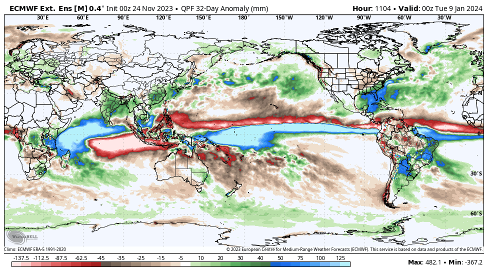
Check out the image of precip anomalies for 1979-2012 for Nov-Mar below: note that the precip bulge center was at 170E on the JFM map whereas it is ~180 on the newer map. The 170E centered map is near phase 6, a typically warm phase. It moves E from there but that still would in theory mean a good bit of 6. On the newer map though it is centered at 180, which is between 6 and 7, and this in theory should mean less of the warm phase 6. I’d love to see the bulge move even further E and thus allow in theory a higher freq of phases 8 and 1:
-
I’m sure @griteatercan explain the precip anomaly bulge way better than me. After all, I saw it for the first time when he posted that JFM Euro precip anomaly map. It appears to possibly be associated with where upper level forcing/OLR is greatest/where MJO is most favored. Maybe it is largely there due to very warm water being most widespread there? Warmer SSTs often lead to more convection. I know that the W portion of 3.4/E part of 4 have warmed a good bit recently due to the strong WWB.
-
Comparing 12/8-1/9 with the Nov 1st prog for JFM, the Dateline bulge has lived on but also the center of it has moved E JFM: bulge max 170W to 150E with mean 170E: Dec 8-Jan 9: centered further E at ~180; E GOM/SE US +anoms stronger
-
We do have at least a month or so to get the final answer. But imho if you were being perfectly honest, you’d admit that todays 0.08 drops were not what you wanted to see/not helpful to chances of ever seeing a+2.4+ daily, even if they reduced the chance just modestly. To improve your quality as a poster, I’d hope to see more objectivity from you as opposed to you just sounding one sided all the time. It is like you never acknowledge that things can be going against your predictions. You’ve been great for this thread and the thread wouldn’t be the same without you. I never make fun of you. But I feel you’d be a better contributor if you’d at least better acknowledge when things go the other way.
-
Here it is, cyclonicwx also fell 0.08 and is now back down to 2.12, very close to WCS’ 2.11:
-
Big drop in OISST 3.4 on WCS from +2.19 yesterday to +2.11 today: last few days 2.12 to 2.15 to 2.19 to 2.11. With this drop and assuming cyclonicwx also shows a significant drop today, that would mean at least a short term top of ~+2.20 has occurred. In order for there to ever be a +2.00 ONI peak, there will almost certainly need to be a higher daily peak later as just the math and history, combined, says that +2.20 daily peak on OISST is very likely not going to be enough to support a 3 month +2.00+ on ERSST. We likely now have had enough warmth to get a +1.80 ONI peak but probably not enough yet to get even a +1.90 ONI per the math. Based on the past, we probably need a daily peak near +2.40 for @snowman19to get an unrounded +2.00 trimonthly and thus declare victory. There’s still another month or so for that possibility, but a possibility is all that is right now and this sudden reversal, itself, was not helpful for that chance obviously: Edit: PS PDO ~same as yesterday’s update and is at -0.84. Let’s see what cyclonicwx OISST has today for 3.4! Will it also have a big drop??
-
NOAA OHC to 300m (1991-2020 climo, 5N to 5S) readjusted warmer and warming further: Brand new: From just yesterday: note the adjustment up since then
-
If that is actually all snowfall and not sleet or ZR, the 1.5-2” down here at SAV on that run would be the 2nd heaviest early Dec snow on record with only Dec 6th of 1740’s 4-5” exceeding it.
-
Today’s Euro Weeklies mean is similar with the weak Dec SPV of yesterday’s run. The EPS mean 60N wind for Dec 7-31 as a whole is at only ~2/3 of the longterm climo mean for Dec. 7-31: li
-
Cyclonicwx’s Nino temps: 11/24 update 1+2: +2.05 3: +2.40 3.4: +2.20 (vs +2.16 yesterday and WCS’ +2.19) 4: +1.48
-
The latest WCS Nino 3.4 OISST rose from +2.12 two days ago to +2.15 yesterday to +2.19 today (as of 11/22). So, although it appeared warming was slowing some yesterday, it is still steadily warming. So, look for a further warming on today’s cyclonicwx graph, too. So, as we approach +2.20 on OISST, one might wonder if that, alone, makes an unrounded +2.00+ ONI peak likely. My opinion is that that, alone, doesn’t. On the dailies, a +2.40ish daily peak is probably going to be needed based loosely on the past. Even on the weeklies, a +2.3 is probably going to be needed based on the last 5 Nino’s. We do have a good shot at a +2.10 week in the next release. So, to get the +2.00 peak ONI, the dailies likely need to warm another 0.20 or so. With today’s warming, we’re likely going to have a +1.80 or so ONI peak at the minimum. The WCS daily PDO major rise of the last two days took a break with it at -0.86 vs -0.84 yesterday.
-
NOAA OHC time series update (5N to 5S)(1991-2020 base):

