heavy_wx
-
Posts
1,628 -
Joined
-
Last visited
Content Type
Profiles
Blogs
Forums
American Weather
Media Demo
Store
Gallery
Everything posted by heavy_wx
-

January Storm Term Threat Discussions (Day 3 - Day 7)
heavy_wx replied to WxUSAF's topic in Mid Atlantic
Lovely bifurcation of the mid-level flow! The resulting confluence promotes anticyclogenesis south of James Bay and cold-air damming into the mid-Atlantic.
-
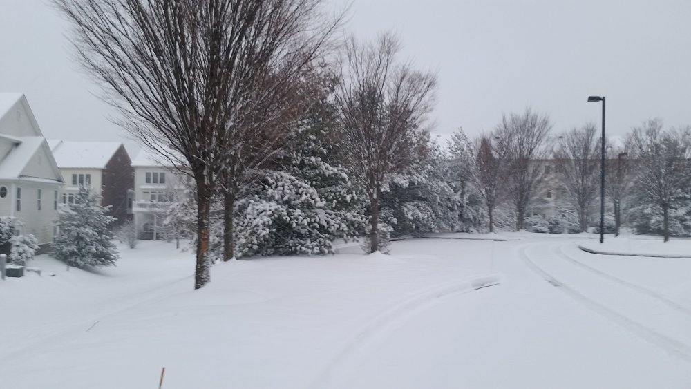
Light to moderate snow here with a coating on the ground.
-
January Storm Term Threat Discussions (Day 3 - Day 7)
heavy_wx replied to WxUSAF's topic in Mid Atlantic
Good question; I'm not sure if the differences in the shortwave evolution are caused by something inherent in the model dynamics or differences in the model initial conditions. -
January Storm Term Threat Discussions (Day 3 - Day 7)
heavy_wx replied to WxUSAF's topic in Mid Atlantic
Yes, the GFS keeps the 500-mb shortwave mostly coherent as it propagates from AZ on 12z Tuesday to the OH river valley, where it acquires a negative tilt.The shortwave on the Euro loses its coherence over the southwest, keeping some of the energy delayed as the feature moves eastward. The result is a flatter, positively tilted shortwave that produces less favorable interaction with the developing surface low. There's definitely potential with this system for snow in the mid-Atlantic, but I think there's too much uncertainty right now in how these features will evolve to be confident in any operational model solution. -
Dec 16-17 Storm OBS Thread
heavy_wx replied to BuffaloWeather's topic in Upstate New York/Pennsylvania
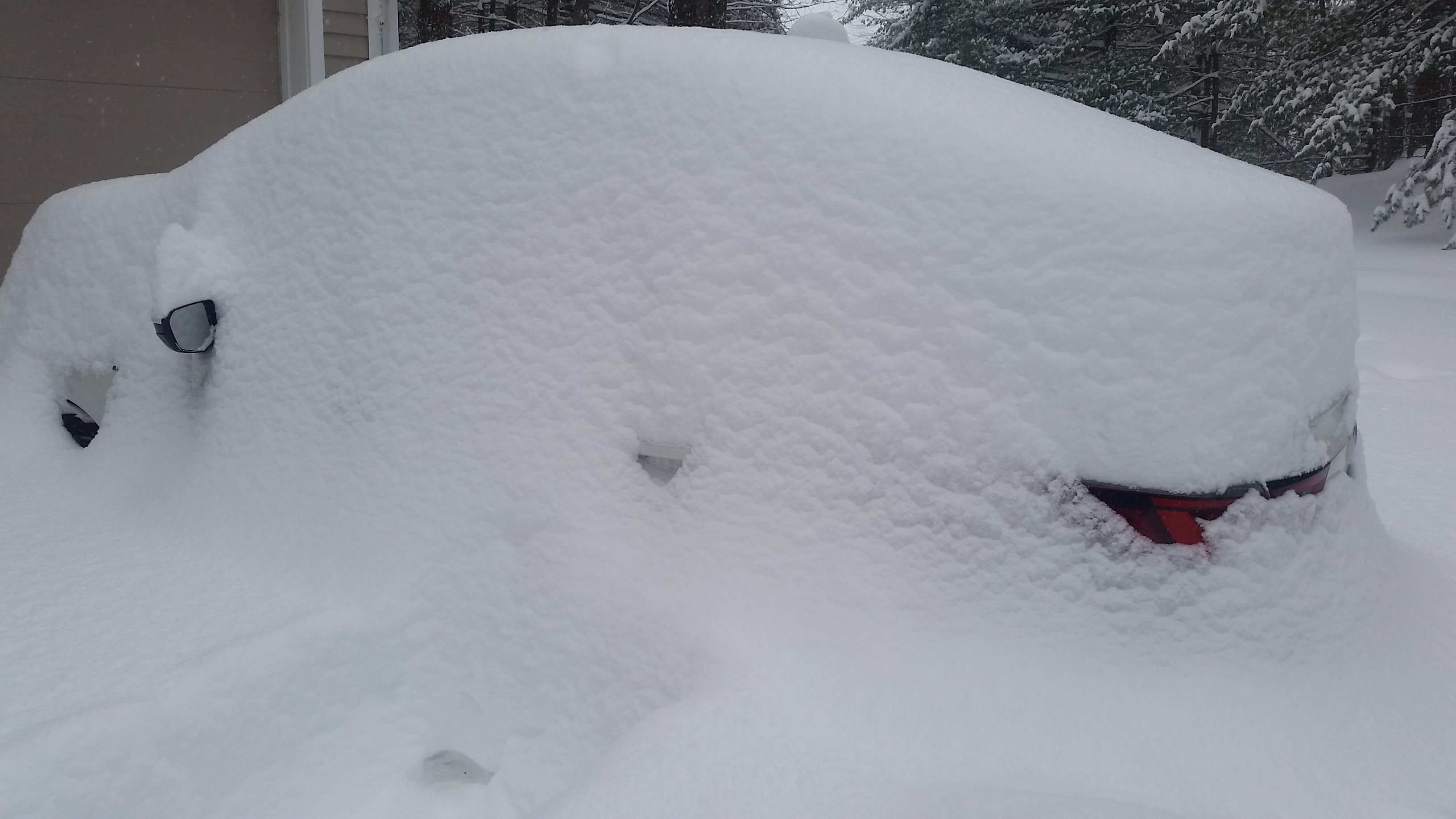
Measured about 19" depth on the ground NW of Albany about an hour ago.
- 693 replies
-
- 10
-

-
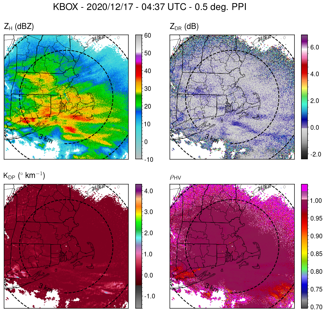
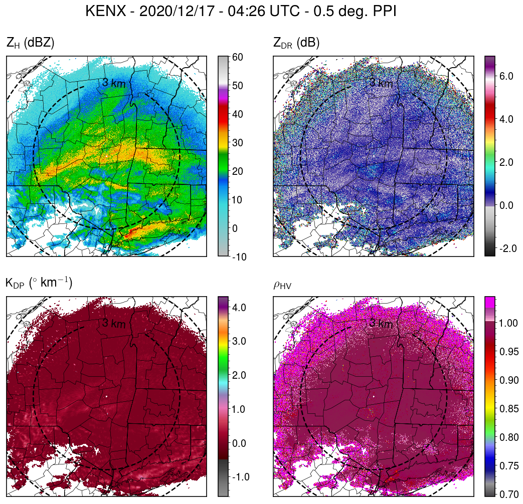
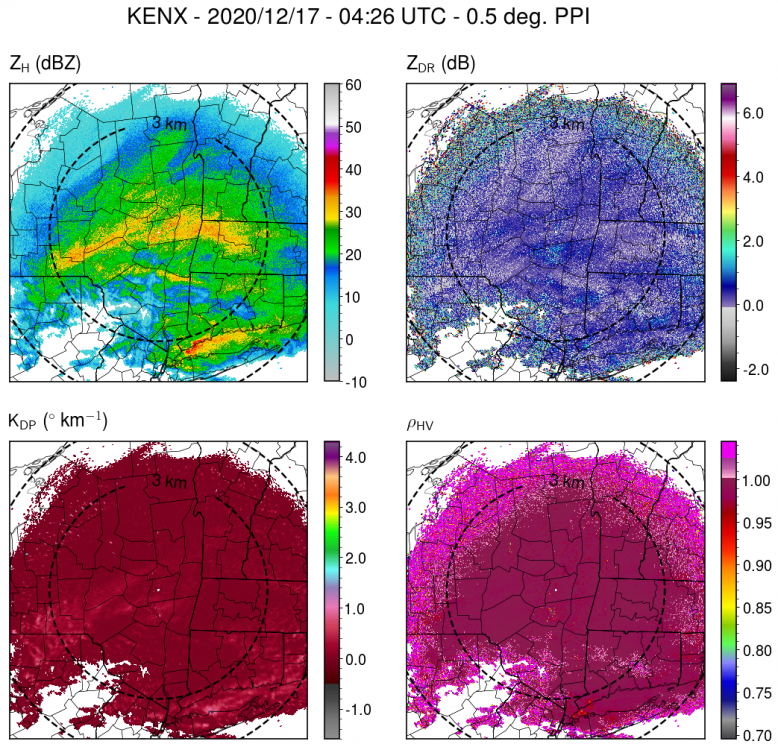
I plotted it from the level-2 NEXRAD data (https://registry.opendata.aws/noaa-nexrad/).
-
Just into the band here in Albany, finding a lot of dendrites and moderate-sized aggregates of dendrites. Corresponds to enhanced reflectivity, KDP, and ZDR within the band from KENX.
-
Dec 16-17 Storm OBS Thread
heavy_wx replied to BuffaloWeather's topic in Upstate New York/Pennsylvania
Some light snow started here within the last half hour just NW of Albany. -
Upstate/Eastern New York
heavy_wx replied to BuffaloWeather's topic in Upstate New York/Pennsylvania
I'm up near the Albany area for this storm...I think it will be better here than where I'd usually be, along I95 in MD! My main concern is if the secondary mid-level (~700-mb) band stays just south of ALB, and we're stuck in the subsidence zone of the circulation during the period of heaviest snow. -
There's a relatively good indication of 1-km AGL rotation from KLWX for the storm west of Baltimore City. Also some shear-induced size sorting evident in the relative placement of the ZDR and KDP maxima.
-
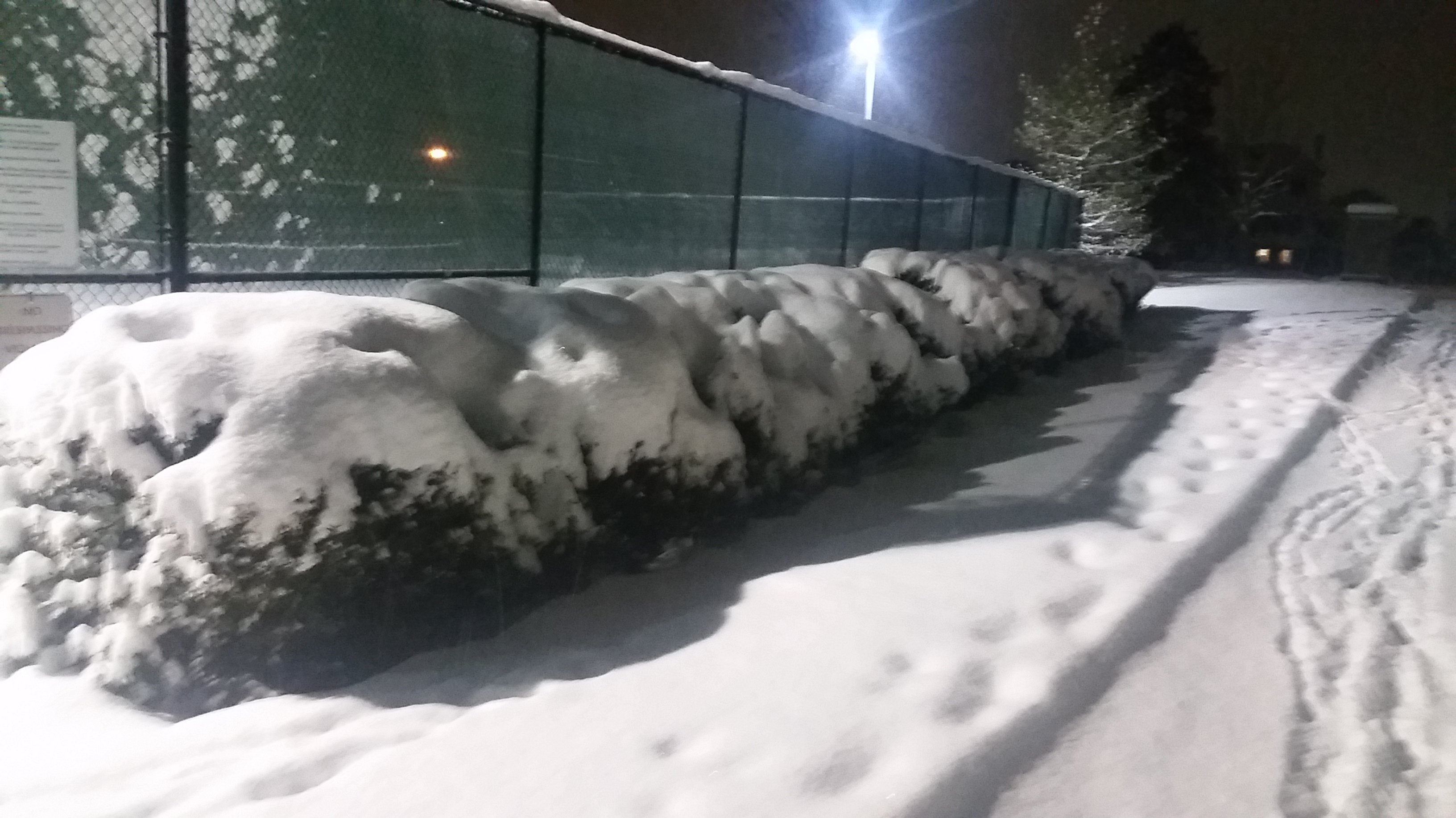
Measured about 9.5" on the ground here.

-
Yeah, definitely high SLR.
-
Low-density fluff falling out there. Nice aggregates composed mainly of rimed dendrites.
-
I think the snow detected by the radar is > 500 m above the ground, so with the N wind, it has moved several km south by the time it reaches the ground. I noticed this as the band approached me in North Laurel, where the precip didn't become all that intense until the center of the band was above me.
-
Getting some moderate-sized aggregates now and reduced visibility within the band of 35-40 dBZ reflectivtiy.
-
Getting a steadier light snow here on the northern edge of the band approaching Howard county. Still relatively small flakes.
-
Getting bigger aggregates now, corresponding to increased reflectivity and reduced ZDR.
-
Measured about 5" on the ground with light snow in North Laurel.
-
Confirmed clumps of dendrites/planar crystals falling within the band of higher reflectivity here. Maybe 1-2" on the ground so far.
-
Light flurries here in North Laurel.
-
Yeah, hopefully it will be a good storm for us down here (my first). It will certainly be interesting to see how the banding sets up.
-
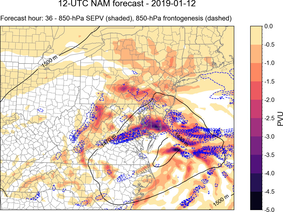
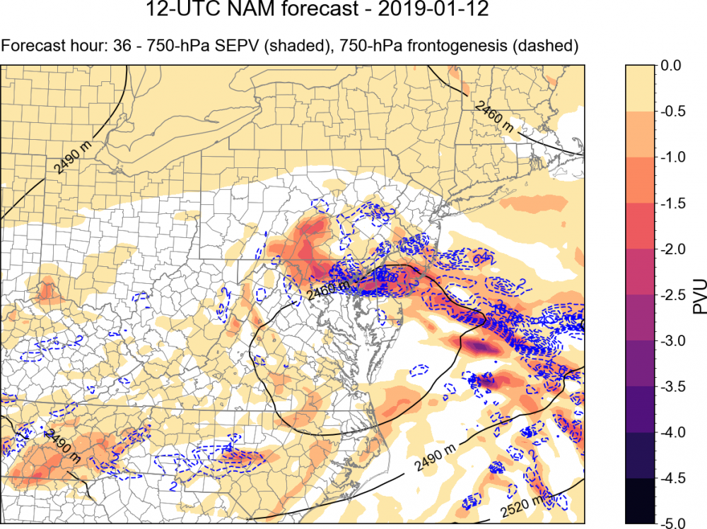
Just for fun, here is a good example of mesoscale banding indicated by some diagnostics of the 12z NAM. The 750 mb heights (black), frontogenesis, and saturation equivalent potential vorticity (SEPV) are plotted above. SEPV is a measure of the stability of air parcels to slantwise and/or vertical displacements in a saturated environment. Regions of negative SEPV have been associated with mesoscale precipitation bands in winter storms. You can see that there is a band of negative SEPV from east of the Delmarva to northern MD, to the north of the closed 750-mb height contour. There is also enhanced 750-mb frontogenesis in this region, associated with a thermally direct circulation (i.e., warm air rising to the south, cold air sinking north). This circulation provides lift, and in the aforementioned environment of conditional stability, leads to enhanced vertical motion within the general synoptic ascent. An important thing to note with these diagonistics is that these circulations and regions of conditional instability occur within layers of the atmosphere, and are often sloped. For example, here is the same plot but for 850 mb: You can see here that the main region of conditional instability and enhanced frontogenesis is displaced to the south over central VA and SE MD. These two levels are different horizontal slices through the same circulation; in this case the circulation is sloped to the north with height. Where this circulation intersects the dendritic growth zone (DGZ) is often where the most intense banded precipitation occurs, due to the region having the most efficient ice crystal growth and aggregation. For more information, this is one good resource: http://cstar.cestm.albany.edu/CAP_Projects/Project6/Mesoscale_Structure/seminar (M. Greenstein).ppt

-
The August 21, 2017 Great American Eclipse
heavy_wx replied to ice1972's topic in Weather Forecasting and Discussion
Yeah, not a bad analogy. -
The August 21, 2017 Great American Eclipse
heavy_wx replied to ice1972's topic in Weather Forecasting and Discussion
Yeah, I was kind of planning on doing that beforehand anyway just because I had a long drive back. I probably would have stayed around a bit longer otherwise.