TheDreamTraveler
Members-
Posts
853 -
Joined
-
Last visited
Content Type
Profiles
Blogs
Forums
American Weather
Media Demo
Store
Gallery
Everything posted by TheDreamTraveler
-
Central PA Winter 25/26 Discussion and Obs
TheDreamTraveler replied to MAG5035's topic in Upstate New York/Pennsylvania
NYC must be getting destroyed. This streamer I watch who's from NYC has lost his power twice now lol. I've seen him stream during snowstorms before and never had anything happen. Must be bad out there. -
Central PA Winter 25/26 Discussion and Obs
TheDreamTraveler replied to MAG5035's topic in Upstate New York/Pennsylvania
Power was flickering on and off. Street lights went out for a few minutes. It's not even windy over here lol -
Central PA Winter 25/26 Discussion and Obs
TheDreamTraveler replied to MAG5035's topic in Upstate New York/Pennsylvania
Starting to think the same. Barely anything has really accumulated on the pavement even though it's been snowing for a few hours over here in Enola. They're still calling 2-5 inches but I think it's going to be on the lower side too. Far cry from the 6-12 inches yesterday -
Central PA Winter 25/26 Discussion and Obs
TheDreamTraveler replied to MAG5035's topic in Upstate New York/Pennsylvania
Biggest forecast fuck up I've seen for my town in a long long time. Went from 6-12 inches down to 5-8 inches and now 2-5 inches and still rain so far. At least others are making out well lol -
Central PA Winter 25/26 Discussion and Obs
TheDreamTraveler replied to MAG5035's topic in Upstate New York/Pennsylvania
Absolutely pouring out right now. Haven't seen a big blob of heavy rain like that in a while -
Central PA Winter 25/26 Discussion and Obs
TheDreamTraveler replied to MAG5035's topic in Upstate New York/Pennsylvania
Does anyone know why we've been having so many air quality alerts recently? I don't remember getting so many so often the past few months. Not a fan honestly. -
Central PA Winter 25/26 Discussion and Obs
TheDreamTraveler replied to MAG5035's topic in Upstate New York/Pennsylvania
Great write up about the storm here. Basically goes into detail about why even though the potential exists for this to be an all time snowstorm it's probably not going to get as close to that mark as some thought. Regardless of that we should still have a big snowstorm to enjoy finally after years. South Central PA has gotten screwed so much the past 6 years it's unreal. https://x.com/HurricaneAddict/status/2014852201026584815 -
Central PA Winter 25/26 Discussion and Obs
TheDreamTraveler replied to MAG5035's topic in Upstate New York/Pennsylvania
Nice to be tracking a potential big one after all these years. I know a lot of the state hasn't seen a big snowstorm in 5 or 6 years now. -
Central PA Winter 25/26 Discussion and Obs
TheDreamTraveler replied to MAG5035's topic in Upstate New York/Pennsylvania
Honestly can be said for just social media in general. That stuff just rots your brain and so many people are just in it for the fame and money that comes with it now. Not worth a lot of peoples time I feel -
Central PA Winter 25/26 Discussion and Obs
TheDreamTraveler replied to MAG5035's topic in Upstate New York/Pennsylvania
It's funny you say you live rent free in his head but he hasn't responded since your last post to him 5 hours ago but you felt the need to respond to him again a second time hours later despite him not having said anything since then lol -
Major Hurricane Melissa - 892mb - 185mph Jamaica landfall
TheDreamTraveler replied to GaWx's topic in Tropical Headquarters
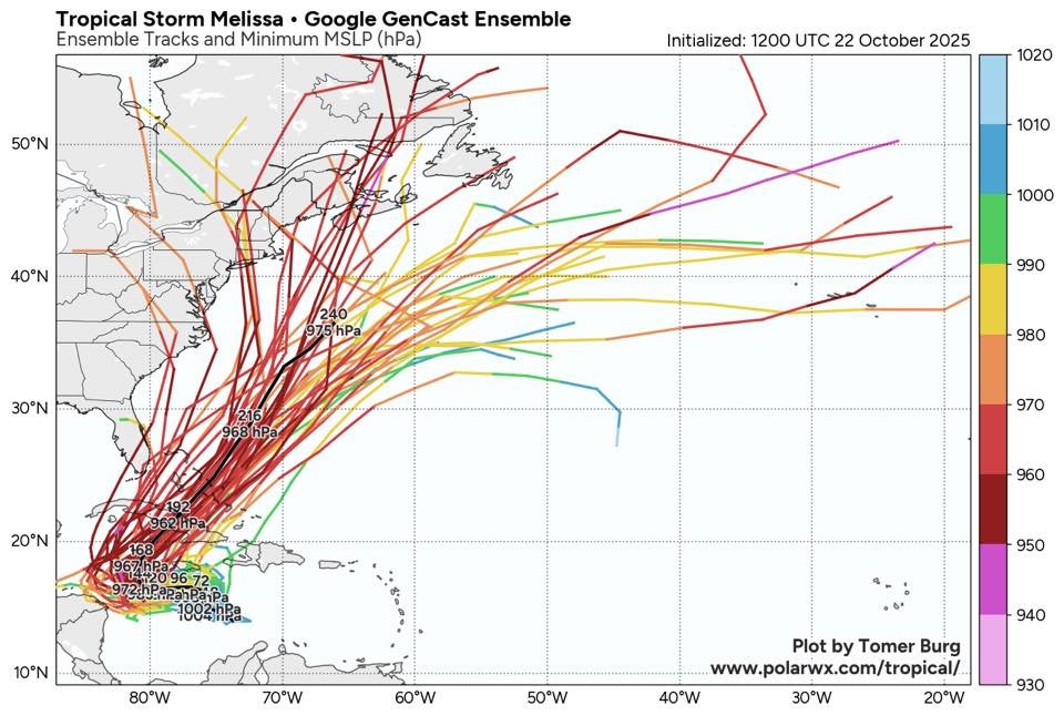
I'd mark this down as another win for some of the AI models as well. They not only guessed the track better when models like the GFS, ICON and UKMET failed spectacularly but they also guessed the insane low pressure below 900mb which many didn't believe it would get to. So glad we finally have something else to use because the GFS has just been a mess the past 5 years. But really this was one of the hardest forecasts we've had in a while but the AI models really nailed it despite the fact. -
Major Hurricane Melissa - 892mb - 185mph Jamaica landfall
TheDreamTraveler replied to GaWx's topic in Tropical Headquarters
I'm absolutely impressed with the buildings in Jamaica. Other than the roofs being blown off and destroyed most of the buildings are completely intact which is really good to see. I have a feeling if their homes weren't made with solid concrete that they would not have survived this well. -
Major Hurricane Melissa - 892mb - 185mph Jamaica landfall
TheDreamTraveler replied to GaWx's topic in Tropical Headquarters
I know you're joking but I can guarantee that you'll see AI video of that on social media and people will just automatically believe it lmao -
Major Hurricane Melissa - 892mb - 185mph Jamaica landfall
TheDreamTraveler replied to GaWx's topic in Tropical Headquarters
I looked on twitter a bit apparently Jim Cantore is saying that's from hurricane Dorian so it's not even Melissa lol https://x.com/JimCantore/status/1983269063339192440 -
Major Hurricane Melissa - 892mb - 185mph Jamaica landfall
TheDreamTraveler replied to GaWx's topic in Tropical Headquarters
From what I've seen on Twitter this is apparently AI. -
Major Hurricane Melissa - 892mb - 185mph Jamaica landfall
TheDreamTraveler replied to GaWx's topic in Tropical Headquarters
Was thinking the same thing. We may have to anticipate and watch this happen all over again in a few days. Even if just a cat 4 it's going to be a disaster for Cuba so I hope the people covering Jamaica didn't burn themselves out when we focus on Cuba -
Major Hurricane Melissa - 892mb - 185mph Jamaica landfall
TheDreamTraveler replied to GaWx's topic in Tropical Headquarters
Wilma is the most intense at 882mb. Unless we're just talking about wind speed then it's pretty much tied with her at 185mph -
Major Hurricane Melissa - 892mb - 185mph Jamaica landfall
TheDreamTraveler replied to GaWx's topic in Tropical Headquarters
185mph is absolutely insane. To think that this is landfalling at this strength at 892mb. What other storms landfalled at this strength? The labor day hurricane in 1935 comes to mind but I can't really think of anything else -
Major Hurricane Melissa - 892mb - 185mph Jamaica landfall
TheDreamTraveler replied to GaWx's topic in Tropical Headquarters
Gotta hand it to the couple of models that were predicting this to get pressure to the 880's a week or two ago. I know some people didn't believe it'd get that low but here we are. -
Major Hurricane Melissa - 892mb - 185mph Jamaica landfall
TheDreamTraveler replied to GaWx's topic in Tropical Headquarters
Third cat 5 of the season. Absolutely insane. -
Major Hurricane Melissa - 892mb - 185mph Jamaica landfall
TheDreamTraveler replied to GaWx's topic in Tropical Headquarters
She's gonna be a beaut. I really can't believe we're watching the worst case scenario for Jamaica play out before our eyes. Especially a country that has avoided very many destructive hurricanes in the past but that luck as finally run out sadly. Like even if Melissa was moving normally this would still be one for the history books but given the slow speed, angle of approach and absolute monster strength it's going to be something that they may never see again for hundreds of years. I really do not think many know what's truly coming. -
Major Hurricane Melissa - 892mb - 185mph Jamaica landfall
TheDreamTraveler replied to GaWx's topic in Tropical Headquarters
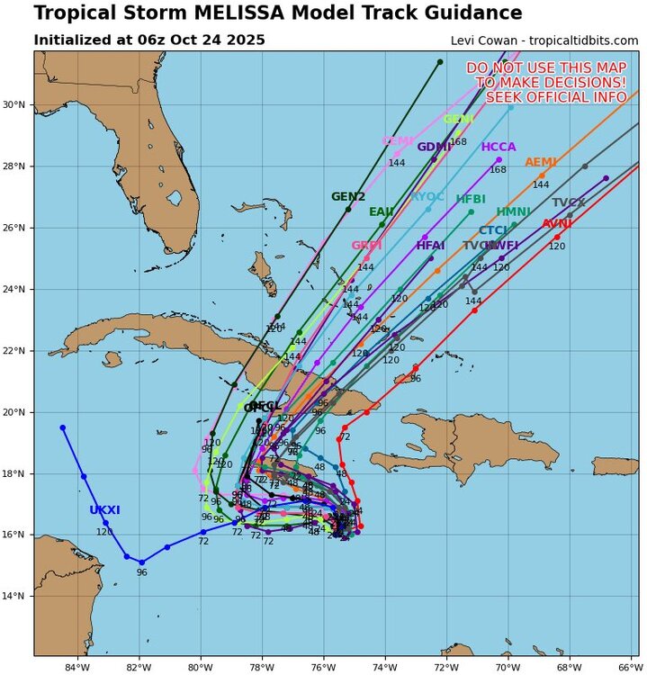
I'm glad the GFS is starting to get some sense with Melissa finally but holy shit what is the UKMET still doing lmao it's been doing this for days now when it's usually one of the best performing models. Just wild we've had the UKMET and GFS performing so poorly for so long with this storm. -
Major Hurricane Melissa - 892mb - 185mph Jamaica landfall
TheDreamTraveler replied to GaWx's topic in Tropical Headquarters
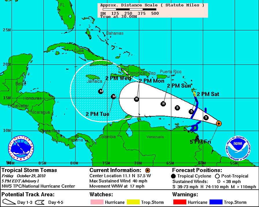
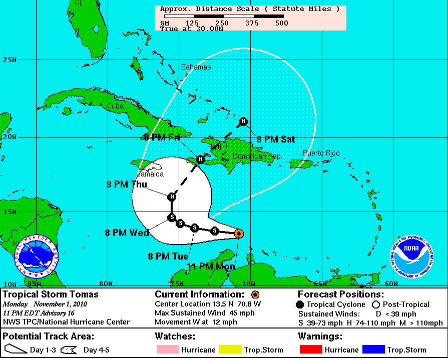
I know everyone's forgotten this storm but it's reminding me of hurricane Tomas for some odd reason. Not sure why but I do know it was predicted to become a powerful major hurricane once it entered the Caribbean and people were very bullish on it. It struggled immensely and was still a tropical storm where it was predicted to become a major lol. Definitely one of the worst intensity forecasts I've ever seen from the NHC. Not saying Melissa is going to under perform but we are in the Caribbean 'graveyard' after all. Normally storms that enter the eastern Caribbean struggle to develop at all unless they are well established before entering. Also NHC's intensity forecasts are a lot better now than compared to 15 years ago but it is still the hardest part to forecast in a hurricane. -
Major Hurricane Melissa - 892mb - 185mph Jamaica landfall
TheDreamTraveler replied to GaWx's topic in Tropical Headquarters
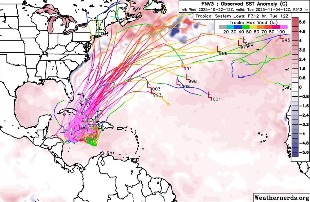
Another thing to keep in mind too is late October is the only real window for these hybrid storms to form with the perfect conditions. The only two storms we have recorded Sandy and The Perfect Storm in 1991 both happened at the very end of October. So it's interesting given the time period we're in and that the overall setup is very similar. Maybe once the GFS stops being absolutely useless and figures things out we'll have a clearer picture of what will happen. Definitely worth keeping an eye on. -
Major Hurricane Melissa - 892mb - 185mph Jamaica landfall
TheDreamTraveler replied to GaWx's topic in Tropical Headquarters
Actually amazing how useless the GFS has been for this storm lol


