

cstrunk
-
Posts
574 -
Joined
-
Last visited
Content Type
Profiles
Blogs
Forums
American Weather
Media Demo
Store
Gallery
Posts posted by cstrunk
-
-
Now 3 tornado warned storms near the red river.
-
SBCAPE is 2500+ in the area SE of Dallas, but dewpoints are still in the low-60's while surface temperatures are in the low-mid-80's. 60-75 knots effective bulk shear might be too much.
-
I was wrong about what I thought was the cumulus field on satellite earlier.
There is an actual cumulus field deepening on the south side of DFW. I think initial storm development in TX may be just southeast of Dallas. SPC Mesoanalysis shows 2000+ SBCAPE, 200+ ESRH, 60+ knots effective bulk shear, and low 60's dewpoints in this area.
-
6 minutes ago, Snowstorm920 said:
Latest run of the HRRRv4 has two areas of convection this afternoon. One in eastern OK and the other in E TX. The eastern TX storms look the most likely for tornadoes
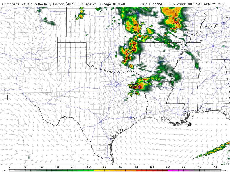
The southern threat area from that model runs lines up with the deepening cumulus field east of DFW. Dewpoints are still struggling, with many locations stuck in the upper 50's.
-
13 minutes ago, Quincy said:
Agreed with moisture concerns. Looks like mainly a severe hail threat initially. As the low-level jet strengthens and moisture return increases a bit closer to 00z, still think there is a bonafide tornado threat. Especially if the storm(s) near the triple point ride a pseudo warm front and don’t congeal into a messy blob.
I agree the biggest threat will be right along the warm front near the Red River towards Texarkana. Storms south of there seem to struggle on the latest HRRR runs.
-
29 minutes ago, jojo762 said:
Looking like SFC d/Tds are going to be pretty sub-par across most or all of the ENH risk area...
Yeah, not sure it will be enough to produce a big tornado threat. There's still a little bit of time for the low-60's dewpoints to head north. There are some readings around 60 in the Texarkana area, but plenty of other mid-upper-50's as well. The latest HRRR runs still show mid-60's to Longview this afternoon, but those don't make it any farther north. The cells south of the Red River don't look as robust as they did in earlier runs, either.
-
With the radar presentation and history of the storm I'm not sure why it's not Tornado warned.
-
Looks like the updraft on the southern storm attempt just got choked off and has weakened... we'll see if it continues to try to break the cap.
-
Clouds and storms in E/SE TX are going to spoil the threat for NE TX as well it seems.
-
Tornado warned storms in East Texas are in an area of 400-600 ESRH according to SPC Mesoanalysis...
-
2 minutes ago, Indystorm said:
Nice clearing rapidly moving in from the west on satellite.
Just had a downpour IMBY in Longview, TX. Now I have sunshine. If this line in E/SE TX can push east we should see more clearing...
-
15 minutes ago, TexMexWx said:
I'm observing the models right now and the 14z HRRR shows a cell forming between 1-2 PM and tracking through the northern DFW metro through about 5 PM, within a decent-looking environment. The 12z 3km NAM shows a storm as well through the center of the metro, but more around 4-7 PM. Those two are probably the more ominous of the convection-allowing models, but of course one shouldn't get caught up in the exact placement of the storms.
I probably should've looked more at other areas cause on the HRRR at least, storms over SE TX and parts of OK looked interesting as well.
I agree, DFW is definitely in a precarious position this afternoon.
28 minutes ago, Chreeyiss said:I don’t think it will be much of an issue. Instability picks up drastically as the dryline approaches this afternoon. That doesn’t mean storms are guaranteed to fire, but any issues won’t be instability driven.
Maybe I should have clarified, I have more of a IMBY bias here in Longview. I do think there is a greater threat in an area bounded by DFW, Sulpher Springs TX, Pauls Valley OK, and McAlester OK. SE TX may also be interesting. Not sure that the greater threat will extend eastwards towards NW LA as per SPC. Not to say there won't be severe storms farther east, as I'm sure there will be.
As always, I'm sure this could/will change...
-
48 minutes ago, cheese007 said:
Bit on the cloudy side this morning. Wonder how fast things will clear out?
Yeah, all of the clouds are going to put a damper on things, IMO. Already seeing junk showers from I-35 east. Need that to move out and see some sun ASAP.
-
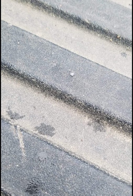
Had a couple pieces of graupel fall from the sky in Longview this morning. Air temp is 46F.
-
 1
1
-
-
19 hours ago, aggiegeog said:
That storm last night was intense. Took down some big trees and either snapped or knocked over tons of trees at my Dads nursery.
Sipapu got around 8" of fresh snow.
Yeah it was. A good 20+ minutes of 50-60 mph gusts here. Knocked over the next door neighbor's fence. Also heard a tree fall a block north and partially land on a house, luckily it wasn't directly on it.
-
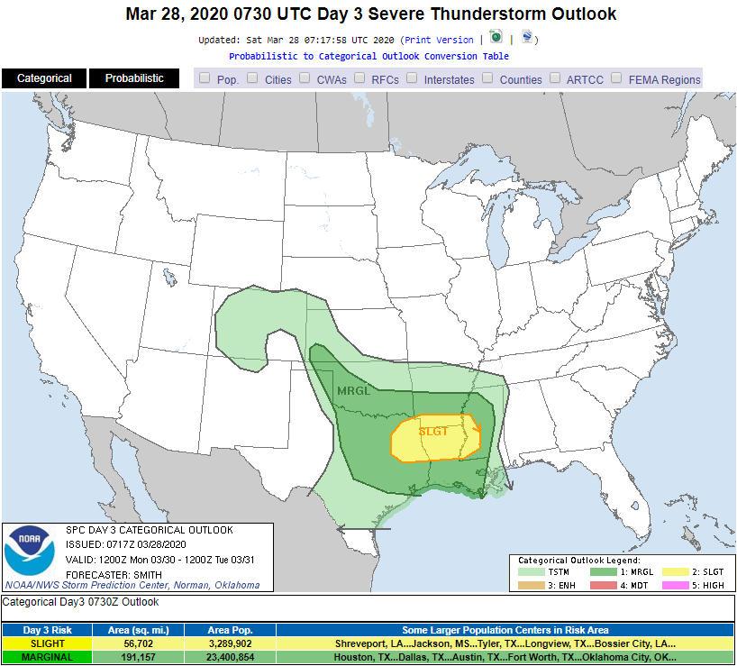
Day 3 Slight Risk for NE TX, N LA, S AR, and W MS. Mentions after dark tornadic potential with strengthening LLJ.
-
Tornado watch for SE NE, southern IA, and northern MO.
Initiation already occurring in SE NE and extreme SW IA in the form of discrete cells.
-
The 15z HRRR has a pretty ridiculous updraft helicity track from SW IA through Des Moines.
-
An area between my hometown of Shenandoah, IA and Omaha, NE would be a good spot to chase this afternoon from the hilltops.
Monitoring a potential severe threat here in NE TX as well. HRRR shows some activity here that could get interesting.
-
Models are showing a pretty good severe/tornado threat this afternoon/evening in extreme SE New Mexico and SW Texas.
-
Measured another 2.5" at my house from yesterday's and last night's rain. My yard is a bit swampy.
-
On 2/13/2020 at 3:36 PM, aggiegeog said:
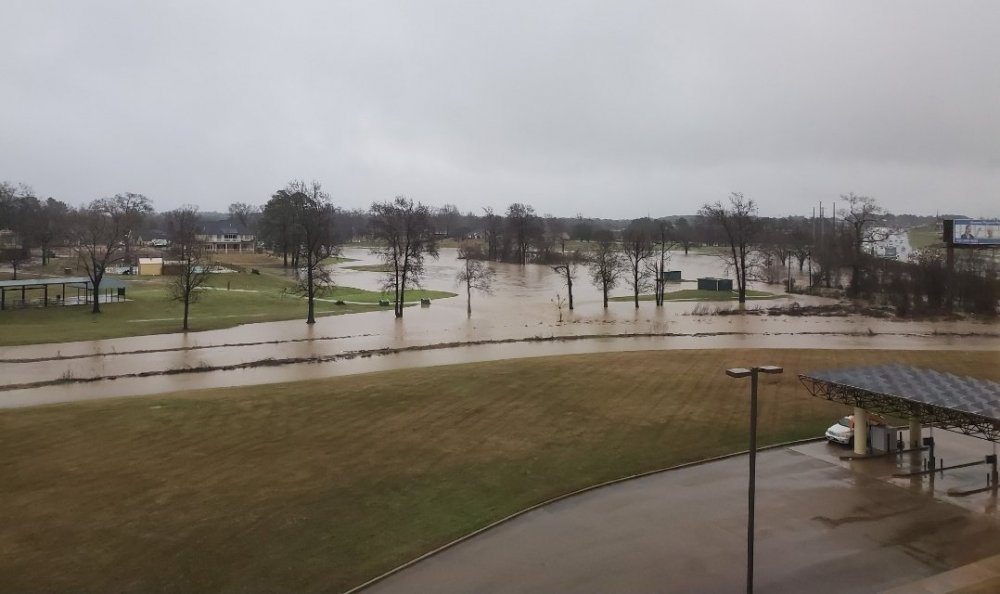
I need to check my rain gauge and see what additional rain I got. The drive into the Arlington Convention Center for NTNGA's Trade Show yesterday morning was interesting in the heavy rain.
Also model teasing another Texas winter storm for the middle of next week. I have not looked at details on that yet.
I had another 0.7" Wednesday during the day, putting my 3 day total at about 8".
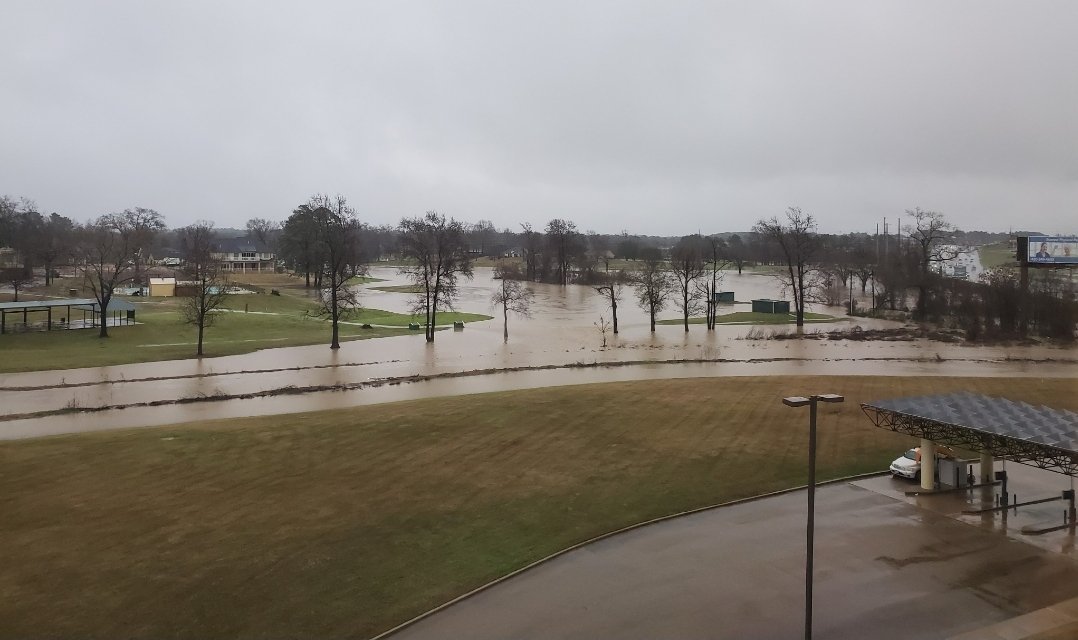
The golf course next to my office had a wee bit of water in it.
-
I measured 4.1" of rain from yesterday through 7 AM this morning.
Combined with 3.2" from earlier this week puts me at 7.3" for the week.
-
1
-
-
I had 2.6" of rain IMBY earlier this morning. More heavy rain expected through Wednesday.
*Update: 3.2" total for the day through 7 pm.
Severe Weather April 28-29th 2020
in Central/Western States
Posted
Ended up getting ~40-45 mph gusts, a bit of pea-size hail, and 2.2" of rain from the complex that moved through my backyard.