

Turner Team
-
Posts
75 -
Joined
-
Last visited
About Turner Team

- Birthday 06/28/1979
Recent Profile Visitors
1,753 profile views


.thumb.jpg.10519f3e44bb0a54bf5da5e63a0e8b03.jpg)
-
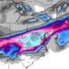
January 20-22 “bring the mojo” winter storm threat
Turner Team replied to lilj4425's topic in Southeastern States
Even if the Euro is correct on track of low and upper level features wouldn't there be a more expansive precipitation field to the NW than is currently shown? Seems like that happens alot in overrunning situations. -
February 18-19 MAJOR Ice Storm Threat
Turner Team replied to NorthHillsWx's topic in Southeastern States
Anyone have the sleet maps from the 12Z models? -
Southeast Sanitarium - A Place to Vent
Turner Team replied to Jonathan's topic in Southeastern States
I think its so funny that all of a sudden everybody is giving up on winter when we are only halfway through winter.. -
Yeah you're definitely in a good spot too. I'm in Cave Spring right behind Cave Spring Middle. Seems like we always do better than other parts on the valley in this type of setup.
-
We are for now.... Looking good for later on tonight though. I think its going to be a situation where there is a very sharp cutoff somewhere just north of 81 though. There definitely should be a wide range of accumulations across the valley though. I wouldn't be surprised at all to see the Bent Mountain or Clearbrook areas get 5 or 6 inches out of this.
