MNstorms
-
Posts
446 -
Joined
-
Last visited
Content Type
Profiles
Blogs
Forums
American Weather
Media Demo
Store
Gallery
Everything posted by MNstorms
-
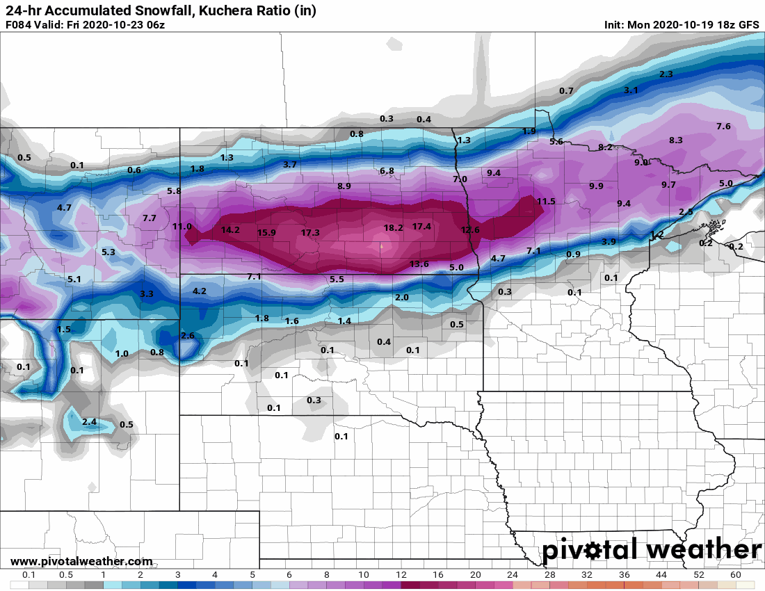
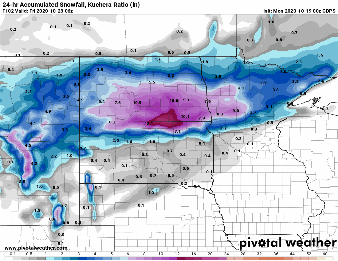
Thursday storm has been trending south. Still rain for me but Twin Cities snow chances increasing.

-
-
Measured 6.6''' as the snow is coming to an end here.
-
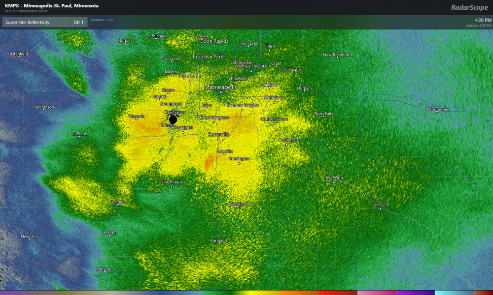
Twin cities getting hammer. I'm south a bit and have about 6''.
-
Probably once or twice. Looks like they will break the record for largest snowfall this early in the season. October snow facts Twin Cities: Largest Daily Snowfall Totals, October Rank Date Amount (inches) 1 October 31, 1991 8.2 2 October 29, 1905 5.5 3 October 20, 1916 3.0
-
Looks like a snowy end to the month possible in the upper midwest
-

Central/Western Medium-Long Range Discussion
MNstorms replied to andyhb's topic in Central/Western States
Monday is a day to keep a look at imo. 6 days out and the models are in decent agreement it seems.
-
Typhoon Yutu looks to hit Northern Mariana Islands