jrips27
-
Posts
3,462 -
Joined
-
Last visited
Content Type
Profiles
Blogs
Forums
American Weather
Media Demo
Store
Gallery
Everything posted by jrips27
-
just went TOR warned.
-
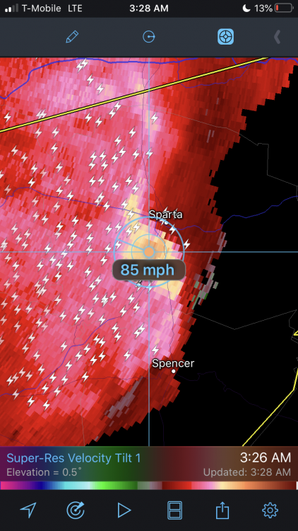
Sparta, TN is about to get rocked by straight line winds 70mph +
-
Euro 3 hour precip depiction GIF courtesy of Ryan Maue https://twitter.com/RyanMaue/status/1070027792589471745
-
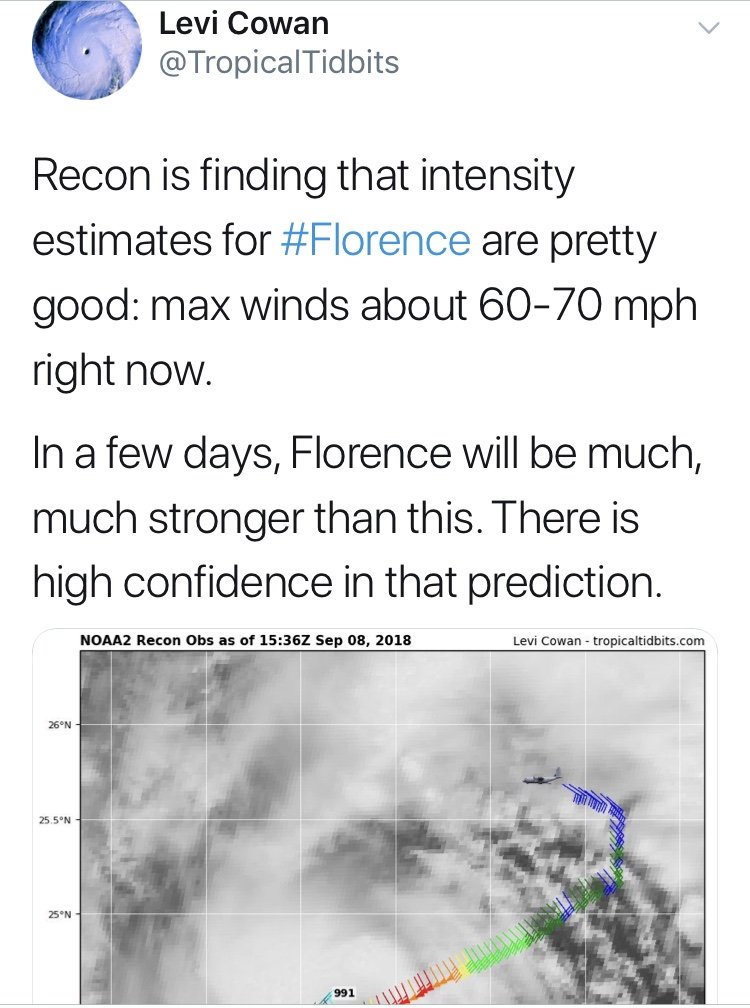
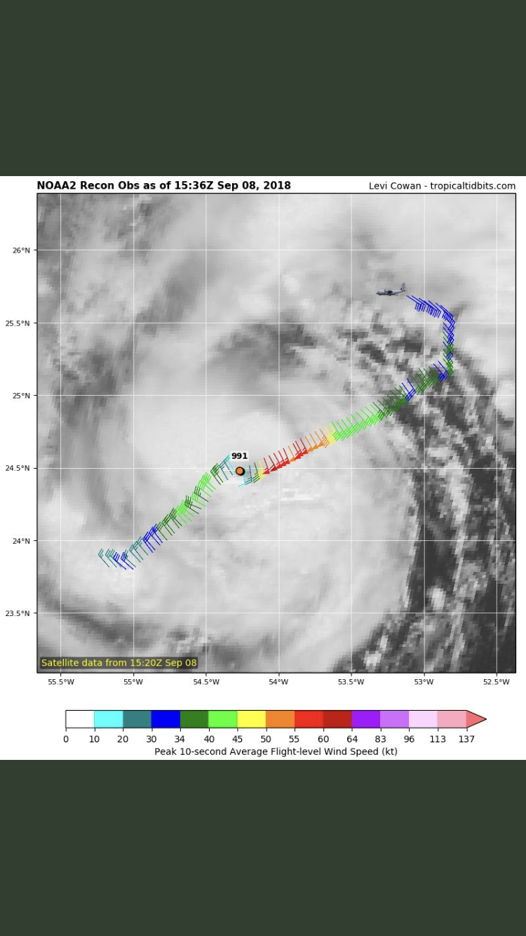
Recon found 991mb. Levi Cowan is a great follow as well for those of you in the path that are on Twitter. Certainly looks like it’s shaping up to be a serious situation.


-
Can anybody give me the 18z GEFS mean snow accumulation map? Wanna see how it lines up with the 0z GEFS when that comes out soon.
-
Wouldn't be the Southeast without some drama
-

Weather References and Newbie Information
jrips27 replied to burgertime's topic in Southeastern States
Great link in the bottom of your post, Burger. Going a bit more into teleconnections which all the newcomers are seeing in the current discussions... This is what you want for snow and cold in the SE. -AO -NAO +PNA Its rare we get all 3 at one time... -
Devastating tornado strikes Joplin, Missouri
jrips27 replied to Hoosier's topic in Weather Forecasting and Discussion
Really glad your OK Jomo! We were all worried sick about you! -
Devastating tornado strikes Joplin, Missouri
jrips27 replied to Hoosier's topic in Weather Forecasting and Discussion
From Alabama meteorologist James Spann a few minutes ago on Facebook. "Joplin, Mo tornado upgraded to EF-5 within the hour after a new damage survey..." We got us an EF-5... -
Historic Tornado Outbreak April 27, 2011
jrips27 replied to CUmet's topic in Weather Forecasting and Discussion
Unreal. -
Historic Tornado Outbreak April 27, 2011
jrips27 replied to CUmet's topic in Weather Forecasting and Discussion
Would some of you guys with advanced radar or relevant info post some in the SE thread? We have a lot of new members who don't even know this thread is here. Once it gets hectic people will be wanting radar. Thanks.