jrips27
-
Posts
3,462 -
Joined
-
Last visited
Content Type
Profiles
Blogs
Forums
American Weather
Media Demo
Store
Gallery
Everything posted by jrips27
-

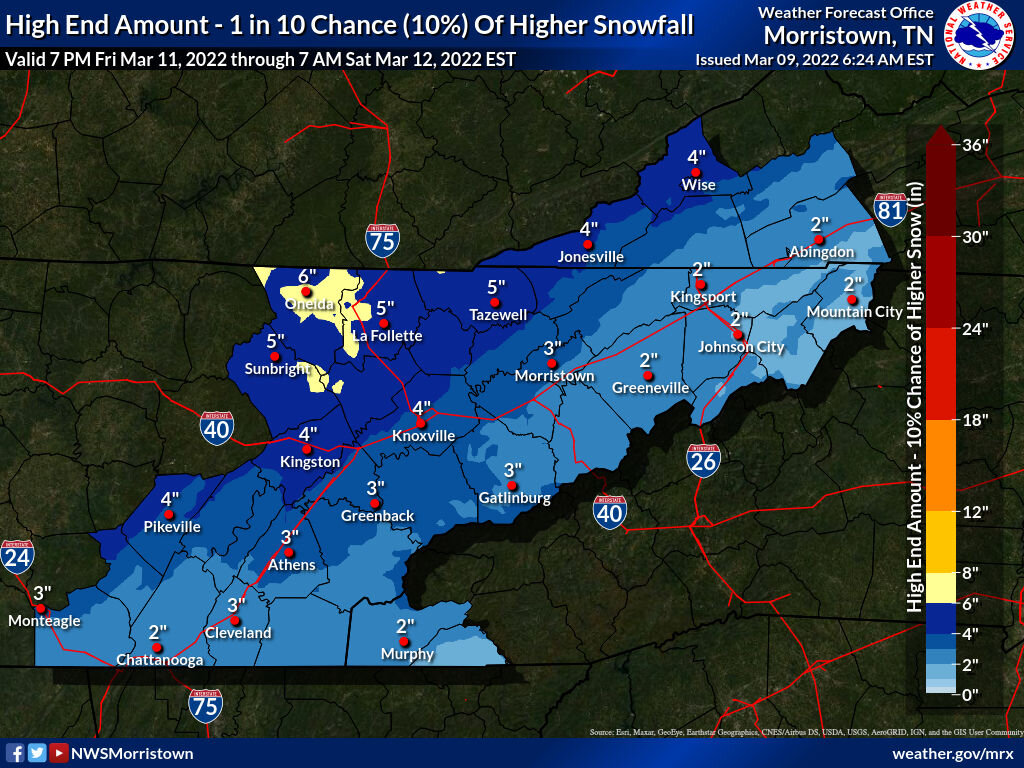
March 11th-13th Winter Weather Event. Winter's last gasp?
jrips27 replied to Windspeed's topic in Tennessee Valley
For sure - just not sure I can risk getting stuck on a mountain somewhere. Need to be back in Atlanta by Sunday afternoon. I found a place at 3000 feet southwest of Gatlinburg on January 3rd and we got 8 inches. Was a lot of fun. They will probably see that if not more like you said. -
March 11th-13th Winter Weather Event. Winter's last gasp?
jrips27 replied to Windspeed's topic in Tennessee Valley
Going back and forth between coming up to your area or trying to get somewhere with some elevation near Gatlinburg. Probably will be a game time decision tomorrow evening. -
March 11th-13th Winter Weather Event. Winter's last gasp?
jrips27 replied to Windspeed's topic in Tennessee Valley
3K NAM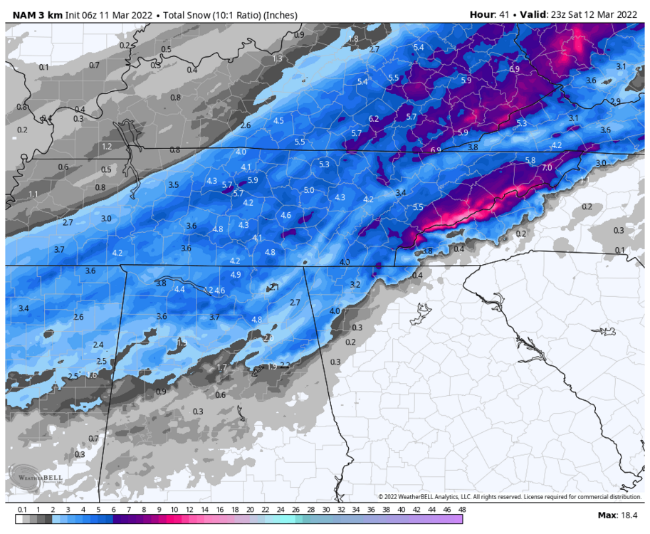
-
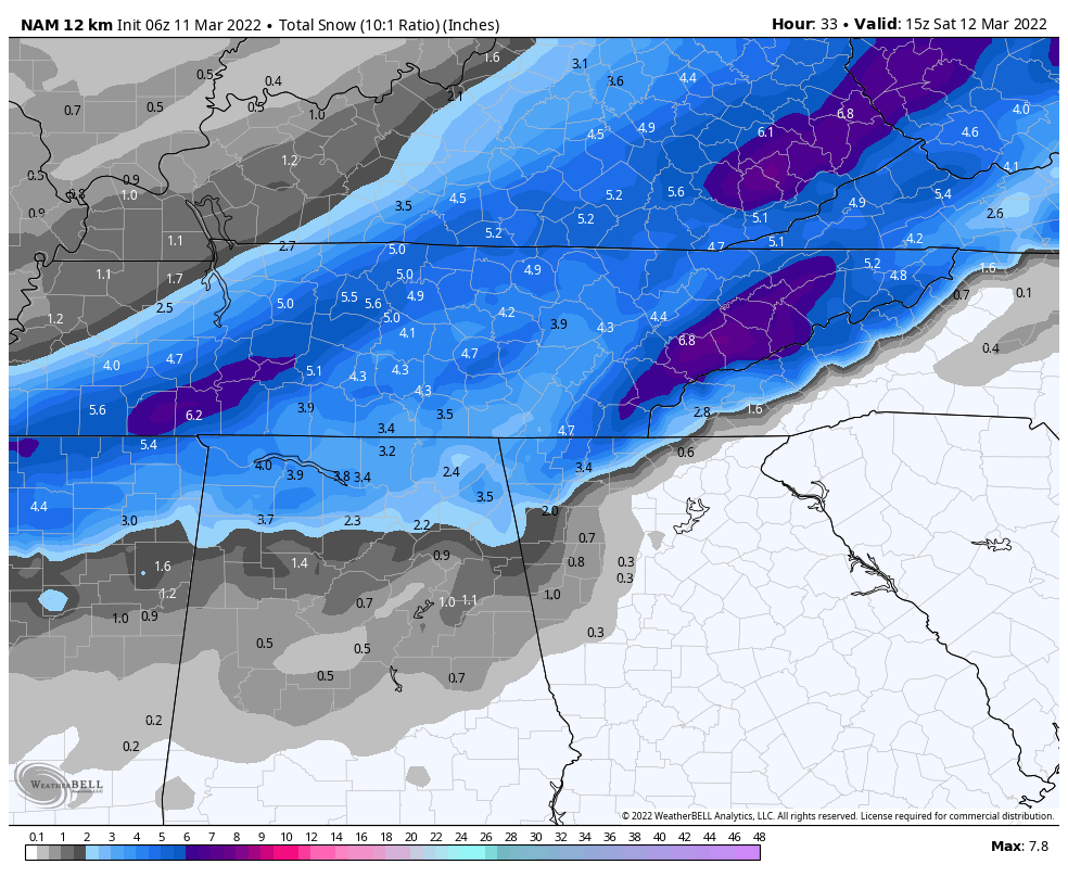
March 11th-13th Winter Weather Event. Winter's last gasp?
jrips27 replied to Windspeed's topic in Tennessee Valley
12k NAM backed off on those higher totals on the plateau, but it’s better for the Chattanooga area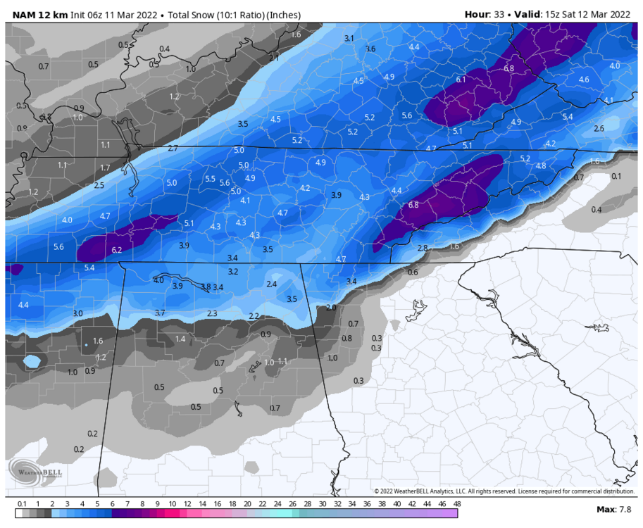
-
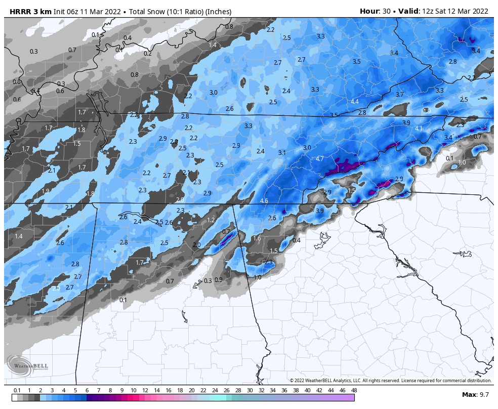
March 11th-13th Winter Weather Event. Winter's last gasp?
jrips27 replied to Windspeed's topic in Tennessee Valley
HRRR is kind of all over the place run to run
-
March 11th-13th Winter Weather Event. Winter's last gasp?
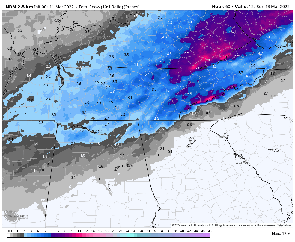
jrips27 replied to Windspeed's topic in Tennessee Valley
0z National Blend of Models (NBM) is up a good bit versus the 18z run. Might see some totals raised overnight.
-
March 11th-13th Winter Weather Event. Winter's last gasp?
jrips27 replied to Windspeed's topic in Tennessee Valley
definitely a better run for most of y’all. Hell even gets an inch down my way 10:1 ratio kuchera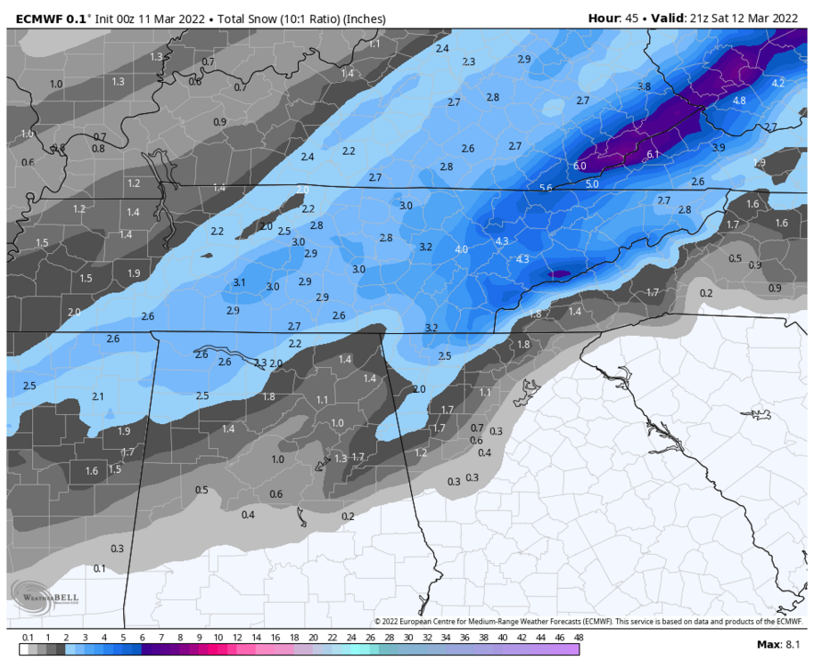
-
March 11th-13th Winter Weather Event. Winter's last gasp?
jrips27 replied to Windspeed's topic in Tennessee Valley
Beauty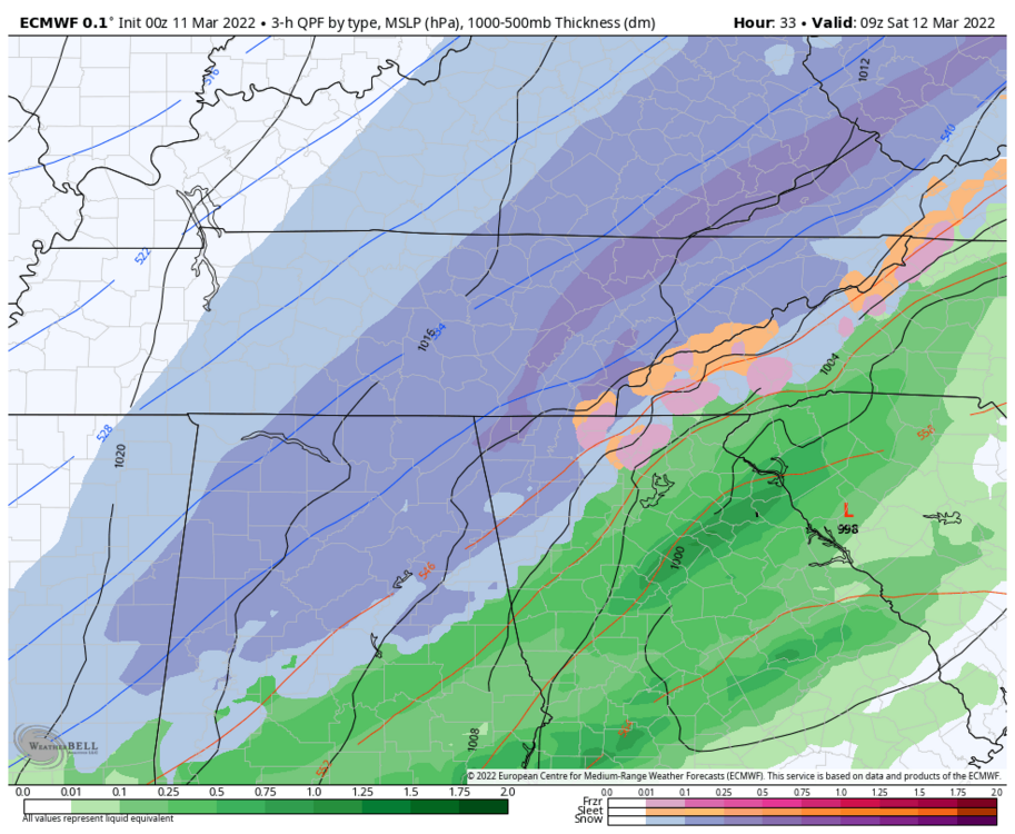
-
March 11th-13th Winter Weather Event. Winter's last gasp?
jrips27 replied to Windspeed's topic in Tennessee Valley
Any suggestions on a good place to head up to tomorrow night? Might take a trip up from Atlanta. Looking for maximum snowfall obviously A decent sized town not too far off the interstate would be nice. I trust y’all’s knowledge of the terrain and sweet spot. Thanks y’all! -
March 11th-13th Winter Weather Event. Winter's last gasp?
jrips27 replied to Windspeed's topic in Tennessee Valley
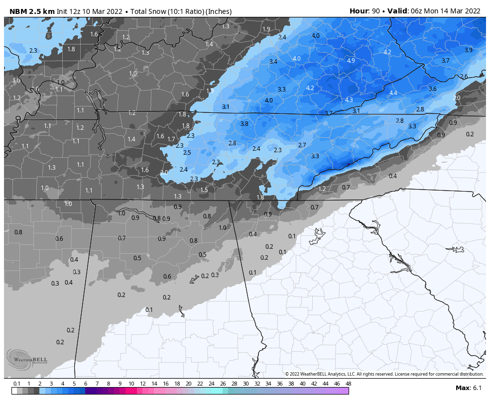
Here was 12z National Blend of Models
-
March 11th-13th Winter Weather Event. Winter's last gasp?
jrips27 replied to Windspeed's topic in Tennessee Valley
Hammer time on the HRRR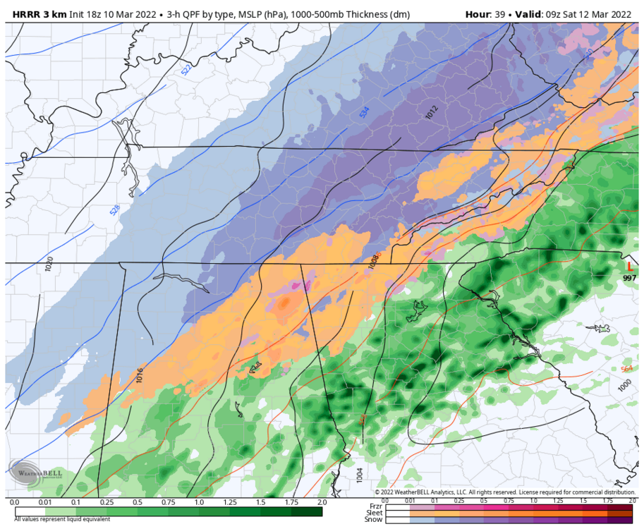
-
March 11th-13th Winter Weather Event. Winter's last gasp?
jrips27 replied to Windspeed's topic in Tennessee Valley
Not too shabby 1 hour snow rates for y’all from the 3K NAM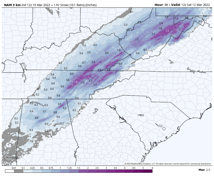
-
March 11th-13th Winter Weather Event. Winter's last gasp?
jrips27 replied to Windspeed's topic in Tennessee Valley
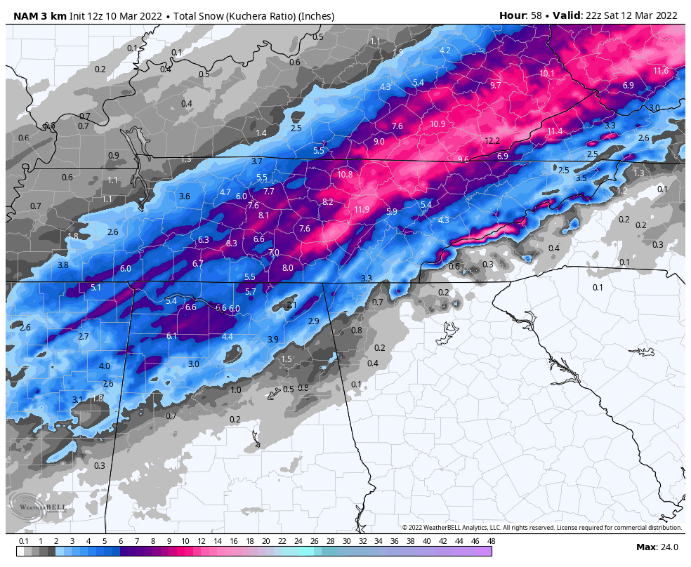
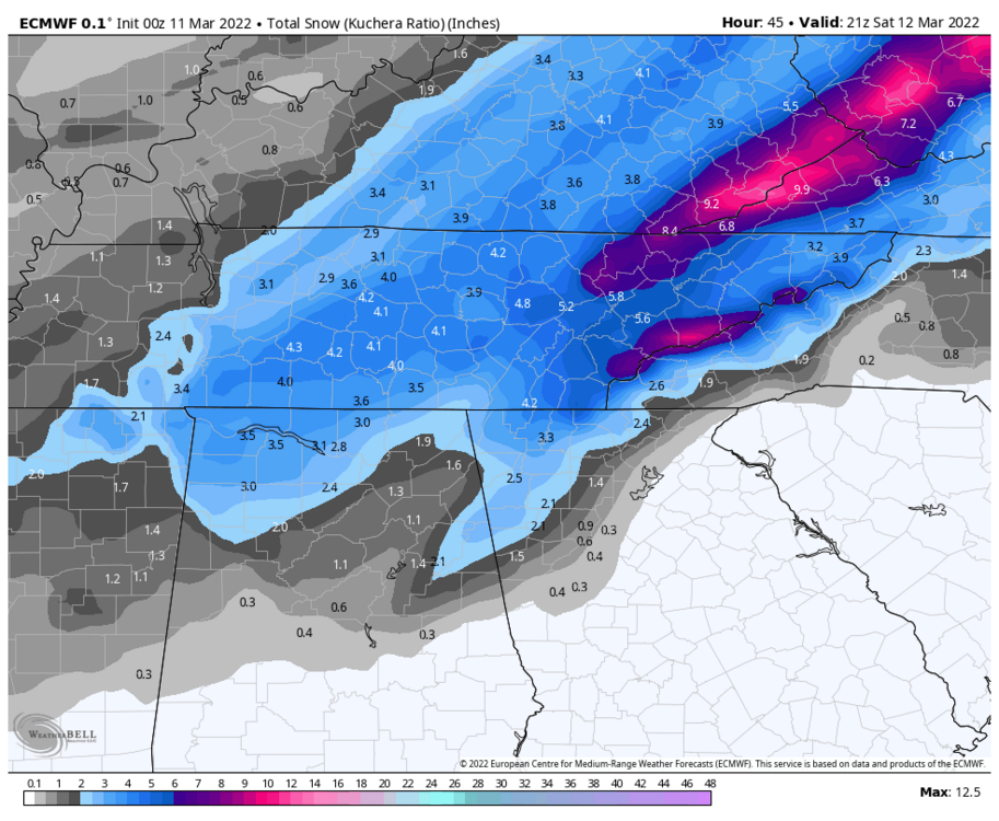
Here’s the 3K NAM 10:1 ratio Kuchera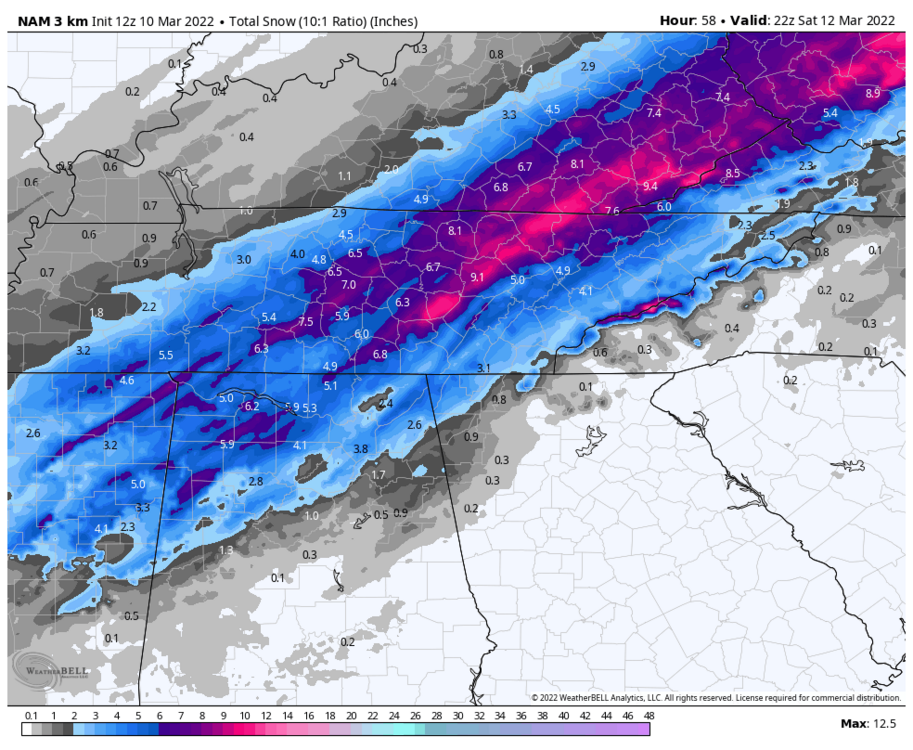

-
March 11th-13th Winter Weather Event. Winter's last gasp?
jrips27 replied to Windspeed's topic in Tennessee Valley
Kuchera if anyone needs it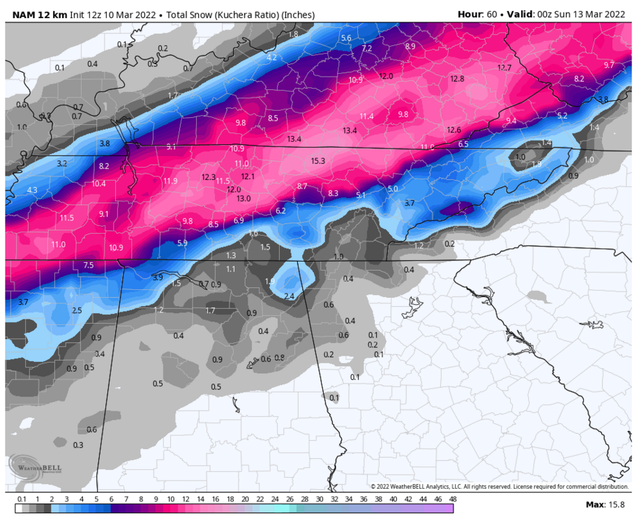
-
March 11th-13th Winter Weather Event. Winter's last gasp?
jrips27 replied to Windspeed's topic in Tennessee Valley
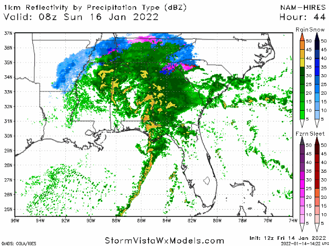
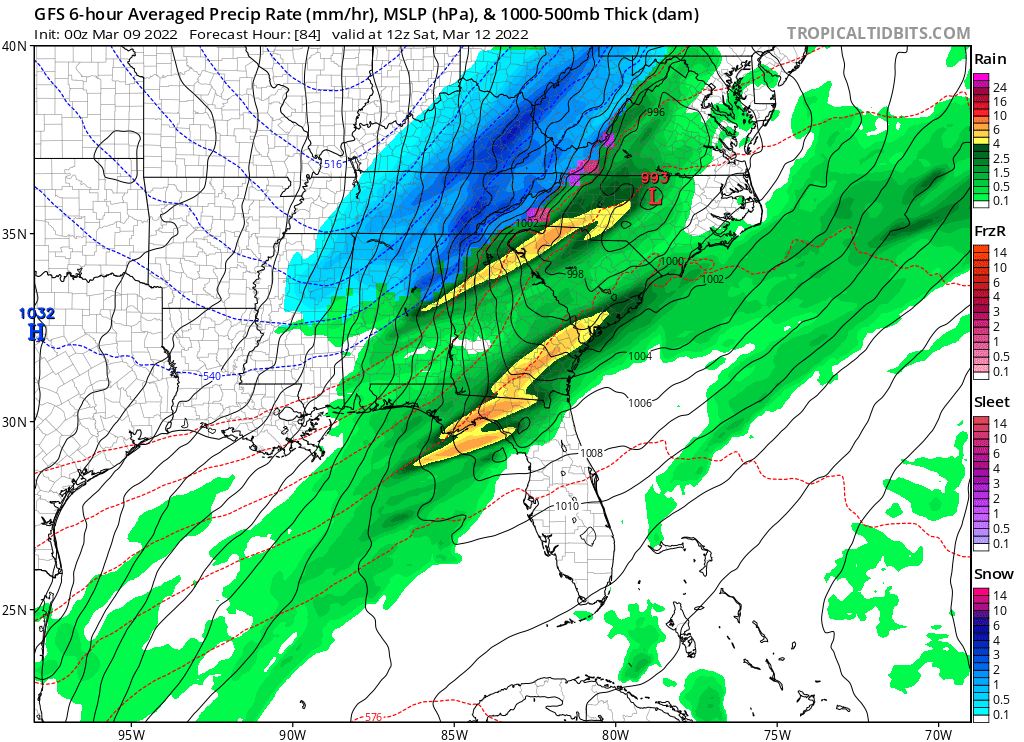
NAM smokes middle TN -
March 11th-13th Winter Weather Event. Winter's last gasp?
jrips27 replied to Windspeed's topic in Tennessee Valley
That’s the 6z -
March 11th-13th Winter Weather Event. Winter's last gasp?
jrips27 replied to Windspeed's topic in Tennessee Valley


-
March 11th-13th Winter Weather Event. Winter's last gasp?
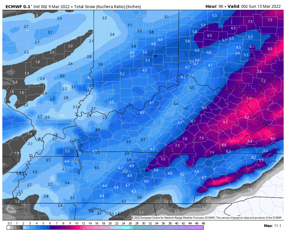
jrips27 replied to Windspeed's topic in Tennessee Valley
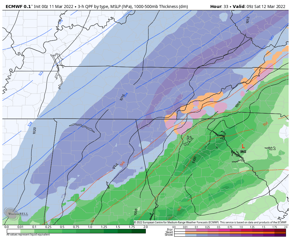
Euro looks great for almost everyone in this forum (except maybe Chattanooga) Feels like this might be a storm where you need to use 10-to-1 because of how warm the ground is going in 10-to-1 mapkuchera map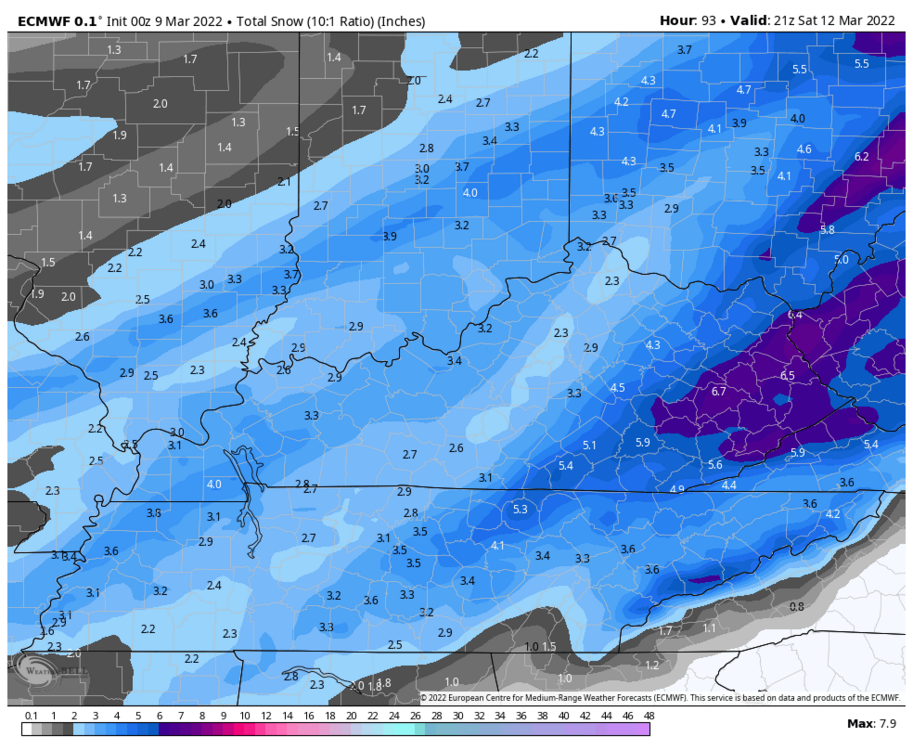
-
March 11th-13th Winter Weather Event. Winter's last gasp?
jrips27 replied to Windspeed's topic in Tennessee Valley
Looks good for most of you. Might be worth a snow chase!
-
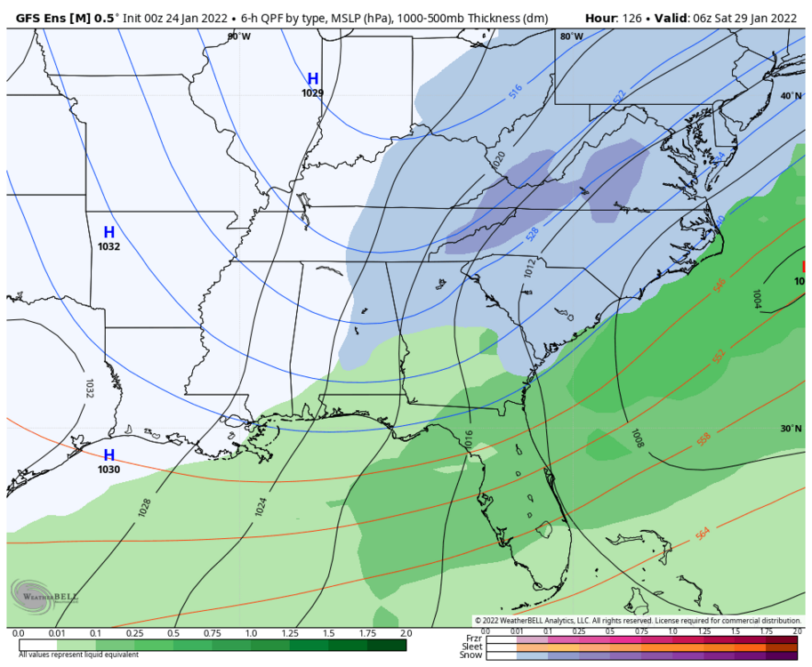
Quite the trend on the GEFS
-
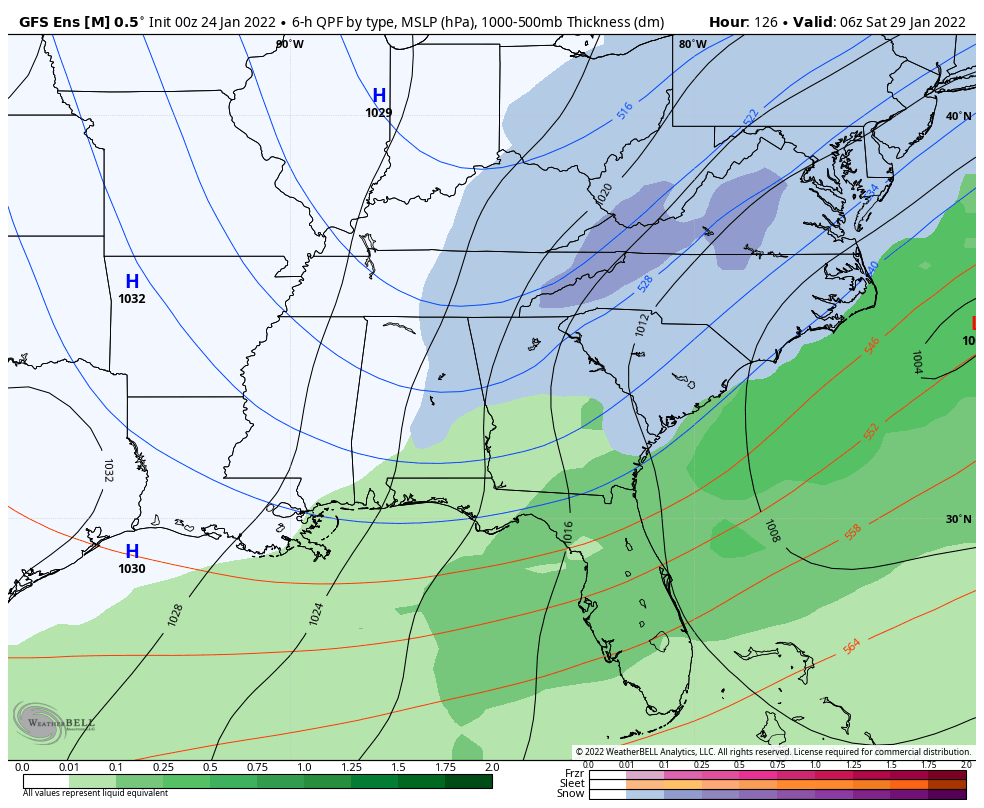
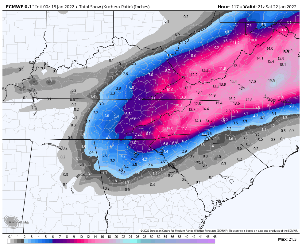
January 20-22 “bring the mojo” winter storm threat
jrips27 replied to lilj4425's topic in Southeastern States

-
Escalating quickly here
-
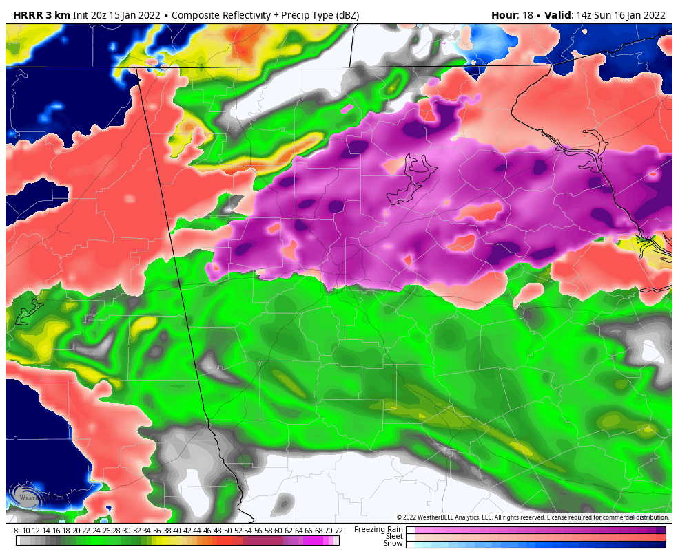
Man. What a wedge on the HRRR. Textbook. I'll be riding it out east of alpharetta on the forsyth and fulton line.

-
12-18 for Nashville? That sounds really high. Where are you getting that from? I think 4-8 inches seems much more reasonable and it’s a bit higher than what is currently progged there by the NWS.
-
Grit posted the 1K on another board if anyone wants it