It's Always Sunny
-
Posts
1,947 -
Joined
-
Last visited
Content Type
Profiles
Blogs
Forums
American Weather
Media Demo
Store
Gallery
Everything posted by It's Always Sunny
-

Active mid December with multiple event potential
It's Always Sunny replied to Typhoon Tip's topic in New England
Yeah because if I recall a couple days ago it was looking more B like but now it appears to dip more into that Gulf moisture. Probably one of the reasons why QPF has gone up. -
Active mid December with multiple event potential
It's Always Sunny replied to Typhoon Tip's topic in New England
Is it just me or is the Dec 16/17 storm beginning to look more Miller A-esque? Almost a Miller A/B hybrid kind of. -
Yeah looks like Euro has better phasing
-
Damaged goods. We cut and move on.
-
I thought you meant it like that lol.
-
Ok I see it now. Thanks!
-
What is the click path to get the model comparison chart on WxModels? I can't seem to find it.
-
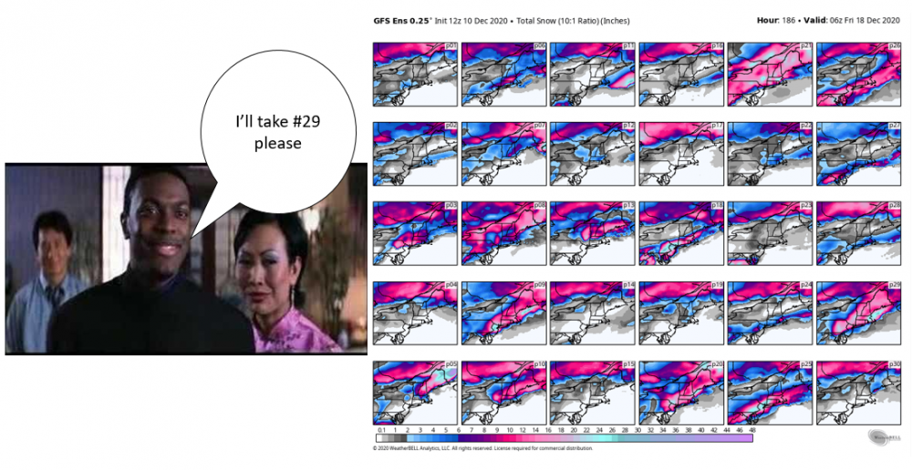
#21 is a good solution for everyone to sip the Kool-Aid I agree. I like #29 mainly bc it crushes I-95 and east and tickles northern portions of 495 from what I can tell.
-
-
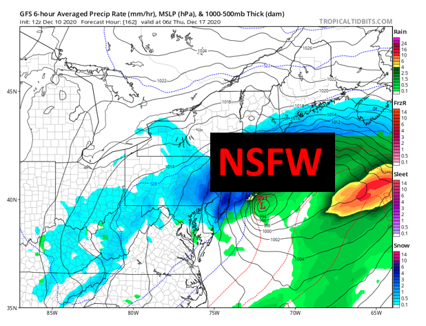
Just got this at work...
-
Doesn't sound like he's on the road to trade school like you had hoped for a few years ago lol.
-
Lol. Scott had his son looking at weather models the day he came home from the hospital.
-
For sure. I had a few days off but earlier this week it wasn't looking as good as it does now for second half of the month. Trending in the right direction.
-
ICON the dark horse
-
Agree...it's not even what I consider a classic CAD setup. Maybe for NH & ME, sure but for MA not seeing it.
-
I thought this was the New England forum, not NY.
-
Haha not likely but you never know. My wife and I both moved to TX separately never thinking we'd be here this long lol.
-
I think it really depends on a few things: how that Rex Block breaks down, how soon after the low over the west coast lifts out once blocking departs and how that s/w interacts w/ what comes out of Pac NW. If I had to place a bet I'd still say it cuts but those are three things that I think could cause models to tick east. Yesterday's storm was originally a cutter around December 1st and it became a coastal so I think there's at least some room for optimism.
-
There's still a chance for that Dec 13-14th event to amount to something for New England. Models have a Rex Block set up over western US which then eventually breaks down and that ridging pattern traverses the rest of the country with our next storm system trailing it. Unfortunately that could very well lead to it cutting it just depends on how much that ridging breaks down out ahead of it. Chances don't look great though but maybe get some back end snow out of it.
-
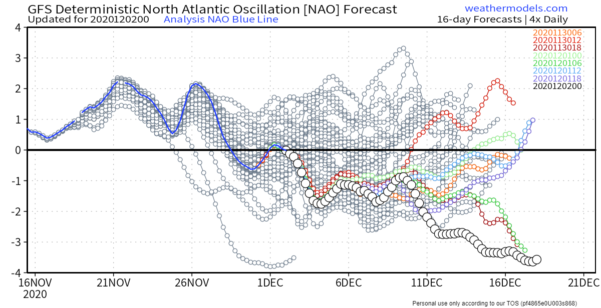
Otoh, NAO goes all Ying-Tang Twin mid-month which is good to see for the latter half of the month.
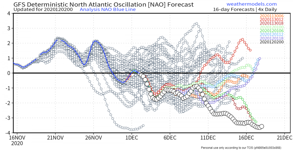
-
Tough break for SNEers with this weekend's upcoming storm. Ridging out west is usually welcomed but in my personal opinion it's almost too much (amplified). It's to the point where it breaks anticyclonically and "pinches off" the mid level low currently over TX Panhandle, preventing it to dig further south which is what needs to happen at this point to get any sort of favorable track to get that cold air to fill in NW of the surface low. I was looking even beyond that and around Dec.13-14th timeframe another massive low develops but it's behind the remnants of a deteriorated Rex Block which slides east and gives ya'll a cutter. You'll need the umbrella more than the shovel. I'm not completely throwing in the towel on these two events for SNE yet but definitely concerned about the synoptic setup. I may end up with more snow than some of you up there
-
FWIW 00Z EPS has higher snowfall for upstate NY, nrn VT, nrn NH, and far nrn ME compared to 12Z. GEFS solution still on low end for areas mentioned.
-
00Z Euro is better for nrn NH
-
I even think Dec.9 coastal has a chance to tick further west that s/w tugging it south and east appears a bit wonky.
-
Yeah 00Z GFS looks much better for nrn NH....much further east with LP.