wxmeddler
-
Posts
6,872 -
Joined
-
Last visited
Content Type
Profiles
Blogs
Forums
American Weather
Media Demo
Store
Gallery
Everything posted by wxmeddler
-
The orioles mascot is a stupid bird and needs a re-brand. Nobody can take it seriously.
-
My wife runs her own business and got a fairly large work/job client offer. Went all the way through the on-boarding process, they even sent 20% down but the check bounced and their "english is my second language so apologies if my emails come off weird" started to fall apart. Was just a big scam. Reported to the police and state fraud center. It's scary how good these scammers are getting with help from AI and such. Really frustrating. I'm sorry that happened to her.
-
I wish I made 150k. A lot of butthurt for frozen water. A board classic since 2006(?).
-
Snow is turning soft in the sunny areas. This would be a good day to break it up and spread it out if you don't want it there.
-
 Because the 850 low went up the Ohio Valley!
 -
Most of you all missed out on when EasternWx / AmWx had conferences. Amazing memories. The confrence threads are likely still around somewhere.
-
The sleet really created a heck of a glacial layer that's got an enormously high albedo. That combined with the temps, this snow isn't melting for at least another 2-3 weeks.
-
Sun angle season is upon us
-
The last week has felt like when I was living in Fargo, it's been great.
-
The weenies got a taste of meat after feeding on veggie scraps for years and are rabidly hunting for more. Edit: Do I also consider myself in this category. Yes. Don’t @ me.
-
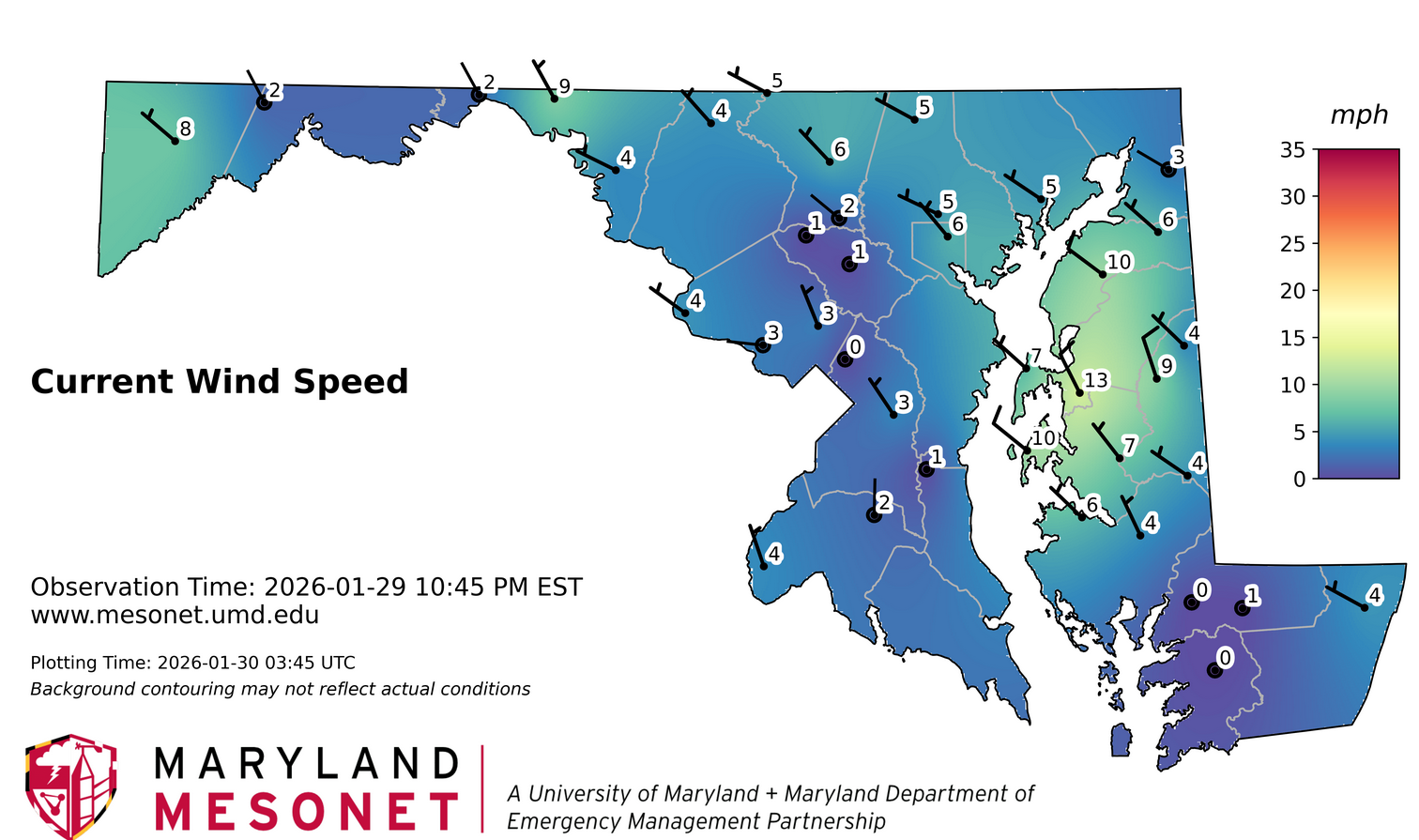
For everyone’s awareness the Clarksville Mesonet location is in a bit of a cold sink. Not at the bottom of it, but down far enough to have it be anomalous compared to the surrounding area. The Hancock station (-9) is in a park that a stream runs through. Likely colder, but not anomalous of other low areas in the broader ridge/valley region.
-
Just die (wind)
-
The snow pack is actually saving the underground water infrastructure right now. Our sub-surface temperature probes have hardly moved post storm. Still safely above freezing below about 4" depth.
-
The Jan 31 Potential: Stormtracker Failure or 'Tracker Trouncing
wxmeddler replied to stormtracker's topic in Mid Atlantic
Convective feedback issues. -
The thing to realize about dew points in this range is that the difference in water vapor between 10F and 0F is between bupkis, and slightly less than bupkis. Once you get down to negatives you're in "absolute bupkis" territory. That is to say that radiational cooling (~200 W/M^2) will absolutely overwhelm whatever tiny vapor pressure is being released by sublimination. Long-Wave radiational cooling will tank the temperatures (and therefore dew points) if given the chance to do so. The only thing that will stop radiational cooling is a blockage of the long wave infrared energy to space (ie. Clouds or Fog).
-
The Jan 31 Potential: Stormtracker Failure or 'Tracker Trouncing
wxmeddler replied to stormtracker's topic in Mid Atlantic
I remember when I first started tracking these things 84hrs was just getting into "what the **** are we dealing with range" not "ass hair ticks" range. Oh how times have changed, and yet I'd love to still be surprised Jan '00 style. -
The Jan 31 Potential: Stormtracker Failure or 'Tracker Trouncing
wxmeddler replied to stormtracker's topic in Mid Atlantic
Takeaways for the 0z runs are that that the globals are still shifting with the northern stream and fairly large disagreements remain. Accentuated by the fact the evolution is very sensitive. Convective feedback / parameterization issues starting to show with the rapid deepening. We wait. -
The Jan 31 Potential: Stormtracker Failure or 'Tracker Trouncing
wxmeddler replied to stormtracker's topic in Mid Atlantic
Interesting
-
The Jan 31 Potential: Stormtracker Failure or 'Tracker Trouncing
wxmeddler replied to stormtracker's topic in Mid Atlantic
H5 is a tick west. Precip is a tick east. No winners though. -
The Jan 31 Potential: Stormtracker Failure or 'Tracker Trouncing
wxmeddler replied to stormtracker's topic in Mid Atlantic
Convective feedback issues. It will sort itself in the next few frames. -
Dr. No strikes again
-
Haven't seen him walking around the building this week, I think he's at AMS in Houston.
-
-
Two more days of “ Check back in every 12 hours” mode till we close the book for the I-95. Ocean City maybe a day after that.
-
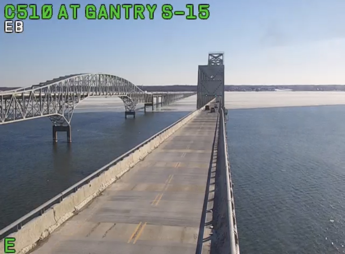
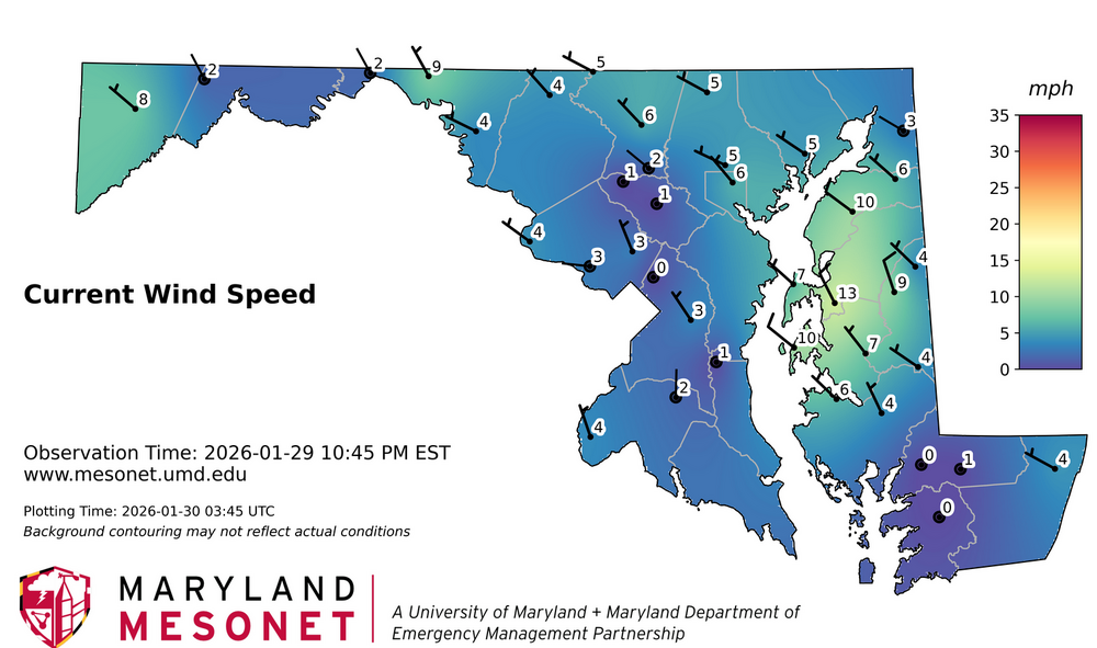
Winds definitely stayed up last night and prevented the low single digits in most places. Those that did go calm got to the advertised 5 deg-ish fairly easily. Look at all the ice that got pushed to the east side of the bay yesterday to Kent Island.