mahantango#1
-
Posts
5,043 -
Joined
-
Last visited
Content Type
Profiles
Blogs
Forums
American Weather
Media Demo
Store
Gallery
Everything posted by mahantango#1
-
Looks like pixie dust falling from the sky.
-
It's a gem alright!
-
Lucky we didn't have a foot of fresh snow on the ground with those winds today.
-
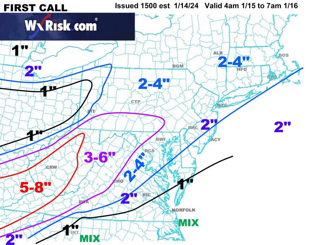
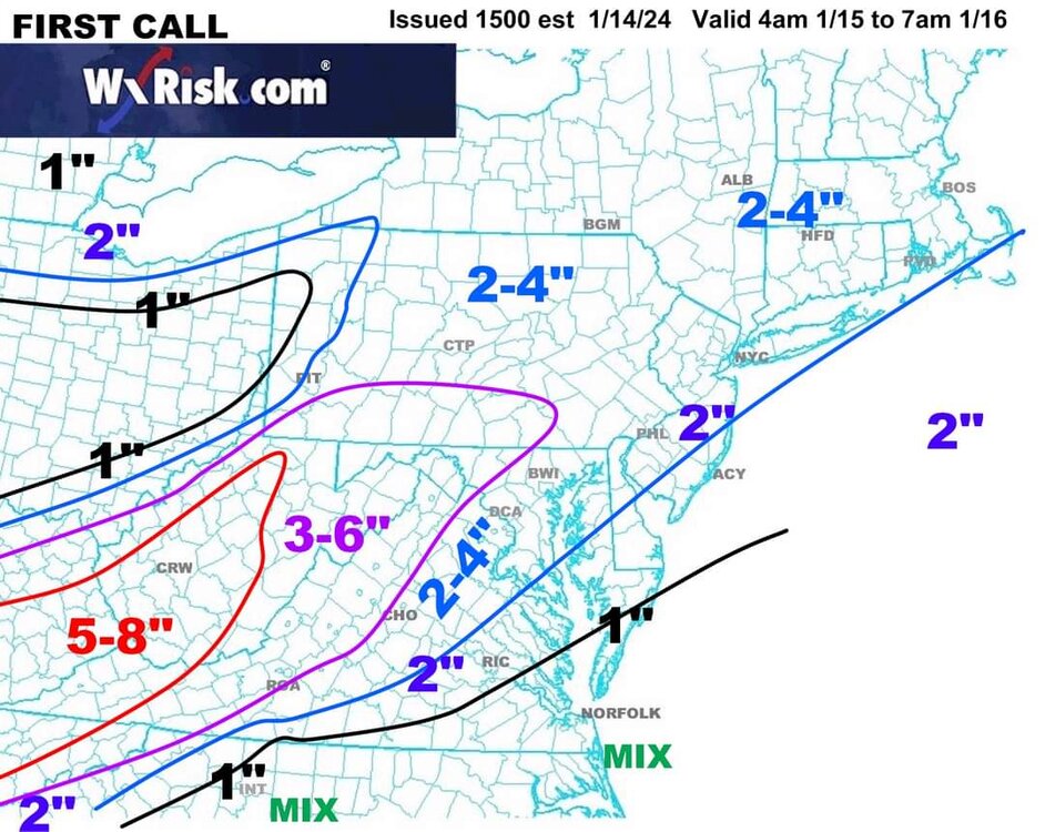
DT first call
-
My son recorded a 64mph wind gust on his ws5000 today.
-
That escalated quickly!

-
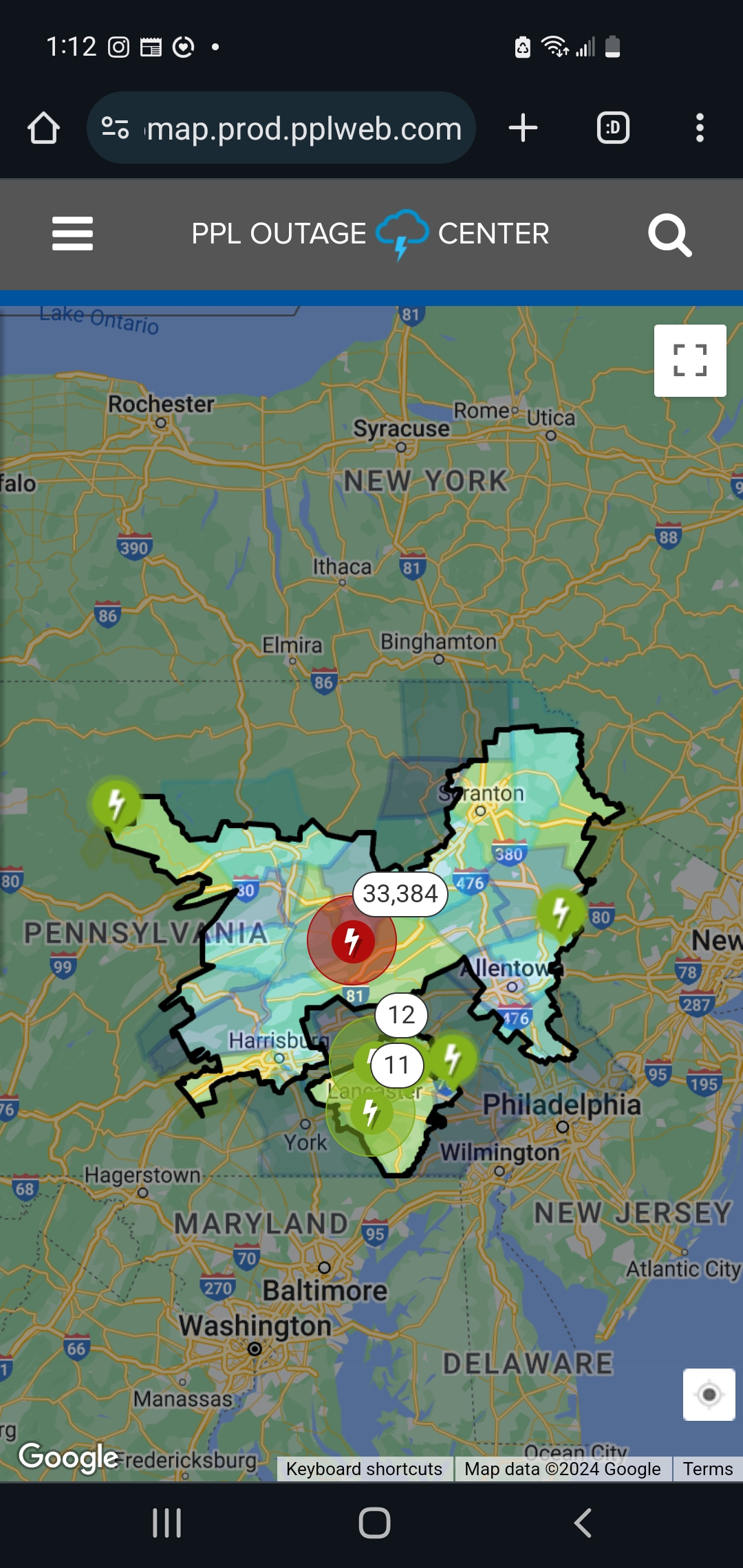
Wind is fierce. Over 14000 customers are without power in PPL coverage area.
-
Everything got coated when a squall just came through.
-
-
-
Instead of punting.. I guess the right term to use is its time to move the goal posts again.
-
One thing for certain the sun has been absent lately.
-
-
It seems like he knows what he's talking about.
-
Time to bring back the snowstorms of yesteryear.
-
THIS WEEK IN WEATHER 10 JAN 2024https://youtu.be/Xp4T2qzEZWU
-
From my place.
-
Finished with 1.60 rain for the event. I hope we don't get too much rain from the event this Friday into Saturday as that would make for some bad flooding.
-
They are usually the last to the party.
-
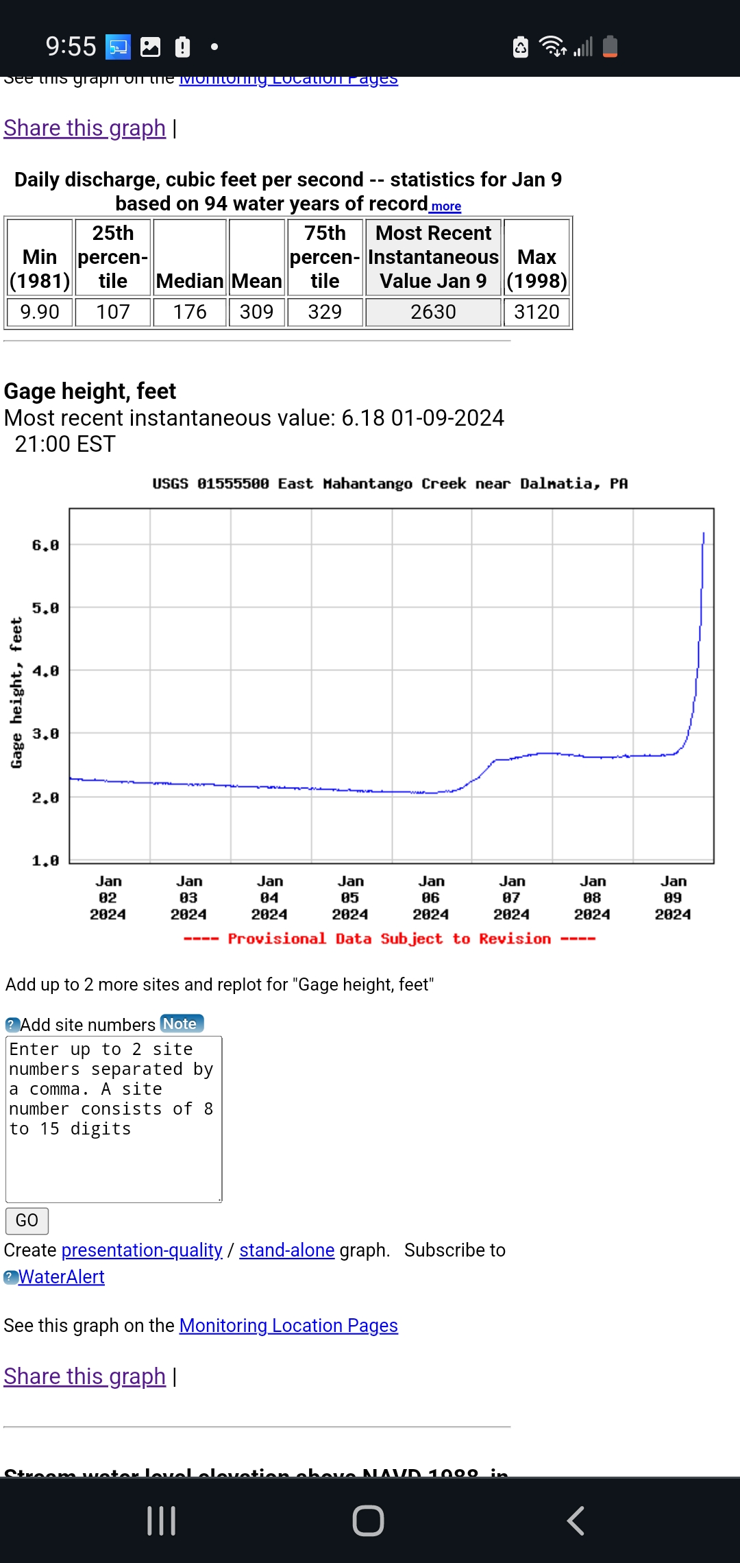
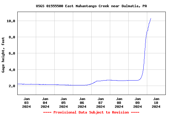
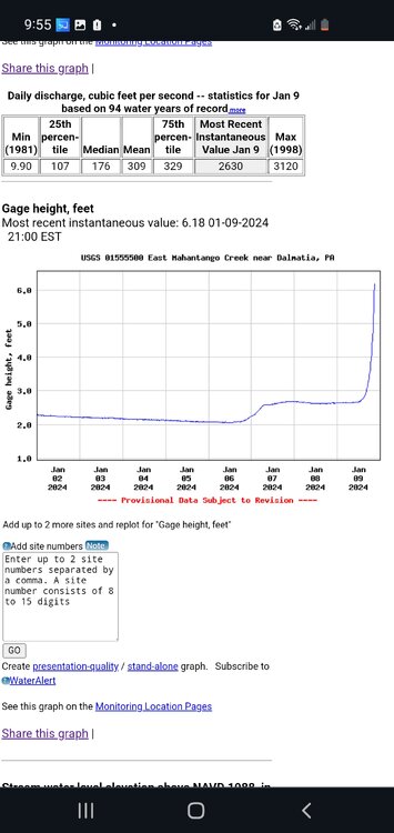
There must have been a lot more rain to the east of me. I didn't expect the creek to rise 8 feet and didn't crest yet. Gage height, feet Most recent instantaneous value: 10.44 01-10-2024 06:00 EST
-
The creek beside me hS risen 4 ft today so far and could rise another1.5-2feet before it crests. It usually takes 4-6 hours after it stops raining at my house till it crests. All that water up stream has to drain in the creek from the orgins of the watershed
-
There are currently over 24000 customers without power in PPL service area.
-
My barometric pressure is low 29.03 that's the lowest i seen in years
-
On a side note, while working outside yesterday. I observed 2 big flocks of geese headed south.
-
Karma has found you. A jinx has been placed on you from the central Pa. weather forum guys.