Met1985
-
Posts
16,564 -
Joined
-
Last visited
Content Type
Profiles
Blogs
Forums
American Weather
Media Demo
Store
Gallery
Everything posted by Met1985
-
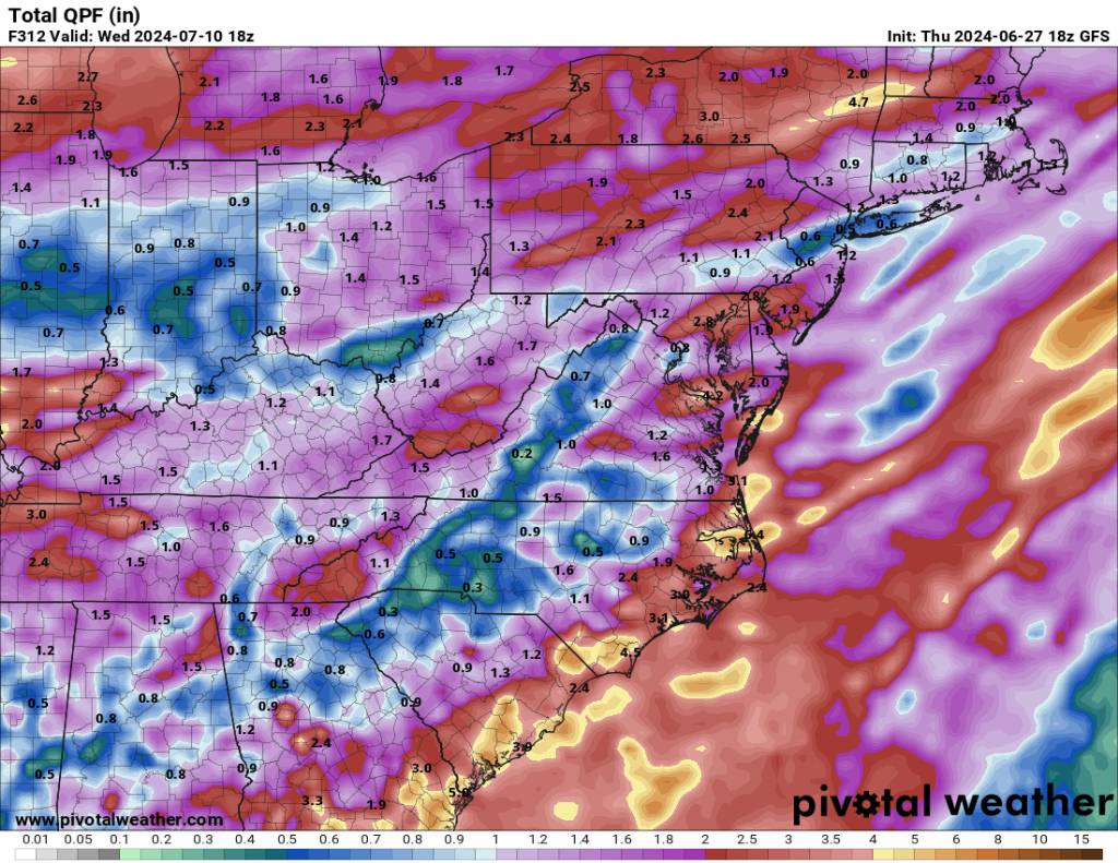
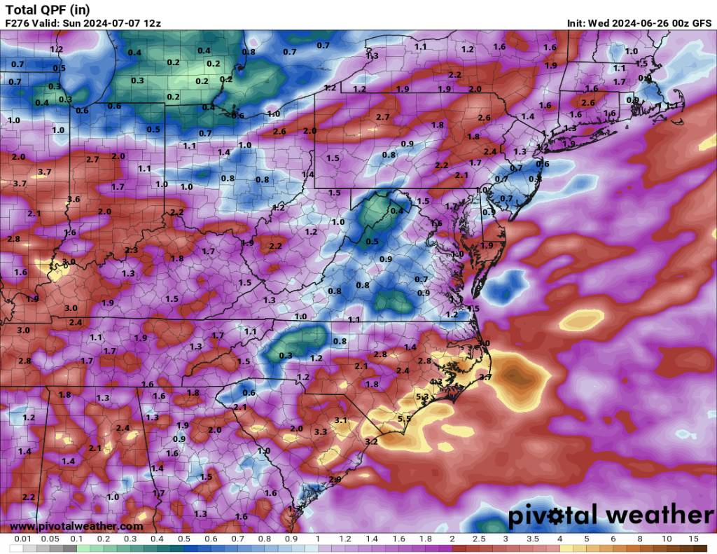
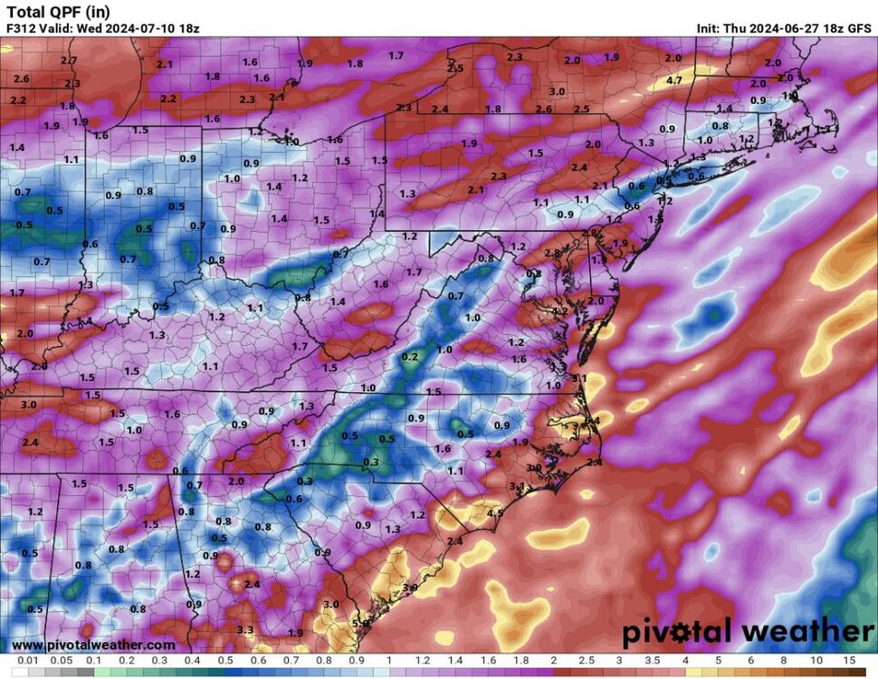
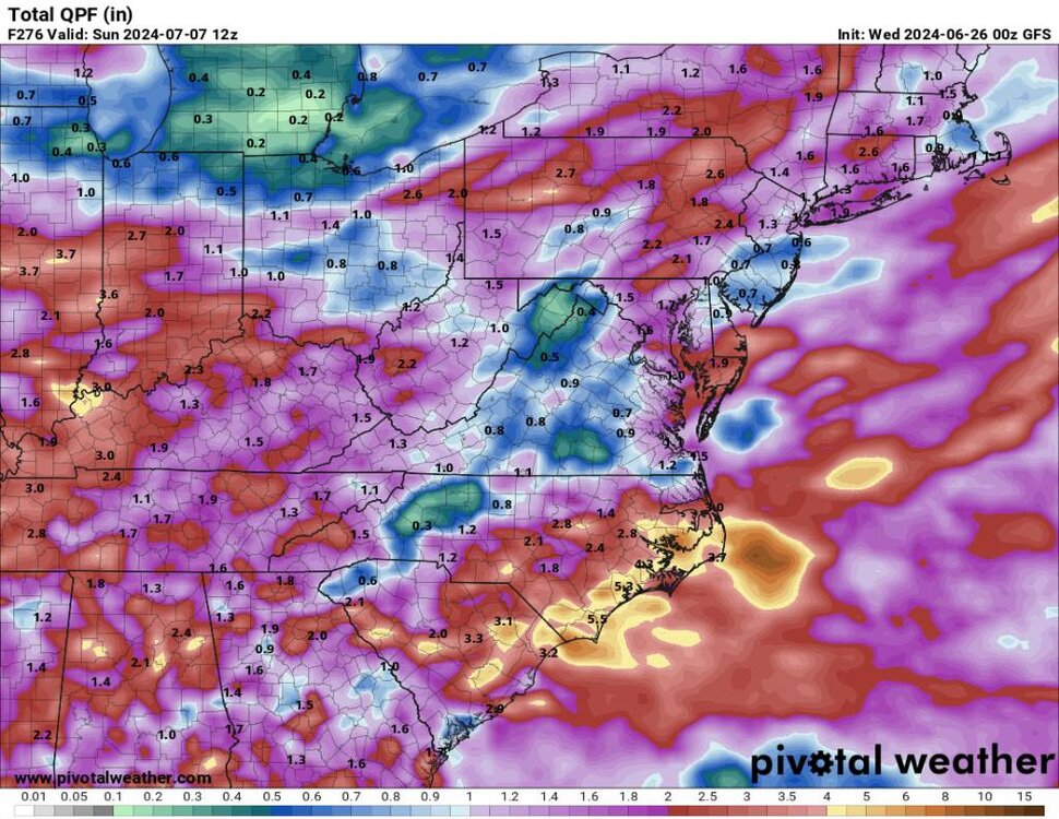
Looks like the mountains will see some decent rains over the next week. Sent from my SM-G998U using Tapatalk
-
Yes sir! Looks like an unsettled weekend which I'm ok with.
-
After a rather warm week we had a half inch of rainfall from this morning and today with a beautiful high of 67! That puts me at an inch of rainfall for the week surprisingly.
-
A beautiful steady rainfall overnight and today. Sitting at 64 degrees.
-
We take small victories!
-
This looks much better. Sent from my SM-G998U using Tapatalk
-
Yes sir! Was 53 here! Absolutely beautiful night and morning.
-
Congrats. We got jipped again. Hasn't rained since we moved the vegetables into the ground. Yeah I saw that. I got woke up to a thunderstorm this morning early and then we got a bit more rainfall around 8 am also.
-
Yep had a high of 76 here with humidity around 59 all day. Current temp is 71. Felt awesome out.
-
Good Lord that's miserable
-
Finally got about a half inch of rainfall from this morning.
-
A beautiful evening Sent from my SM-G998U using Tapatalk

-
Nice. We got a trace over my area. Very hit and miss.
-
Oh yeah I got blanked myself. Hoping today I get some rainfall.
-
Those storms hardly moved last night. Crazy how they just trained over and over for hours. That's why that's considered temperate rain forest.
-

Summer-Fall 2024 Weather Disco Med/Long Range
Met1985 replied to John1122's topic in Tennessee Valley
I'm right there with you! Would love to have a home out there.- 688 replies
-
- 1
-

-
- heat
- thunderstorms
- (and 7 more)
-
Summer-Fall 2024 Weather Disco Med/Long Range
Met1985 replied to John1122's topic in Tennessee Valley
It's literally in the 70s out there and then by Monday a foot plus over 6k feet.... -
Yesterday was picture perfect with a high of 70 and this mornings low of 47 degrees.
-
Yeah this line really blew up as it got into eastern Tennessee.
-
It's coming Sent from my SM-G998U using Tapatalk
-
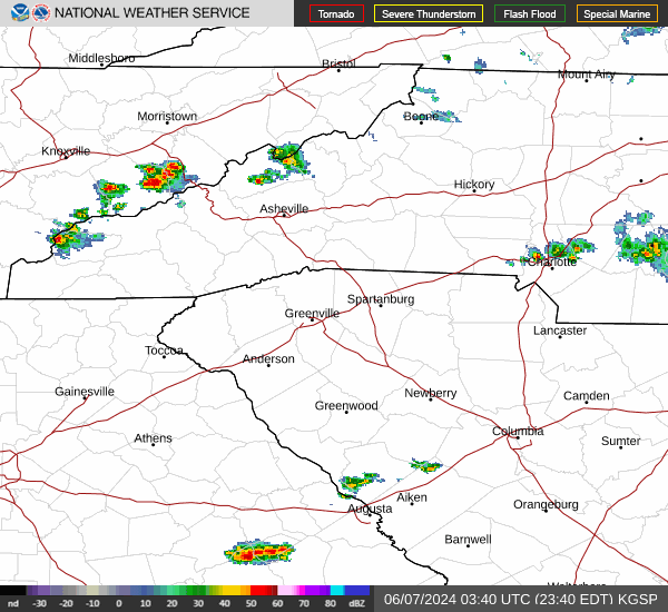
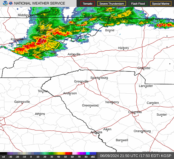
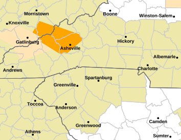
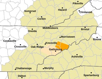
Severe Thunderstorm Warning for... Southern Madison County in western North Carolina... Northern Haywood County in western North Carolina... Buncombe County in western North Carolina... * Until 700 PM EDT. * At 604 PM EDT, severe thunderstorms were located along a line extending from 7 miles east of Newport to 9 miles east of Gatlinburg, moving southeast at 50 mph. HAZARD...70 mph wind gusts and penny size hail.
-
Severe Thunderstorm warning. Sent from my SM-G998U using Tapatalk
-
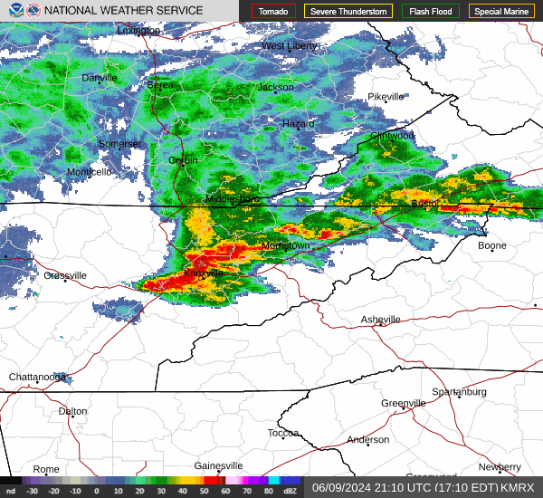
Looks like these storms might be going severe. Sent from my SM-G998U using Tapatalk
-
Looks like some pretty decent storms going to blow through. Sent from my SM-G998U using Tapatalk
-
Looks like some could see some storms tonight. Sent from my SM-G998U using Tapatalk