Met1985
-
Posts
16,895 -
Joined
-
Last visited
Content Type
Profiles
Blogs
Forums
American Weather
Media Demo
Store
Gallery
Everything posted by Met1985
-
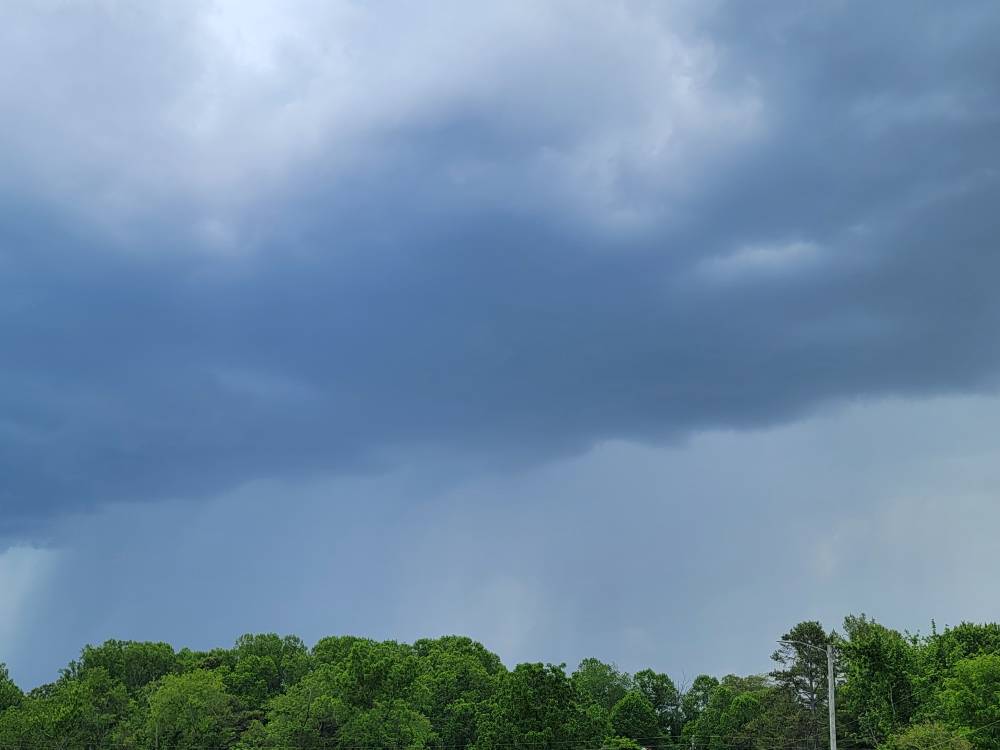
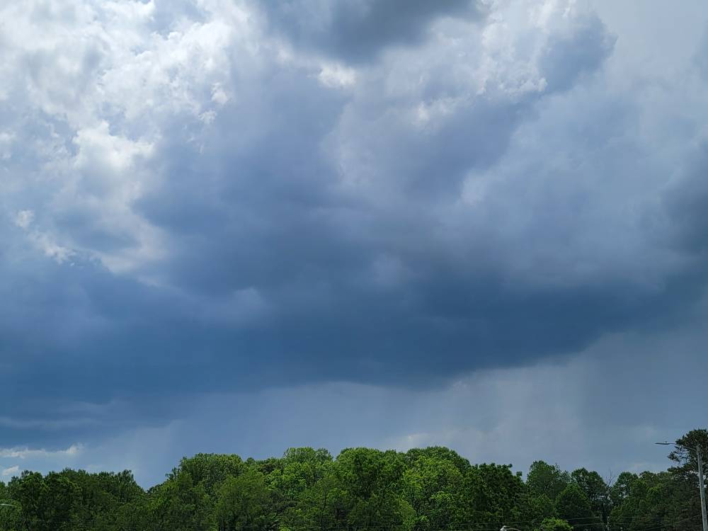
Some really good cloud to ground strikes around the ENKA/ Candler area
-
Getting more organized now. Sent from my SM-G998U using Tapatalk
-
Little cell Sent from my SM-G998U using Tapatalk
-
Got a little cell blowing up on the Haywood Buncombe line currently.
-
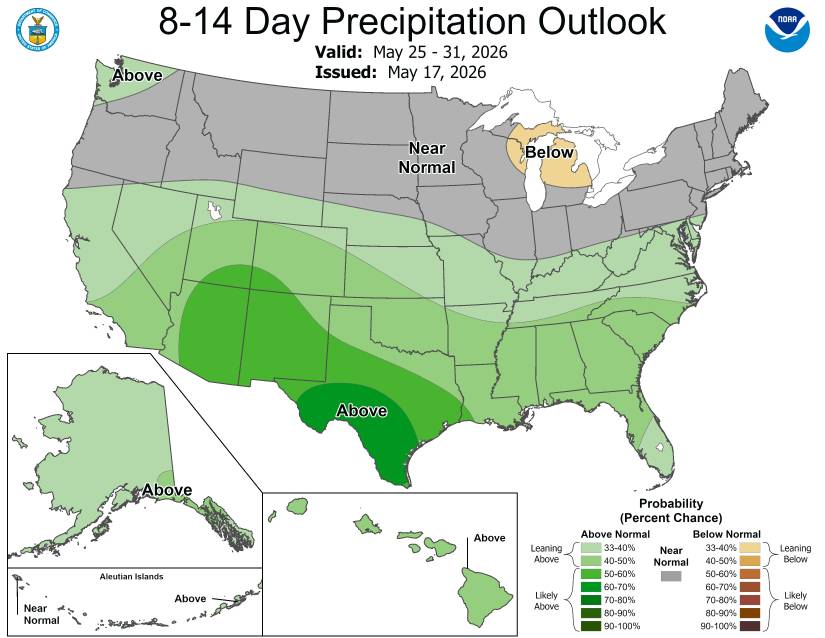
Should be some today.
-
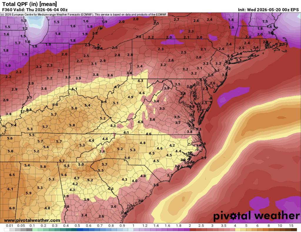
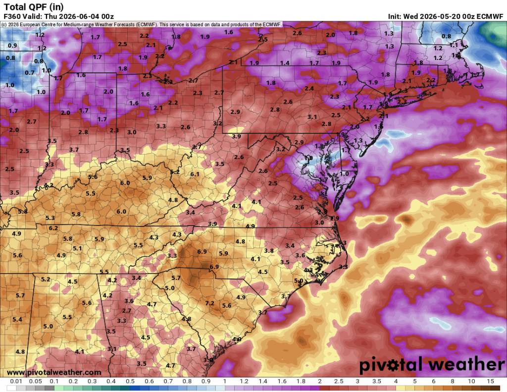
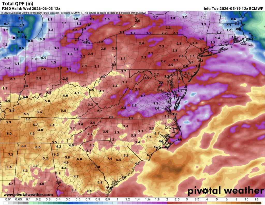
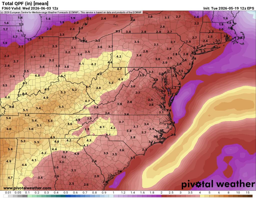
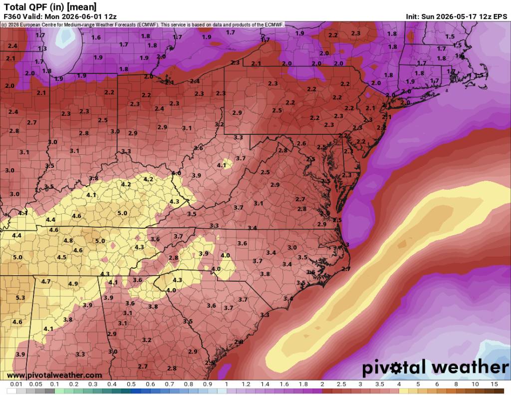
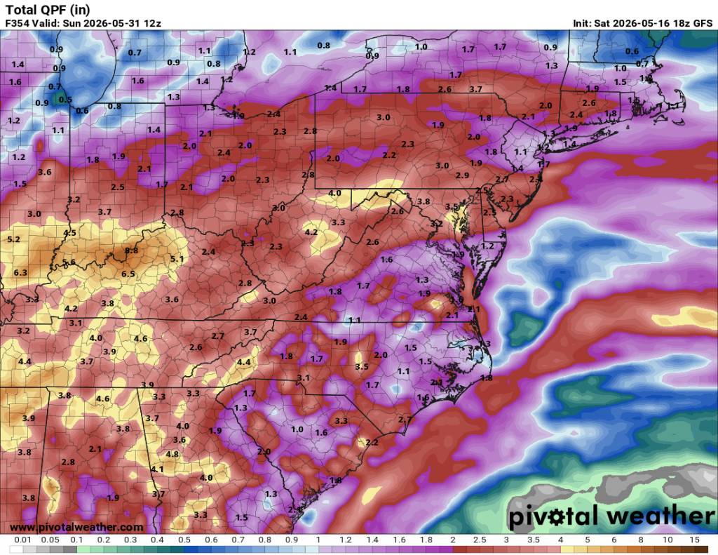
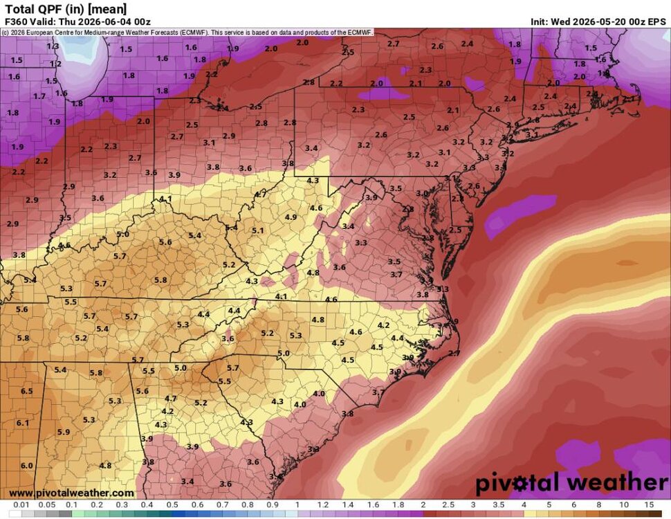
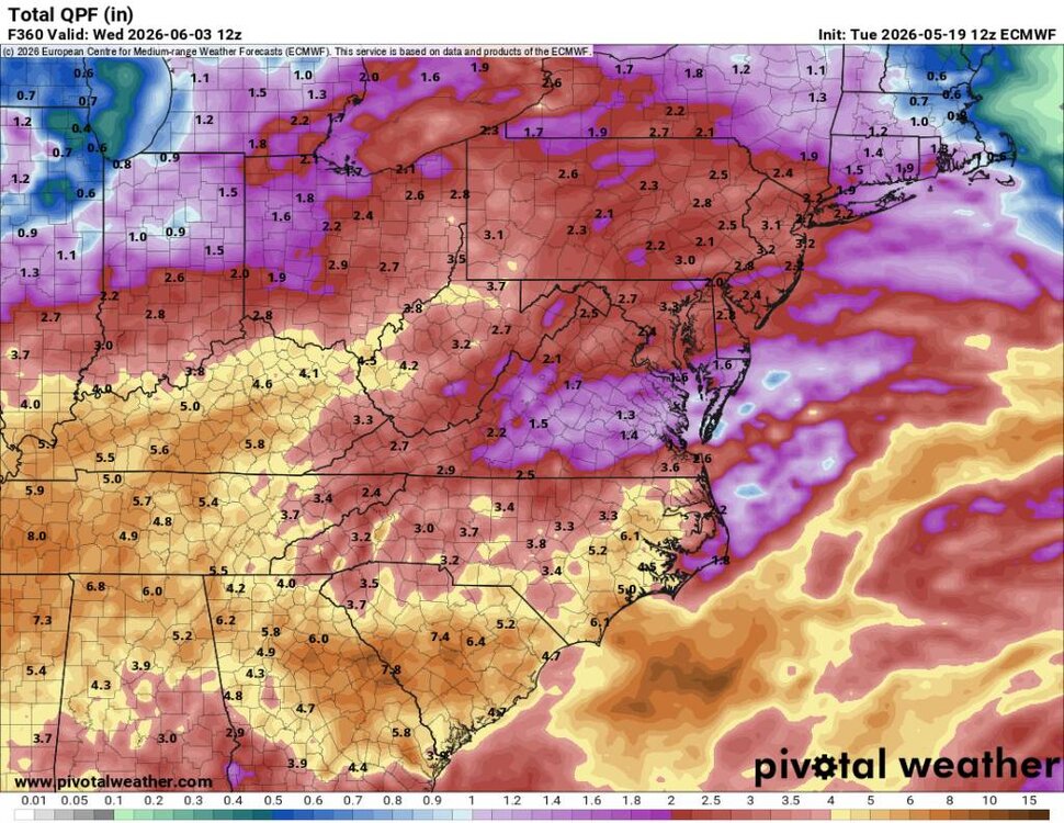
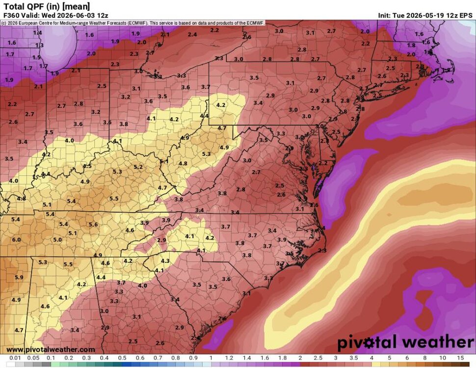
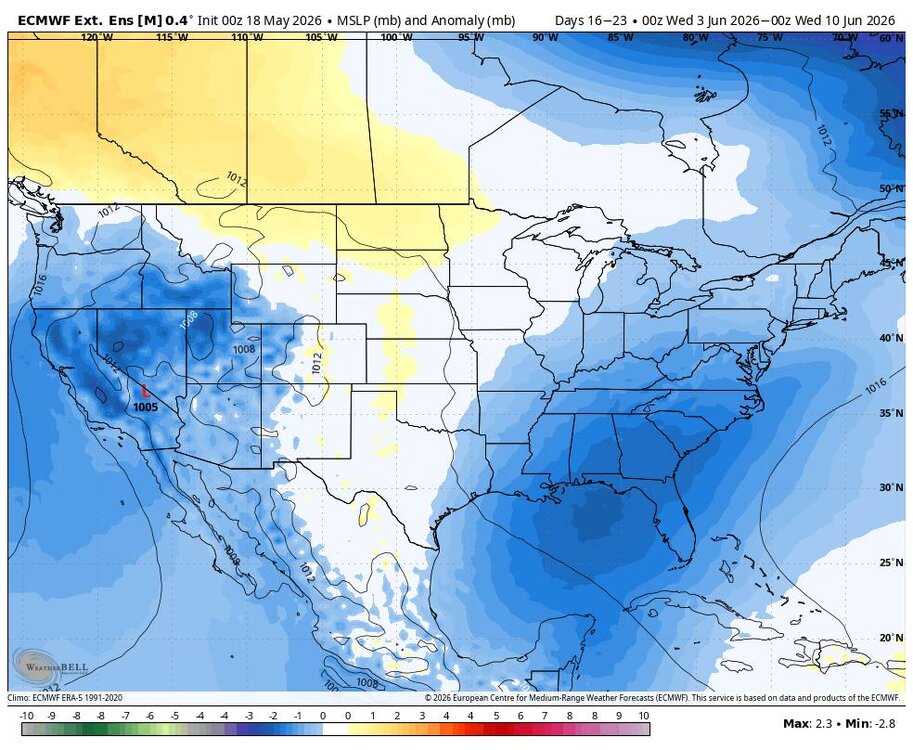
Overnight Euro and EPS are robust. Sent from my SM-G998U using Tapatalk

-
Today's Euro and EPS are steadfast. Sent from my SM-G998U using Tapatalk
-
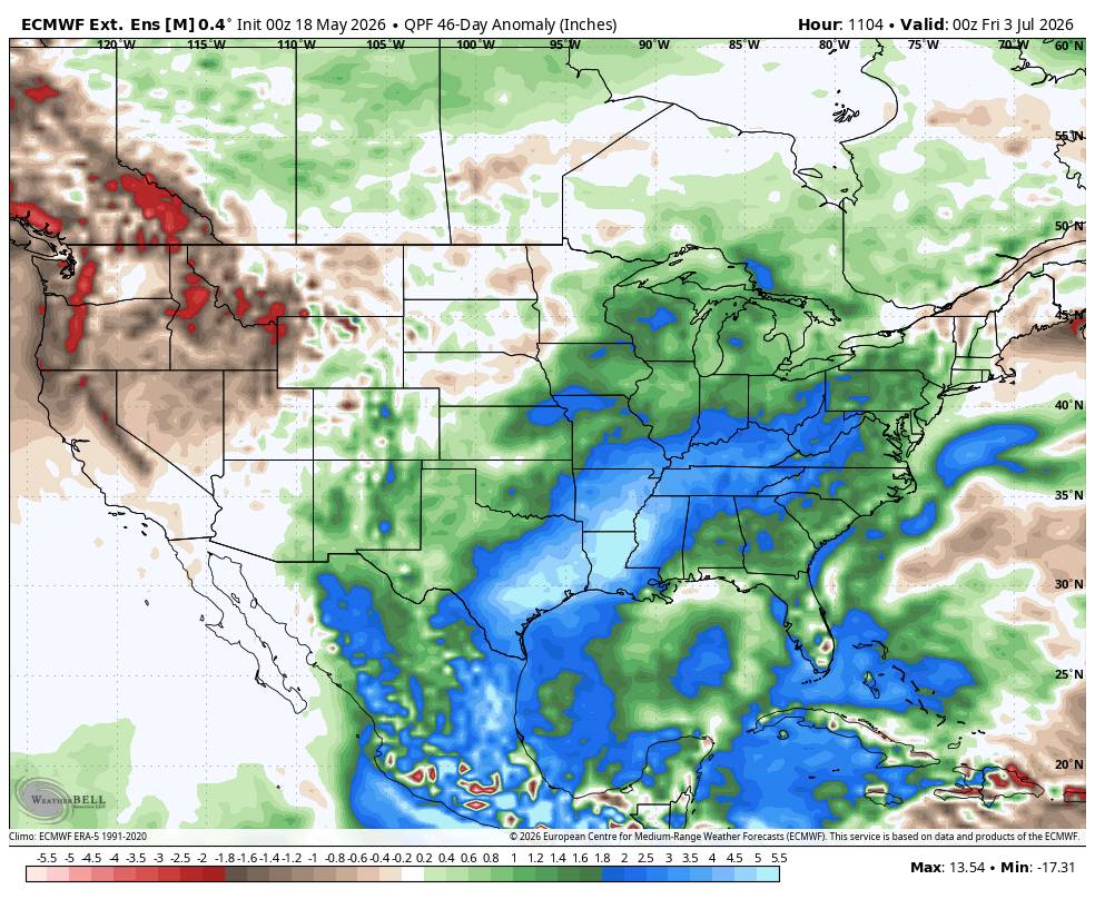
A lot of tropical moisture to work with.
-
Yes sir they do.
-
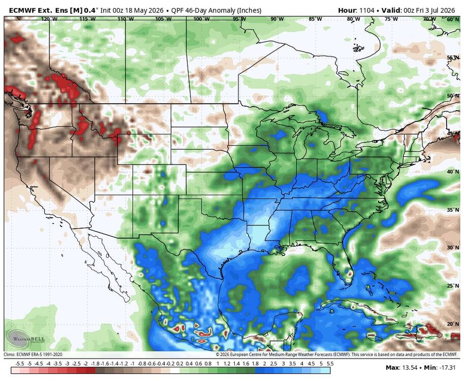
This is exactly what we need. Ample supply of gulf moisture. Sent from my SM-G998U using Tapatalk
-
This for sure!
-
Drought forever
-
This would definitely be something... Sent from my SM-G998U using Tapatalk
-
Yes sir!
-
Yesterday evening. Sent from my SM-G998U using Tapatalk


-
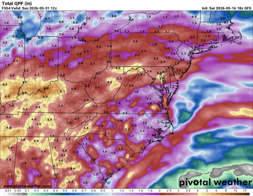
12z EPS looking great. If you've not been paying attention this upcoming pattern change has been advertised for since this week. Sent from my SM-G998U using Tapatalk

-
Should be. We won't stay in a drought forever. El Nino is getting setup currently and we should see a lot more moisture not only for us but for a large part of the southern USA.
-
Tropical moisture coming. Sent from my SM-G998U using Tapatalk
-
A cold frosty morning this morning with a low of 31 degrees. Considerably lower than what was forecast.
-
It'll rain next month.
-
Dang only 48 at the house.
-
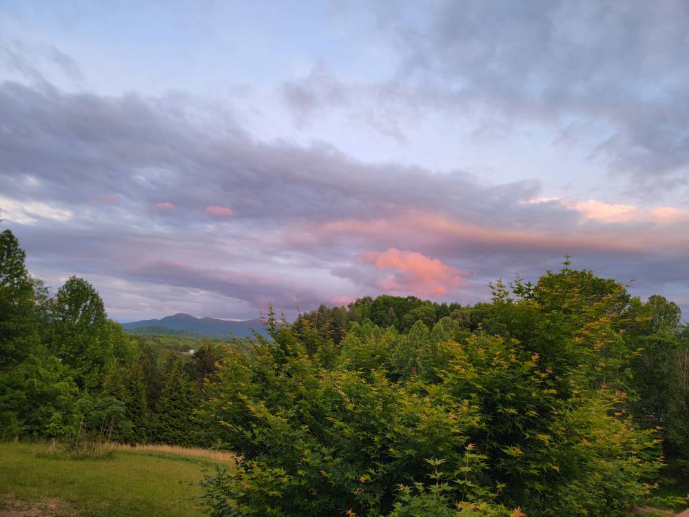
A beautiful sunset the other evening. Sent from my SM-G998U using Tapatalk
-
This week has been beautiful. Highs in the 60s and lows in the 40s.
-
A nice cool morning with a low of 37 this morning.
-
Windy with a temp down to 53 degrees already.