NC_hailstorm
-
Posts
2,668 -
Joined
-
Last visited
Content Type
Profiles
Blogs
Forums
American Weather
Media Demo
Store
Gallery
Everything posted by NC_hailstorm
-
Now you're cookin with hot grease lol,18z tonight full phase.
.thumb.png.0b124a2283b50ceed26e8a98b49ab8ae.png)
-
A phase or a partial at 162 on the 18z GFS,,this can get a little better with some tweaks.
-
Something like this....12z AI
.thumb.png.58180a04ede6c47485afb815aa2bf157.png)
-
Euro has to kick that Baja low a little further east or the shortwave dropping down has to tick west at day 8/9.Either might work but if you get both well....woof.
-
The big dog is barking this morning.
-
Mid to Long Range Discussion ~ 2024
NC_hailstorm replied to buckeyefan1's topic in Southeastern States
A 594 dm death ridge in California and a 486 dm polar vortex in far southeast Canada at the end of the run.And neither seems to be giving ground lol. -
Mid to Long Range Discussion ~ 2024
NC_hailstorm replied to buckeyefan1's topic in Southeastern States
Yep that's a big dog. -
Mid to Long Range Discussion ~ 2024
NC_hailstorm replied to buckeyefan1's topic in Southeastern States
Crazy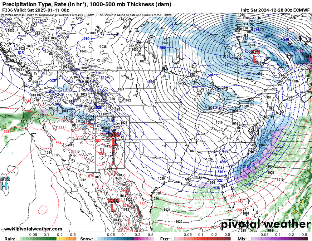
-
Mid to Long Range Discussion ~ 2024
NC_hailstorm replied to buckeyefan1's topic in Southeastern States
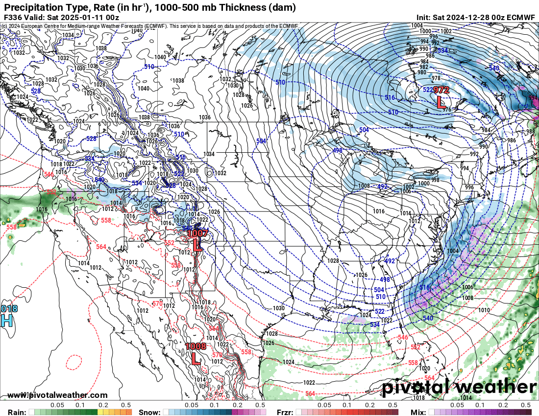
Tonight's Euro run might beat anything I've ever seen,492 polar vortex into N.Carolina good grief.That's a high in the single digits? Might save that one. -
Mid to Long Range Discussion ~ 2024
NC_hailstorm replied to buckeyefan1's topic in Southeastern States
Euro and the Canadian are further east with the trough at day 7 while the GFS,ICON,and UK are further west. Somewhere in the middle might work but a tick west would be better to give these shortwaves more room to dig. -
Mid to Long Range Discussion ~ 2024
NC_hailstorm replied to buckeyefan1's topic in Southeastern States
That ridging out west is strong and persistent,I even seen a few frames hitting 591dm that's close to death ridge stuff you see in the summertime. -
Mid to Long Range Discussion ~ 2024
NC_hailstorm replied to buckeyefan1's topic in Southeastern States
Anyways the 18z GFS says Merry Christmas,brings the big dog and puts everyone in the freezer late in the run. -
Mid to Long Range Discussion ~ 2024
NC_hailstorm replied to buckeyefan1's topic in Southeastern States
GFS is finally getting a clue and progressing things,no digging and dumping in the west this run. -
Mid to Long Range Discussion ~ 2024
NC_hailstorm replied to buckeyefan1's topic in Southeastern States
GFS is still going with the dig and dump solution out west day 7/8. EURO,Canadian,ICON,UK disagree at the moment and keep things progressive. -
Mid to Long Range Discussion ~ 2024
NC_hailstorm replied to buckeyefan1's topic in Southeastern States
Euro brings the big dog late in the run,good grief. -
Mid to Long Range Discussion ~ 2024
NC_hailstorm replied to buckeyefan1's topic in Southeastern States
There's also the 11 year solar lag response for NAO,AO.Also affects the Aleutian Low Doesn't guarantee cold other things have to be included as QBO,ENSO,and MJO and where they are. On average for eastern/central N America Lag 0 year-warm Lag 1 year -warm Lag 2 year -warm Lag 3 year warm Lag 4 year- cold (here now) Lag 5 year- cold Lag 6 year-cold Lag 7 year -cold Lag 8 year-cold Lag 9 year- neutral to cold Lag 10 year-warm Lag 11 year -warm -
Mid to Long Range Discussion ~ 2024
NC_hailstorm replied to buckeyefan1's topic in Southeastern States
Seen that,and the Euro is sorta honking too but not as big .Makes sense MJO coming into phase 8 around the new year. -
Mid to Long Range Discussion ~ 2024
NC_hailstorm replied to buckeyefan1's topic in Southeastern States
The PNA is very positive,AO is negative let's see what happens. -
Mid to Long Range Discussion ~ 2024
NC_hailstorm replied to buckeyefan1's topic in Southeastern States
Good grief a 972 low on the Canadian. -
Mid to Long Range Discussion ~ 2024
NC_hailstorm replied to buckeyefan1's topic in Southeastern States
Don't know if it's right but a hit on the Icon tonight....... -
Mid to Long Range Discussion ~ 2024
NC_hailstorm replied to buckeyefan1's topic in Southeastern States
Canadian might be a hit for western NC,foothills,western piedmont. Heck of a storm off the coast. -
Mid to Long Range Discussion ~ 2024
NC_hailstorm replied to buckeyefan1's topic in Southeastern States
Just from what I'm seeing at 144,the UKMET,ICON,and Canadian have more shortwave energy further north in CO,OK.and northern TX. Euro a tick south of there,GFS way way south of there. Oh and the GFS is scoring very poorly lately,way behind the other three. NOAA/NWS Headline Scores: ACC 31 Days -
February 11-12 ULL Winter Storm
NC_hailstorm replied to Upstate Tiger's topic in Southeastern States
Good news I have the S word in the forecast now Sunday Snow before 10am, then rain. High near 39. Breezy. Chance of precipitation is 100%. -
Mid to Long Range Discussion ~ 2023
NC_hailstorm replied to buckeyefan1's topic in Southeastern States
Yep that wacky 0z GFS is dropping that PV into the USA late in the run. -
Mid to Long Range Discussion ~ 2023
NC_hailstorm replied to buckeyefan1's topic in Southeastern States
Think that was the 1st Euro run that dropped the polar vortex into the USA,GFS has already had a few.
.png.2d3407daf6885ba0db7d97ac1fc447b0.png)

.png.12ba7d52d1ebc63e15697bd71d777d91.png)