NC_hailstorm
-
Posts
2,649 -
Joined
-
Last visited
Content Type
Profiles
Blogs
Forums
American Weather
Media Demo
Store
Gallery
Everything posted by NC_hailstorm
-
Is that 30"" just south of Raleigh? lol gotta love it.
-
Looks like some light snow gets in here 171-180 but the GFS goes for that 2nd shortwave around 192-201 and blows it up.
-
Tanking AO,positive PNA, and a MJO coming into phase 8. Even at day 7 right now all the models (EURO,GFS,UK,CAN) look very close to each other.I am mildly/moderately interested.
-
I think Big AL just unloaded again tonight at 18z,further south this time.
-
1/21-1/22 Winter Storm OBS Thread
NC_hailstorm replied to metalicwx367's topic in Southeastern States
Light snow 21.9,my road literally got covered in 10 minutes just a fine powdery snow. -
1/21-1/22 Winter Storm OBS Thread
NC_hailstorm replied to metalicwx367's topic in Southeastern States
Flurries/light snow just started 23.2 -
Good grief that Canadian might be right,go Canada lol.
-
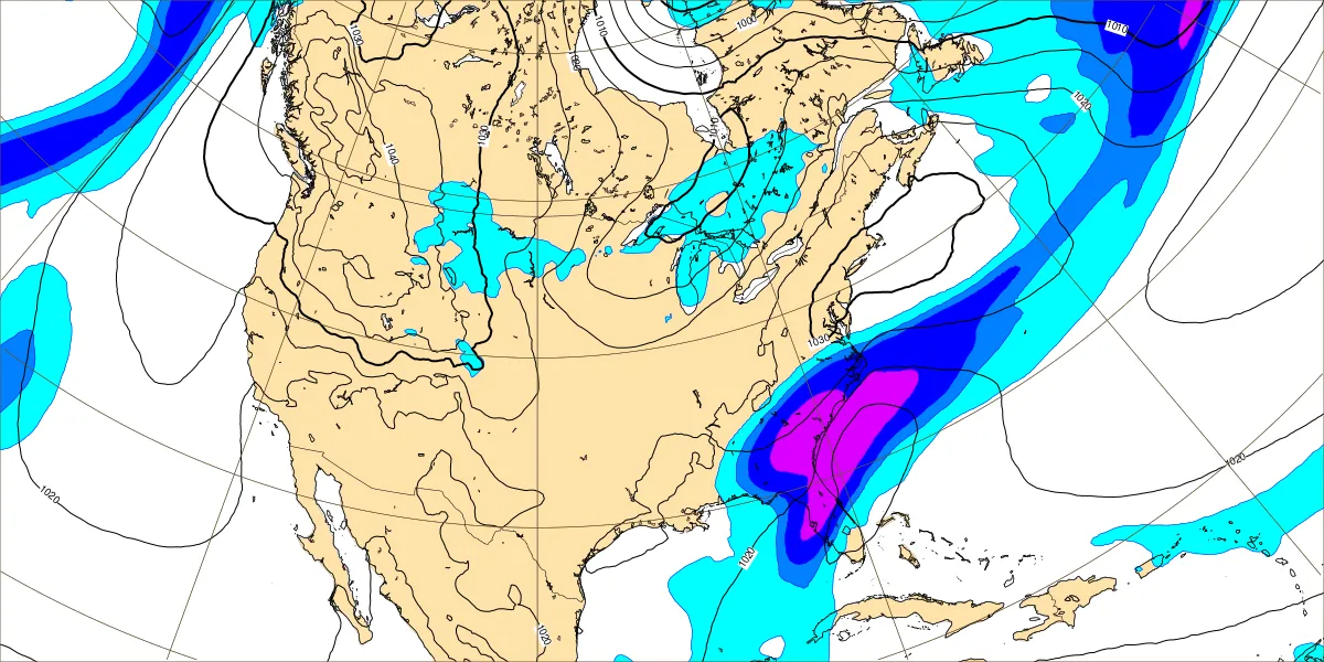
Hour 150 Al Euro
-
Looks like the 18z Euro Al made a decent jump NW.
-
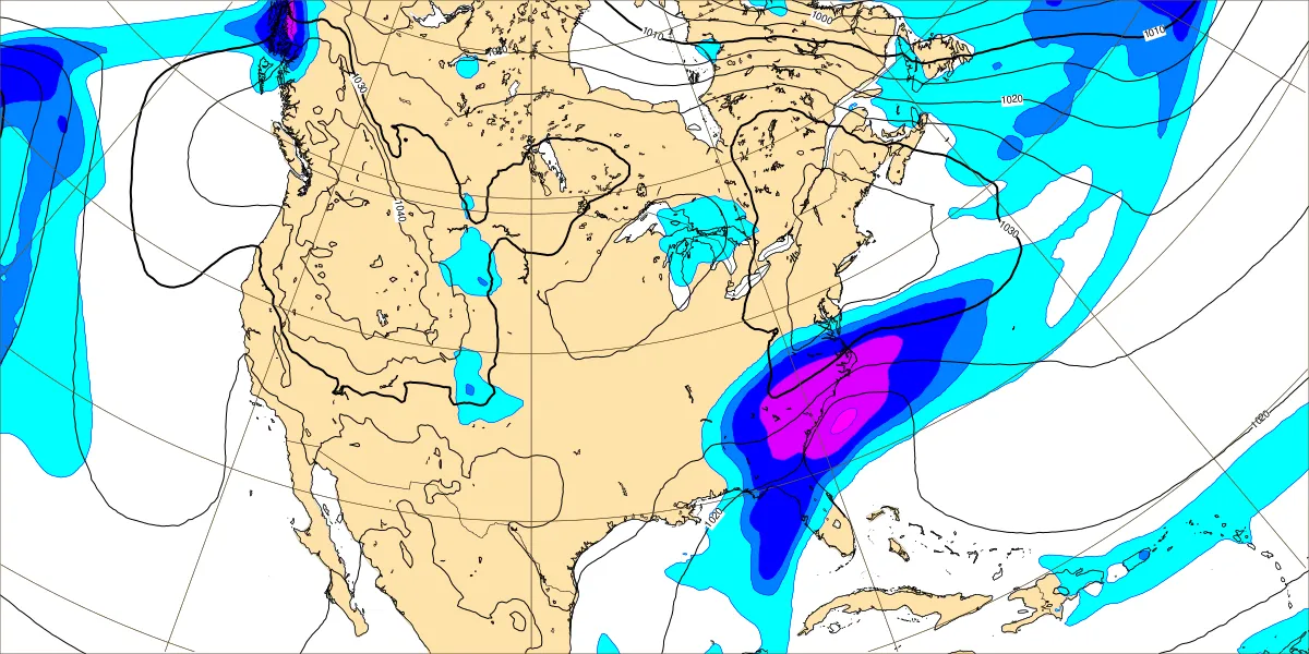
Just by looking at the shape of the shortwave in the Pacific northwest,it looks like it's getting pressed more to the southwest by the polar vortex.The Canadian being the furthest pressed southwest and producing the biggest storm right now. Just an observation.
-
GFS isn't in the ballparkt,it's not even in the parking lot yet. Vastly different with the shortwave placement.
-
That's hour 174 but moisture is already up in the Carolinas at 168 so day 7/8
-
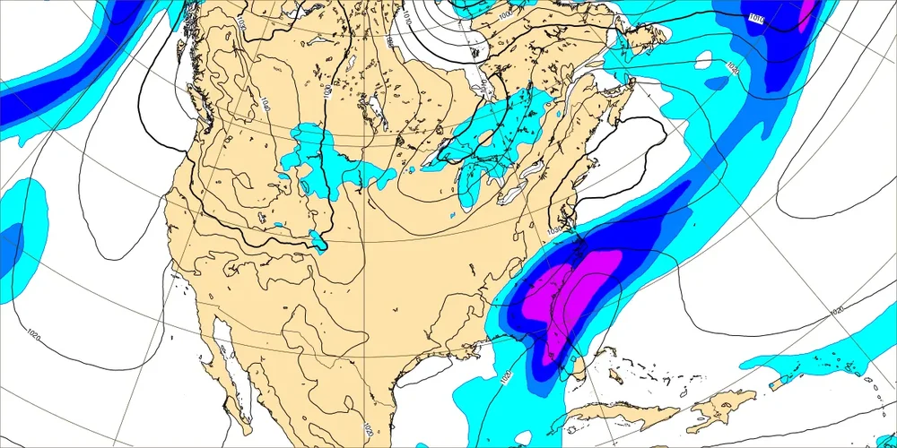
Artificial Intelligence Forecasting System,or known as Euro AI or (Big AL) is cooking today.

-
Big Dog and I mean big.
-
Canadian is barking today and getting real close,lmuch further southeast with the low/cold press at day 9.
-
Euro is barking tonight,nice hit day 8/9
-
Have to see if the trough can clear the southeast and not get hung up over the Apps in 7-10 days.Euro was real close day 9-10 at something.
-
1/10-11 super awesome winter SE OBS thread
NC_hailstorm replied to strongwxnc's topic in Southeastern States
Going over to sleet now, 26.1 -
1/10-11 super awesome winter SE OBS thread
NC_hailstorm replied to strongwxnc's topic in Southeastern States
Large flakes now,moderate snow and 26.2 Roads covered. -
1/10-11 super awesome winter SE OBS thread
NC_hailstorm replied to strongwxnc's topic in Southeastern States
Heavier burst now bigger flakes mixing in.Up to a dusting and 27.9 -
1/10-11 super awesome winter SE OBS thread
NC_hailstorm replied to strongwxnc's topic in Southeastern States
Light snow now, 29.3 -
1/10-11 super awesome winter SE OBS thread
NC_hailstorm replied to strongwxnc's topic in Southeastern States
Flurries here,29.7 -
NAM putting down .7 to .8 here and finally correcting the temps.
-
Thing I've noticed today is most of the models have had an uptick in QPF. HRRR has .6 here.
-
Stick with the Euro AI it's been rock steady most of the way.