RogueWaves
-
Posts
2,559 -
Joined
-
Last visited
Content Type
Profiles
Blogs
Forums
American Weather
Media Demo
Store
Gallery
Everything posted by RogueWaves
-
If referring to @Hoosier yeah. Got banned. All the disco wrt can be seen in the banter thread over the past couple weeks.
-
Well, thread title was for the weekend and DTW scored a bit more than DAB (depending on your definition ofc) yesterday morning.
-
First half of March for me, so 2 more days. Have zero use for April snows, but they're not as uncommon as I wish they were. I just hope we don't see flakes all month long.
-
All depends on the spring. If it flips hard - trouble. 2014 presented historic SPWE across SMI and we had a slow transition into the warm season and zero hydro issues. Contrast that with 2018's hard flip with heavy rains just as we peaked in depth and that was a record flood along the Kzoo river basin.
-
Dreamscape award. I'm with @SchaumburgStormer let's move on already..
-
They did, lol. P-sure the Canton report's legit tho. You can see there were similar totals not too far north of here and I believe it extended further S to this region as well.
-
Surprise!
-
No, I couldn't measure since I am at work about 11 hrs a day. This snow was mostly gone by evening. No signs of plowing on our streets, just a little sidewalk clearing. IF we actually got 4-5" then it was the fastest melt-off of that amount in history, lol. (DTW for example had 4" depth reported Sat morning). Drove to work in on/off moderate rates with about an inch down. Left my wipers up to make clearing the windshield easier after work (like normally on a snowfall day). Wasn't a flake to be found on my car when I got to it. I was embarrassed I left them up tbh. What a joke event - total opposite of the week prior when the most heavily pre-salted roads and parking lots had tons of snow that needed plowing despite temps never really getting properly below freezing. Impressive to see piles, and even some area plow banks still making it look a lot more like winter here despite 45 and 50F almost every day.
-
Sigh. Back to the lame game here. Watched DTX's radar loop several times. Downriver gets a boost via Lk Erie, and W/NW of here gets a little boost via elevation & temps . Meanwhile I get 2.5"
-
JB > Cromartie
-
The last Heavy Snow Warning I can remember was in Dec '05 when 8-10" fell. Apparently the lack of wind kept it from being a warning.
-
Finally catching that break. I'll take it
-
Will be waiting a long time to see anything over here rivaling last Friday's intensity. Amazing how much snow we've actually scored with so few days below freezing all winter including zero below freezing in March, which is now way above normal snowfall for the month and isn't done.
-
8.2" here on the month - #winning! (was a splendid wint-spring morning)
-
WPC/CPC says hello to da Mitt Slowly trying to erode that brown stain in SEMI with the white stuff, lol
-
While snow cover lasted after 1/25, this week's storm was by far the best of the season. That was my main point. Snow rates were very similar to two other events in the last notoriously warm winter 11/29/11 in Marshall, and 3/3/12 in NWMI. I will take a good grinder storm any day, but the intense storms are always exciting.
-
here we go...again
-
@michsnowfreak Feeling like I owe you an apology. More legit winter happened. In fact, the BEST of this winter happened, lol. Stranger things have happened, I just can't remember when.
-
No! More! Damage storms pls. I'm good for a while
-
DARK (k)NIGHT here alive and well living a pseudo 19th century lifestyle, lol
-
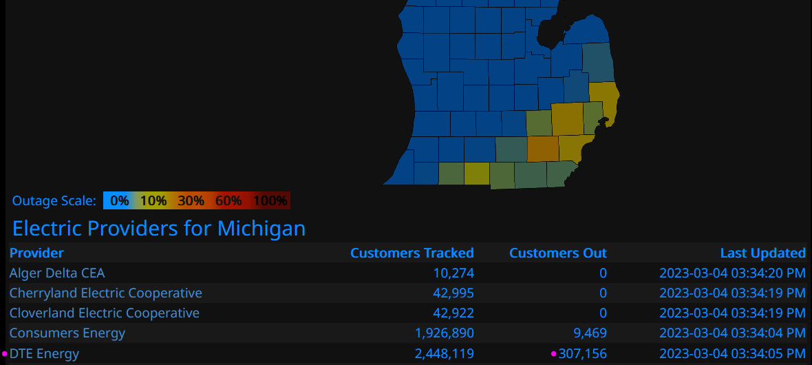
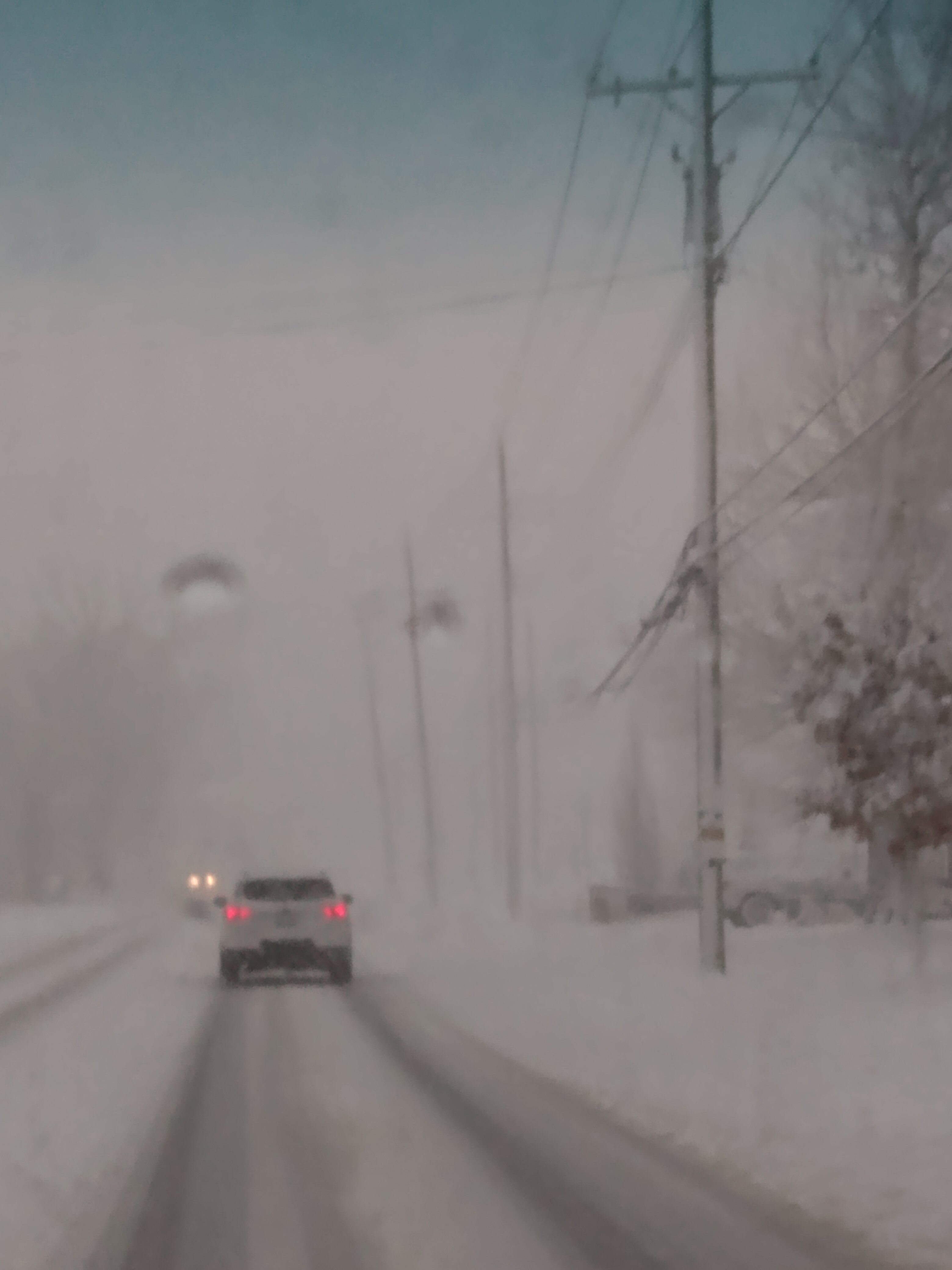
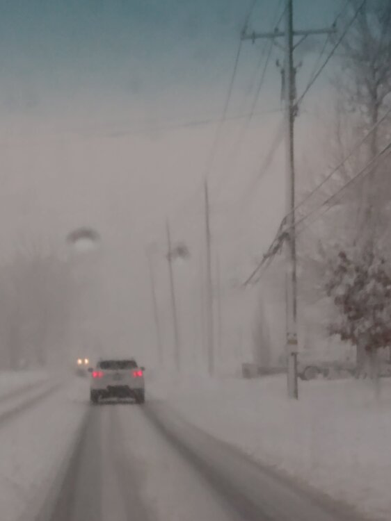
Almost a given we get a nice sunny day after a S stream SW hits and departs. Awesome storm, fun to see cars stuck on snowy roads in the metro. Thanks to snow actually accumulating on the pavement this time, plow banks and piles are legit. Only minor negative is I'm still one of these stats:

-
Still in the dark. DTE site did not have good news. They have yet to assess the cause and planned recovery time. Peeked outside and saw a blue green flash. Transformer? Idk, but phone batt is not going to last too long.
-
Hold that jealousy. Eating a cold dinner by candlelight here in Canton. Starting to get chilly. Entire complex went dark an hour ago. Rumbles continue. Drive home about 5:30 was a crawl.
-
Because I was.. 1) Done with this lame-ass winter 2) Wrote this off 2 days ago 3) Promised to eat my words if it came full circle for DTW OFC!
-
I'm ok with flat (storms)