-
Posts
715 -
Joined
Content Type
Profiles
Blogs
Forums
American Weather
Media Demo
Store
Gallery
Posts posted by WeatherMonger
-
-
Went outside and about 10 coworkers standing around staring up at the sky, "right there, that's a tornado about to form"

looked at radar and it's the outflow/gust front moving through, did have some cool cloud movement with it.
100% guaranteed to rain/storm here as it is the opening night of the State Fair.
-
 2
2
-
-
I have to go mow in this crap. 3" of rain yesterday and the possibility of even more the next few days I can't wait until Friday like I had hoped. 89/78 for a 103 index, ugh
-
ILX will do a 19Z sounding today
-
 2
2
-
-
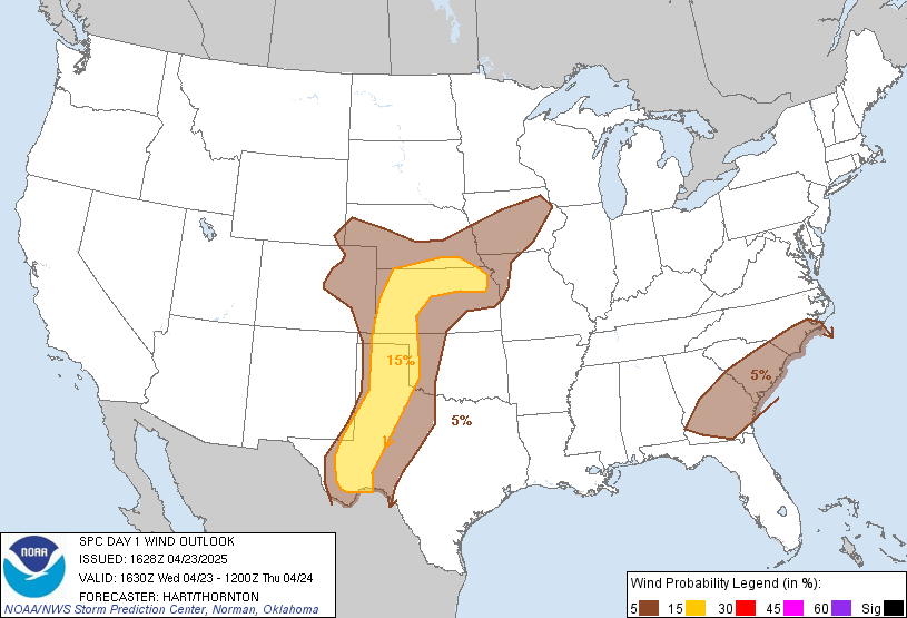
not understanding this portion of 1630Z update, they trimmed it yet says they expanded it....
Given the aforementioned possibilities of more than one storm cluster and the area of large to extreme CAPE, have expanded the higher damaging wind probabilities farther south into MO/IL
1630Z

Previous 1300Z

-
 2
2
-
-
Anyone had contact with Chicago Storm since his last post?
Hopefully it wasn't a bad situation holy chit, remember he had a brush with the last tornado up there a while back.
-
Enhanced over N IL, WI and Iowa tomorrow for wind with a hatched area into the slight down to central IL.


-
 1
1
-
-
ILX with a rare descriptive mid-morning update.
.UPDATE...
Issued at 1041 AM CDT Fri Jul 9 2021

A pair of observations from the 12z HREF: (1) impactful
convection is trending later into the evening, and (2) picking
a favorite hi-res model is not going to help nail down the
forecast; there is simply too much spread and uncertainty among
them.

To gain a better understanding of the convective potential, it is
best to take a step back into the synoptic space. Current GOES WV
imagery depicts a shortwave trough digging southeastward across
central Iowa, coinciding with a 50+ kt speed max at 500-mb. At the
surface, a warm front is draped from roughly Sioux City to
Nashville. This front and upper-level forcing will provide the
focus for convective initiation this afternoon across portions of
southern Iowa and northern Missouri as the capping inversion
erodes.

Storm relative hodographs suggest any discrete convection that
develops late this afternoon and early evening west of the
Mississippi River Valley will become linear as it approaches
central Illinois and interacts with the LLJ. The current
expectation is for an MCS to initially propagate along the warm
front/MUCAPE gradient, which runs roughly parallel to a Galesburg
to Effingham line. But, as the cold pool becomes more mature late
this evening, the MCS should show a tendency to follow the 0-3 km
shear vectors into portions of central and southern Illinois.
Depending on the strength of the cold pool (will need to assess
theta-e differentials from 00z ILX sounding), there could be some
bowing segments along the leading edge of the MCS. This will lead
to a damaging straight-line wind threat late this evening with
pockets of 70+ MPH gusts possible. A few brief tornadoes will also
be possible within these bowing segments wherever the
3-ingredients method (QLCS mesovortex system) comes into
alignment.

As mentioned previously, timing all of this out is perhaps our
biggest challenge. But for now, we`ll peg the peak severe weather
threat between 9pm - 3am.

Perhaps the bigger and understated threat this evening is hydro.
While the HREF doesn`t offer much continuity with convective mode
and timing, we do believe it offers a helpful solution on QPF;
namely the LPMM, which suggests a widespread 0.5"-1.0" with
localized streaks of 3.0"-5.0" wherever the heaviest convection
occurs.
-
 1
1
-
-
-
Nice thunderstorm moving through now.
-
 1
1
-
-
3 hours ago, Powerball said:
I guess we're in the same miserable club together.
Had a torrential downpour yesterday afternoon at around 2pm, on June 28th, and wasn't a rumble of thunder nor a lightning strike to be found. But in other news, I read that San Antonio observed ( I believe it was) Texas' largest hailstone ever this season.
Apparently, this just isn't our year for strong/severe t'storms..
-
 1
1
-
 1
1
-
-
-
-
1 minute ago, HillsdaleMIWeather said:
Until a survey is done they put it in as what the NWS sends it as, some of the wind damage from a couple days ago was changed to tornadoes eventually.
I'm not saying it will stay that way, not sure if they will survey it or not. He said trees were down but the images I seen it was just limbs/branches. Just based it on what I seen on radar and while outside. Only about 4 miles from me to my SW. Had some gusty winds just before the warning was issued. Could have been stronger over that way
-
SPC has the damage down as wind damage, I doubt a brief touchdown is what occurred.
-
Tree and powerline damage out by Capitol Airport. Friend who lives in the subdivision but was not there at the time thinks it was a brief touchdown. Local fire department posted a few pics as they responded for powerlines down, but nothing very telling
-
Storm aspect of it is pretty lame, wouldn't even call it heavy rain for having 2" PWATS. Maybe 34-40mph gusts right arounf the time tornado warning was issued. Sirens never went off. Lightning stopped just before the rain got here. Just a moderate rain falling.
-
Back inside, rain started and lightning hetting close
-
Kinda cool seeing the upper couds moving north east, then lower ones movving more east southeast. Not sure how well video turned out
-
I see it now, was actually just to my west. Now directly overhead. Now dead calm
-
 2
2
-
-
Not sure what they're seeing via radar. I don't see anything as far as wall cloud would literally be overheard or just to my north.
-
Right on top of me actually
-
Phone just went off for tornado warning again. Polygon not up. Not aure if norrh or SW of me.
Winds picking up
-
-


August 9-12, 2021 Severe Threats
in Lakes/Ohio Valley
Posted
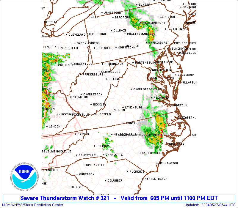
Didn't have much wind on my side of the plant, but had a power flash and the east end of the plant is out.
Coworker got a call from his wife, had a pine tree fall on his trailer, caved in the kitchen so apparently had some wind with it, he's on same side of town as me but a bit further North. Fairgrounds probably took some wind, never fails during the fair.