SBUWX23
-
Posts
1,292 -
Joined
-
Last visited
Content Type
Profiles
Blogs
Forums
American Weather
Media Demo
Store
Gallery
Everything posted by SBUWX23
-
 Still would like to see a bump north too
 -
Do you like snow? Seems like you are rooting for the drier models.
-
You can see where there may be problems in CT, and any shift south that could reach LI too. It's a fine line. Never a fan of inverted troughs
-
18z HRRR out through 48 hours looks decent, and yes I am aware of its unreliability beyond 18 hours.
-
youll prob end up better there anyway as its colder up there.
-
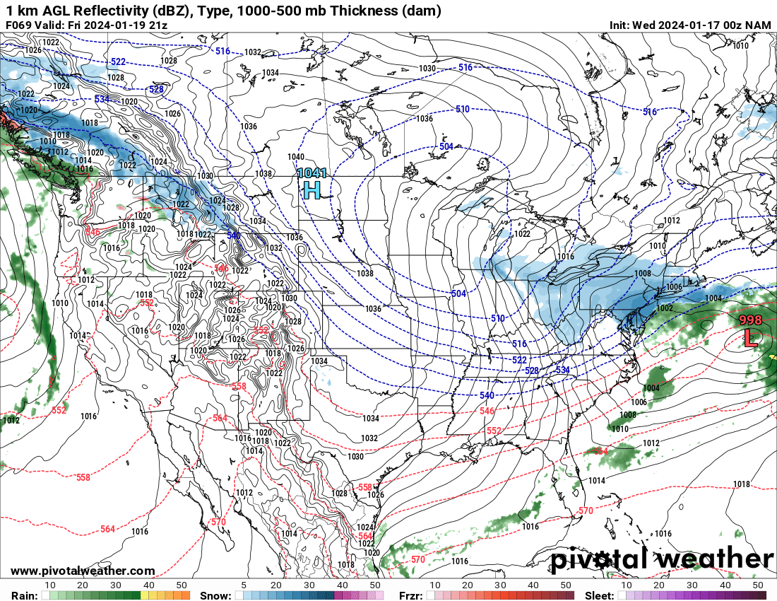
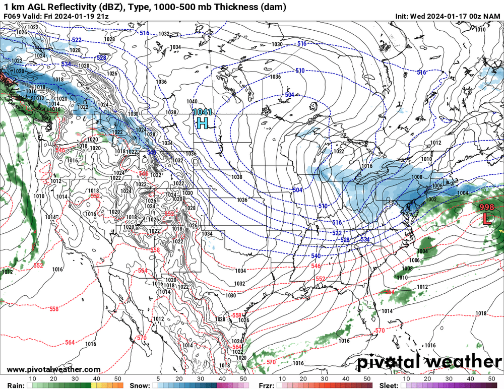
Yep, it was too dry with the last event too. I do believe the NAM was more on target and actually had the right idea overall as the even drew closer. I know there were some concerns that models were overdone qpf wife, but we had a good bit of rain out here and the NAM really handled the fact there was gonna be ZR well. Hopefully we can narrow down things on Thursday.
-
doesnt mean its right. its not the gospel model when it comes to smaller details like what we are looking for with this event.
-
The 12z NAM has about 0.3 liquid around the city. The nam is a bit noisy with the QPF owing likely to the localized banding potential with the inverted trough.
-
thats nyc all the time
-
sun angle is also higher.
-
at least its not 55 degrees, flooding rains, and wind.
-
Expect a light snowfall and enjoy whatever we get. at least it wont wash away with rain Friday night.
-
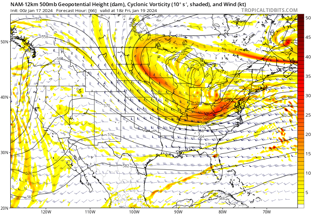
that is some top notch analysis. It improved at 500 mb since 00z. There is a ceiling with this, but the 500 mb improvement could yield a bit more snow down the road.
-
I feel like the NAM may be "slightly" better. Maybe.
-
What is? Share the mean
-
Understand the concern but at 500 MB it makes sense why it's trying to redevelop the surface low where it is.

-
This is crap? It's not a ku but this isn't necessarily crap
-
Jeez sorry I didn't know I wasn't letting people vent man.
-
I will say though models almost never trend west or north. Wherever the gradient is now should verify. Models almost never miss these situations.
-
At the same time it can also tighten the forcing gradient and where it is snowing under light returns its full of fluff.
-
You live near an ocean that has a warm stream running near and off the coast. You have been spoiled over the last 10-15 years with big storms and KUs. They don't always work that way. Both of these systems are not classics by any stretch and of course they'll have some challenges.
-
All will depend on the strength of the subsidence to the north and the confluent flow.
-
No significant change on the GFS. Been pretty consistent the last several cycles on a light but fluffy event for portions of the region mainly south of New England.
-
18z ICON also sorta backed off from it's 12z run.


.png.a106414164edbfba3f10b8e581f0a6b1.png)