-
Posts
1,292 -
Joined
-
Last visited
Content Type
Profiles
Blogs
Forums
American Weather
Media Demo
Store
Gallery
Everything posted by SBUWX23
-
Extreme Cold, Snow & Sleet: SECS 1/24 - 1/26
SBUWX23 replied to TriPol's topic in New York City Metro
the high for the day can happen before midnight, so you will be in the teens all day and maybe come up a bit late -

Extreme Cold, Snow & Sleet: SECS 1/24 - 1/26
SBUWX23 replied to TriPol's topic in New York City Metro
CMC isn't my favorite model but it's still a potential solution. One thing the CMC and rgem were consistently over amplified in past years at this range. -

Extreme Cold, Snow & Sleet: SECS 1/24 - 1/26
SBUWX23 replied to TriPol's topic in New York City Metro
I would think something in between but we don't really have that. I would use kuchera with caution. But I would also take your qpf and go with something like a 13-15:1 as a cautionary start -

Extreme Cold, Snow & Sleet: SECS 1/24 - 1/26
SBUWX23 replied to TriPol's topic in New York City Metro
High qpf events doesn't mean you wont have higher than 10:1. I think the point is 20:1 is not easy to do and should not be expected for the majority of the event -

Extreme Cold, Snow & Sleet: SECS 1/24 - 1/26
SBUWX23 replied to TriPol's topic in New York City Metro
I don't think 6:1 would happen if it's 5 outside but also the snow size would be small. The colder it is the more chance the snow is smaller, finer. It's also dependent on the height at which the snow grows. It may be 5 at surface but if it's warmer aloft it could be higher. It's not clear cut and why modeling of simple 10:1 is not the great. -

Extreme Cold, Snow & Sleet: SECS 1/24 - 1/26
SBUWX23 replied to TriPol's topic in New York City Metro
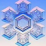
Ratios are not just dependent on temperature. Snow habit makes a huge difference. Dendritic snow has the best chance for higher ratio even in a marginal thermal profile. -

Extreme Cold, Snow & Sleet: SECS 1/24 - 1/26
SBUWX23 replied to TriPol's topic in New York City Metro
I'd say your best chance is at the beginning but I'd be more leaning towards at 15:1 vs 20. And then getting closer to 10 as it gets closer to any potential dry slot or mix, if that were to occur -

Extreme Cold, Snow & Sleet: SECS 1/24 - 1/26
SBUWX23 replied to TriPol's topic in New York City Metro
If I were everyone I would urge caution expecting something different from the new recon data.its sampling the upper low off California but there is still northern stream energy that is involved that plays a big roll too. -

Extreme Cold, Snow & Sleet: SECS 1/24 - 1/26
SBUWX23 replied to TriPol's topic in New York City Metro
Got timed out on the other forum and not even sure why. Saw your post about this on it and wanted to respond. This should calm some nerves right now as the floor may already be high. The thump is legit -

Discussion-OBS snow event sometime between 06z Thu 2/20-12z Fri 2/21?
SBUWX23 replied to wdrag's topic in New York City Metro
Just a few reminders here about how things can change really close to game time Most recently for those on LI Jan 2022 trended nw just enough on top of having a great jet structure to slam us and Boston. Just grazed nyc with moderate totals. Feb 2021 - this waivers back and forth and ultimately trended north enough that some had mixing and dry slot issues out here. Dec 2020: snow max once modeled over NYC was well update. No model not even the euro was the far north. GFS was atrocious with this too. Jan 2018: trended nw. Quick hitting snow event with a foot in the city and 15 out here Jan 2016. Modeled to max DC and it maxed over NYC. It can change on a dime. Don't forget that and don't think that what we are seeing now is #lockedin -

Refresher snow & obs between ~midnight and Noon Sat Feb 17 2024
SBUWX23 replied to wdrag's topic in New York City Metro
Those squalls out on eastern LI had awesome graupel. -

Refresher snow & obs between ~midnight and Noon Sat Feb 17 2024
SBUWX23 replied to wdrag's topic in New York City Metro
Not really sure but Bernie Rayno says follow the 528 thickness line, but that was news to me -

Refresher snow & obs between ~midnight and Noon Sat Feb 17 2024
SBUWX23 replied to wdrag's topic in New York City Metro
Thankfully we still got solid snowfall. Could easily have been skunked. Definitely wasn't subsidence over us or we would not have anything -

Refresher snow & obs between ~midnight and Noon Sat Feb 17 2024
SBUWX23 replied to wdrag's topic in New York City Metro
Official measurements are every 6 hours and don't happen on a tabletop. -

Refresher snow & obs between ~midnight and Noon Sat Feb 17 2024
SBUWX23 replied to wdrag's topic in New York City Metro
Nice snow out there now with these last bands coming through eastern LI. -

Refresher snow & obs between ~midnight and Noon Sat Feb 17 2024
SBUWX23 replied to wdrag's topic in New York City Metro
Guess it was a bust. -

Refresher snow & obs between ~midnight and Noon Sat Feb 17 2024
SBUWX23 replied to wdrag's topic in New York City Metro
@psv88 how'd you do? Even for portions N of the band should have at least 2 or 3 inches. Was never in heavy rates where I am in Yaphank and still have close to 3 and snowing still. -

Refresher snow & obs between ~midnight and Noon Sat Feb 17 2024
SBUWX23 replied to wdrag's topic in New York City Metro
I see them now thanks I missed the LSRs. -

Refresher snow & obs between ~midnight and Noon Sat Feb 17 2024
SBUWX23 replied to wdrag's topic in New York City Metro
Where did you get the NYC area amounts from -

Refresher snow & obs between ~midnight and Noon Sat Feb 17 2024
SBUWX23 replied to wdrag's topic in New York City Metro
And it's AllSnow -

Refresher snow & obs between ~midnight and Noon Sat Feb 17 2024
SBUWX23 replied to wdrag's topic in New York City Metro
It's inching north -

Refresher snow & obs between ~midnight and Noon Sat Feb 17 2024
SBUWX23 replied to wdrag's topic in New York City Metro
Park is at 32 now..so much for it being too warm. -

Refresher snow & obs between ~midnight and Noon Sat Feb 17 2024
SBUWX23 replied to wdrag's topic in New York City Metro
Still seems like things are ever so slightly inching north. -

Refresher snow & obs between ~midnight and Noon Sat Feb 17 2024
SBUWX23 replied to wdrag's topic in New York City Metro
Can't wait for your ripping posts soon


